
Not many tourists make it to Zanskar, and there is a real reason for that. Mainly it is because the road that leads there is only open couple of months a year, and even then it is in a truly dreary condition. Anyways, once it opened a week or so ago, we were in for a ride, because if the road is bad, there must be some sort of reward, right?
In fact, we had not have to wait too long for the rewards, which already started to become clear even before we reached the Zanskar valley proper, but first we had to brave the road from Leh back to Kargil where the turnoff to Zanskar begins.
Somehow (even though we had done this road a month ago) we had remembered it to be in a better shape than it actually was, and bumping along the great scenery we found ourselves cursing the endless military convoys plying the same road, just like in slow motion accompanied by huge amounts of diesel smoke and dust - and people stopped alongside the road, and waved to them, just as they were national heroes of some sort! Frankly, would it not make more sense to invest a bit more of resources into civil infrastructure, rather than keep preparing yourself for imminent invasion by a fictious enemy? Instead, heavy tanks sweep the highway and not a day goes by without some helicopter, grimly painted military-purpose cargo airplane or a fighter flying over our heads. The people are made to believe that both Pakistan and China make for powerful enemies, although as far as I know, Pakistan is no match to India, and there is no active conflict going on with China. But as one propaganda sign that we noticed alongside the road says - "The Tree Of Freedom Only Grows If It Is Watered With Blood". Take it or leave it.
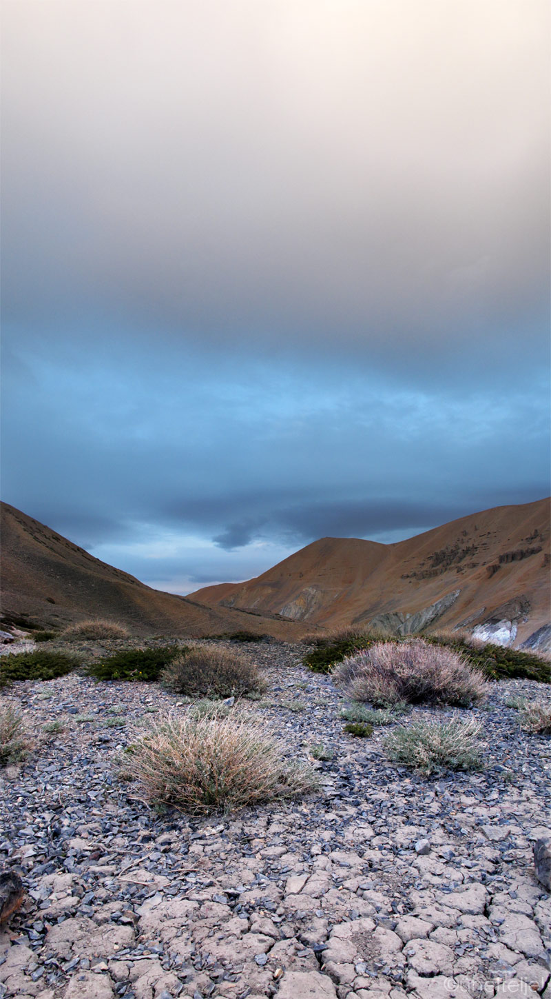
But back to the rewards. Soon after the turnoff to Zanskar we found the most perfect place to pitch our tent. It was flat, grassy, and well hidden from the road, offering at the same time wonderful views of the surrounding mountains and countryside. We even witnessed an avalanche for the first time in our lives! There were some hoof marks on the ground suggesting we might have guests some time.
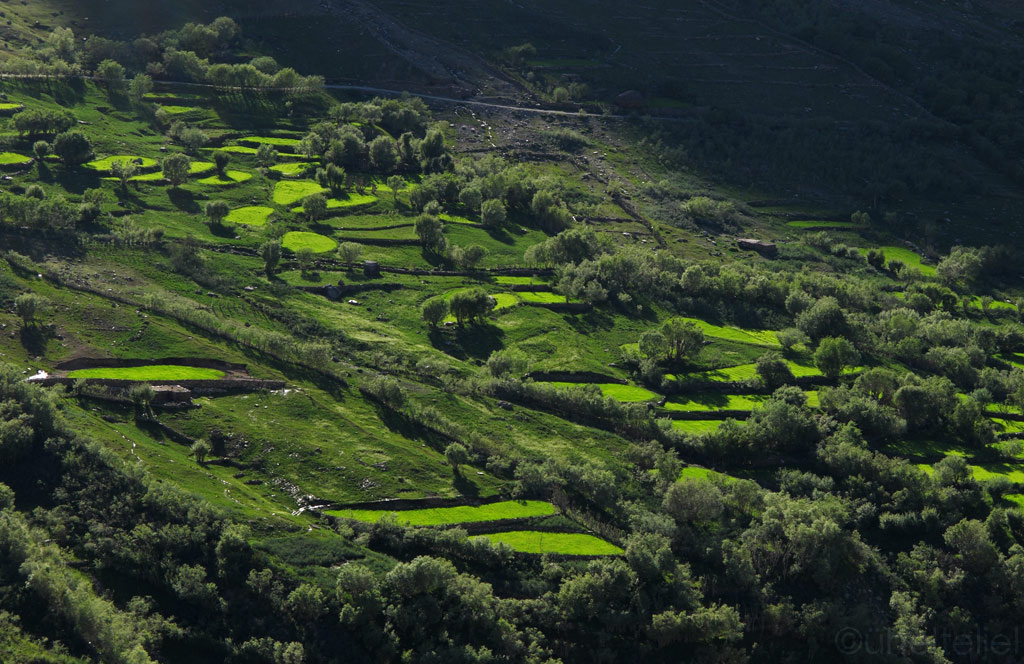
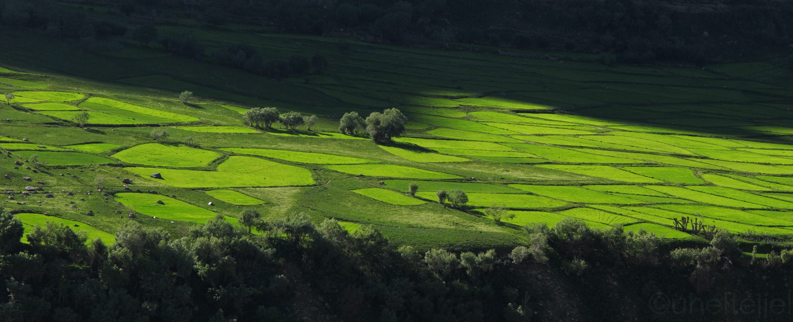
Heavenly green hillsides, on the way to Zanskar...

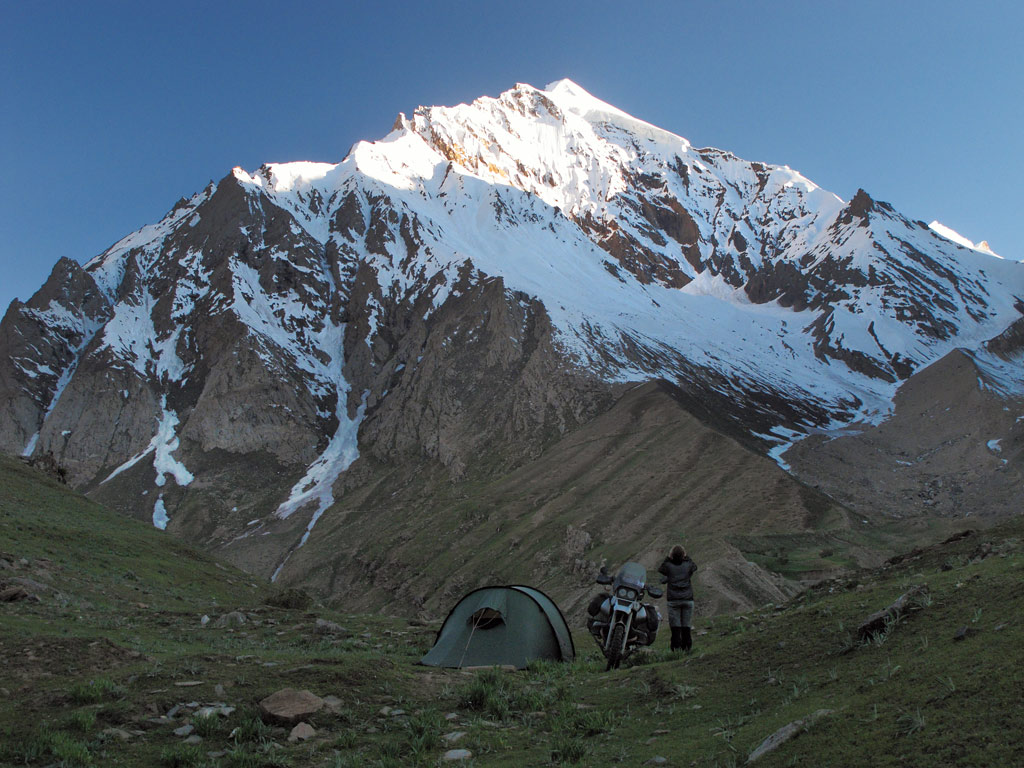
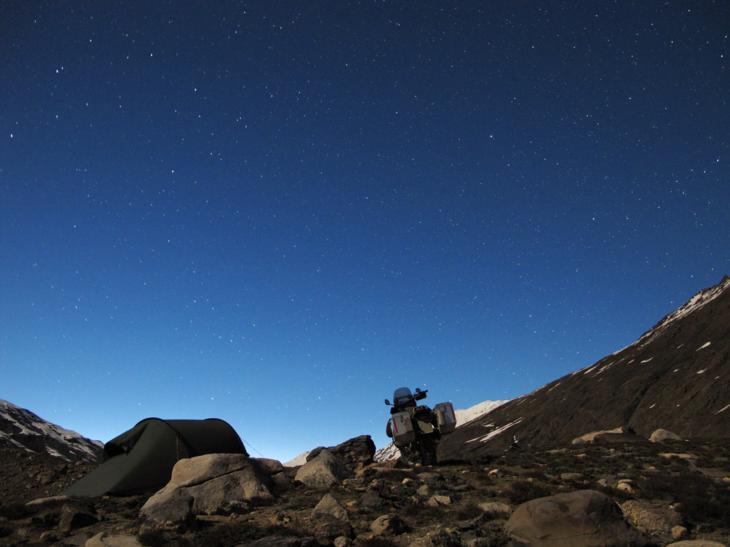
Our camping spot in the last sunlight.
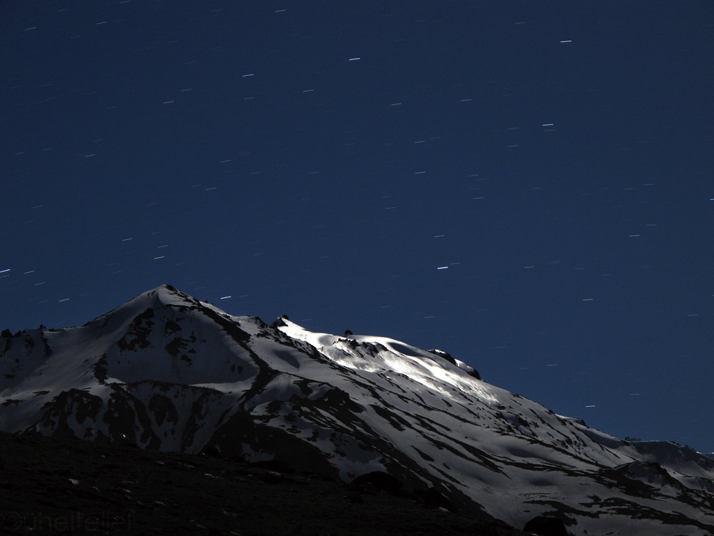
Moonlight reflection from the snowwy top that's been turned into reflective surface by the Sun from daytime and feezing temperatures in the night - a natural mirror. A stunning sight in real-life!
Mountain in moonlight.
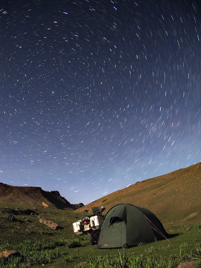
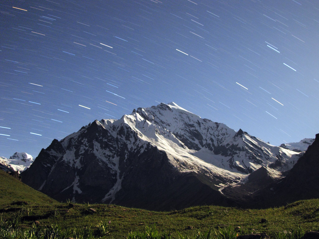
Global circulation around the static Northern Star, us and the GS underneath it, lit by the moonlight. Our moment in the vast Universe.
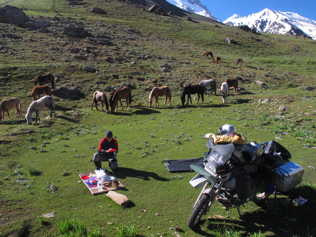
Sure enough, the breakfast was accompanied by some horses, but as we did not have much camping food to spare, they had to stick to their green diet.
Without rushing we packed our stuff and got on our way. But what a way it was! If you remember what the last kilometers to Tso Moriri looked like - well, this was quite similar, but there was also sand, mud, snow and lots of water, and it all stretched for some 200 kilometers (and back again the same way because there is only one road leading into Zanskar)!
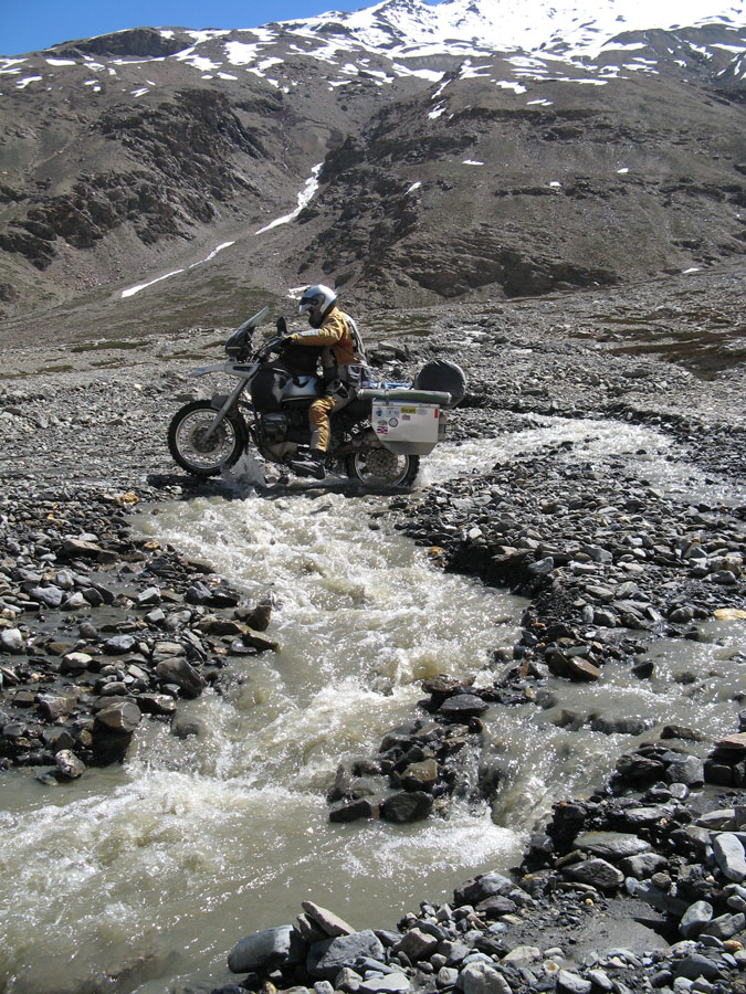
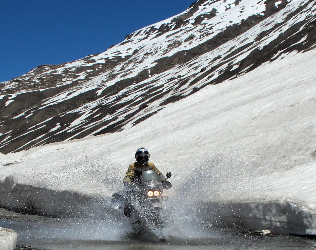
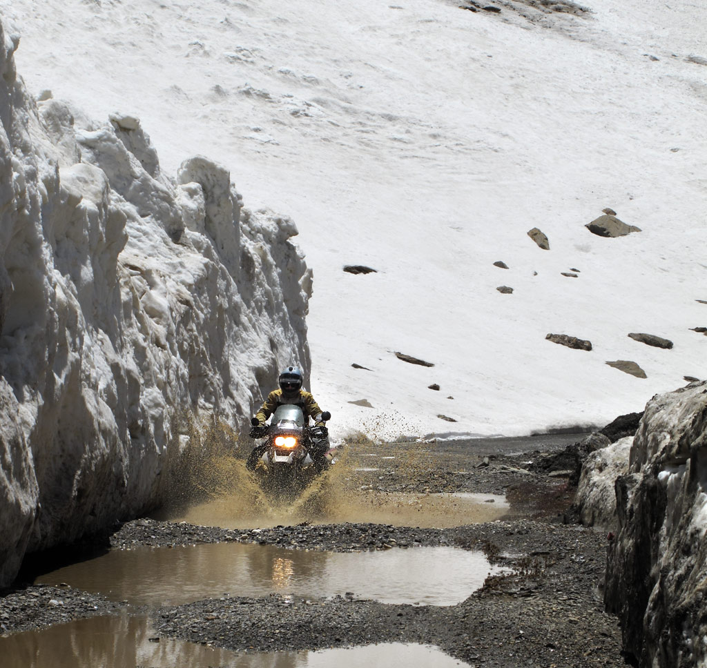
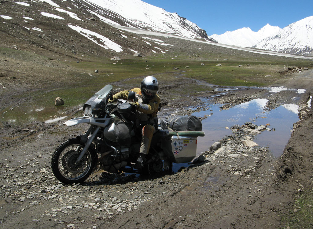
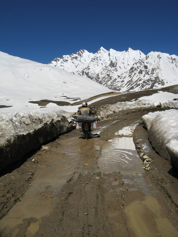
We had been told before that there would be lots of snow in Zanskar, but as we were to find out, it was not the snow that would make the conditions so difficult, but the fact that it was all melting - often, ferocious torrents of meltwater would come rushing down the steep slopes and across the track (indeed, it mostly consisted of hard packed soil that had loads of sharp edged rocks mixed in it), sometimes taking part of the soil with them and leaving you struggle with the huge, loose rocks. Chance must have played its part in us not falling down into the icy cold water not even once, although we counted some one river crossing per each kilometre.
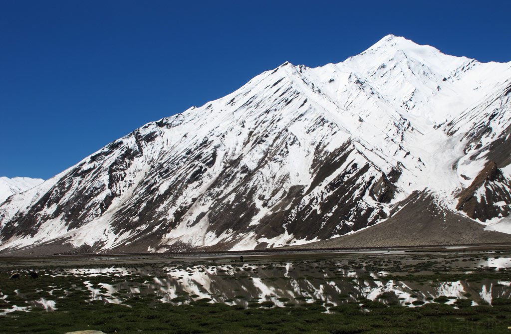
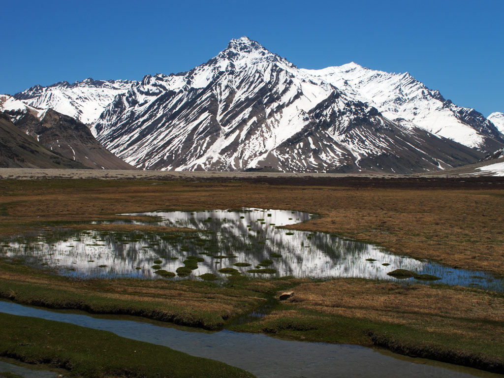
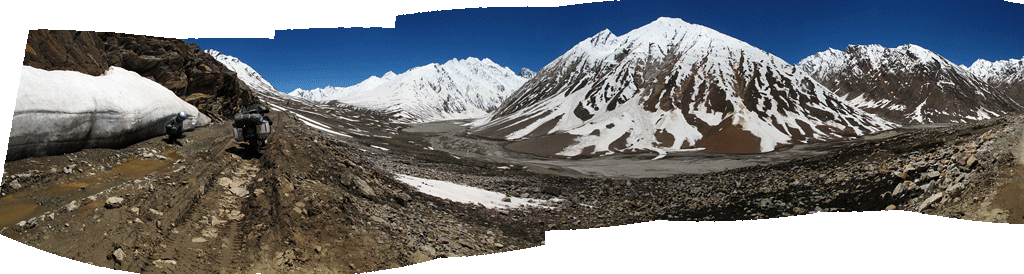
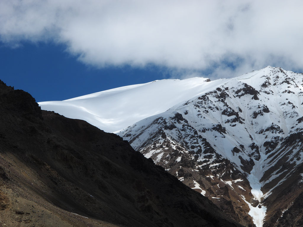
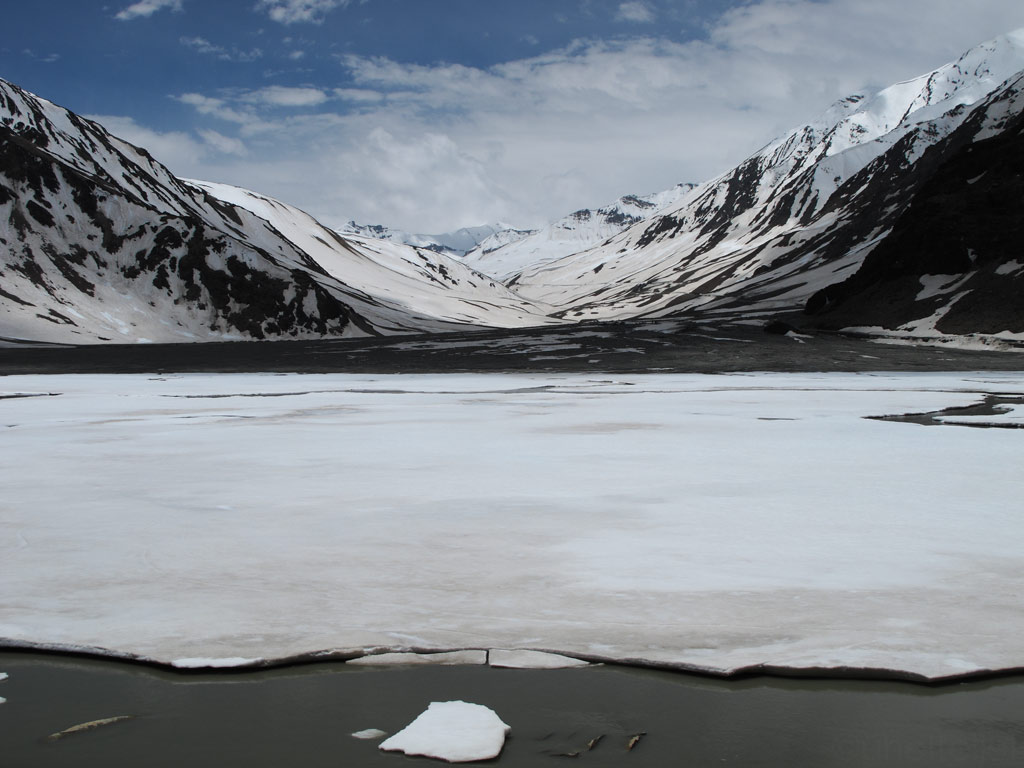
But back again to the rewards. At the beginning, the road took us through rocky canyons, but then the valley widened up, playing host to green wetlands reflecting the shine of the snowy mountains bordering it. Of course there was a pass to cross, this time a 4401 meter (14 400 ft) high Pensi La, and of course, the closer we got to it, the more there was snow. On top it was just like winter wonderland, everything covered by the bright layer of snow, only interrupted by a single dark line of dirt - our road. And then there were bluish frozen lakes, and a magnificent glacier, Drang Drung.
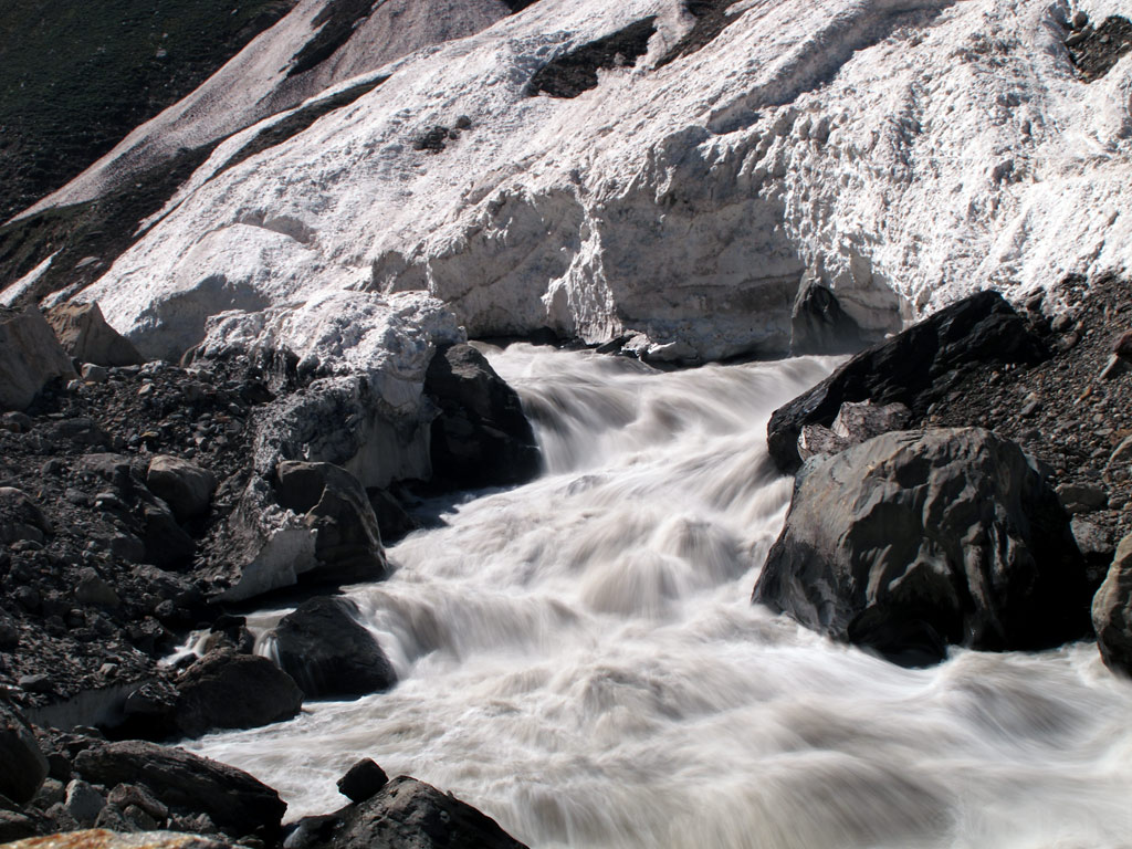
Fast rivers created by the rapidly melting glaciers and steep mountains.
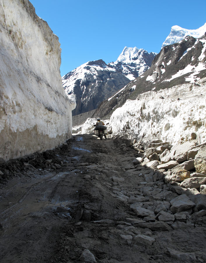
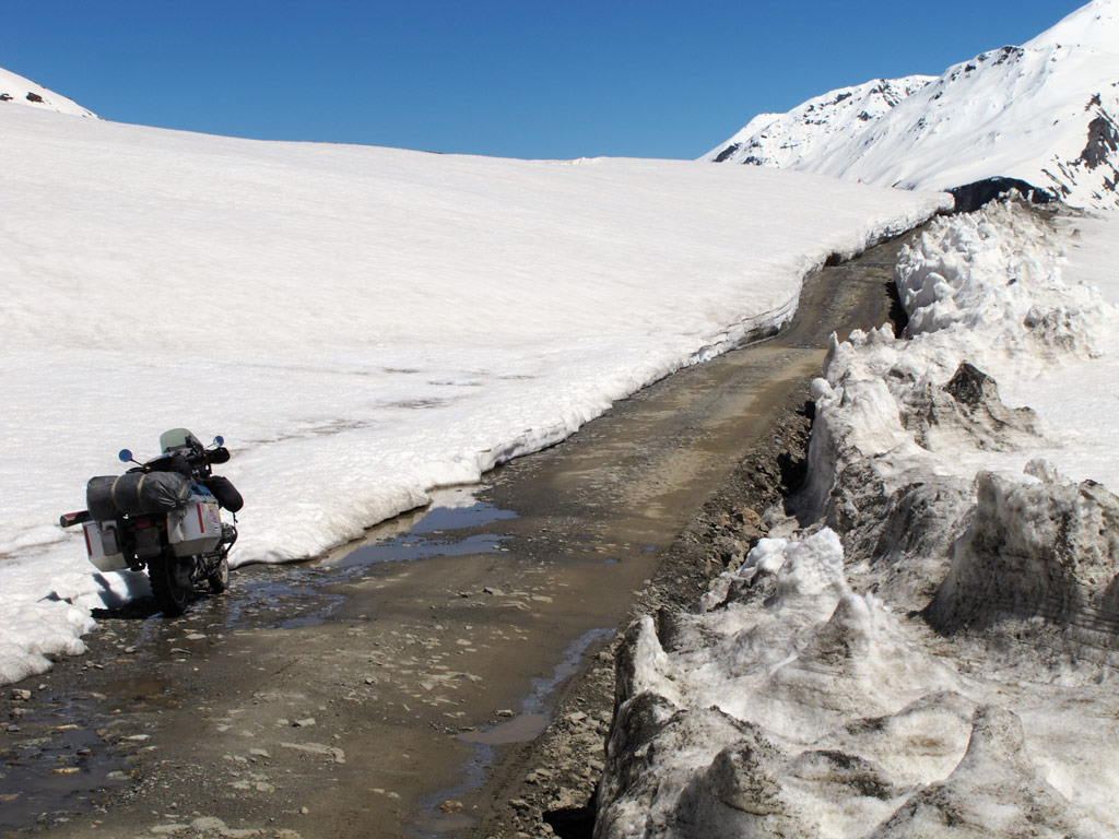
A typical Zanskarian road (ahem, rather a trail!).
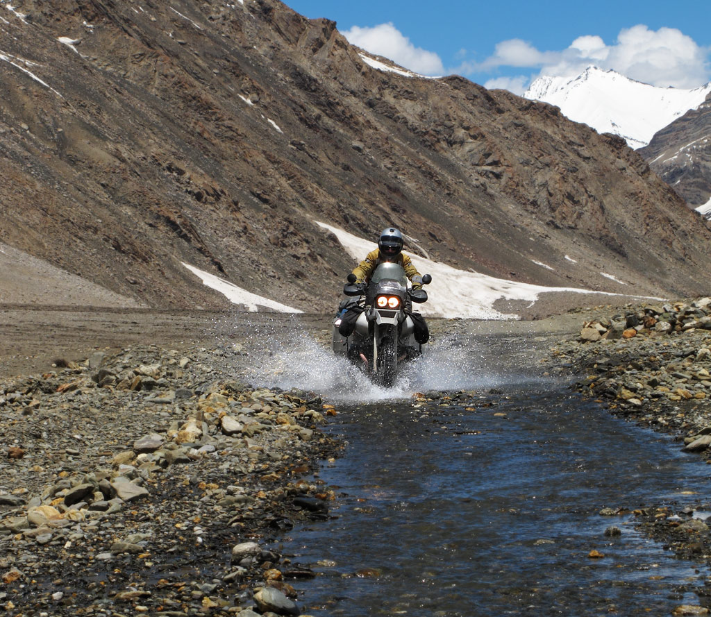
Often the trail is inside the river.
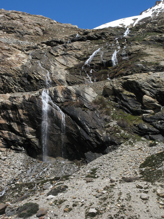
Lots of melting water.
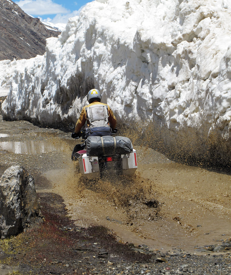
But our fully loaded GS kept its momentum with its decent bottom end grunty torque, relentlessly kicking through anything that's thrown under the wheels.
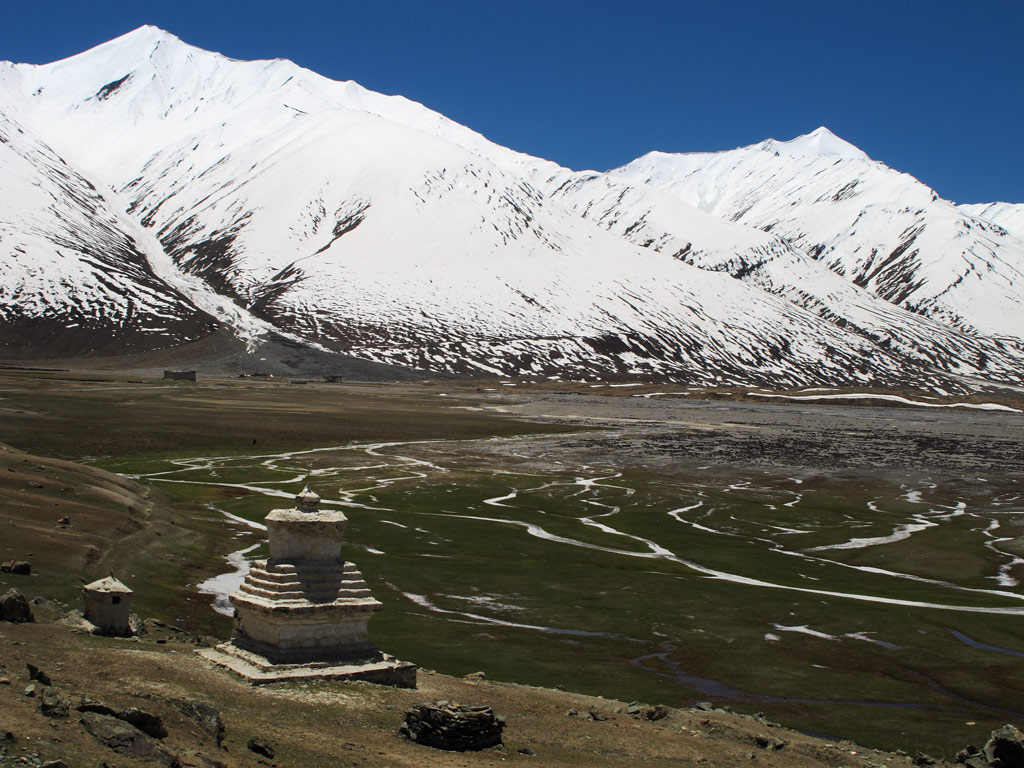
A lonely chörten in the vast Zanskar valley.
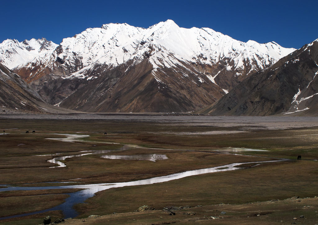
You see some herd on the wet valley bottom.
And quite a few meters of snow still left from the winter.
And rivers washing the already fragile trail away at visible speed.
Same spot as on above picture seen from below - it won't be long before the road will have to be completely fresh cut (with explosive stuff) out of the cliff again or an alternative route found around the same mountain.
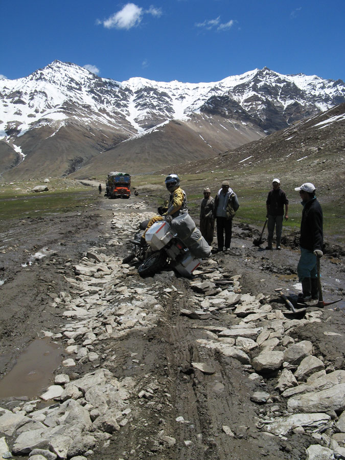
Nice rocky ground for the muddy valley bottom built by the allmighty TATA truck drivers - their trucks are completely stuck in the mud in the background and they're building the road by hand for their trucks using those big rocks.
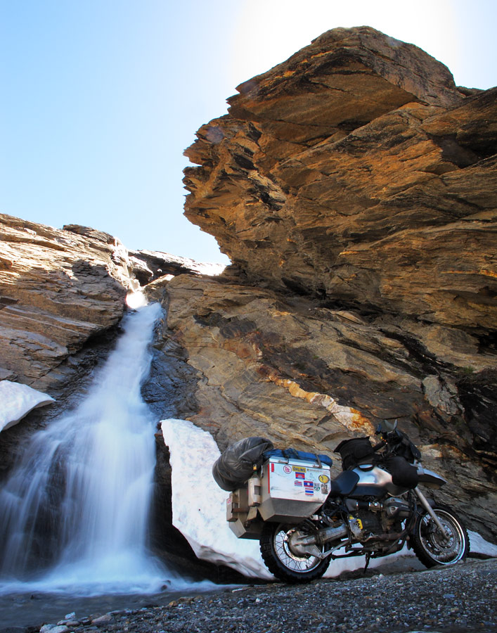
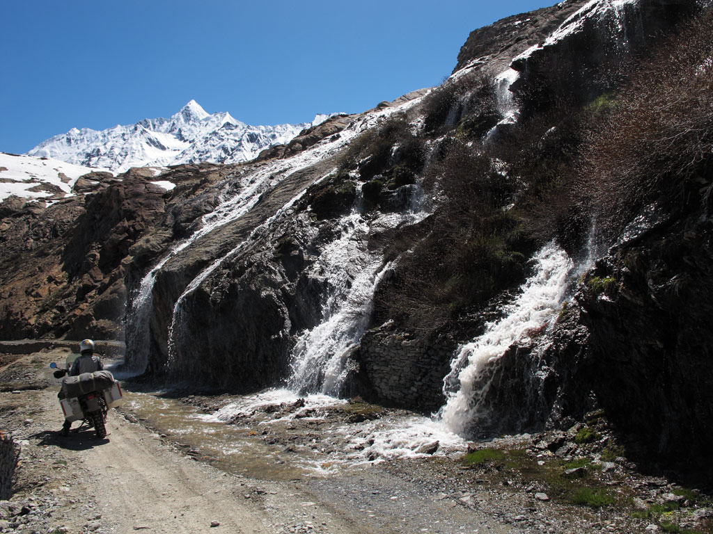
Under a waterfall.
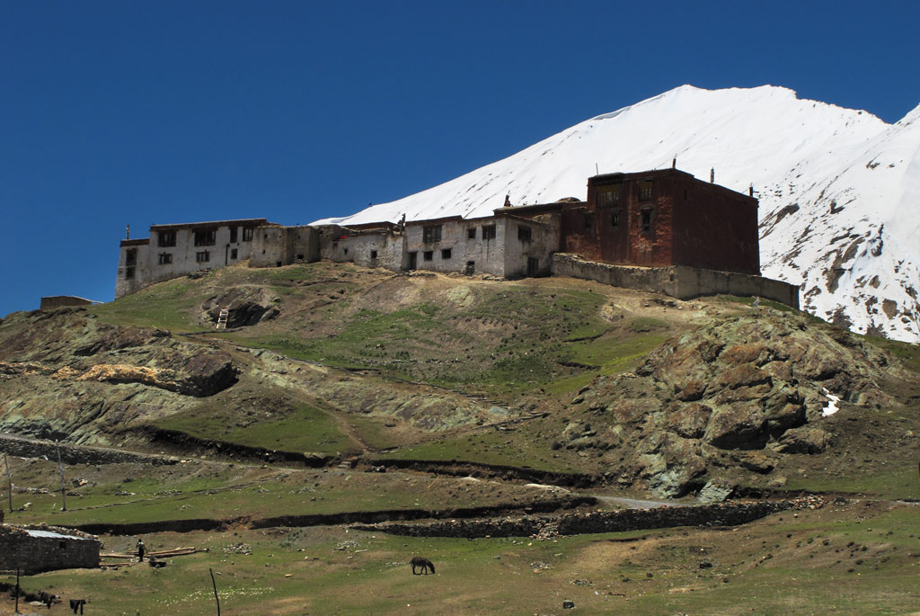
Randung gompa. An excellent meditiation spot for Buddhists, being situated in the remote valley on a small hill surrounded by 6000 meter peaks.
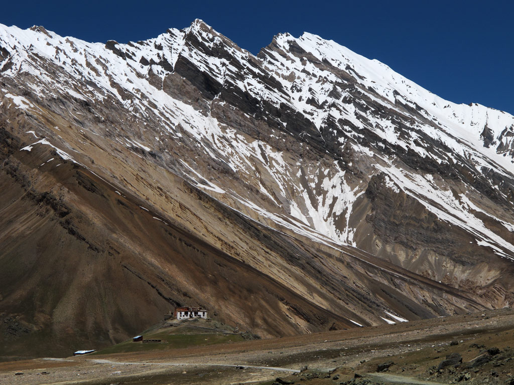
Randung gompa from the distance.
Mudpools too often surprised with their depth.
Reflections.
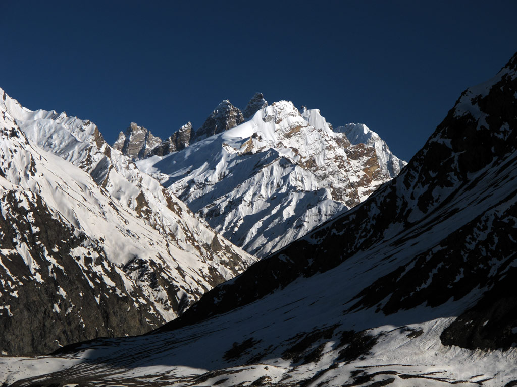
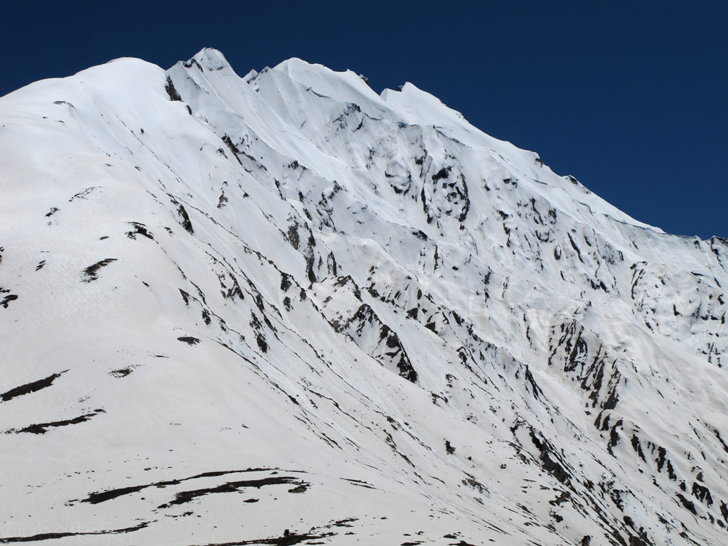
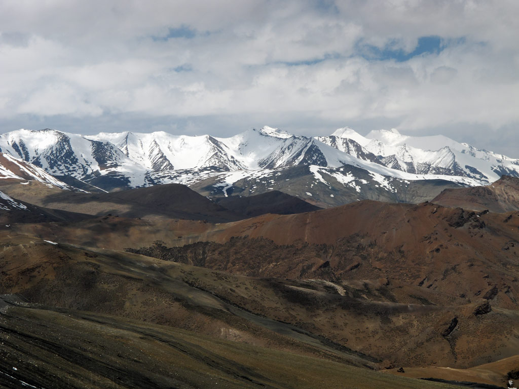
Zanskar range of the mighty Himalayas.
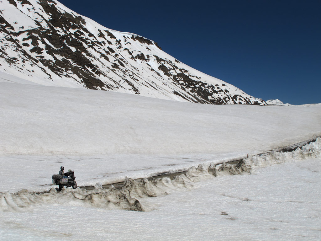
That's very typical Zanskar trail condition, together with endless rivercrossings. No wonder why our average moving speed by GPS is around 10-15 mph.
Stunning mountains surrounding the trail.
Click to enlarge the panorama.
Trail pushes us constantly above and below the snowline.
Exposing stunning views above the snowlevel...
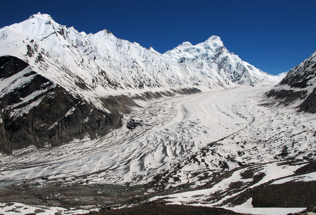
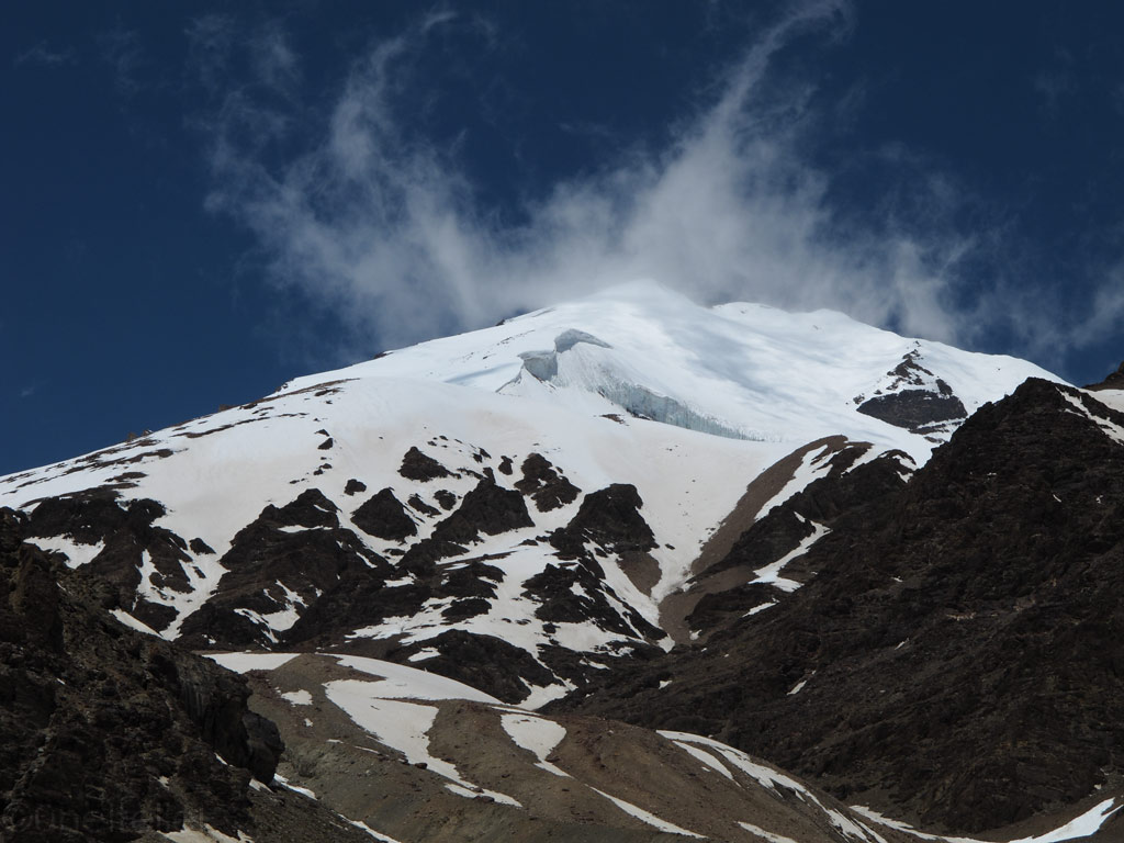
Drang Drung glacier.

Closer.
That's relatively easy part of the Zanskar trail.
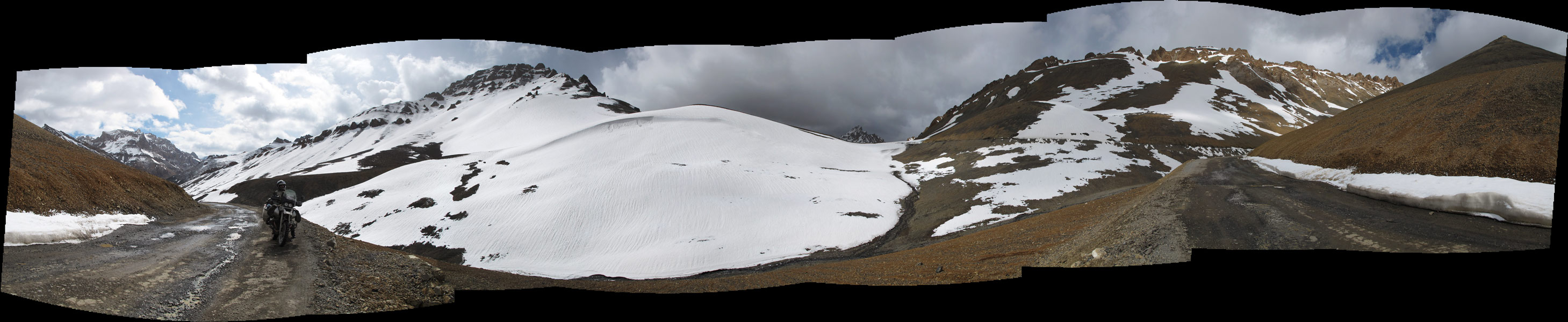
Click to enlarge the panorama - check the typical trail condition.
From above the snow level.
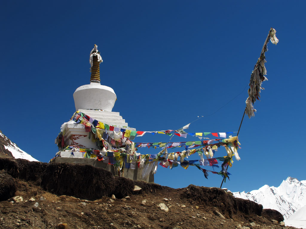
Stunning chörtens erected into the heights of remote places, with colourful prayer flags distributing the Buddhist mantras into the surrounding spacetime through the vicious Himalayan wind.
Fresh (bluish) vs old (white) snow.
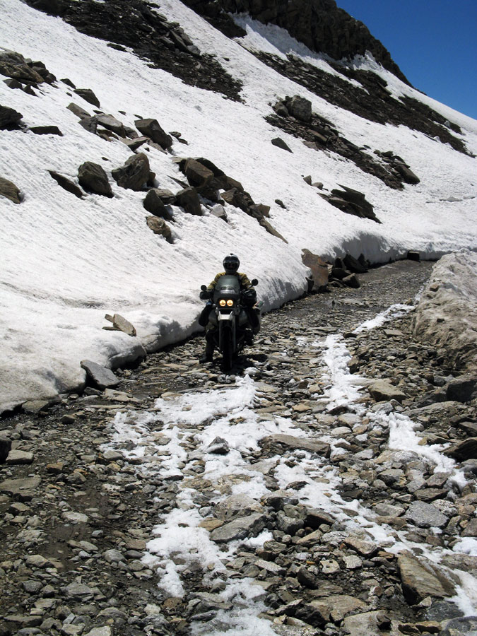
Road.
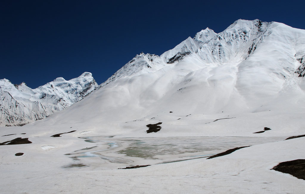
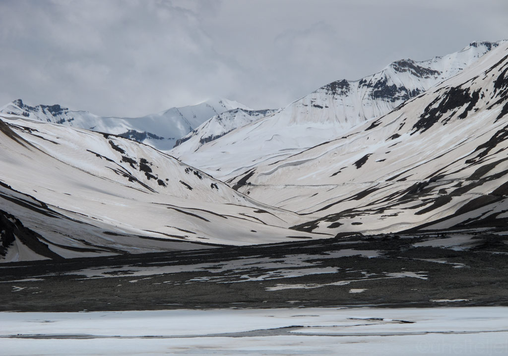
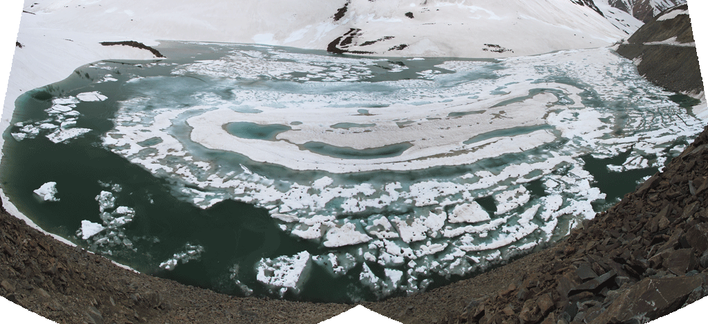
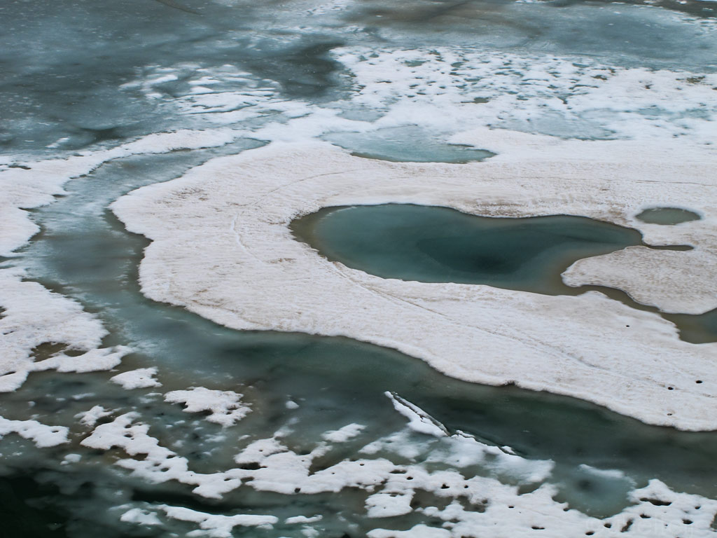
Frozen lakes at high altitudes on Pensi La.

Click to enlarge the panorama from Pensi La.
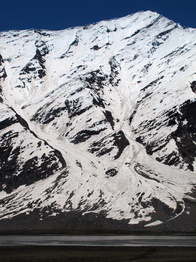
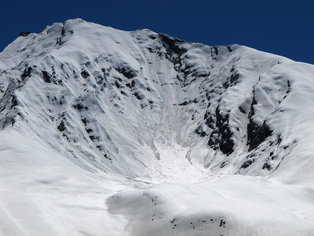
Massive avalanches waiting to be happen.
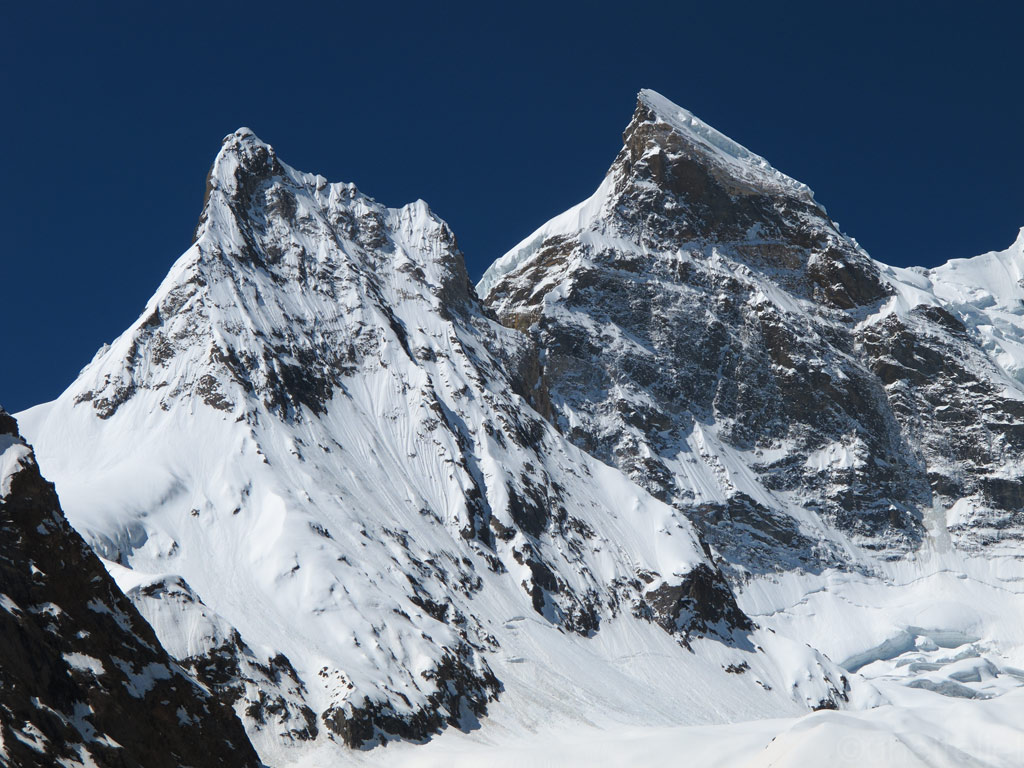
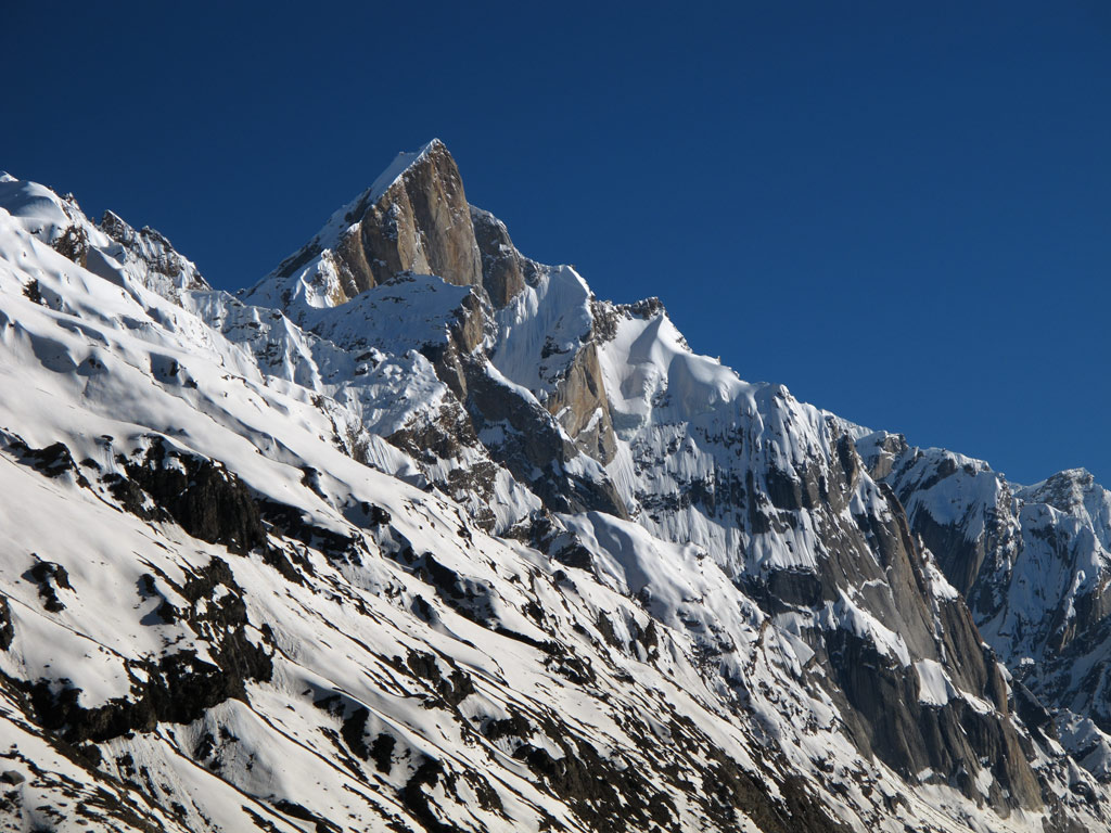
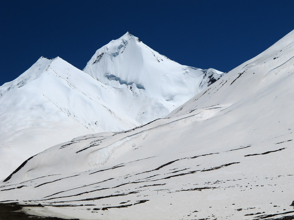
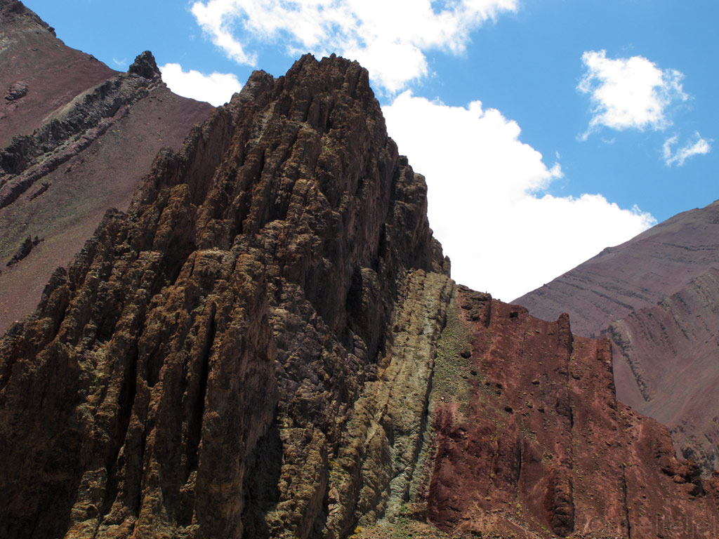
Sharp Zanskarian peaks.
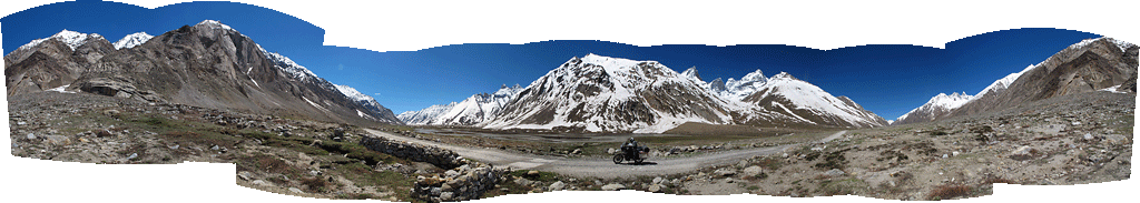
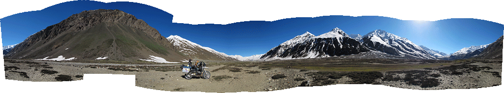
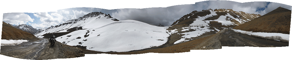
Panorama from the road (click to enlarge).
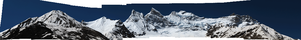
Peaks panorama (click to enlarge).
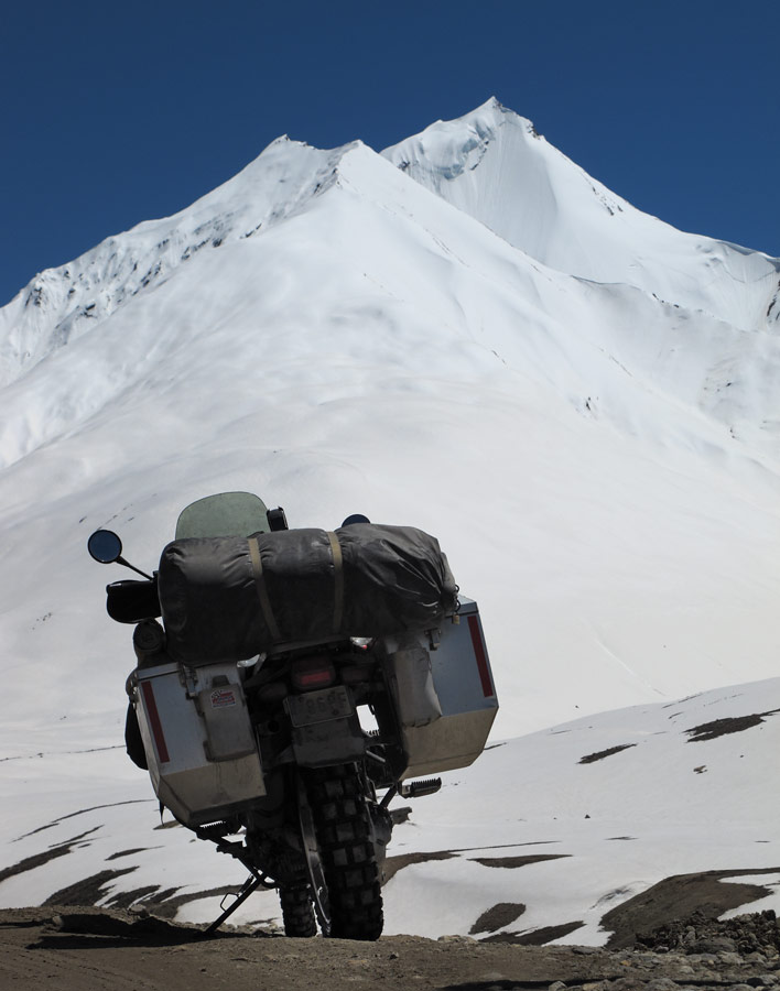
It might not have been the best time to visit Zanskar in terms of riding conditions, but then again had we come later, the baking summer sun would have had melt away much of the snow and part of all the power and magic of the Zanskar range (averaging the height of 6000 meters or 19 700 ft) would have been lost.
Moving at the average speed of some 20 km/h (13mph, more would have destroyed the bike in no time) and making loads of stops for taking photos, by the time we had crossed the Pensi La and entered the Zanskar valley proper, it was already time to find a place to spend the night. Spoiled as we are by the views of our last camping spots, we could not settle for less this time, so we scored a place with a breathtaking view just opposite a glacier. We did not care that a) both the tent and the bike were well visible from the road, b) the surface was rocky, uneven and exposed to the wind, c) we only had half a litre of water with us. The important thing was that the view was simply breathtaking!
Tenting spot with a million dollar view.
20 000 ft peaks with a stunning glacier just before us.
Under the stars lit by the midnight Moon.
In the moonlight, the snow on the mountains acquired magical glow.
Had to wake up quite early, even before the sunrays reached our tent, since the screeching of the marmots nearby was too loud.
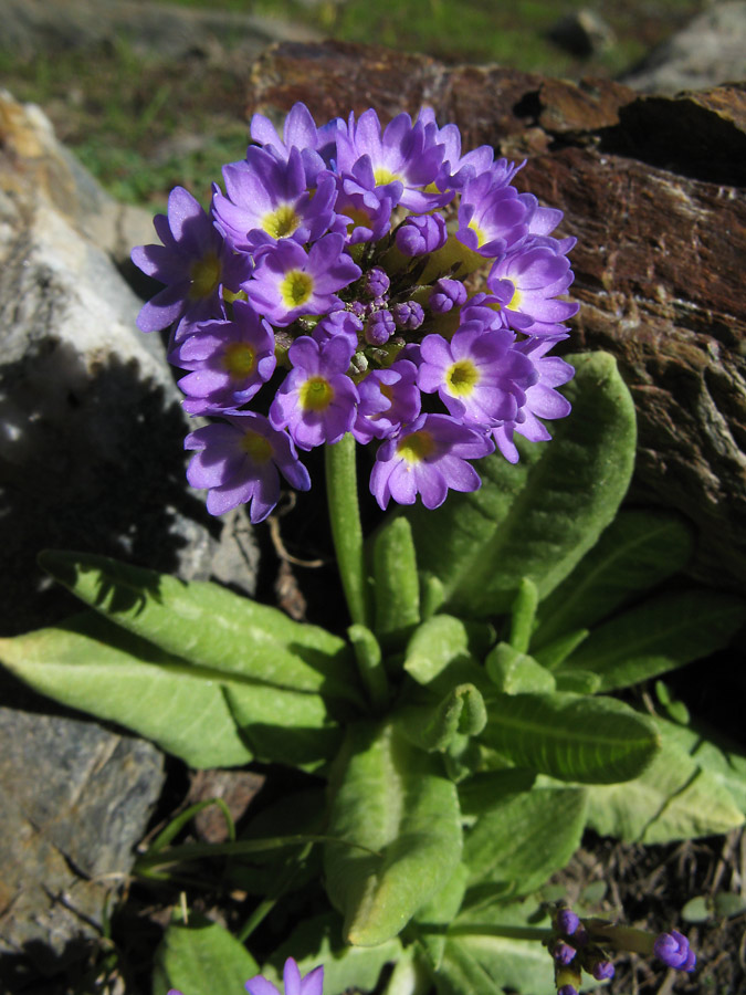
By the way, a nearby stream solved our drinking water problems. With no filters or iodine tablets it tasted just great, and did not have any negative consequences. Right at the stream, many flowers had burst in bloom:
Red flowers that grew only in the stream water.
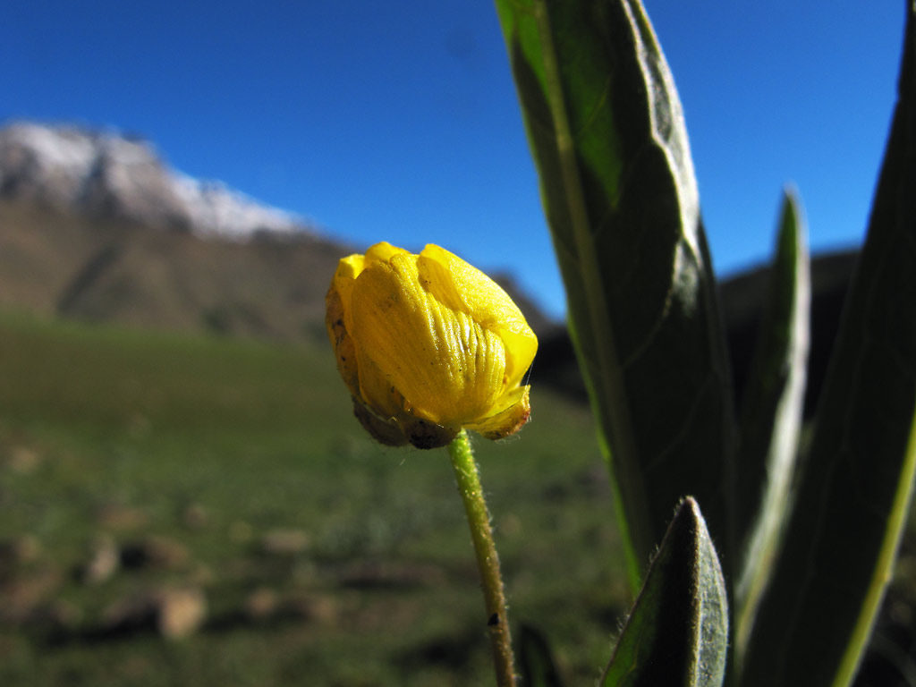
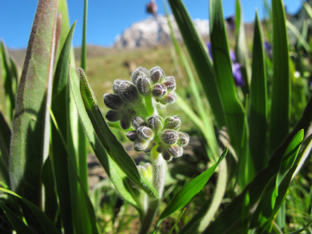
Different types of flora in the green Zanskar valley.
In Zanskar we could observe the life style of both Buddhists and Muslims which turned out to be quite distinct, starting from their architecture and ending with their garments.
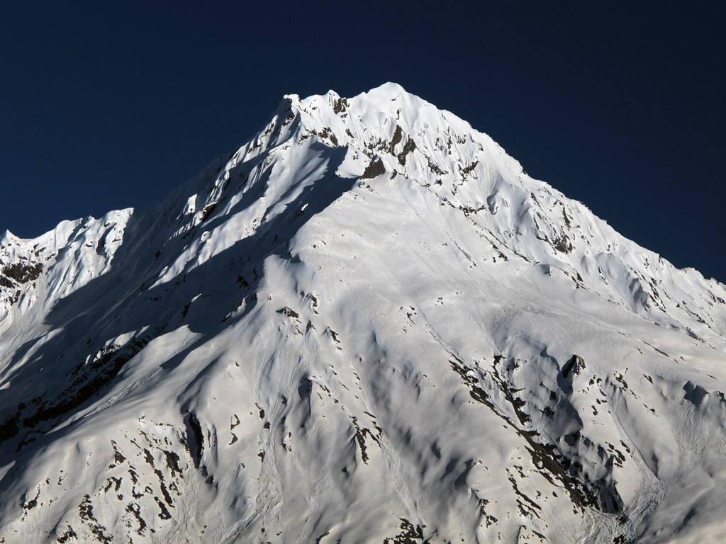
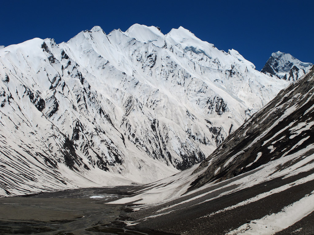
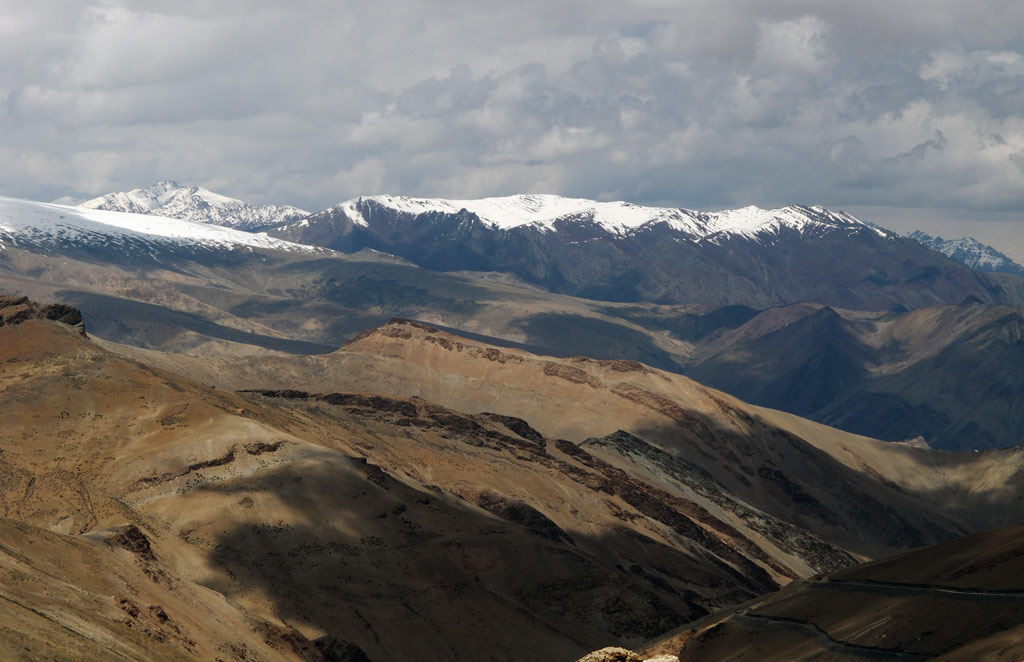
Positioned within the Zanskar range.
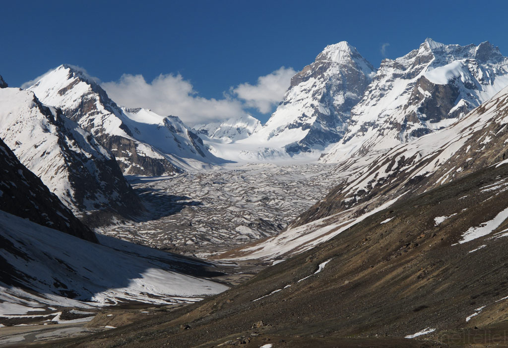
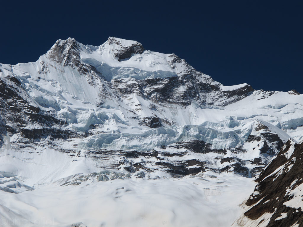
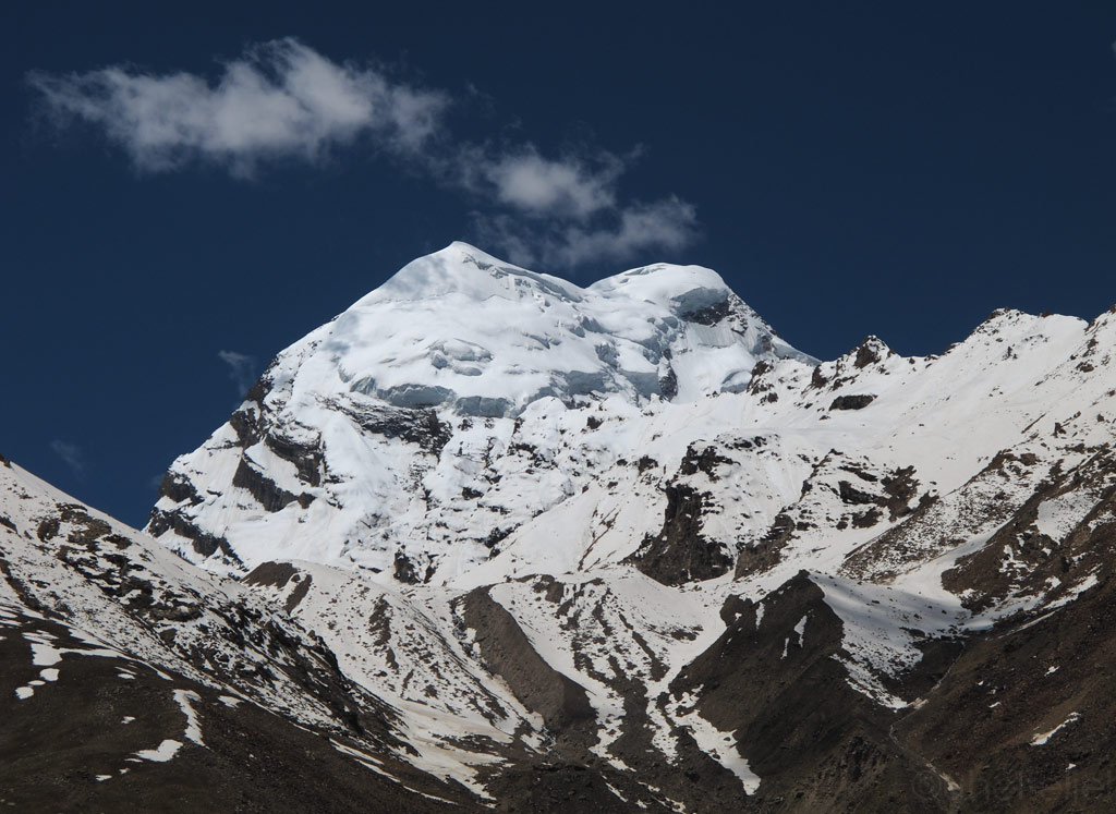
One of the many massive glaciers in Zanskar.
Avalanches on hold. A high top visible from Padum (the "capital" village of Zanskar).
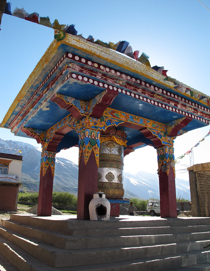
Big prayer wheel in Padum.
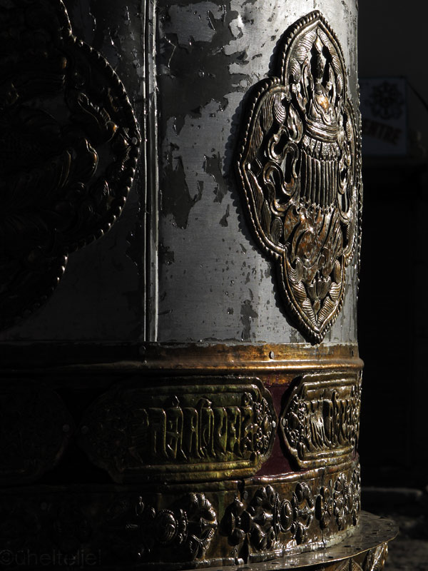
Another nicely carved prayer wheel in Padum.
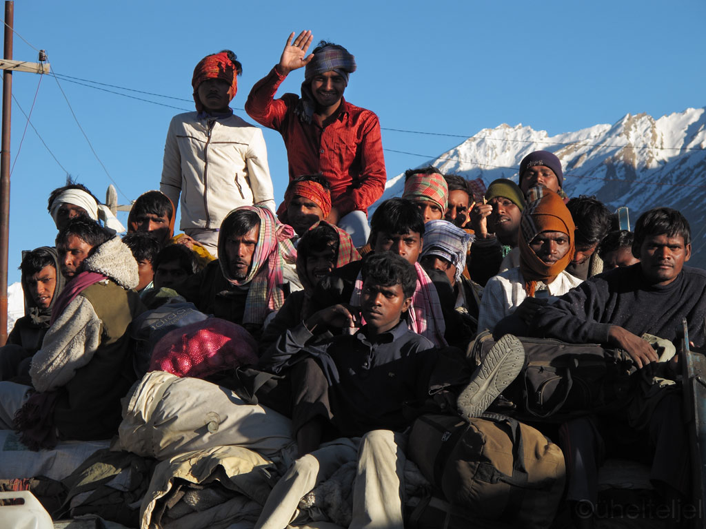
In Padum we saw a lot of road and construction workers apparently imported from South-India.
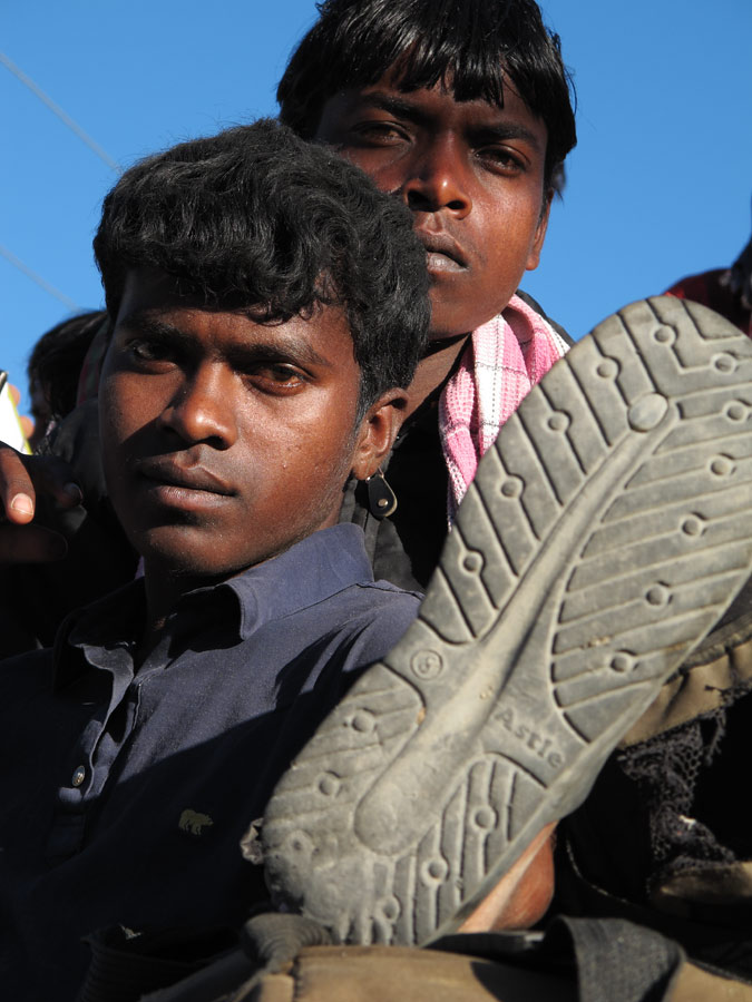
South-Indians enjoying the last warm sunlight before the typical Zanskar night freeze kicks in.
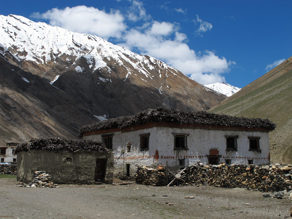
Tibetan style house in Zanskar.
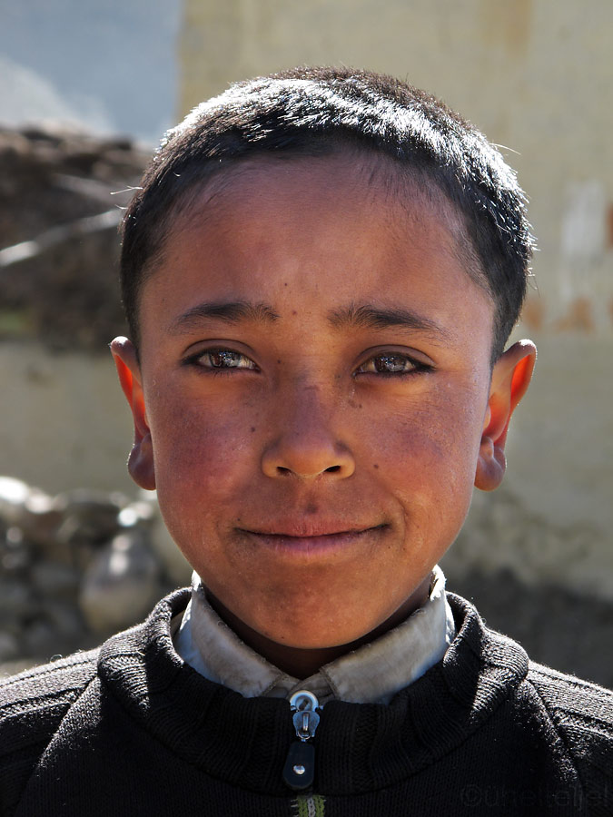
Young Buddhist man.
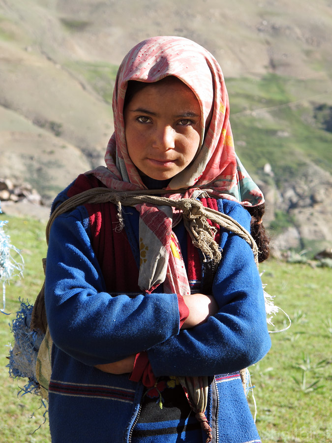
Buddhist girl.
A Zanskarian smile.
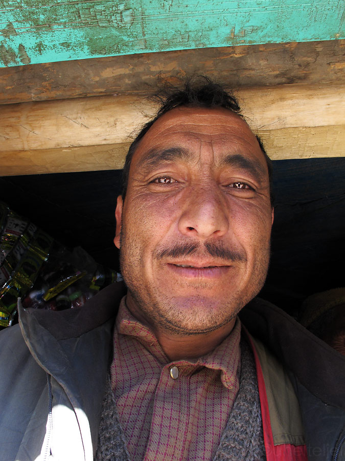
Buddhist man - we helped him to tape up his scratched finger.
A woman in UV-cover.
Some 100 klicks later the muslim community started who have their houses built in the green valley.
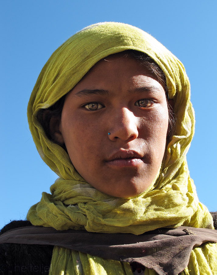
Muslim children.
Muslim men in the only shop I saw within some 150 clicks.
On the way back we decided to spend the night at the same spot where we pitched out tent the first time. This time there were no horses in the morning, but a group of young ladies collecting the sunbaked dung left by the yak and horses to be used as a fire material (the trees are really scarse in that area).
Muslim girls collecting fire material from the hillsides, where the herd usually is.
After a 1000 kilometre (of which 500 km courtesy of Zanskar) ride we were back in Leh. Exhausted and hurting from all the places, we went to look for some food as we bumped into Axel, a German whom we had met a couple of weeks ago and who is fond of discovering the treasures of the Himalayas on foot. "We know now what you meant when you said that the road to Zanskar, also known as the Road of Hundred Rivers* is one of the most beautiful roads on Earth", we told him. We must have looked blasted (hopefully satisfied as well), as he kindly paid for our meal which we were deeply thankful for.
*actually it refers to a trekking route which involves crossing the same rivers multiple times, but we did not manage to escape with dry feet either!
We first arrived in Ladakh it all seemed very calm, nearly abandoned. We were the only guests at our hotel, and there was nothing weird about locals greeting us merrily on the street, even if we had never met before. And no one was trying to sell us anything.
But as the time passed, the days grew warmer and more and more tourists made it to Leh. The locals became more reserved, and the town more noisy. Then the road to Manali finally opened, giving us one more signal that it was time to leave.
We said goodbye to all the places that we had become fond of, and after more than a month of coming and going we packed all our stuff once again - this time we were not leaving our trusty basecamp for a short side trip, but for good (or, alt least, until the next time).
We'll be remembering Leh by many sounds - helicopters flying above our heads, cows mooing in the streets, and frequent bleeping of the batteries signalling of another power cut. But there is also the ever present recital of Quran (there is a strong Muslim presence in this Buddhist country) and occasional bursts of traditional music.
So we headed to Manali, taking the legendary, highest road in the world. In the end, that is what we had come here for in the beginning.
The weather wasn't exactly promising the morning we started our ride - threatening clouds were blanketing the mountain tops right in the direction we were heading, so we could not help but to imagine all the misery awaiting us. But as it happens in the mountains, the situation changed quickly, soon revealing the blue skies and warm sunshine.
The following kilometers proved that after all those unforgettable, breathtaking rides, the Himalayan landscapes and lifestyle still had some nice surprises for us.
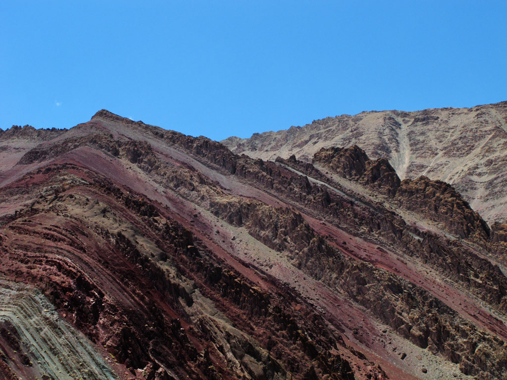
Nowhere else before had we seen layered ground pushed in a vertical position in such a spectacular way. One can only try to imagine the force of the landmasses that collided millions of years ago, and creating all this remarkable "mess" which the erosion later seasoned to perfection.
Ground pushed vertical in stunning scales, note the sci-fi colours of the rock.
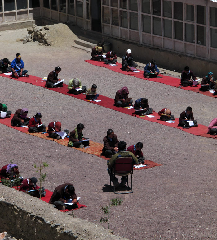
One more new thing to us was to witness a class at a local school.
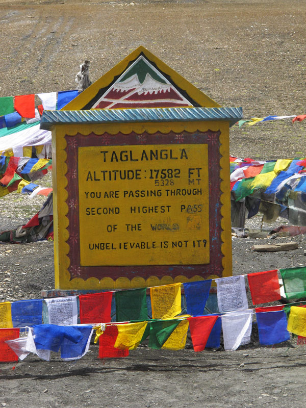
We crossed Taglang La, a pass that is, at 5328 meters (17 582 ft) allegedly the second highest motorable pass in the world.
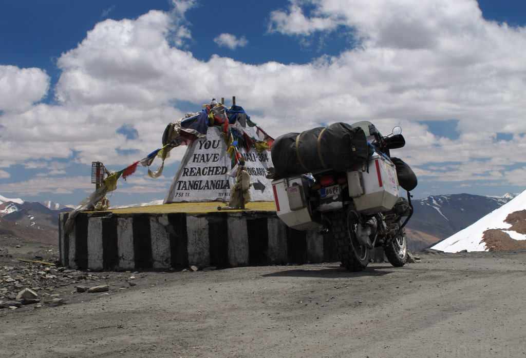
Taglang La - 17582 ft.
Views from 17 000+ ft.

Panorama from the road (click to enlarge)
Indian "Cappadocia"?
We decided to break up the journey somewhere in the middle of the Leh-Manali road, and to experience one last time, what it is like to camp in the Himalayas. No million dollar views this time, but we easily found a quiet spot from which to observe the romance of the clouds and the fading light. It was a night of sentimental feelings, with scenes of the might and the beauty of the landscapes that we had visited and with which we had developed an intimate relationship appearing again and again in our minds. Just as if it had all been in a dream, from which it was time to wake up. Half asleep, half awake, we tried to record all the sensations in every single cell of our bodies, to carry them with us anywhere we go.
Fading light through clouds - view from our tent's door.
By the morning the magic had disappeared - instead of a warm farewell the sky was covered in clouds and there was ice both of the bike and the tent. By the time we really got out of our tent it did light up a bit though - maybe the mountains weren't so willing to let go of us after all.
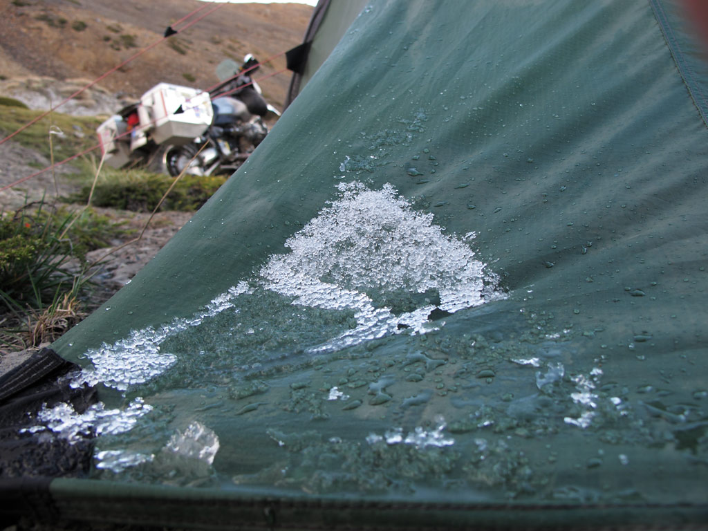
Snow melting off the tent in the warmer morning light.

Good (chilly) morning on the GS seat.
Our another usual wild camp spot, this one was 4550 meters (14 927 ft) above sea level.
Panorama from the tent spot (had to climb up from that mountain side covered with loose rocks with the GS - click to enlarge).
But the further south we rode, the more cloudy and dark it became again, just as if there was a sentiment of sadness, or maybe disappointment on behalf of our magnificent host. Or maybe it was just the monsoon gaining territory on the southern edge of the mountains. In any case, none of the majestic features were lost.
Lachulung La - 16 616 ft.
Every high pass has prayer flags that give them a somewhat romantic feel.
Himalayas through snowing.
Rocky stuff.
Majestic Himalayas.
Unfreezing lake.
Avalanches on hold.
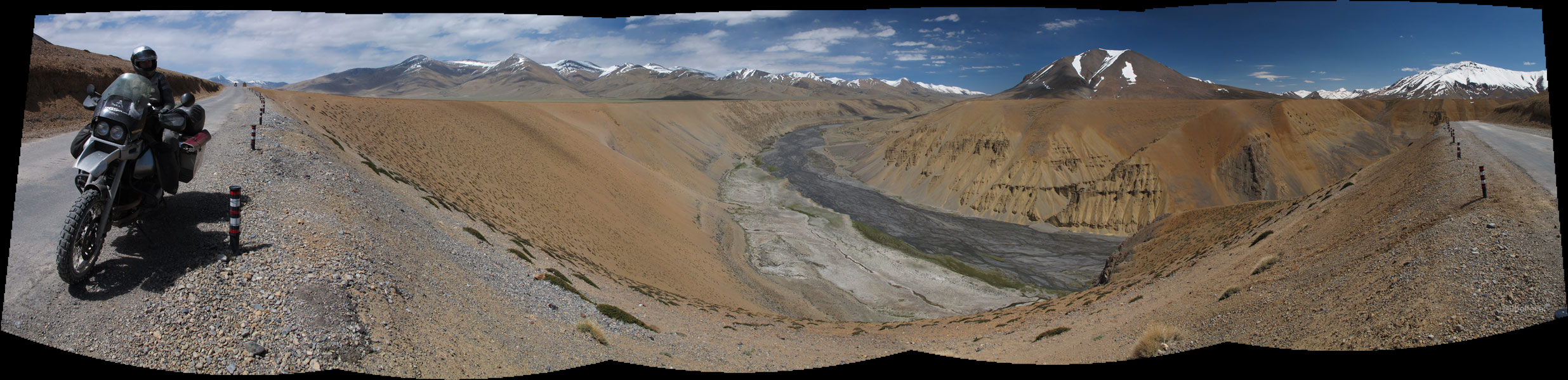
You can see our road on the right - Baralacha La is somewhere there waiting for us to cross it.
Suraj Tal (click to enlarge the panorama)
Artistry of the nature closer on the Suraj lake.
Panorama from the road - click to enlarge.
And it really started to snow.
At one point the chance of rain became too obvious, so we decided to pull over and put on our waterproofs. While we were struggling to get them on, we heard someone shout "Run!". His voice was reflected off the mountain slopes, but we could not see who it was or whom was his shout directed to. Seconds later, a huge rock came rushing down the slope, which landed smack in the middle of the road just some fifty meters (165 ft) away from us, the muffled sound of impact wafting through our bodies and the ground beneath our feet. Had we been passing some minutes later than we did, or had we decided to stop before we did…
A "fresh" massive rock from the heights.
Distance from where we parked the bike when we heard the fall.
As we rode on, the rain became denser and denser, so by the time we reached Rohtang La, the last pass on our way, it was pure mud and water festival. With quite a bit of an effort, we crossed the pass, and there we were again, at the same point where we had had to turn back the last time, some two months ago. Back then, the road to Leh had been closed, and we promised ourselves to be back once it opens. Back then we had though of how bad our timing was, but now that we think of it, it could not have been better.
Now the circle was closed. We were back in the reality, with mighty Himalayas left behind, at the same time still living in our memories.
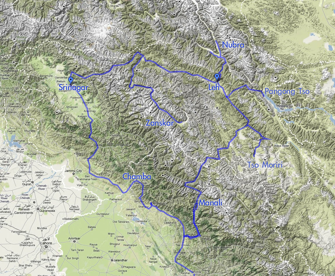
To put things into perspective, here is the map of our route during some two months or so:
As we were setting off from Manali we figured it would not take more than two days to reach the sacred city of Amritsar right near the border with Pakistan. Of course, we were wrong.
The morning we were about to begin the final leg of our journey through India we found out the rear tyre to be flat. Without much fuss, an agent to blame - a rusty nail - was found, the puncture was plugged and we gor on our way.
A couple of hours later we were forced to stop by the road because the tyre was empty again. We looked up a tiny puncture, and once again repaired it wondering to ourselves how so much air could have escaped through such a small hole. Just in case we decided to check the whole tyre for more possible punctures, and found two more.
Got all of them plugged, and just as I was trying to pump some air into the tyre to see if there's more if them, the valve came flying off. Apparantly it had been broken and apparently it had been the actual reason for the air leaking faster.
While we were trying to figure out how to sort the situation in a place which was most likely at least tens of kilometers away from the nearest (tubeless) tyre shops, some local bikers stopped by. All they could say was - "Nice bike!" Then they rolled off.
With not many options to choose from, I figured that with some luck, some super glue should help to keep us going for a while. So we rolled of, too, on a tyre that had been plugged from too many places (four in total, including one additional small puncture that I didn't dare to repair), and had the valve super glued to it. Not a very reliable option - more like having a ticking bomb between your legs. Having had similar "too easy to puncture" problems in South-East asia we again must point out that the Continental TKC80 have utterly weak carcas beneth the tubeless tyre. I'd kill to get the proper strong tubeless Heidenau K60 in South-Asia, but we just can't get 'em here.
Anyways, somehow it happened that the tyre did not disintegrate and we managed to get to Dharamshala safely. And, to have it face lifted despite all the holidays, week-ends and a strike. Sure enough, the only workshop we managed to find at such turbulent times did not have the proper tools, but we got the tyre on and off with raw force only, got the punctures patched (five patches total as there was one more tiny puncture), and the valve replaced.
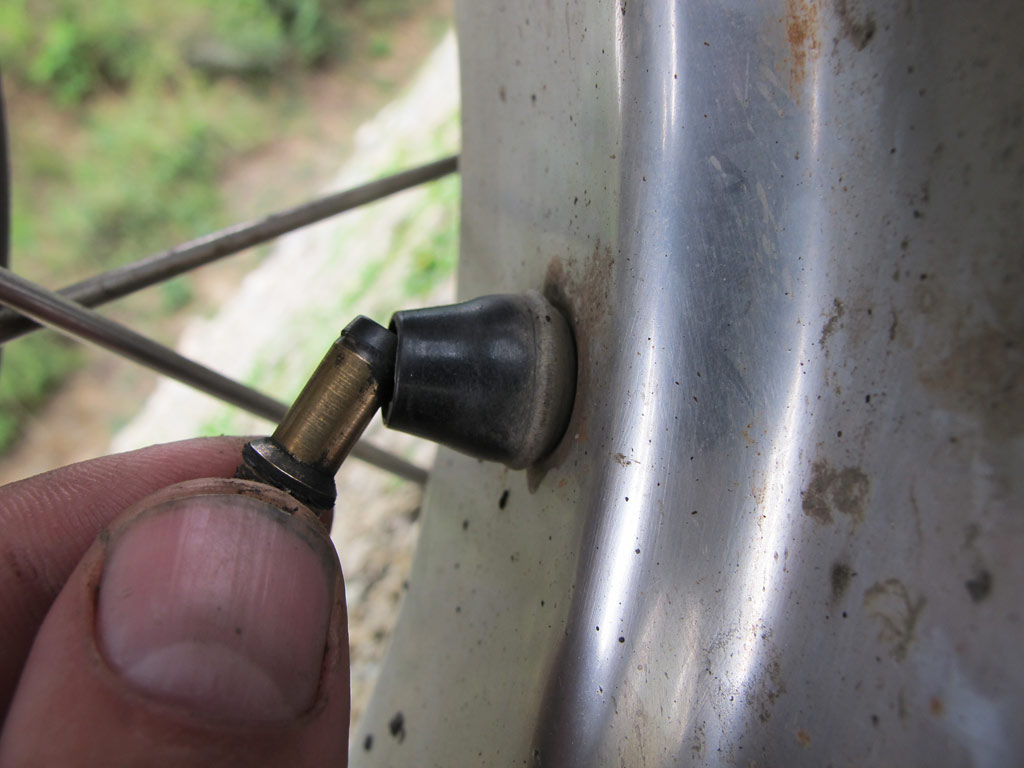
Blown off valve.
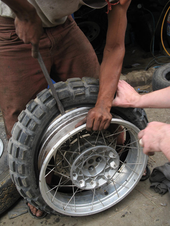
Removing tyre with simple rods. The TKC80 is a very soft tyre for a tubless, with a little manly force you can even remove or mount it without any special tools (and that's not a good sign for a tubless tyre.)
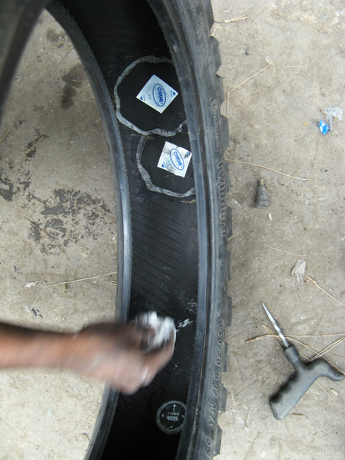
Made in India patches.
It is fair to say we were a bit sceptical about all this thing, but it sure got us to Amritsar.
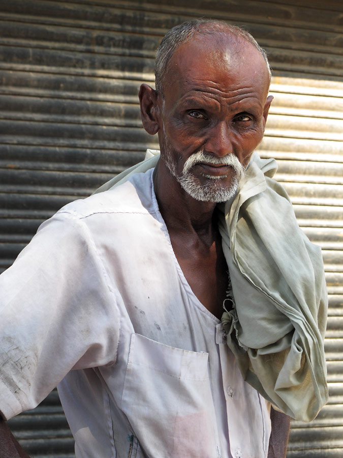
Indian man staring curiously at us.
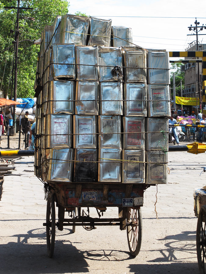
Rickshaw transport in Amritsar.
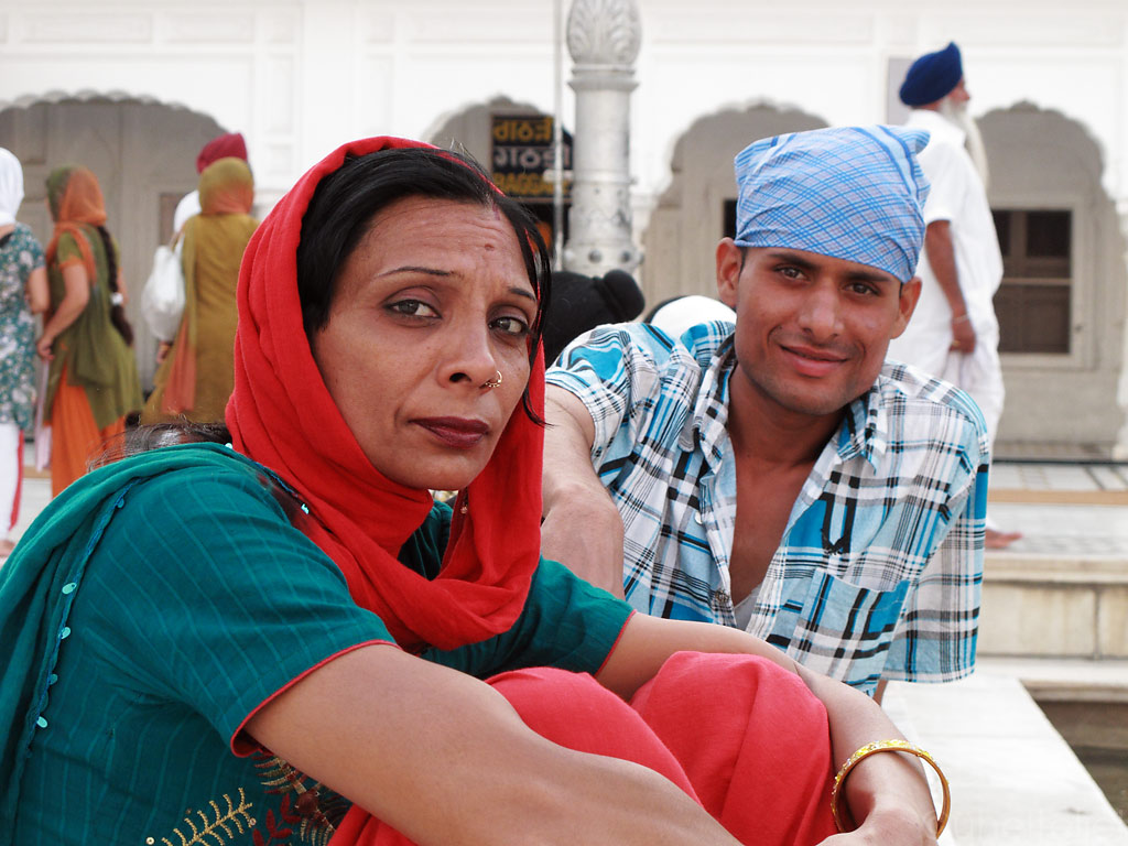
We were the highlight for many indians.
Amritsar is the holy city of Sikhs, followers of a religion that is not so widely known, but who make up some 70% of the population of Punjab province in India. In the street, they are immediately recognisable as they wear the head dress called turban, and those that are baptised also have a small dagger or a sword complementing their outfit. Actually the Sikhs, who believe in one and only God, also believe that the greatest battle is within. They certainly leave a very dignified, but at the same time very open impression.
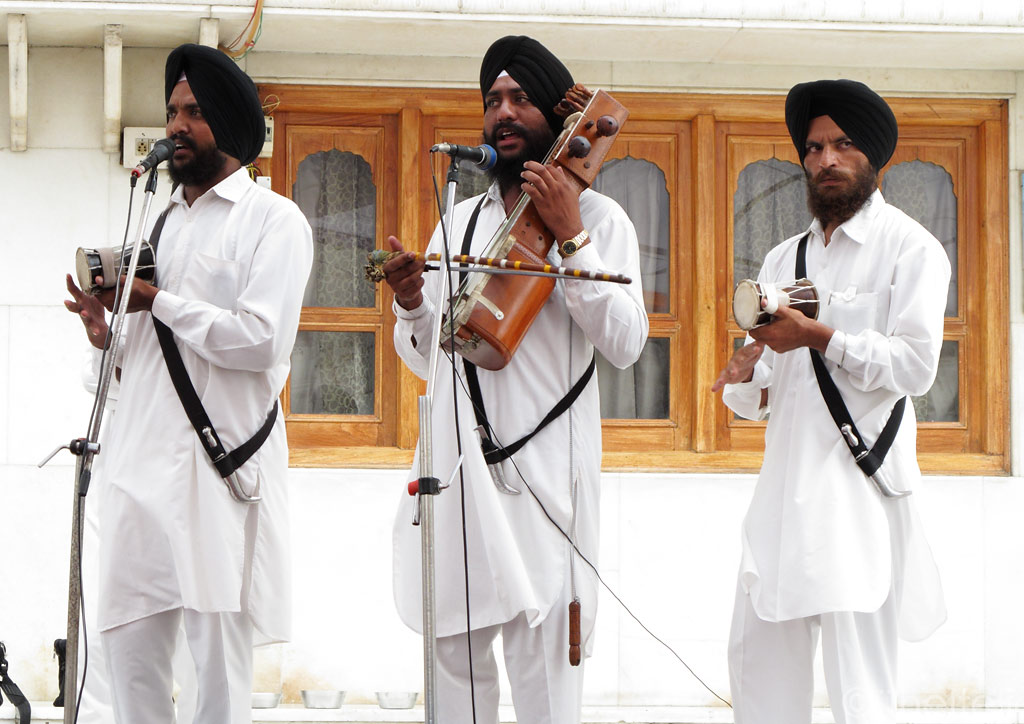
The centre of their universe, just as Kaba for Muslims, is the Golden Temple of Amritsar. The difference is, that everyone is welcome at the temple (but shoes must be taken off and both men and women must have their head covered). As the name suggests, it is covered with some 100 kilograms of leaf gold, but its foremost value lies in the Original Book that it contains. Each day, from sunrise to sunset, prayers are being sung around it, accompanied by harmonium and tablas. As they are reflected from the marble walls of the temple complex, it creates a peaceful, if somewhat melancholic atmosphere. By the way, each and every one of Sikh prayers ends with the plea for the benefit of all humanity. I was simply blown away by their welcoming and friendliness and their inspiring spirituality in their dynamic sound.
Different kinds of Sikh religious music can be heard around the temple complex:
The Sikhs believe that all the humanity was created by one God who has different names and forms, and therefore that all religions should be accepted. One of their principles is also equality, making no difference between races, castes, gender or nationality.
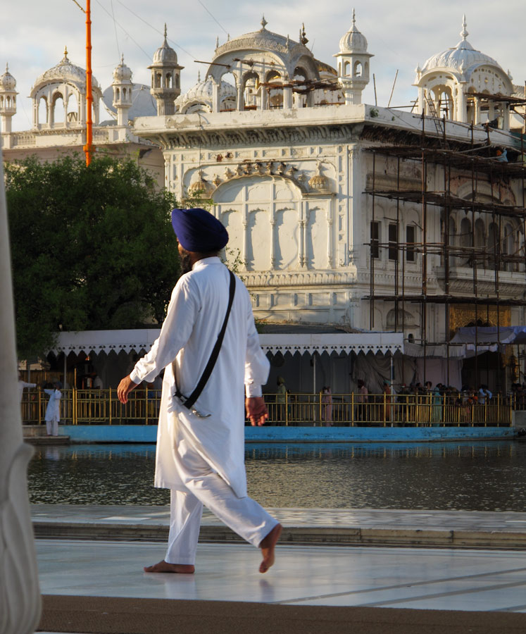
Sikh walking around the Golden Temple.
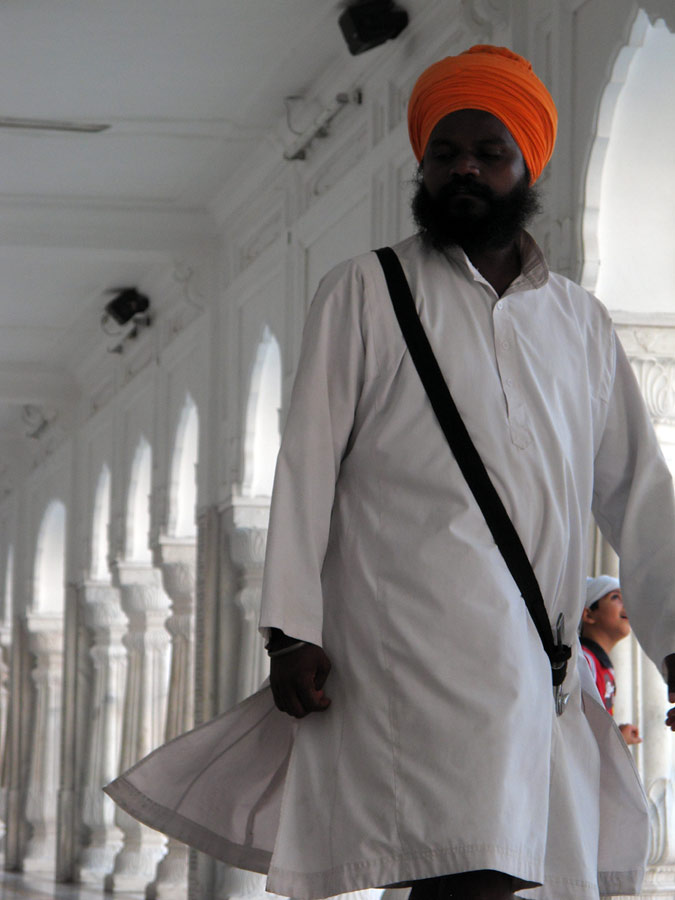
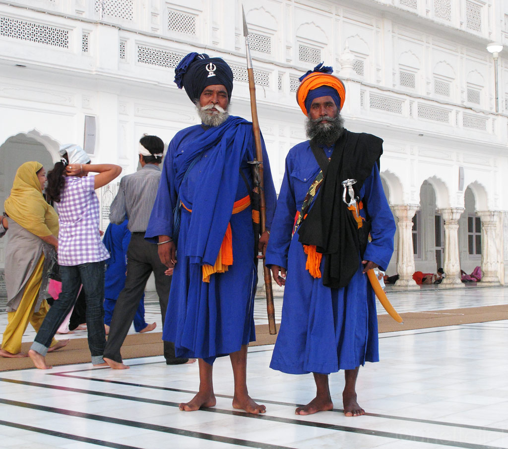
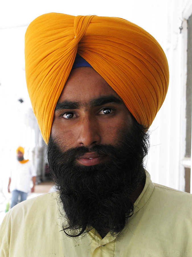
Sikhs in their traiditional clothing and weaponry.
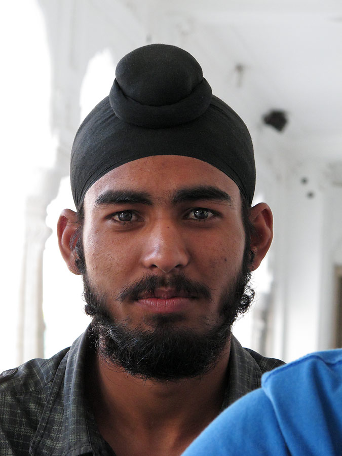
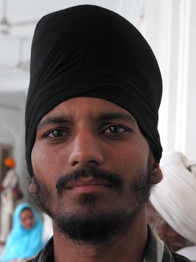
Younger Sikh men carry only the small turban.
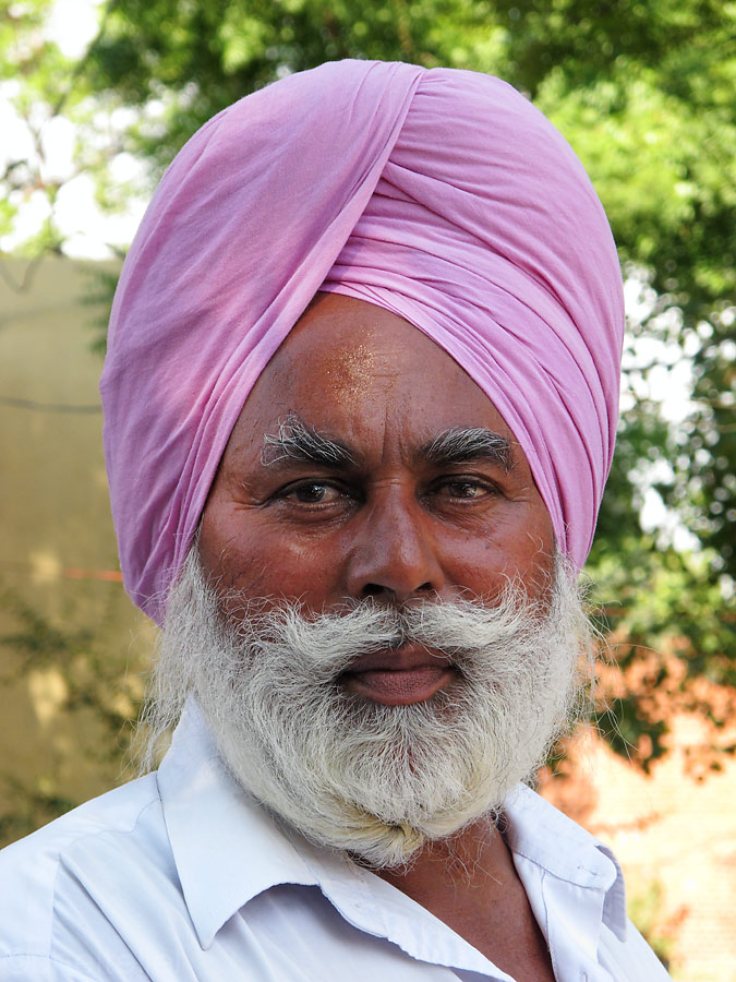
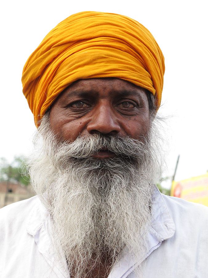
Proper "double" turban on older more wise and experienced men.
But even Sikhs have different tribe variations.
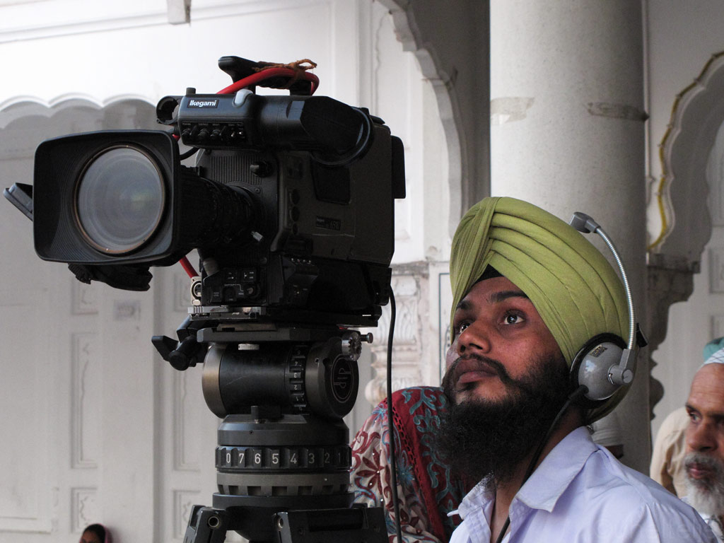
Sikh cameraman carefully filming the happenings around the Golden Temple.
Sikh volunteer cleaning up the pool in front of the Golden Temple.
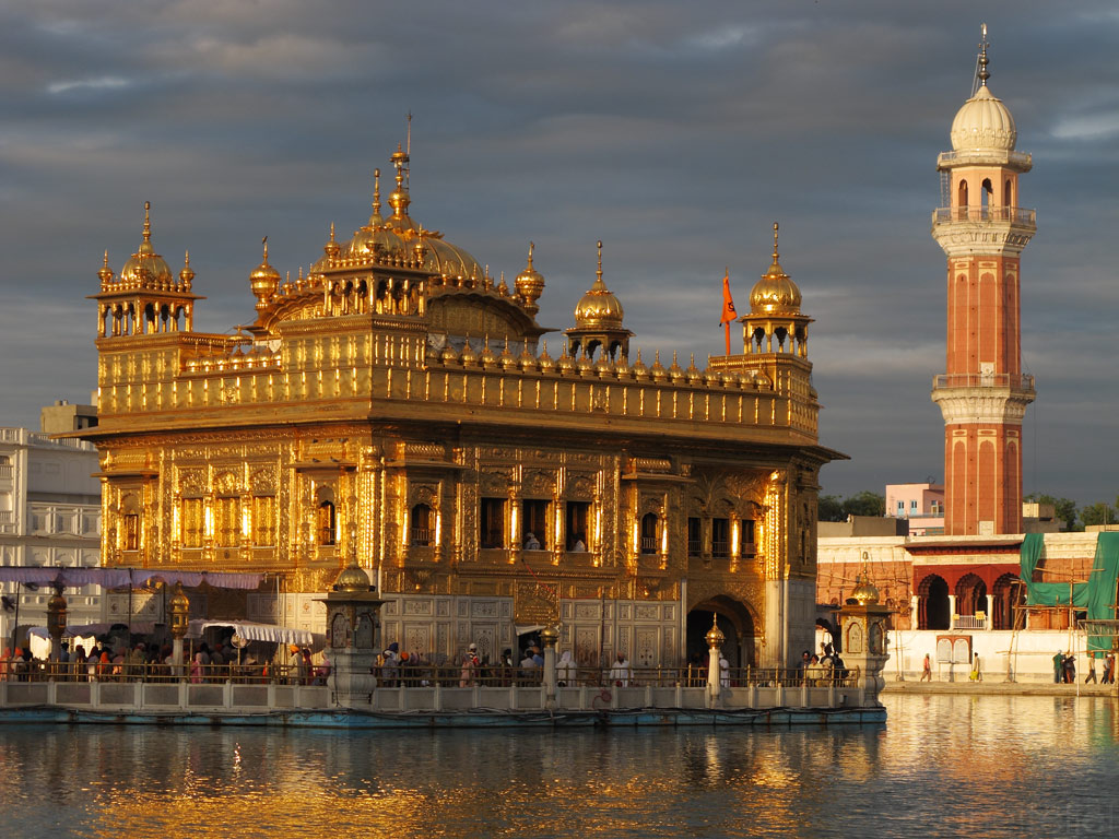
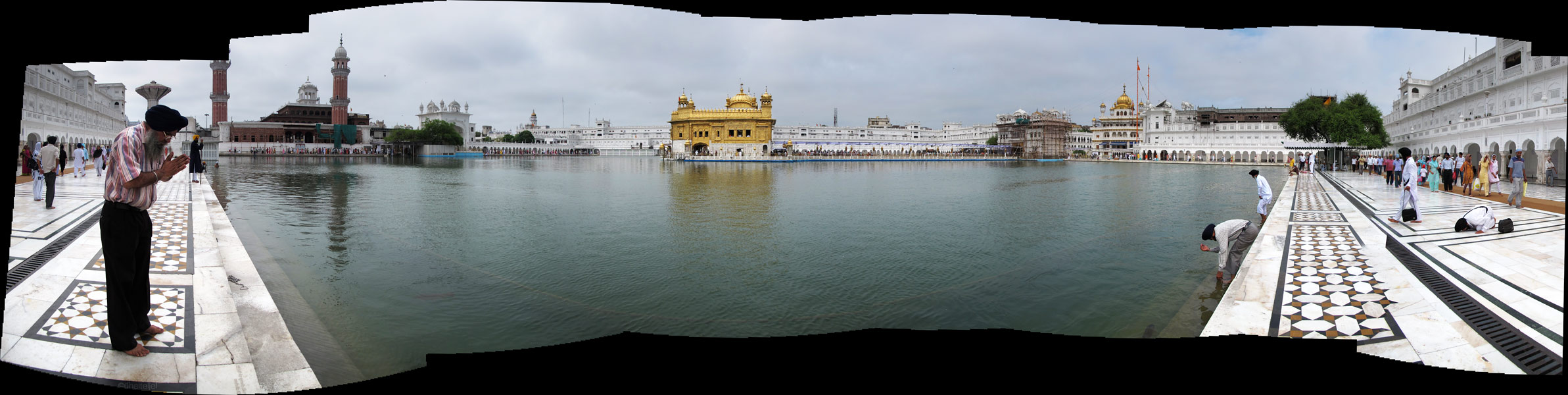
The Golden Temple at one angle.
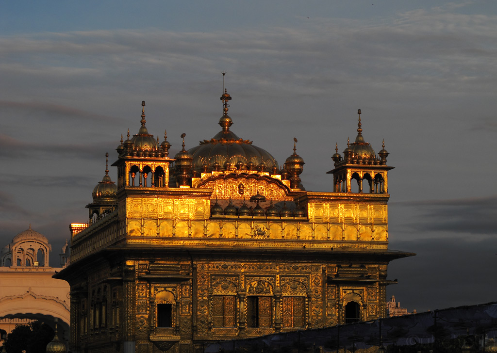
100kg (220 lb) of the Sikh holy gold in the last golden sunbeams.
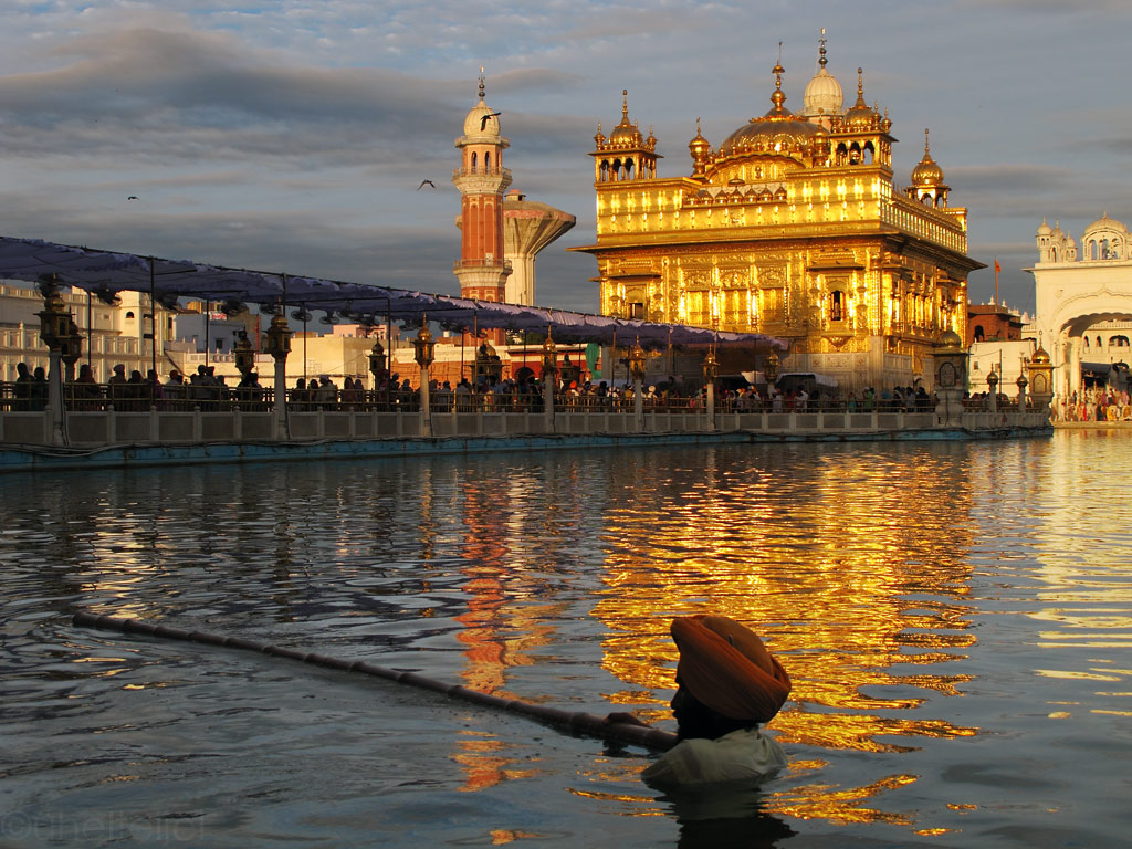
The Golden Temple sits it the middle of a large pool, which is also where the city of Amritsar got its name from. "Sarovar" or simply "sar" means a pool, and "amrit" stands for the nectar of immortality. No pilgrimage to Amritsar is considered complete without bathing in this pool, also home to some well fed fish.
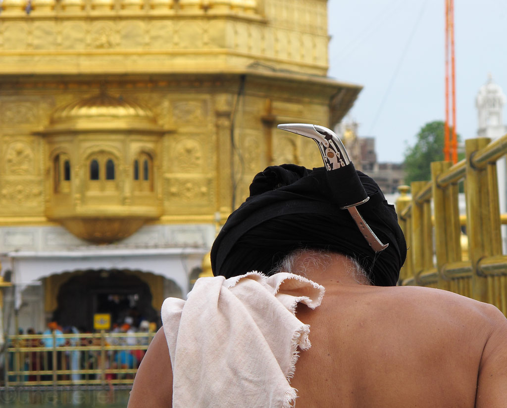
Sikhs put their knife in the turban when going to swim.
Coming out of the holy water, blessed.
One more important part of a pilgrimage, which also emphasizes the principle of equality, is a free meal at the huge communal kitchen on the premises of the temple complex. Everyone is welcome - regardless if you are a pilgrim or just a visitor - at this simple meal consisting of rice, chapatis and dhal (lentils and beans). Some tens of thousands people get fed there every day.
Food is basic, but tastes good!
.... and to sum up India - some pics and words about Indian food:
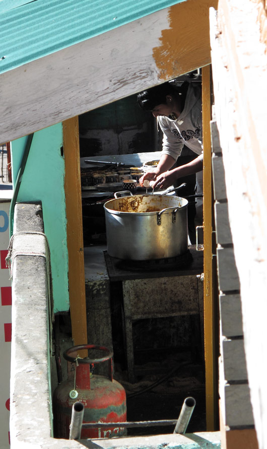
Typical Indian kitchen - may look not so clean and modern, but it produces some really superb food.
Now that we've gotten a good taste of it, a couple of words about Indian food. To be honest, we were first pretty sceptical about it - also because it is mostly vegetarian, but while in India we have learned to truly love some dishes. Indeed, the variety is great and the abundance of spices almost makes up for the lack of meat.
For example, nothing makes for a better breakfast than a parantha (pancake like stuffed bread) accompanied by plain curd. Normally it is eaten by hand - you just tear a piece of it, put some curd on it, and eat it. The fillings are different, ranging from onion to cauliflower, but we like the most paranthas with potato (aloo parantha) and unfermented cheese (paneer parantha).
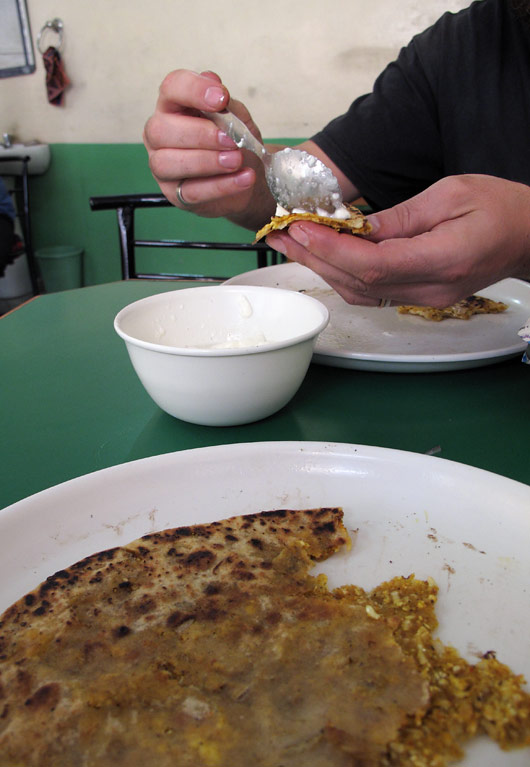
Parantha with curd.
Parantha is usually served with some pickles, i.e. pickled fruits and vegetables. Often the strong vinegar smell emanating from this otherwise tasty looking condiment is almost frightening.
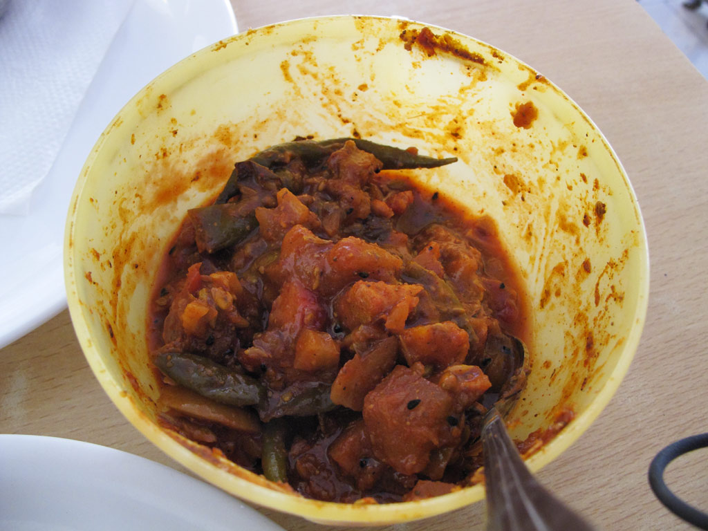
Pickles.
The best snack, served by almost every roadside shack is, of course, samosa - a deep fried piece of dough (normally with cumin seeds) with spicy potato filling. We had our best samosas at a random shack at a random crossroads in Punjab where we could see the whole cooking process (so they were definitely fresh). Served with a little bit of tomato sauce they are perfect for killing the hunger for an hour or two.
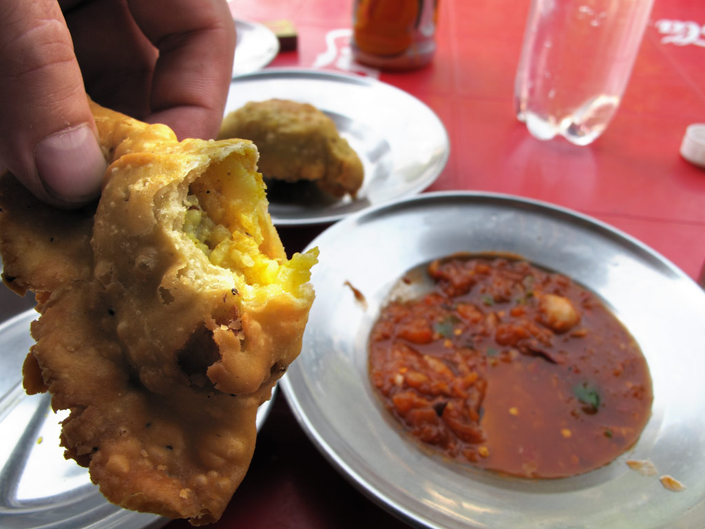
Samosa.
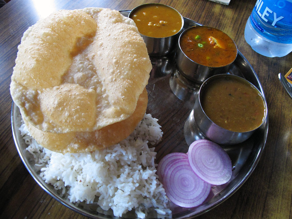
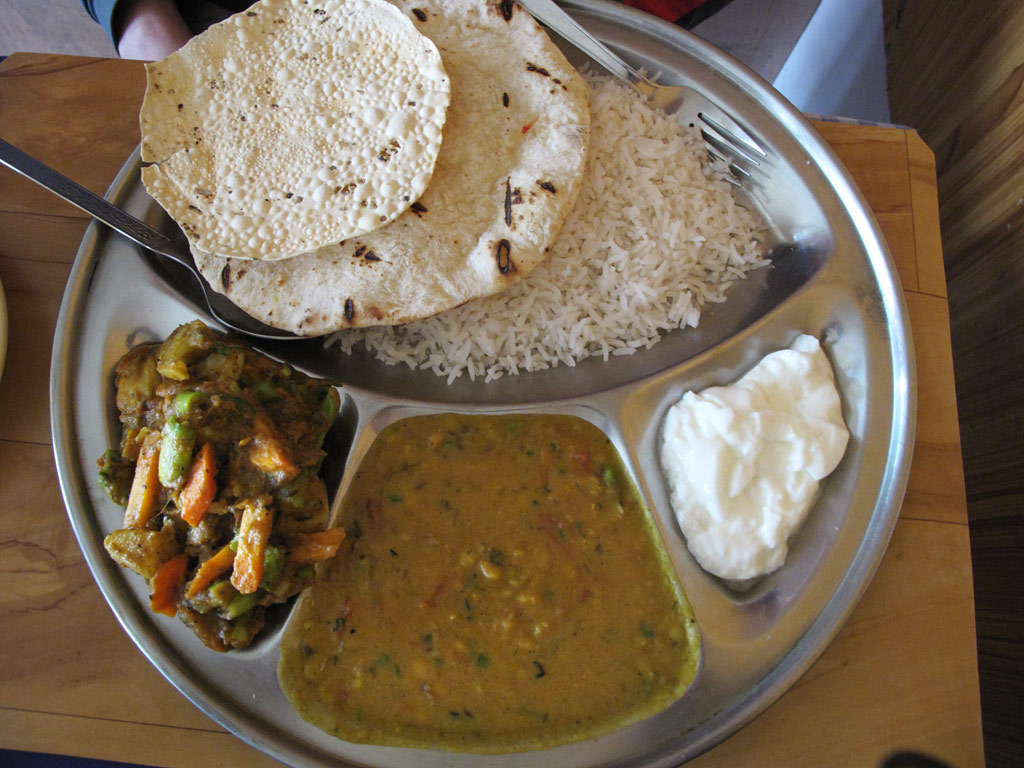
Kariina's favourite lunch or dinner is thali, a mix of everything - some rice, bread (chapati or naan), vegetables and some sort of curry. Its content differs from restaurant to restaurant, and even from day to day - probably depending on which curries they have been preparing that day. It is a really filling dish.
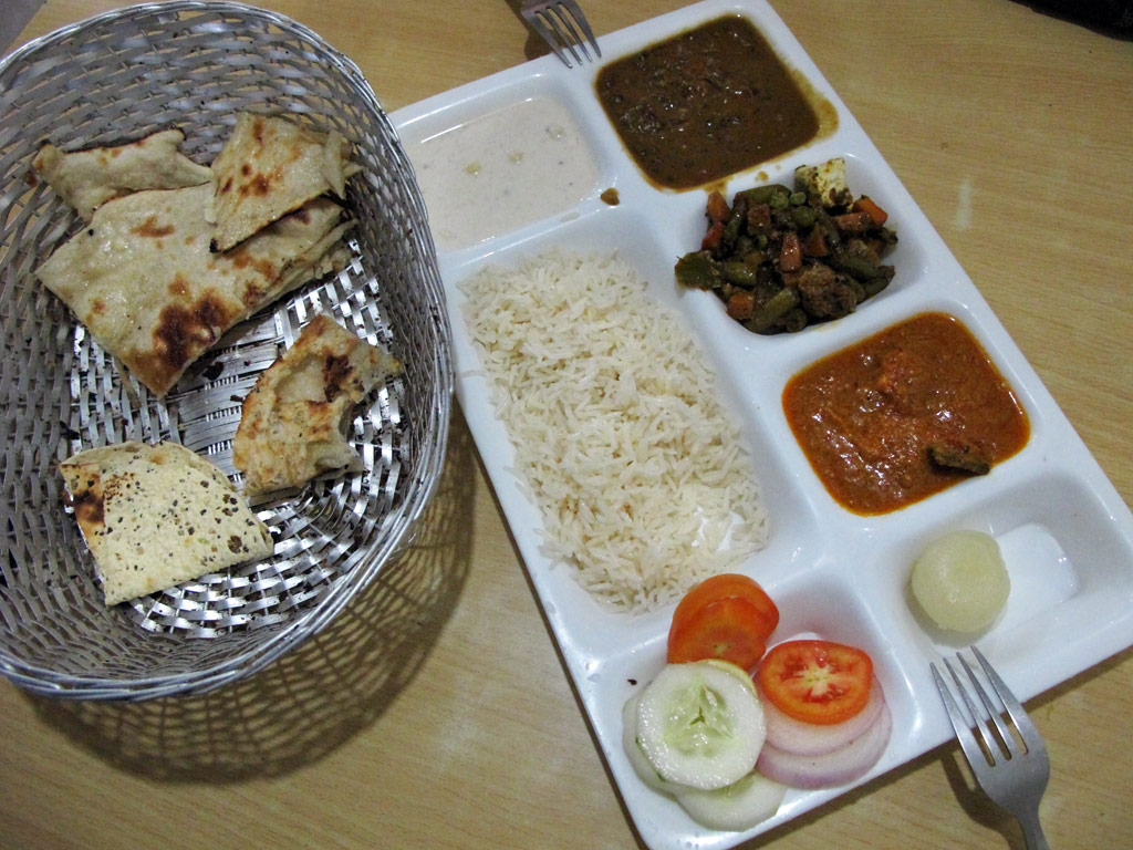
Thali.
My favourite is a dish called dosa. It is like a huge rice flour pancake rolled around a spicy filling of potatoes, paneer or something else, and it is served with a small bowl of spicy-and-sour vegetable soup and some soothing coconut paste. This one is rather a snack, so if you're realy hungry, better go for something else.
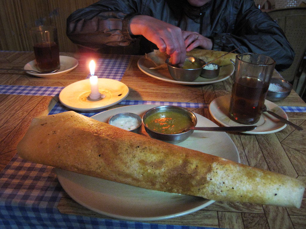
Dosa.
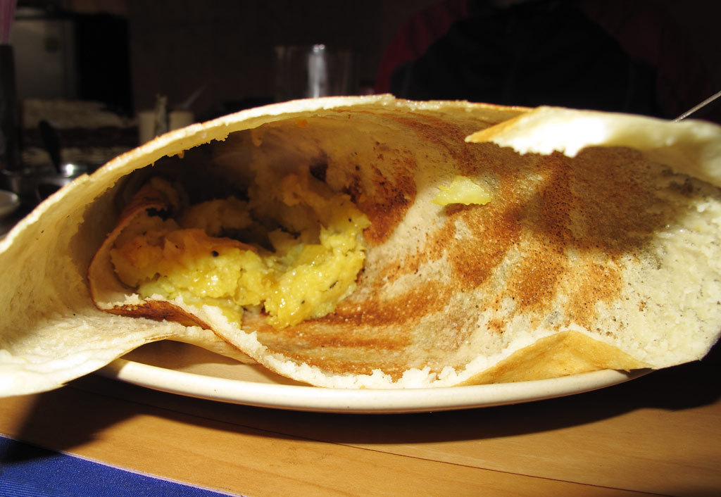
Dosa from inside.
And then there are endless varieties of curries that go well with rice and naan bread. We have found the best ones to be:
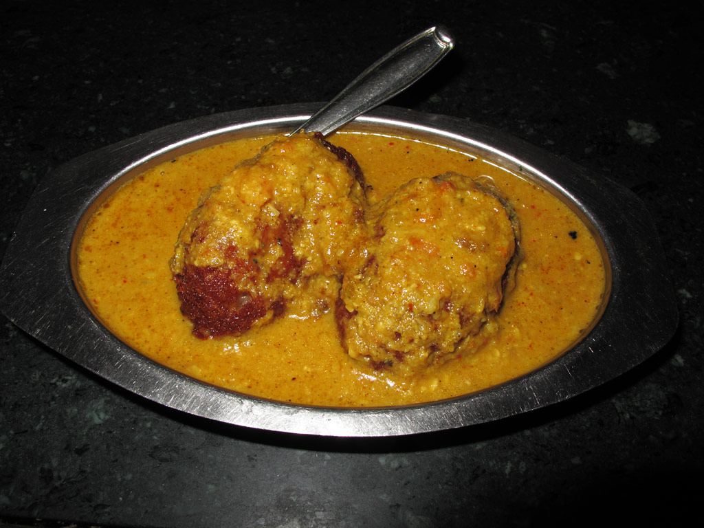
Malai kofta (soft boiled potato in a spiced tomato sauce).
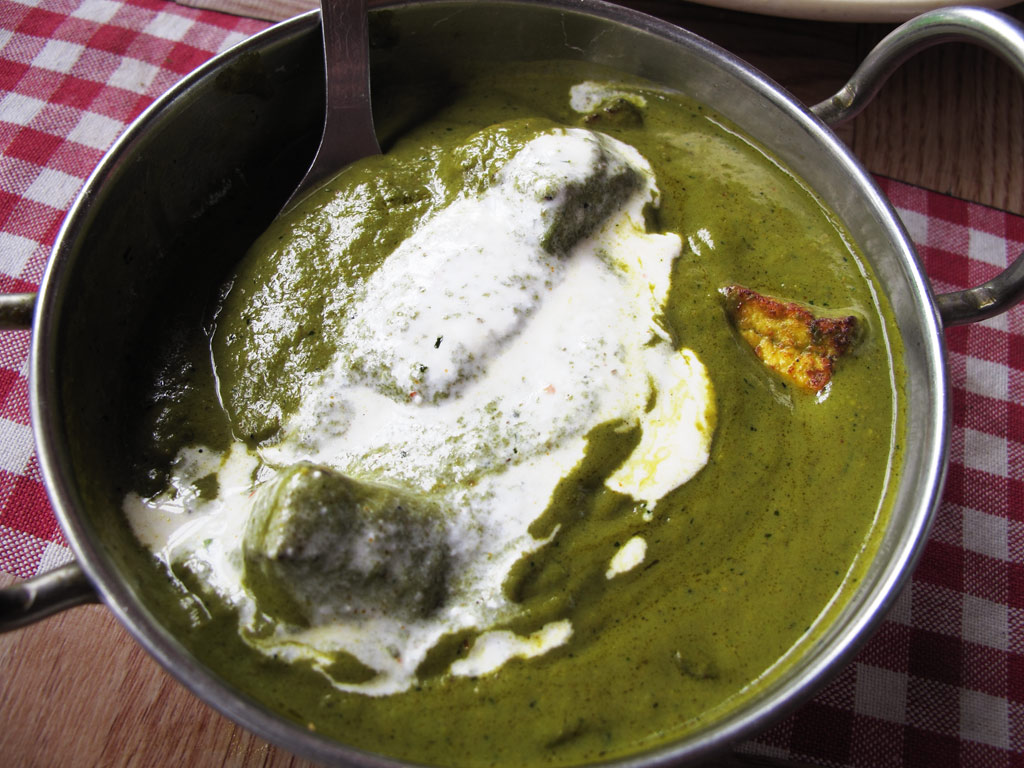
Palak paneer (unfermented cheese cubes in spinach sauce):
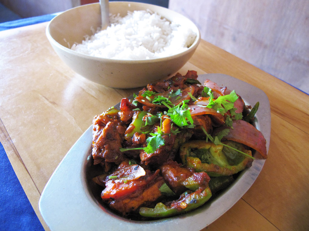
Chicken tikka masala (pieces of chicken marinated in yoghurt and spices, cooked in tomato sauce).
As I said, curries go well with bread. The best is naan bread:
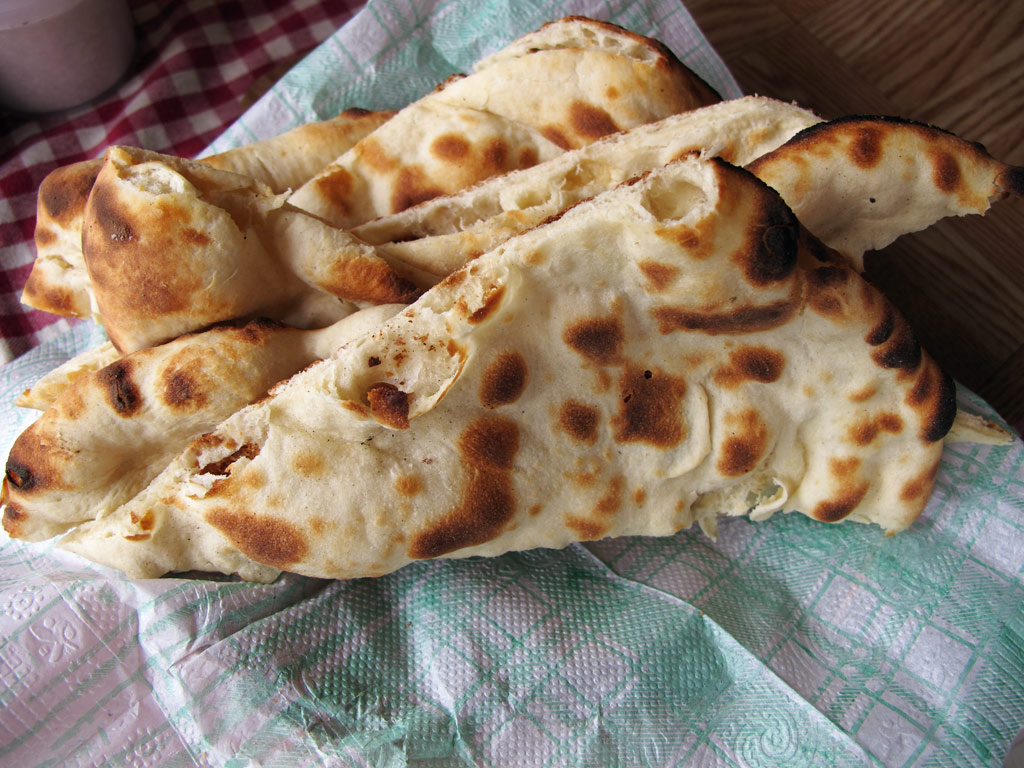
Naan.
But we have also liked other breads, such as this one (baked in a random hole-in-the-wall bakery in Leh):
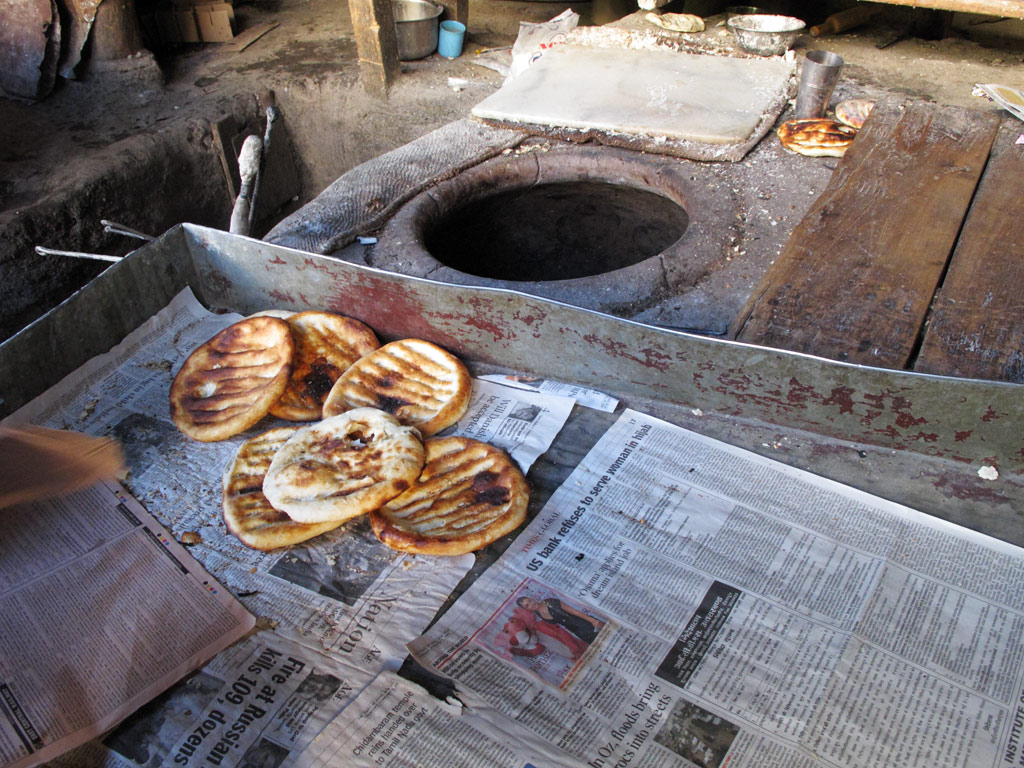
Fresh from homey bread factory.
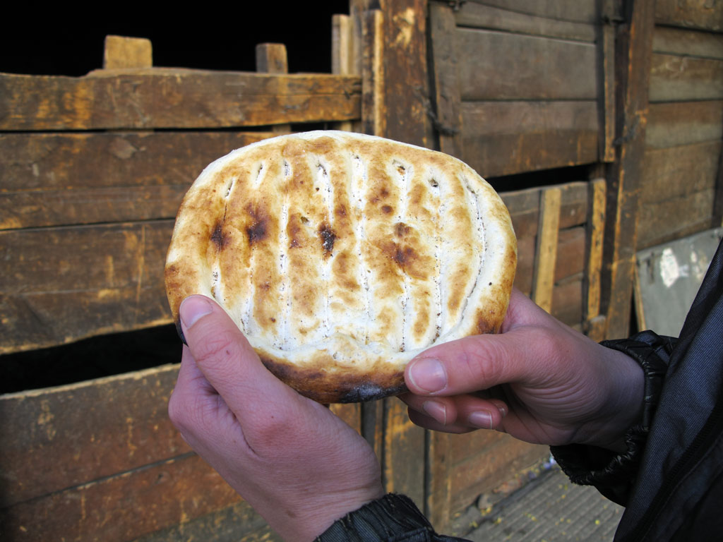
They taste superb.
Every once in a while we grow tired of the Indian taste, but luckily in North-India it is easy to find also Tibetan food such as momos (steamed or fried dumplings) which taste just as good as in Nepal.
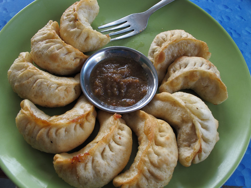
Momo.
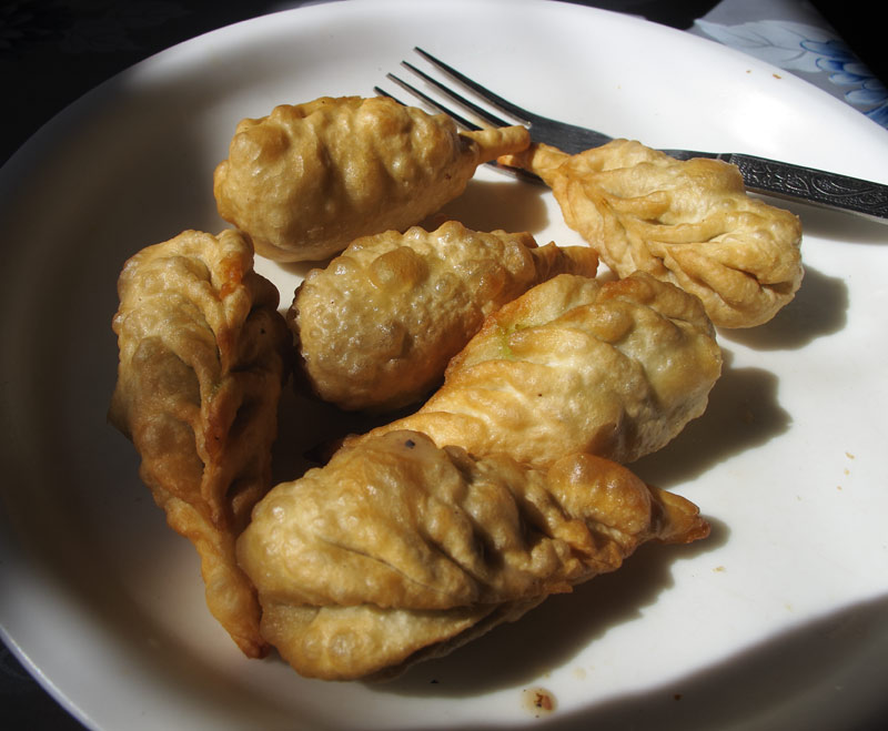
Momos have different shapes and serving styles with diffrent sauces (sometimes without).
And then there is thukpa, Tibetan noodles, which are often cooked with mutton.
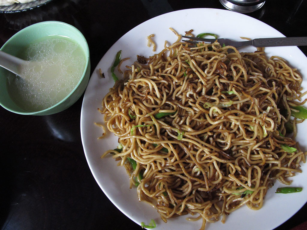
Thukpa usually served together with a very fatty soup - good energy for severe cold Tibetan climate.

An "unshaved" mutton on Leh street.
The most popular drink here is, of course, chai or milk tea (sometimes with spices), or the so-called Kashmiri tea (black tea with cardamom and cinnamon). On a hot day, a yoghurt drink called lassi (salted or sweet) is just the right thing).
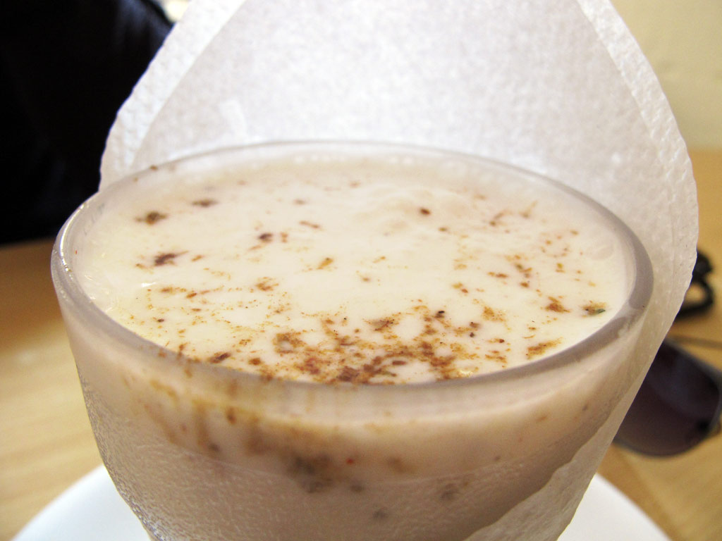
Lassi.
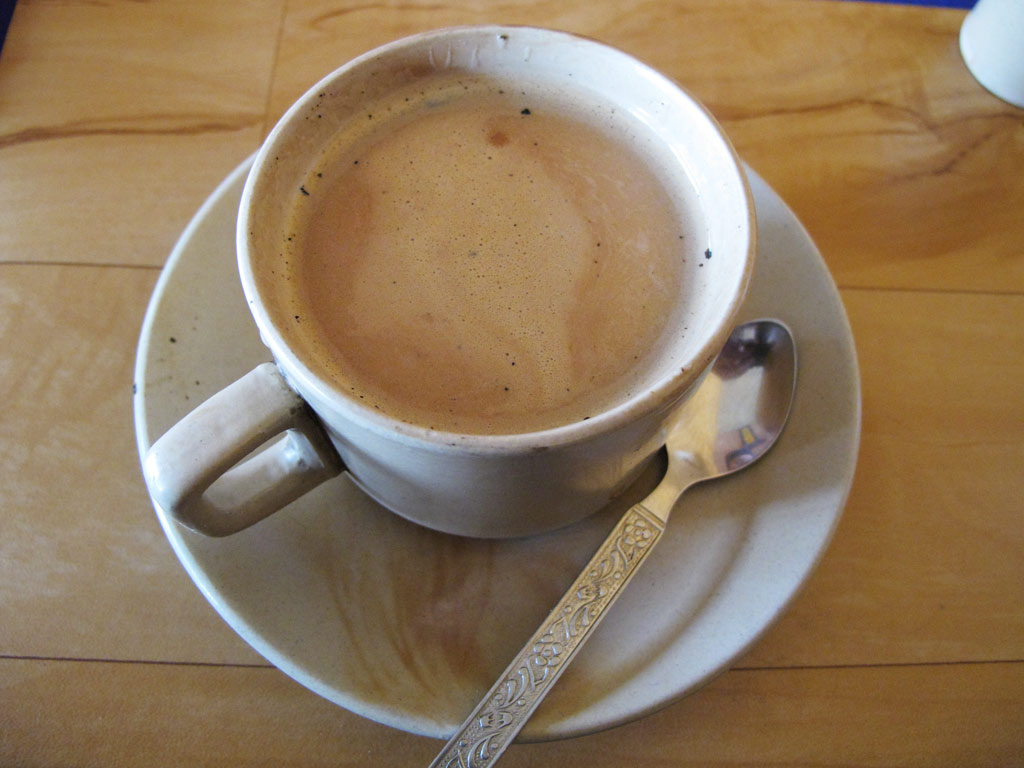
Chai.
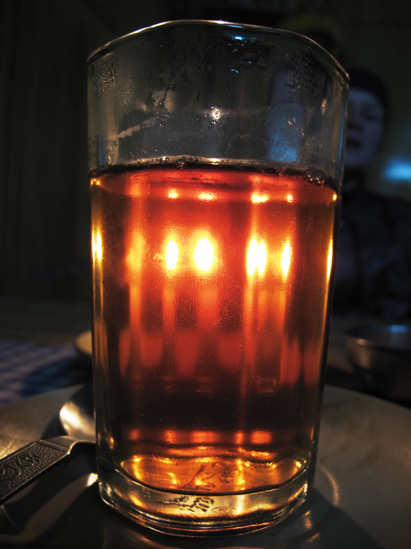
Kashmiri tea.
And to finish it all off - the sweets. Many bakeries here dish out tasty pastry, but the main thing is of course the milky, sweet, syrupy stuff just like in Nepal. An interesting thing to note - the sweet shops will always pack them into paper bags - an environmentally friendly option.
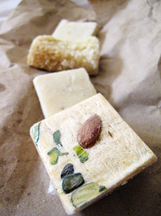
Indian sweets.
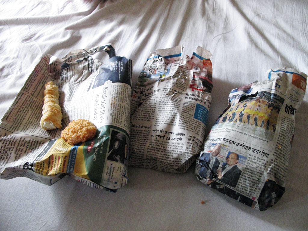
Pakced into bags made out of newspapers. Ingenious recycling.
That's it folks. Hope you liked it.
Next stop: Islamic Republic of Pakistan.
In fact, we had not have to wait too long for the rewards, which already started to become clear even before we reached the Zanskar valley proper, but first we had to brave the road from Leh back to Kargil where the turnoff to Zanskar begins.
Somehow (even though we had done this road a month ago) we had remembered it to be in a better shape than it actually was, and bumping along the great scenery we found ourselves cursing the endless military convoys plying the same road, just like in slow motion accompanied by huge amounts of diesel smoke and dust - and people stopped alongside the road, and waved to them, just as they were national heroes of some sort! Frankly, would it not make more sense to invest a bit more of resources into civil infrastructure, rather than keep preparing yourself for imminent invasion by a fictious enemy? Instead, heavy tanks sweep the highway and not a day goes by without some helicopter, grimly painted military-purpose cargo airplane or a fighter flying over our heads. The people are made to believe that both Pakistan and China make for powerful enemies, although as far as I know, Pakistan is no match to India, and there is no active conflict going on with China. But as one propaganda sign that we noticed alongside the road says - "The Tree Of Freedom Only Grows If It Is Watered With Blood". Take it or leave it.
But back to the rewards. Soon after the turnoff to Zanskar we found the most perfect place to pitch our tent. It was flat, grassy, and well hidden from the road, offering at the same time wonderful views of the surrounding mountains and countryside. We even witnessed an avalanche for the first time in our lives! There were some hoof marks on the ground suggesting we might have guests some time.
Heavenly green hillsides, on the way to Zanskar...
Our camping spot in the last sunlight.
Moonlight reflection from the snowwy top that's been turned into reflective surface by the Sun from daytime and feezing temperatures in the night - a natural mirror. A stunning sight in real-life!
Mountain in moonlight.
Global circulation around the static Northern Star, us and the GS underneath it, lit by the moonlight. Our moment in the vast Universe.
Sure enough, the breakfast was accompanied by some horses, but as we did not have much camping food to spare, they had to stick to their green diet.
Without rushing we packed our stuff and got on our way. But what a way it was! If you remember what the last kilometers to Tso Moriri looked like - well, this was quite similar, but there was also sand, mud, snow and lots of water, and it all stretched for some 200 kilometers (and back again the same way because there is only one road leading into Zanskar)!
We had been told before that there would be lots of snow in Zanskar, but as we were to find out, it was not the snow that would make the conditions so difficult, but the fact that it was all melting - often, ferocious torrents of meltwater would come rushing down the steep slopes and across the track (indeed, it mostly consisted of hard packed soil that had loads of sharp edged rocks mixed in it), sometimes taking part of the soil with them and leaving you struggle with the huge, loose rocks. Chance must have played its part in us not falling down into the icy cold water not even once, although we counted some one river crossing per each kilometre.
But back again to the rewards. At the beginning, the road took us through rocky canyons, but then the valley widened up, playing host to green wetlands reflecting the shine of the snowy mountains bordering it. Of course there was a pass to cross, this time a 4401 meter (14 400 ft) high Pensi La, and of course, the closer we got to it, the more there was snow. On top it was just like winter wonderland, everything covered by the bright layer of snow, only interrupted by a single dark line of dirt - our road. And then there were bluish frozen lakes, and a magnificent glacier, Drang Drung.
Fast rivers created by the rapidly melting glaciers and steep mountains.
A typical Zanskarian road (ahem, rather a trail!).
Often the trail is inside the river.
Lots of melting water.
But our fully loaded GS kept its momentum with its decent bottom end grunty torque, relentlessly kicking through anything that's thrown under the wheels.
A lonely chörten in the vast Zanskar valley.
You see some herd on the wet valley bottom.
And quite a few meters of snow still left from the winter.
And rivers washing the already fragile trail away at visible speed.
Same spot as on above picture seen from below - it won't be long before the road will have to be completely fresh cut (with explosive stuff) out of the cliff again or an alternative route found around the same mountain.
Nice rocky ground for the muddy valley bottom built by the allmighty TATA truck drivers - their trucks are completely stuck in the mud in the background and they're building the road by hand for their trucks using those big rocks.
Under a waterfall.
Randung gompa. An excellent meditiation spot for Buddhists, being situated in the remote valley on a small hill surrounded by 6000 meter peaks.
Randung gompa from the distance.
Mudpools too often surprised with their depth.
Reflections.
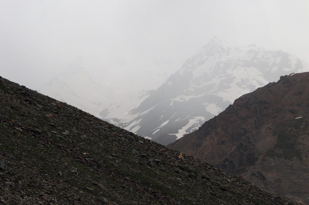
Zanskar range of the mighty Himalayas.
That's very typical Zanskar trail condition, together with endless rivercrossings. No wonder why our average moving speed by GPS is around 10-15 mph.
Stunning mountains surrounding the trail.

Click to enlarge the panorama.
Trail pushes us constantly above and below the snowline.
Exposing stunning views above the snowlevel...
Drang Drung glacier.
Closer.
That's relatively easy part of the Zanskar trail.

Click to enlarge the panorama - check the typical trail condition.
From above the snow level.
Stunning chörtens erected into the heights of remote places, with colourful prayer flags distributing the Buddhist mantras into the surrounding spacetime through the vicious Himalayan wind.
Fresh (bluish) vs old (white) snow.
Road.
Frozen lakes at high altitudes on Pensi La.
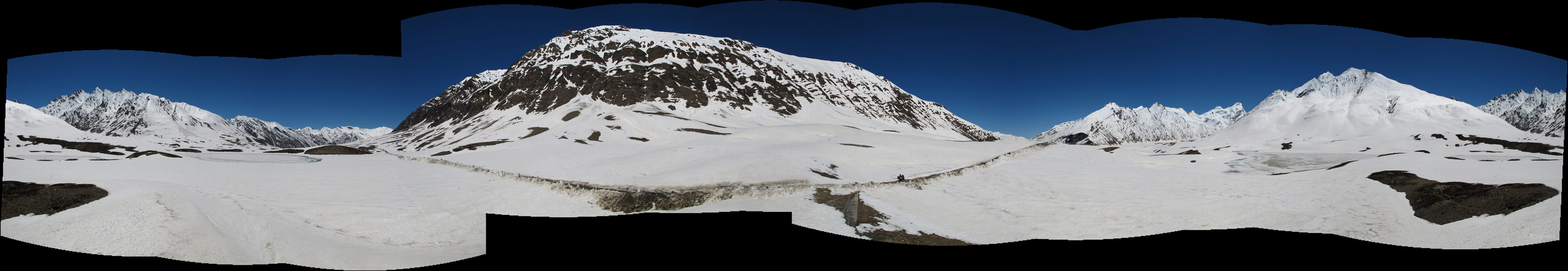
Click to enlarge the panorama from Pensi La.
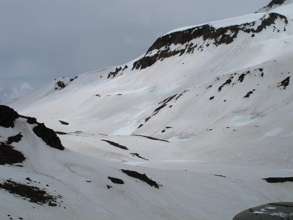
Massive avalanches waiting to be happen.
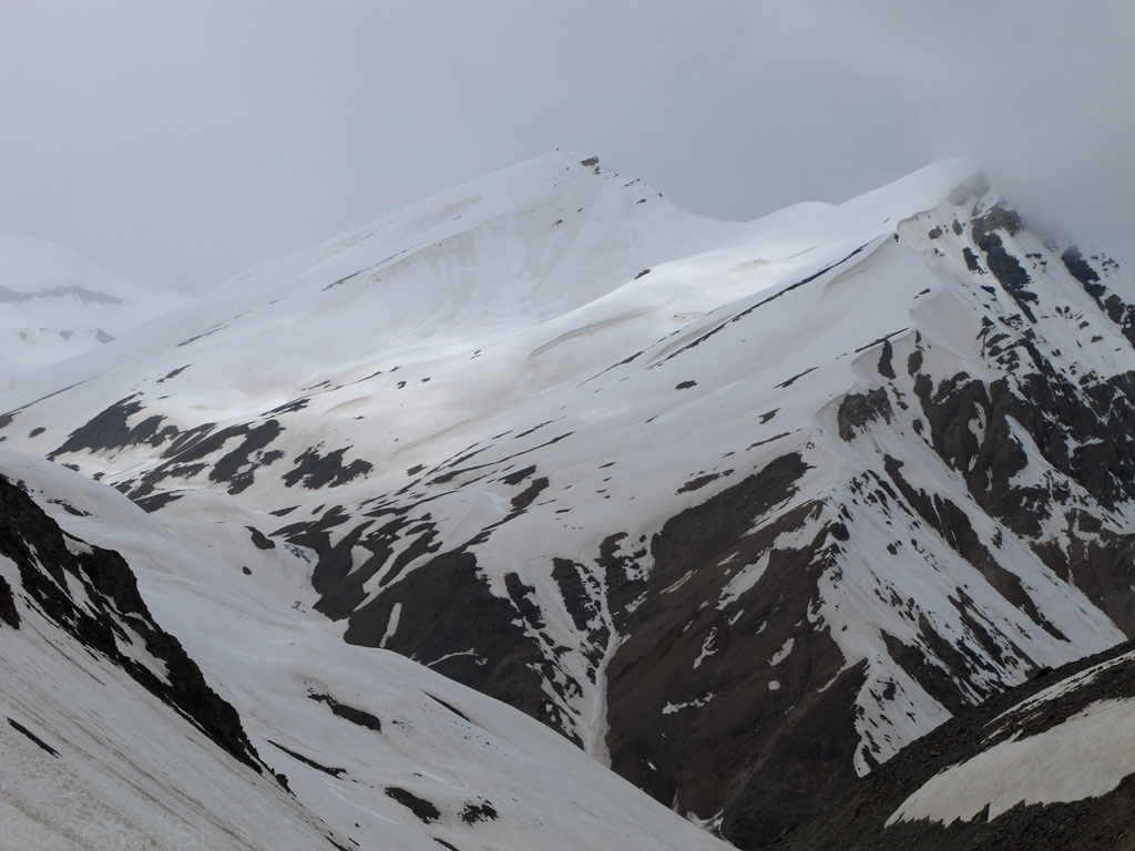
Sharp Zanskarian peaks.
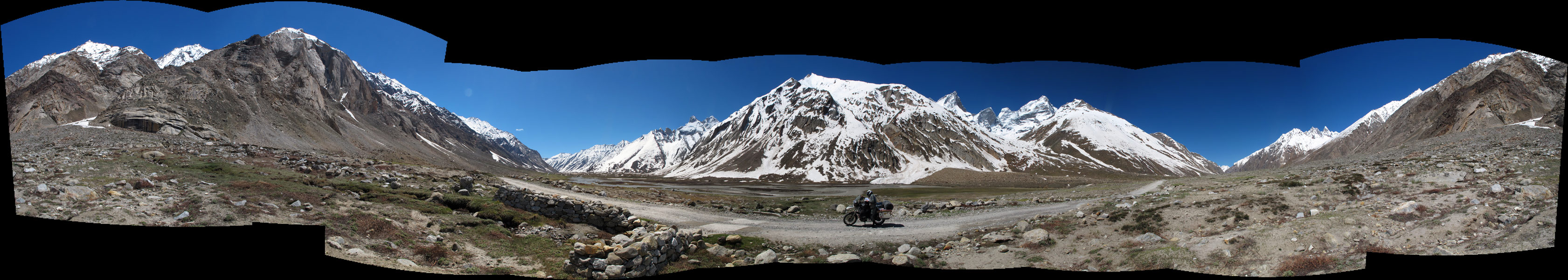
Panorama from the road (click to enlarge).
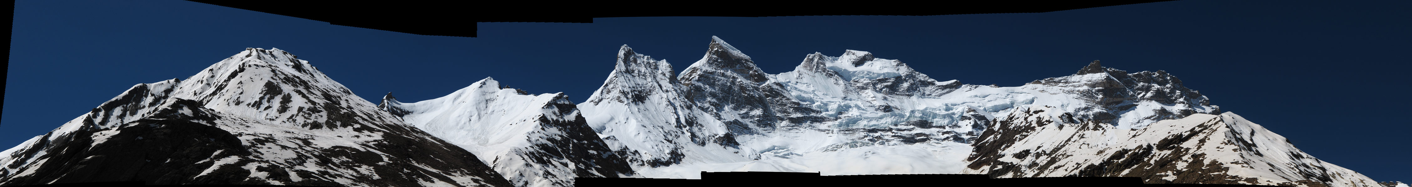
Peaks panorama (click to enlarge).
It might not have been the best time to visit Zanskar in terms of riding conditions, but then again had we come later, the baking summer sun would have had melt away much of the snow and part of all the power and magic of the Zanskar range (averaging the height of 6000 meters or 19 700 ft) would have been lost.
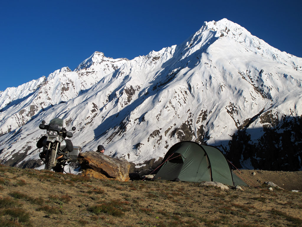
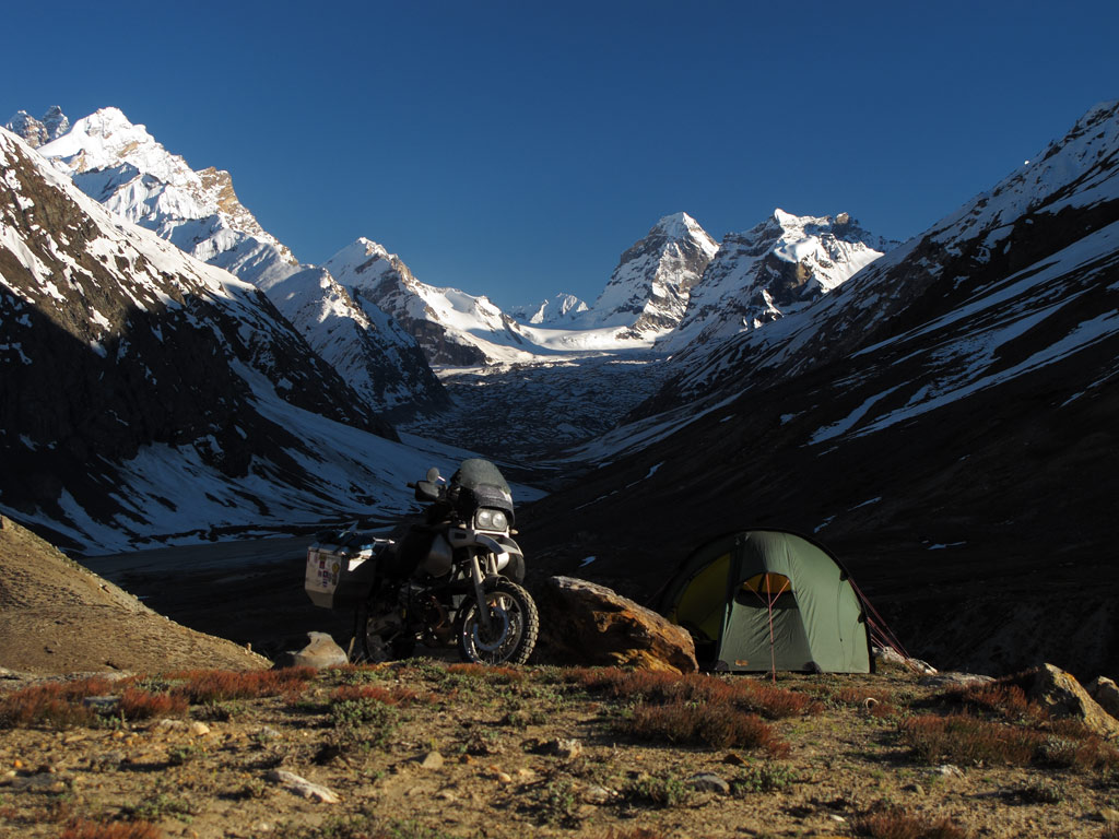
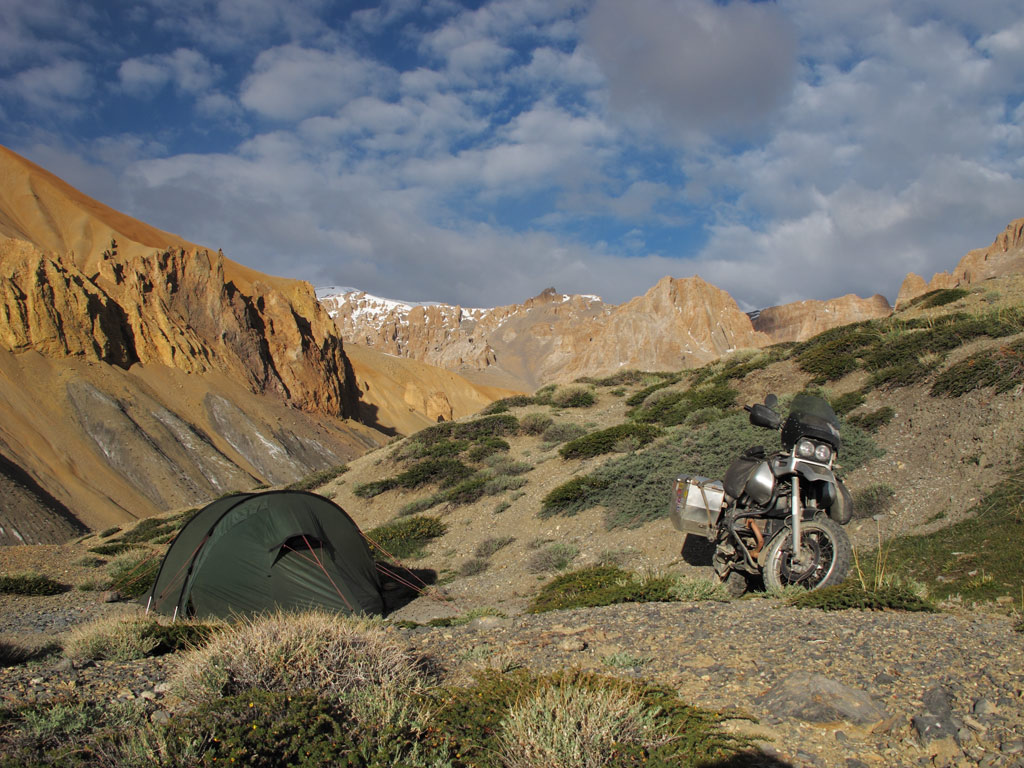
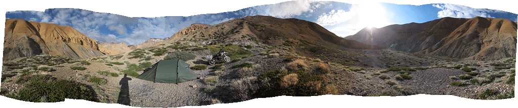
Moving at the average speed of some 20 km/h (13mph, more would have destroyed the bike in no time) and making loads of stops for taking photos, by the time we had crossed the Pensi La and entered the Zanskar valley proper, it was already time to find a place to spend the night. Spoiled as we are by the views of our last camping spots, we could not settle for less this time, so we scored a place with a breathtaking view just opposite a glacier. We did not care that a) both the tent and the bike were well visible from the road, b) the surface was rocky, uneven and exposed to the wind, c) we only had half a litre of water with us. The important thing was that the view was simply breathtaking!
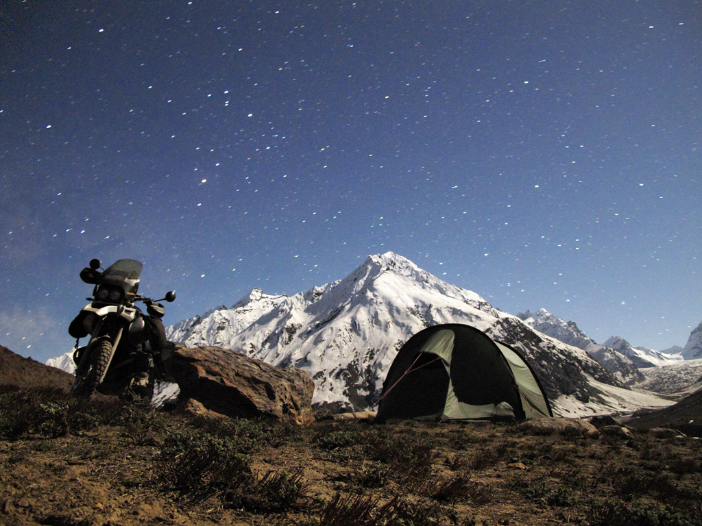
Tenting spot with a million dollar view.
20 000 ft peaks with a stunning glacier just before us.
Under the stars lit by the midnight Moon.
In the moonlight, the snow on the mountains acquired magical glow.
Had to wake up quite early, even before the sunrays reached our tent, since the screeching of the marmots nearby was too loud.
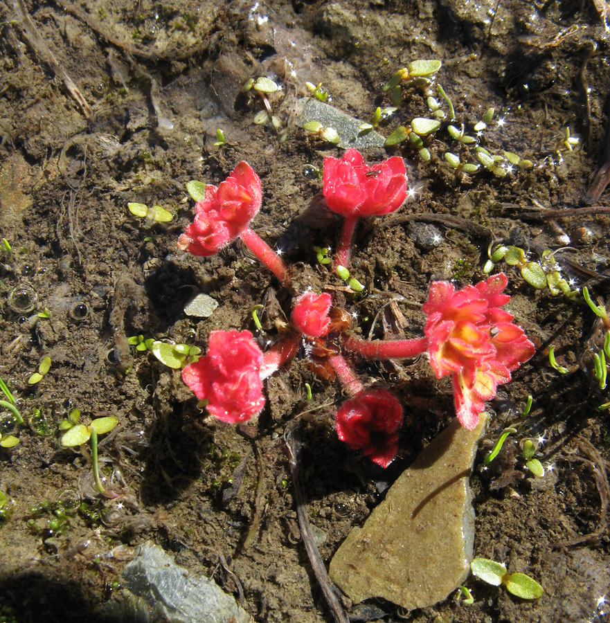
By the way, a nearby stream solved our drinking water problems. With no filters or iodine tablets it tasted just great, and did not have any negative consequences. Right at the stream, many flowers had burst in bloom:
Red flowers that grew only in the stream water.
Different types of flora in the green Zanskar valley.
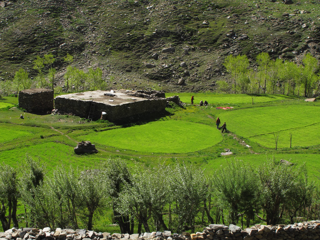
In Zanskar we could observe the life style of both Buddhists and Muslims which turned out to be quite distinct, starting from their architecture and ending with their garments.
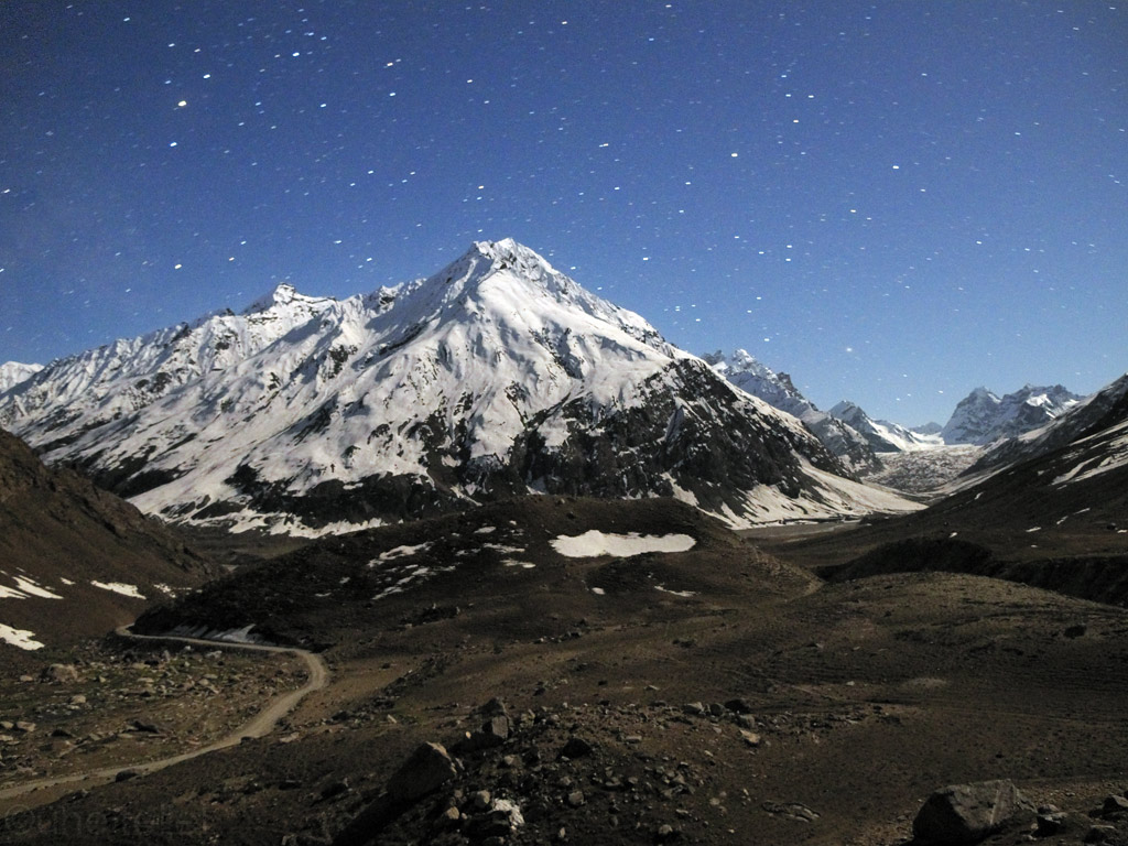
Positioned within the Zanskar range.
One of the many massive glaciers in Zanskar.
Avalanches on hold. A high top visible from Padum (the "capital" village of Zanskar).
Big prayer wheel in Padum.
Another nicely carved prayer wheel in Padum.
In Padum we saw a lot of road and construction workers apparently imported from South-India.
South-Indians enjoying the last warm sunlight before the typical Zanskar night freeze kicks in.
Tibetan style house in Zanskar.
Young Buddhist man.
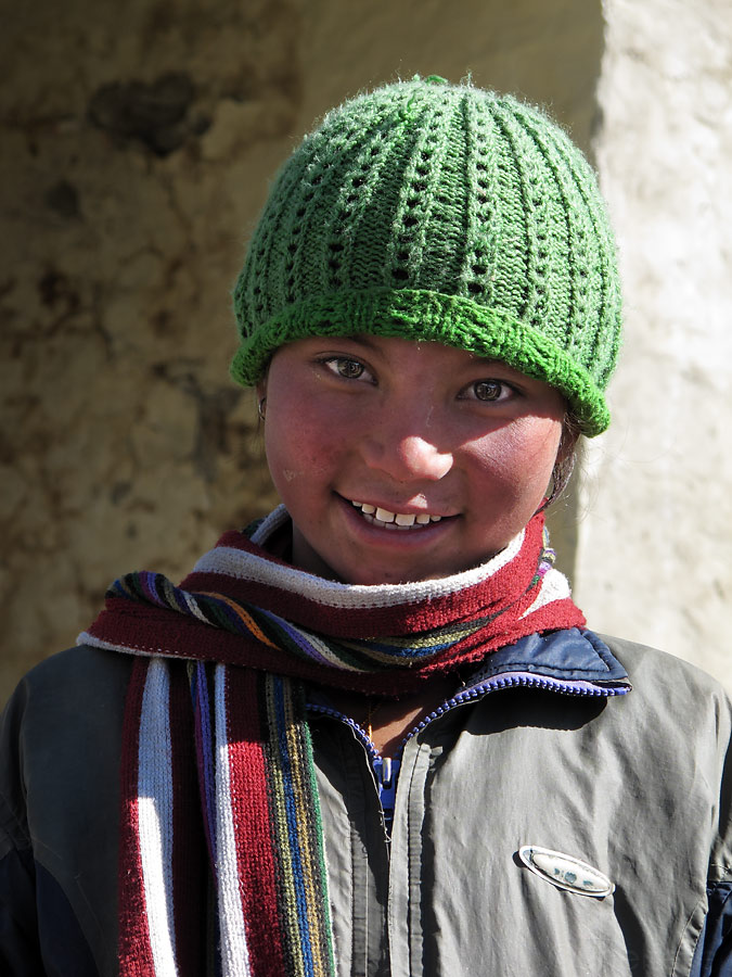
Buddhist girl.
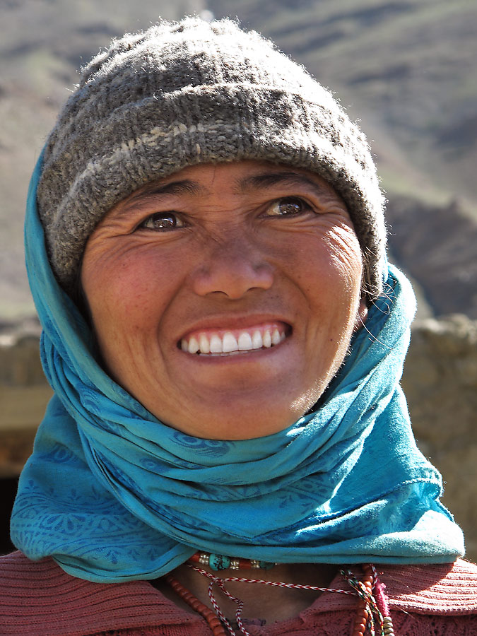
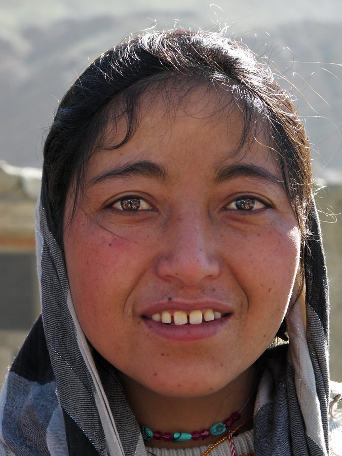
A Zanskarian smile.
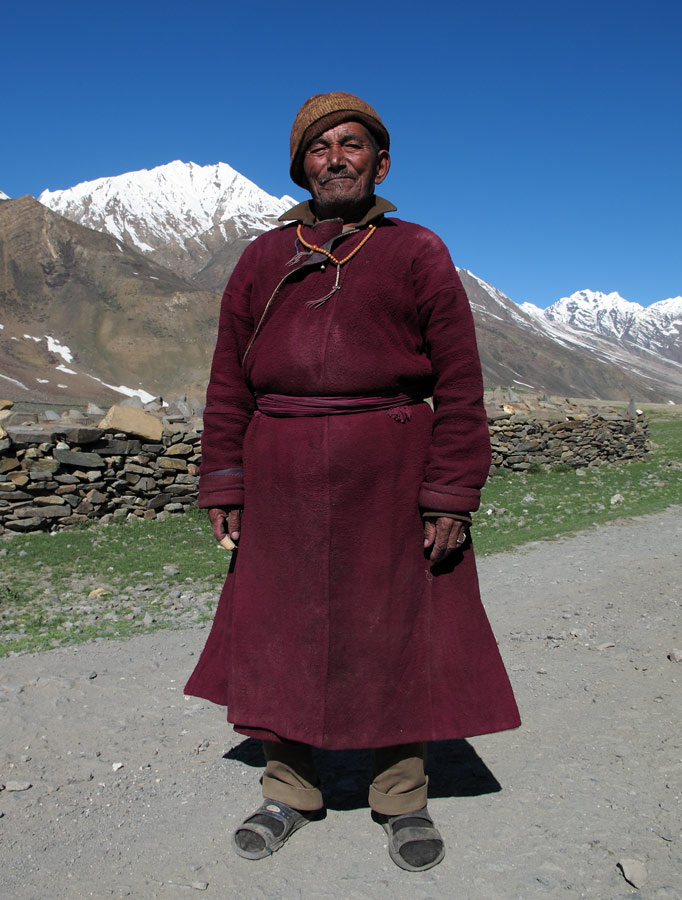
Buddhist man - we helped him to tape up his scratched finger.
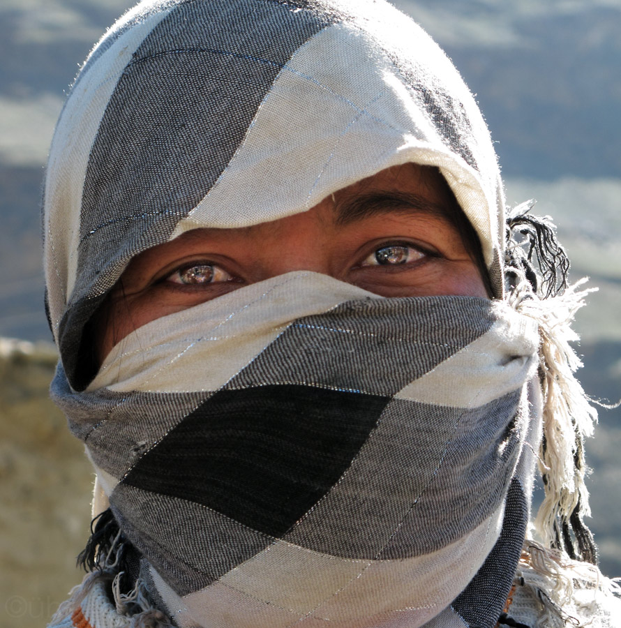
A woman in UV-cover.
Some 100 klicks later the muslim community started who have their houses built in the green valley.
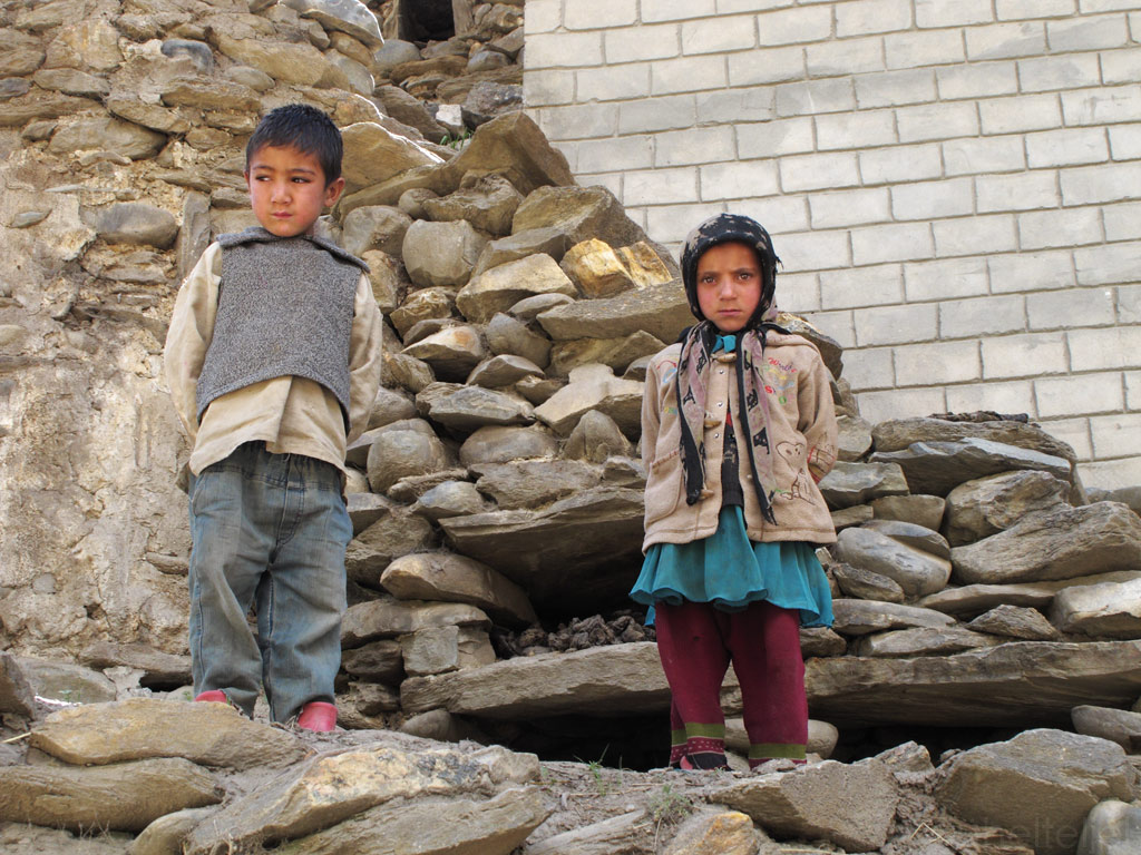
Muslim children.
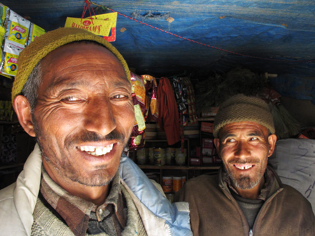
Muslim men in the only shop I saw within some 150 clicks.
On the way back we decided to spend the night at the same spot where we pitched out tent the first time. This time there were no horses in the morning, but a group of young ladies collecting the sunbaked dung left by the yak and horses to be used as a fire material (the trees are really scarse in that area).
Muslim girls collecting fire material from the hillsides, where the herd usually is.
After a 1000 kilometre (of which 500 km courtesy of Zanskar) ride we were back in Leh. Exhausted and hurting from all the places, we went to look for some food as we bumped into Axel, a German whom we had met a couple of weeks ago and who is fond of discovering the treasures of the Himalayas on foot. "We know now what you meant when you said that the road to Zanskar, also known as the Road of Hundred Rivers* is one of the most beautiful roads on Earth", we told him. We must have looked blasted (hopefully satisfied as well), as he kindly paid for our meal which we were deeply thankful for.
*actually it refers to a trekking route which involves crossing the same rivers multiple times, but we did not manage to escape with dry feet either!
We first arrived in Ladakh it all seemed very calm, nearly abandoned. We were the only guests at our hotel, and there was nothing weird about locals greeting us merrily on the street, even if we had never met before. And no one was trying to sell us anything.
But as the time passed, the days grew warmer and more and more tourists made it to Leh. The locals became more reserved, and the town more noisy. Then the road to Manali finally opened, giving us one more signal that it was time to leave.
We said goodbye to all the places that we had become fond of, and after more than a month of coming and going we packed all our stuff once again - this time we were not leaving our trusty basecamp for a short side trip, but for good (or, alt least, until the next time).
We'll be remembering Leh by many sounds - helicopters flying above our heads, cows mooing in the streets, and frequent bleeping of the batteries signalling of another power cut. But there is also the ever present recital of Quran (there is a strong Muslim presence in this Buddhist country) and occasional bursts of traditional music.
So we headed to Manali, taking the legendary, highest road in the world. In the end, that is what we had come here for in the beginning.
The weather wasn't exactly promising the morning we started our ride - threatening clouds were blanketing the mountain tops right in the direction we were heading, so we could not help but to imagine all the misery awaiting us. But as it happens in the mountains, the situation changed quickly, soon revealing the blue skies and warm sunshine.
The following kilometers proved that after all those unforgettable, breathtaking rides, the Himalayan landscapes and lifestyle still had some nice surprises for us.
Nowhere else before had we seen layered ground pushed in a vertical position in such a spectacular way. One can only try to imagine the force of the landmasses that collided millions of years ago, and creating all this remarkable "mess" which the erosion later seasoned to perfection.
Ground pushed vertical in stunning scales, note the sci-fi colours of the rock.
One more new thing to us was to witness a class at a local school.
We crossed Taglang La, a pass that is, at 5328 meters (17 582 ft) allegedly the second highest motorable pass in the world.
Taglang La - 17582 ft.
Views from 17 000+ ft.
Panorama from the road (click to enlarge)
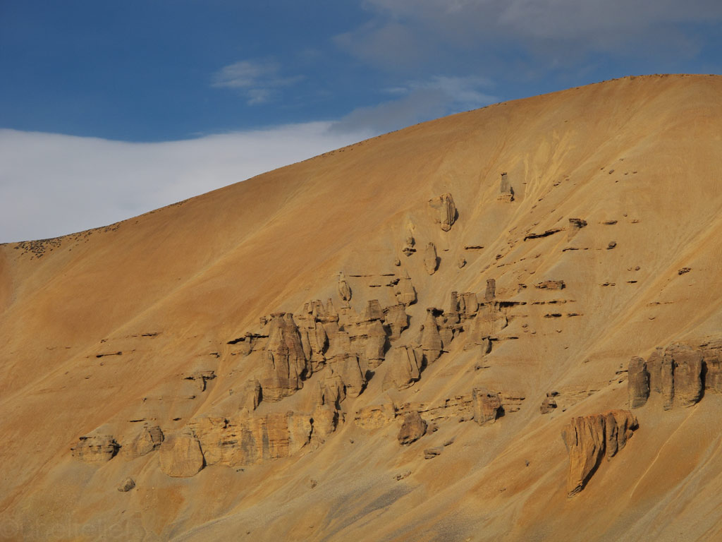
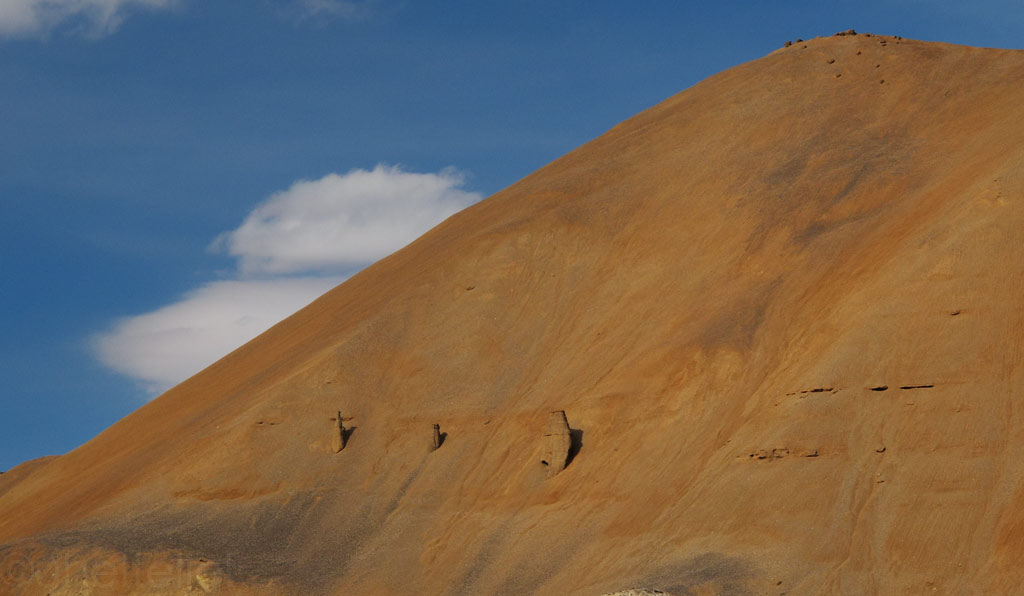
Indian "Cappadocia"?
We decided to break up the journey somewhere in the middle of the Leh-Manali road, and to experience one last time, what it is like to camp in the Himalayas. No million dollar views this time, but we easily found a quiet spot from which to observe the romance of the clouds and the fading light. It was a night of sentimental feelings, with scenes of the might and the beauty of the landscapes that we had visited and with which we had developed an intimate relationship appearing again and again in our minds. Just as if it had all been in a dream, from which it was time to wake up. Half asleep, half awake, we tried to record all the sensations in every single cell of our bodies, to carry them with us anywhere we go.
Fading light through clouds - view from our tent's door.
By the morning the magic had disappeared - instead of a warm farewell the sky was covered in clouds and there was ice both of the bike and the tent. By the time we really got out of our tent it did light up a bit though - maybe the mountains weren't so willing to let go of us after all.
Snow melting off the tent in the warmer morning light.
Good (chilly) morning on the GS seat.
Our another usual wild camp spot, this one was 4550 meters (14 927 ft) above sea level.
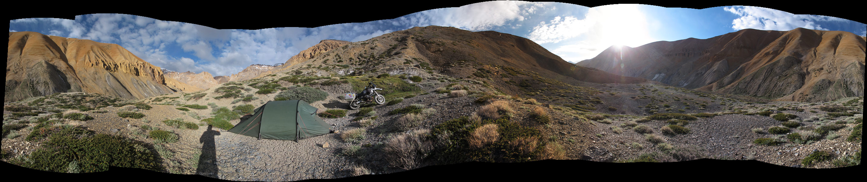
Panorama from the tent spot (had to climb up from that mountain side covered with loose rocks with the GS - click to enlarge).
But the further south we rode, the more cloudy and dark it became again, just as if there was a sentiment of sadness, or maybe disappointment on behalf of our magnificent host. Or maybe it was just the monsoon gaining territory on the southern edge of the mountains. In any case, none of the majestic features were lost.
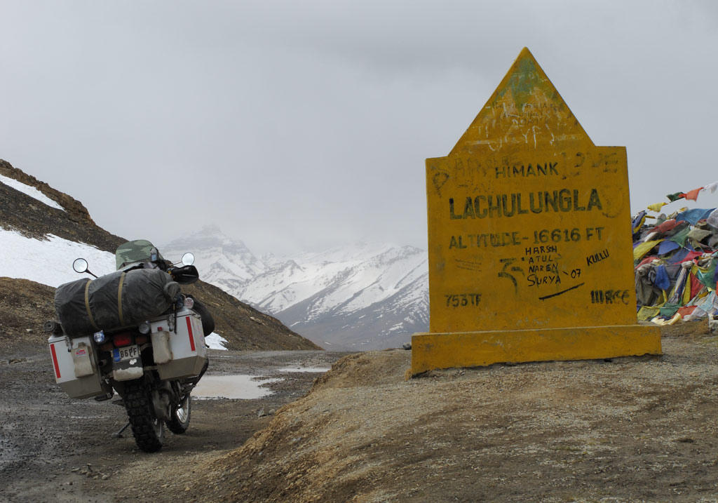
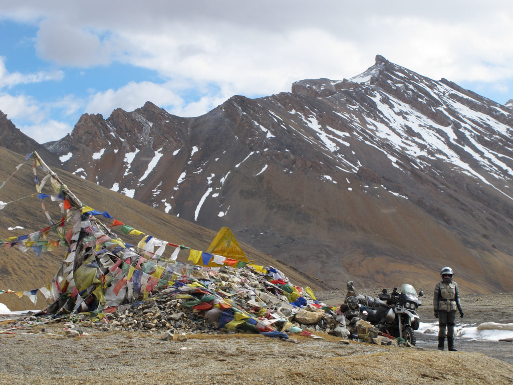
Lachulung La - 16 616 ft.
Every high pass has prayer flags that give them a somewhat romantic feel.
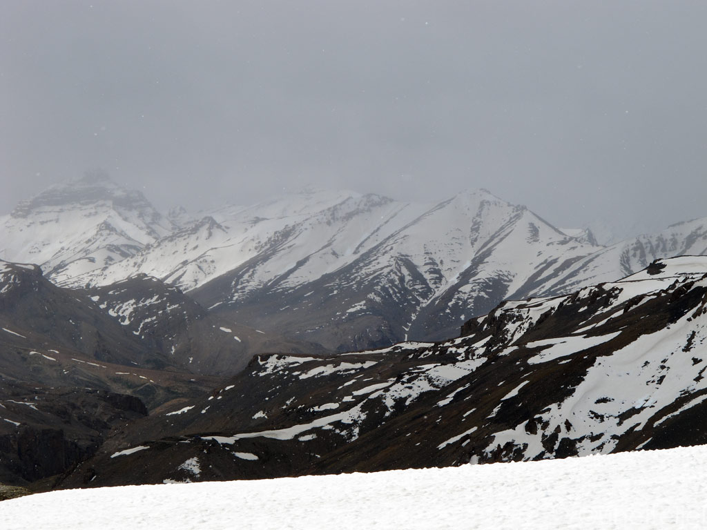
Himalayas through snowing.
Rocky stuff.
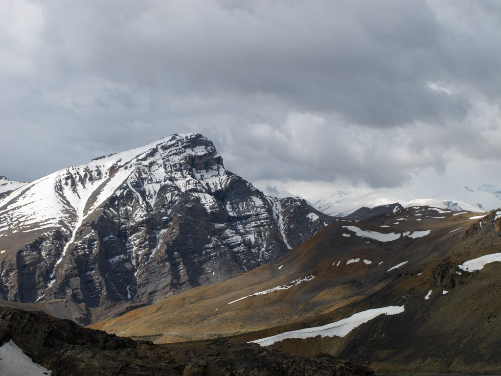
Majestic Himalayas.
Unfreezing lake.
Avalanches on hold.
You can see our road on the right - Baralacha La is somewhere there waiting for us to cross it.

Suraj Tal (click to enlarge the panorama)
Artistry of the nature closer on the Suraj lake.
Panorama from the road - click to enlarge.
And it really started to snow.
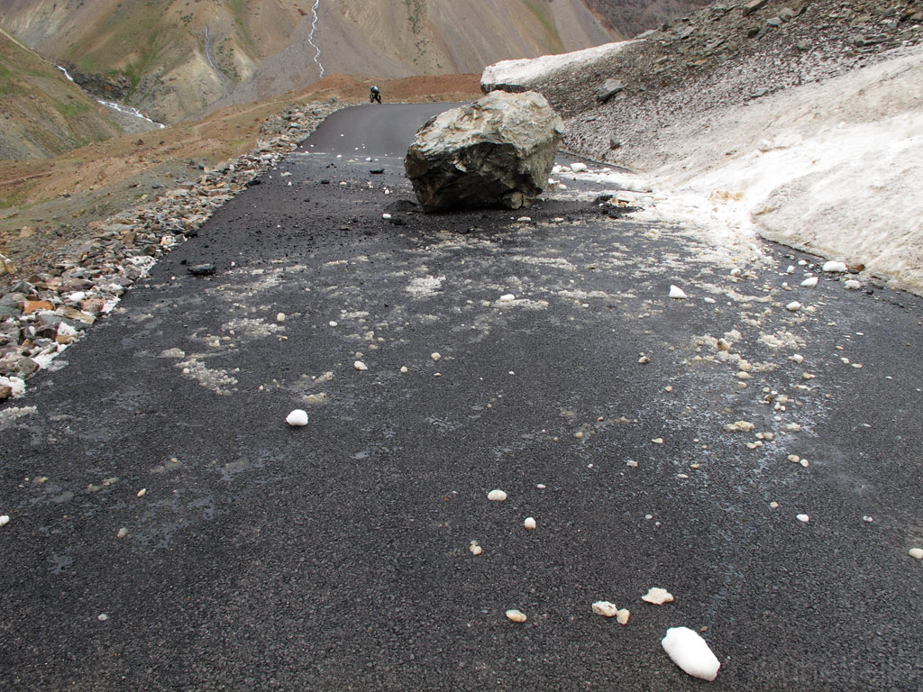
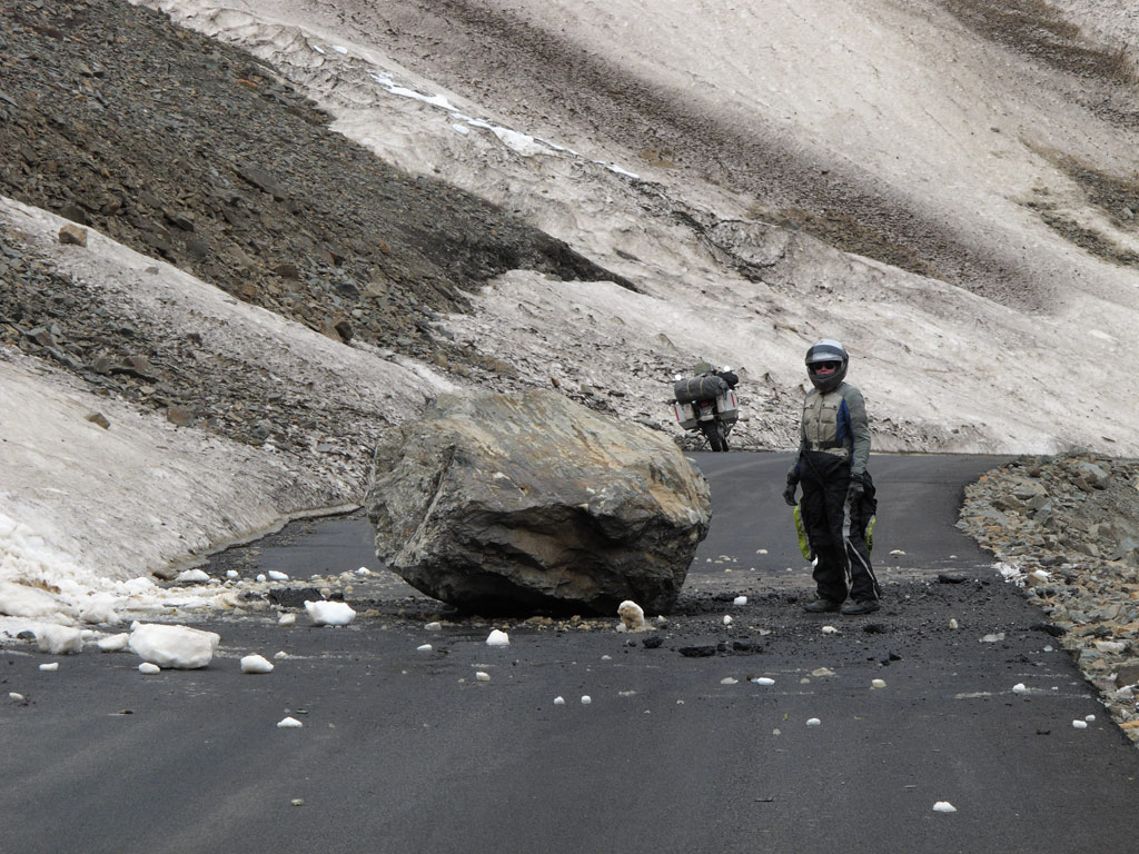
At one point the chance of rain became too obvious, so we decided to pull over and put on our waterproofs. While we were struggling to get them on, we heard someone shout "Run!". His voice was reflected off the mountain slopes, but we could not see who it was or whom was his shout directed to. Seconds later, a huge rock came rushing down the slope, which landed smack in the middle of the road just some fifty meters (165 ft) away from us, the muffled sound of impact wafting through our bodies and the ground beneath our feet. Had we been passing some minutes later than we did, or had we decided to stop before we did…
A "fresh" massive rock from the heights.
Distance from where we parked the bike when we heard the fall.
As we rode on, the rain became denser and denser, so by the time we reached Rohtang La, the last pass on our way, it was pure mud and water festival. With quite a bit of an effort, we crossed the pass, and there we were again, at the same point where we had had to turn back the last time, some two months ago. Back then, the road to Leh had been closed, and we promised ourselves to be back once it opens. Back then we had though of how bad our timing was, but now that we think of it, it could not have been better.
Now the circle was closed. We were back in the reality, with mighty Himalayas left behind, at the same time still living in our memories.
To put things into perspective, here is the map of our route during some two months or so:
As we were setting off from Manali we figured it would not take more than two days to reach the sacred city of Amritsar right near the border with Pakistan. Of course, we were wrong.
The morning we were about to begin the final leg of our journey through India we found out the rear tyre to be flat. Without much fuss, an agent to blame - a rusty nail - was found, the puncture was plugged and we gor on our way.
A couple of hours later we were forced to stop by the road because the tyre was empty again. We looked up a tiny puncture, and once again repaired it wondering to ourselves how so much air could have escaped through such a small hole. Just in case we decided to check the whole tyre for more possible punctures, and found two more.
Got all of them plugged, and just as I was trying to pump some air into the tyre to see if there's more if them, the valve came flying off. Apparantly it had been broken and apparently it had been the actual reason for the air leaking faster.
While we were trying to figure out how to sort the situation in a place which was most likely at least tens of kilometers away from the nearest (tubeless) tyre shops, some local bikers stopped by. All they could say was - "Nice bike!" Then they rolled off.
With not many options to choose from, I figured that with some luck, some super glue should help to keep us going for a while. So we rolled of, too, on a tyre that had been plugged from too many places (four in total, including one additional small puncture that I didn't dare to repair), and had the valve super glued to it. Not a very reliable option - more like having a ticking bomb between your legs. Having had similar "too easy to puncture" problems in South-East asia we again must point out that the Continental TKC80 have utterly weak carcas beneth the tubeless tyre. I'd kill to get the proper strong tubeless Heidenau K60 in South-Asia, but we just can't get 'em here.
Anyways, somehow it happened that the tyre did not disintegrate and we managed to get to Dharamshala safely. And, to have it face lifted despite all the holidays, week-ends and a strike. Sure enough, the only workshop we managed to find at such turbulent times did not have the proper tools, but we got the tyre on and off with raw force only, got the punctures patched (five patches total as there was one more tiny puncture), and the valve replaced.
Blown off valve.
Removing tyre with simple rods. The TKC80 is a very soft tyre for a tubless, with a little manly force you can even remove or mount it without any special tools (and that's not a good sign for a tubless tyre.)
Made in India patches.
It is fair to say we were a bit sceptical about all this thing, but it sure got us to Amritsar.
Indian man staring curiously at us.
Rickshaw transport in Amritsar.
We were the highlight for many indians.
Amritsar is the holy city of Sikhs, followers of a religion that is not so widely known, but who make up some 70% of the population of Punjab province in India. In the street, they are immediately recognisable as they wear the head dress called turban, and those that are baptised also have a small dagger or a sword complementing their outfit. Actually the Sikhs, who believe in one and only God, also believe that the greatest battle is within. They certainly leave a very dignified, but at the same time very open impression.
The centre of their universe, just as Kaba for Muslims, is the Golden Temple of Amritsar. The difference is, that everyone is welcome at the temple (but shoes must be taken off and both men and women must have their head covered). As the name suggests, it is covered with some 100 kilograms of leaf gold, but its foremost value lies in the Original Book that it contains. Each day, from sunrise to sunset, prayers are being sung around it, accompanied by harmonium and tablas. As they are reflected from the marble walls of the temple complex, it creates a peaceful, if somewhat melancholic atmosphere. By the way, each and every one of Sikh prayers ends with the plea for the benefit of all humanity. I was simply blown away by their welcoming and friendliness and their inspiring spirituality in their dynamic sound.
Different kinds of Sikh religious music can be heard around the temple complex:
The Sikhs believe that all the humanity was created by one God who has different names and forms, and therefore that all religions should be accepted. One of their principles is also equality, making no difference between races, castes, gender or nationality.
Sikh walking around the Golden Temple.
Sikhs in their traiditional clothing and weaponry.
Younger Sikh men carry only the small turban.
Proper "double" turban on older more wise and experienced men.
But even Sikhs have different tribe variations.
Sikh cameraman carefully filming the happenings around the Golden Temple.
Sikh volunteer cleaning up the pool in front of the Golden Temple.
The Golden Temple at one angle.
100kg (220 lb) of the Sikh holy gold in the last golden sunbeams.
The Golden Temple sits it the middle of a large pool, which is also where the city of Amritsar got its name from. "Sarovar" or simply "sar" means a pool, and "amrit" stands for the nectar of immortality. No pilgrimage to Amritsar is considered complete without bathing in this pool, also home to some well fed fish.
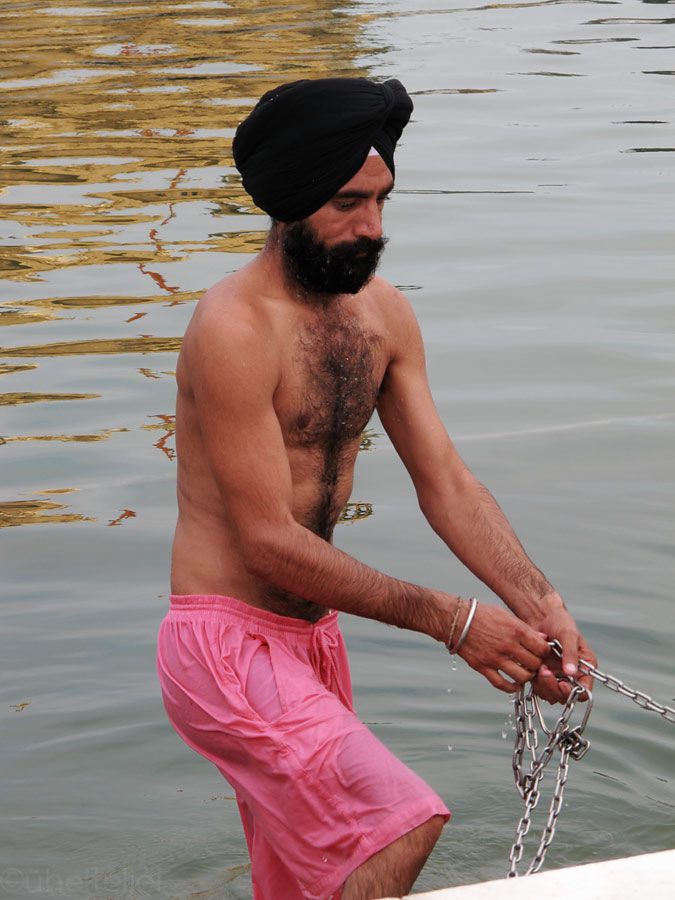
Sikhs put their knife in the turban when going to swim.
Coming out of the holy water, blessed.
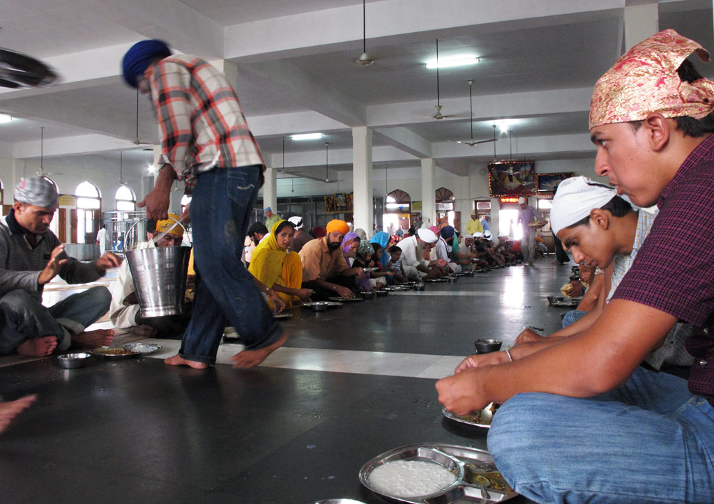
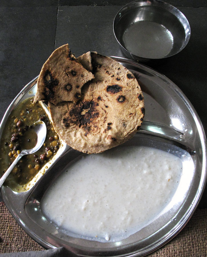
One more important part of a pilgrimage, which also emphasizes the principle of equality, is a free meal at the huge communal kitchen on the premises of the temple complex. Everyone is welcome - regardless if you are a pilgrim or just a visitor - at this simple meal consisting of rice, chapatis and dhal (lentils and beans). Some tens of thousands people get fed there every day.
Food is basic, but tastes good!
.... and to sum up India - some pics and words about Indian food:
Typical Indian kitchen - may look not so clean and modern, but it produces some really superb food.
Now that we've gotten a good taste of it, a couple of words about Indian food. To be honest, we were first pretty sceptical about it - also because it is mostly vegetarian, but while in India we have learned to truly love some dishes. Indeed, the variety is great and the abundance of spices almost makes up for the lack of meat.
For example, nothing makes for a better breakfast than a parantha (pancake like stuffed bread) accompanied by plain curd. Normally it is eaten by hand - you just tear a piece of it, put some curd on it, and eat it. The fillings are different, ranging from onion to cauliflower, but we like the most paranthas with potato (aloo parantha) and unfermented cheese (paneer parantha).
Parantha with curd.
Parantha is usually served with some pickles, i.e. pickled fruits and vegetables. Often the strong vinegar smell emanating from this otherwise tasty looking condiment is almost frightening.
Pickles.
The best snack, served by almost every roadside shack is, of course, samosa - a deep fried piece of dough (normally with cumin seeds) with spicy potato filling. We had our best samosas at a random shack at a random crossroads in Punjab where we could see the whole cooking process (so they were definitely fresh). Served with a little bit of tomato sauce they are perfect for killing the hunger for an hour or two.
Samosa.
Kariina's favourite lunch or dinner is thali, a mix of everything - some rice, bread (chapati or naan), vegetables and some sort of curry. Its content differs from restaurant to restaurant, and even from day to day - probably depending on which curries they have been preparing that day. It is a really filling dish.
Thali.
My favourite is a dish called dosa. It is like a huge rice flour pancake rolled around a spicy filling of potatoes, paneer or something else, and it is served with a small bowl of spicy-and-sour vegetable soup and some soothing coconut paste. This one is rather a snack, so if you're realy hungry, better go for something else.
Dosa.
Dosa from inside.
And then there are endless varieties of curries that go well with rice and naan bread. We have found the best ones to be:
Malai kofta (soft boiled potato in a spiced tomato sauce).
Palak paneer (unfermented cheese cubes in spinach sauce):
Chicken tikka masala (pieces of chicken marinated in yoghurt and spices, cooked in tomato sauce).
As I said, curries go well with bread. The best is naan bread:
Naan.
But we have also liked other breads, such as this one (baked in a random hole-in-the-wall bakery in Leh):
Fresh from homey bread factory.
They taste superb.
Every once in a while we grow tired of the Indian taste, but luckily in North-India it is easy to find also Tibetan food such as momos (steamed or fried dumplings) which taste just as good as in Nepal.
Momo.
Momos have different shapes and serving styles with diffrent sauces (sometimes without).
And then there is thukpa, Tibetan noodles, which are often cooked with mutton.
Thukpa usually served together with a very fatty soup - good energy for severe cold Tibetan climate.
An "unshaved" mutton on Leh street.
The most popular drink here is, of course, chai or milk tea (sometimes with spices), or the so-called Kashmiri tea (black tea with cardamom and cinnamon). On a hot day, a yoghurt drink called lassi (salted or sweet) is just the right thing).
Lassi.
Chai.
Kashmiri tea.
And to finish it all off - the sweets. Many bakeries here dish out tasty pastry, but the main thing is of course the milky, sweet, syrupy stuff just like in Nepal. An interesting thing to note - the sweet shops will always pack them into paper bags - an environmentally friendly option.
Indian sweets.
Pakced into bags made out of newspapers. Ingenious recycling.
That's it folks. Hope you liked it.
Next stop: Islamic Republic of Pakistan.


")


