
INTRODUCTION
This thread all about a suggestion to ride a possible route along 15 mountain passes in four days. The passes might be just what you want to ride or might be a long way from where you intend to go but stay with it. The real purpose of the thread is twofold:
(1) That it's possible to take ideas on roads to ride, things to see and places to stay from a variety of sources, so don't just limit yourself to motorbike orientated ideas. Lots of people - far more than the really very few who ride a motorcycle - like touring. They too like good views, nice roads to ride and decent hoteliers. It's easy to guess that most people in a sports car will avoid goat tracks but will like 'twisties', so they are not so very different to blokes on motorcycles. Use their ideas, too.
(2) Further down the thread, starting at post #7, then continuing at post #13 through to post #20 I have tried to show how it's possible to take a route from another source (in this case RiDE magazine) then join it to the very specific Porsche route to create one complete tour: Calais > 15 Alpine passes > Calais.
Hopefully, anyone should be able to do the same thing for their own holidays, as the same methods and ideas could apply if they wanted to go to Scotland or Croatia or Spain. There is lots of stuff out there, use it as it's all free, you can't break it and it's ultimately so much better than someone doing it ALL for you.
Richard
So let's get going.......
Porsche - 15 passes in four days
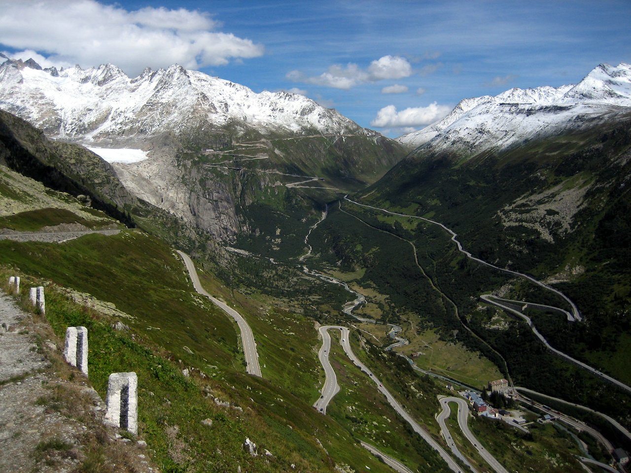
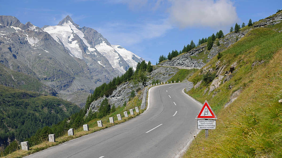
Porsche sponsors the publication of quite a nice book, detailing a reasonably relaxed way to take in 15 passes in four days. The route starts in Switzerland at Glarus, to cross the high Klausen Pass (1,948m) across amongst others the Stelvio, via Cortina in Italy, to finish at Zell am See in Austria.
In all, the route and passes go:
Day one, 97 miles
Klausenpass (1,948m)
Sustenpass (2,264m)
Grimselpass (2,165m)
Day two, 260 miles
Furkapass (2,436m)
Nufenpass (2,478m)
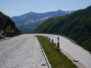
Gotthardpass (2,106m)
Fluelapass (2,383m)
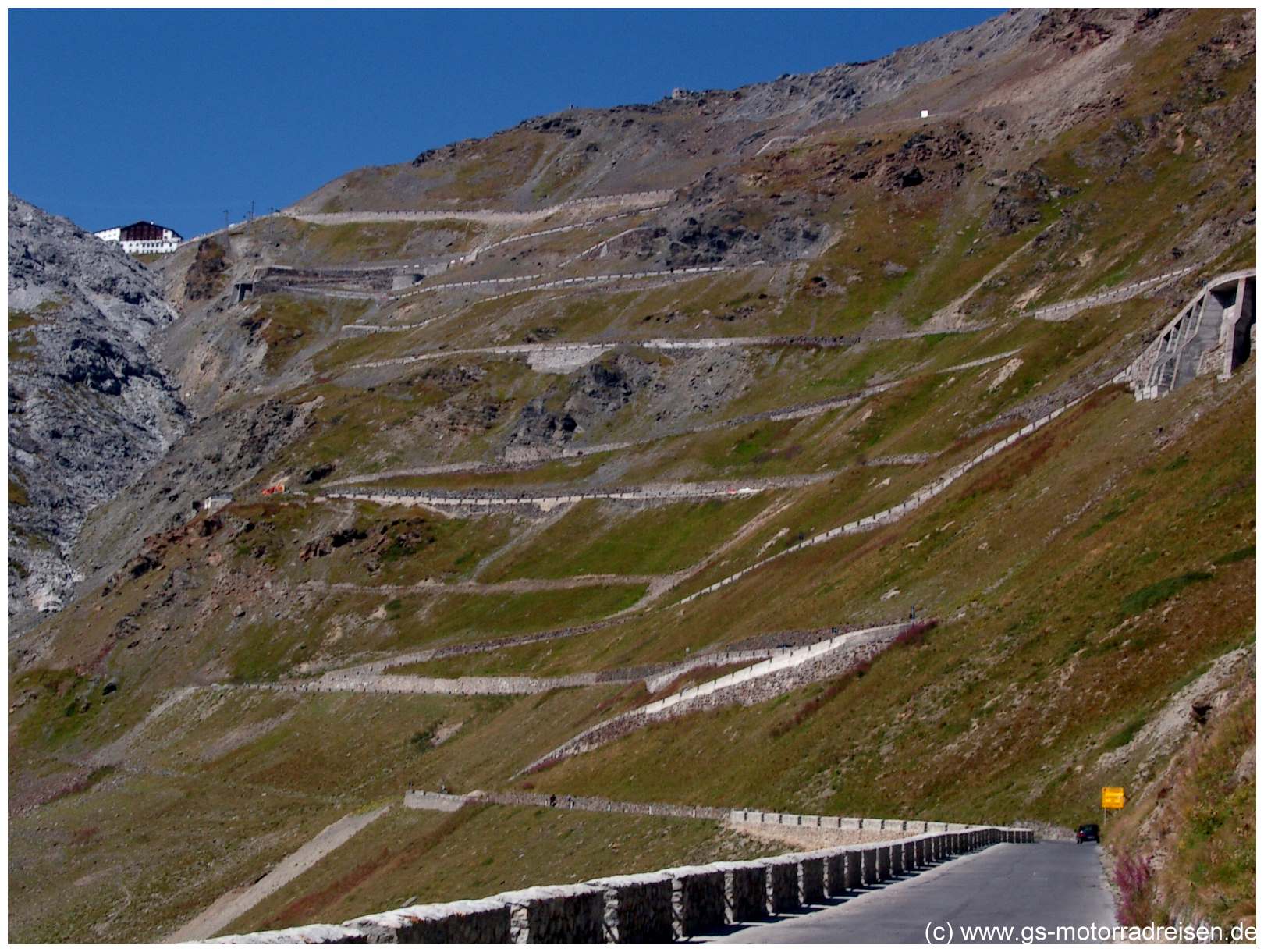
Stilfser-Joch / Stelvio (2,757m)
Day three, 161 miles
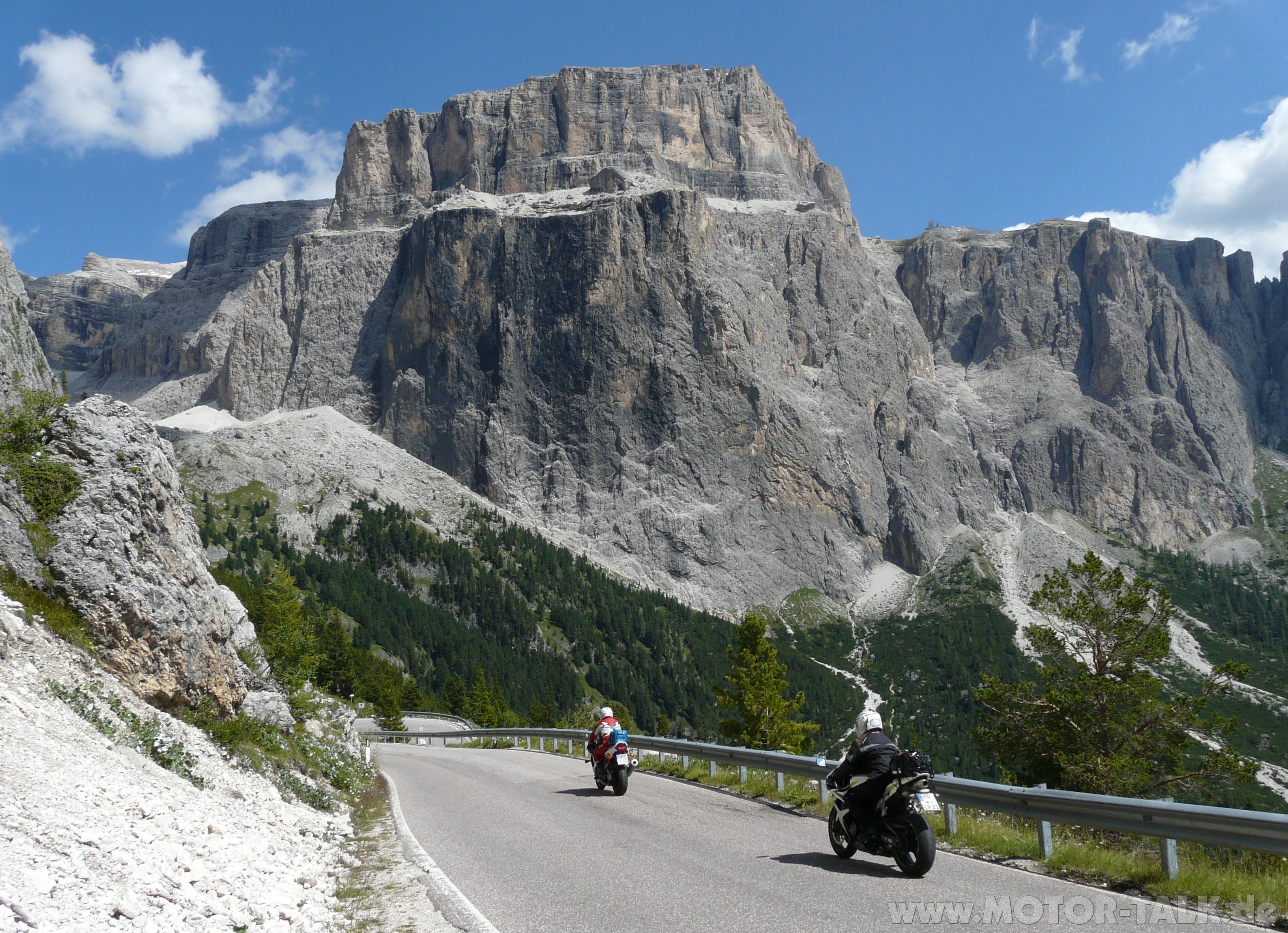
Pordoijoch (2,239m)
Sellajoch (2,240m)
Grodner Joch (2,121m)
Passo di Falzarego (2,105M)
Passo di Giau (2,236m)
Day 4, 121miles
Drei Zinnen (2,320m)
Grossglockner Hochalpenstrasse (2,504m)
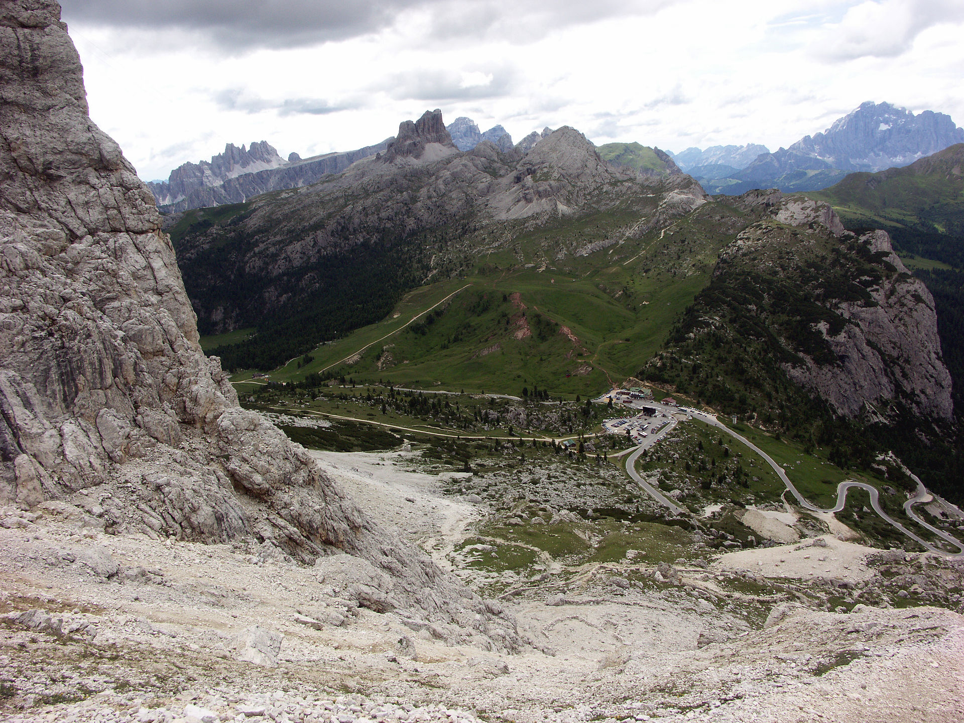
As the route runs west to east, purists can argue that it crosses the mighty Stilfser-Joch / Stelvio by ascending the gentler side, before cresting the top and starting the descent via the multiple hairpins of the eastern side. Other commentators will doubtless tell you that its not worth doing at all or that there are better passes around. Meanwhile, yet more bods will tell you that the twisty side ascent is too frightening for words and that it's impossible to overtake anything, ever. The answers to which are: If you don't want to do it, do something else. If you want to reverse the route, to climb up the hairpins, start at the other end. In a similar vein, the route takes you up and over the old Gotthardpass (Tremola), which is made of blocks or cobbles. If you don't like the thought of that, take the very smooth modern road that runs parallel. Whilst you do so, consider that blokes (and girls) ride bicycles up the old road, whilst some other bod will be going up in his very hard suspension GT3 RS. Which will leave others time to debate whether riding up the private (toll) road to the excellent views at Drei Zinnen (Tre Cime di Lavaredo, in Italian) or the return loop up to the top of the very nice Passo Pordoi counts or not. The suggested route, is what it is. What do I think riders and drivers would get out of it? A reasonable pre-made route west to east, or visa-versa across some of the most iconic passes, nicely paced and above all taking you from the mountains of the Alps, to the much different shaped Dolomites and back into the Alps again.


I have cut the route into BaseCamp and saved it on Dropbox. I haven't checked it fully but from a rough run through it seems OK.
https://www.dropbox.com/s/dxnauuvc24acx6h/Porsche = 15 passes in 4 days.GPX?dl=0
It's .gpx file. Anyone using a Mac might find that Dropbox sometimes adds a .txt extension to the file. If this happens, download, save the file and then rename it, deleting the .txt part. It should then open up in BaseCamp or Mapsource.
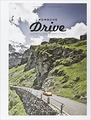
Here's the book, it's available on Amazon:
Other reading:
John Hermann's bible of Alpine travel, of course:

Maps: You could do worse than heading to the Mapsman site: http://www.mapsman.com My advice though is that maps are a personal thing. What looks right for one person, looks like a muddled mess for another and visa-versa. I'd go into a decent bookshop, like Waterstones and look at the maps they have on offer, choosing maybe one or two of the maps I liked. Better still, I'd visit somewhere like Stanfords, to see just about all the maps on offer http://www.stanfords.co.uk/?gclid=CJGwkKvRyNECFfQW0wodkTECIw Failing that, I'd always keep my eyes open for maps and guides locally when I was there. Why would I always take a map or two? They are cheap and will last for years, giving you a much better broader idea of where you are, where you've been and where you are going than any GPS device.
How to get there and back again? There are lots of threads on this site and others which, with a bit of imagination, anyone could mix'n'match into a route to suite them. It should also be possible to cobble something together by adding in ideas from the RiDE magazine website, too. Come on, you've got the 'Across the Alps' bit done for you..... anyone can do the rest.
Richard
This thread all about a suggestion to ride a possible route along 15 mountain passes in four days. The passes might be just what you want to ride or might be a long way from where you intend to go but stay with it. The real purpose of the thread is twofold:
(1) That it's possible to take ideas on roads to ride, things to see and places to stay from a variety of sources, so don't just limit yourself to motorbike orientated ideas. Lots of people - far more than the really very few who ride a motorcycle - like touring. They too like good views, nice roads to ride and decent hoteliers. It's easy to guess that most people in a sports car will avoid goat tracks but will like 'twisties', so they are not so very different to blokes on motorcycles. Use their ideas, too.
(2) Further down the thread, starting at post #7, then continuing at post #13 through to post #20 I have tried to show how it's possible to take a route from another source (in this case RiDE magazine) then join it to the very specific Porsche route to create one complete tour: Calais > 15 Alpine passes > Calais.
Hopefully, anyone should be able to do the same thing for their own holidays, as the same methods and ideas could apply if they wanted to go to Scotland or Croatia or Spain. There is lots of stuff out there, use it as it's all free, you can't break it and it's ultimately so much better than someone doing it ALL for you.
Richard
So let's get going.......
Porsche - 15 passes in four days
Porsche sponsors the publication of quite a nice book, detailing a reasonably relaxed way to take in 15 passes in four days. The route starts in Switzerland at Glarus, to cross the high Klausen Pass (1,948m) across amongst others the Stelvio, via Cortina in Italy, to finish at Zell am See in Austria.
In all, the route and passes go:
Day one, 97 miles
Klausenpass (1,948m)
Sustenpass (2,264m)
Grimselpass (2,165m)
Day two, 260 miles
Furkapass (2,436m)
Nufenpass (2,478m)
Gotthardpass (2,106m)
Fluelapass (2,383m)
Stilfser-Joch / Stelvio (2,757m)
Day three, 161 miles
Pordoijoch (2,239m)
Sellajoch (2,240m)
Grodner Joch (2,121m)
Passo di Falzarego (2,105M)
Passo di Giau (2,236m)
Day 4, 121miles
Drei Zinnen (2,320m)
Grossglockner Hochalpenstrasse (2,504m)
As the route runs west to east, purists can argue that it crosses the mighty Stilfser-Joch / Stelvio by ascending the gentler side, before cresting the top and starting the descent via the multiple hairpins of the eastern side. Other commentators will doubtless tell you that its not worth doing at all or that there are better passes around. Meanwhile, yet more bods will tell you that the twisty side ascent is too frightening for words and that it's impossible to overtake anything, ever. The answers to which are: If you don't want to do it, do something else. If you want to reverse the route, to climb up the hairpins, start at the other end. In a similar vein, the route takes you up and over the old Gotthardpass (Tremola), which is made of blocks or cobbles. If you don't like the thought of that, take the very smooth modern road that runs parallel. Whilst you do so, consider that blokes (and girls) ride bicycles up the old road, whilst some other bod will be going up in his very hard suspension GT3 RS. Which will leave others time to debate whether riding up the private (toll) road to the excellent views at Drei Zinnen (Tre Cime di Lavaredo, in Italian) or the return loop up to the top of the very nice Passo Pordoi counts or not. The suggested route, is what it is. What do I think riders and drivers would get out of it? A reasonable pre-made route west to east, or visa-versa across some of the most iconic passes, nicely paced and above all taking you from the mountains of the Alps, to the much different shaped Dolomites and back into the Alps again.
I have cut the route into BaseCamp and saved it on Dropbox. I haven't checked it fully but from a rough run through it seems OK.
https://www.dropbox.com/s/dxnauuvc24acx6h/Porsche = 15 passes in 4 days.GPX?dl=0
It's .gpx file. Anyone using a Mac might find that Dropbox sometimes adds a .txt extension to the file. If this happens, download, save the file and then rename it, deleting the .txt part. It should then open up in BaseCamp or Mapsource.
Here's the book, it's available on Amazon:
Other reading:
John Hermann's bible of Alpine travel, of course:
Maps: You could do worse than heading to the Mapsman site: http://www.mapsman.com My advice though is that maps are a personal thing. What looks right for one person, looks like a muddled mess for another and visa-versa. I'd go into a decent bookshop, like Waterstones and look at the maps they have on offer, choosing maybe one or two of the maps I liked. Better still, I'd visit somewhere like Stanfords, to see just about all the maps on offer http://www.stanfords.co.uk/?gclid=CJGwkKvRyNECFfQW0wodkTECIw Failing that, I'd always keep my eyes open for maps and guides locally when I was there. Why would I always take a map or two? They are cheap and will last for years, giving you a much better broader idea of where you are, where you've been and where you are going than any GPS device.
How to get there and back again? There are lots of threads on this site and others which, with a bit of imagination, anyone could mix'n'match into a route to suite them. It should also be possible to cobble something together by adding in ideas from the RiDE magazine website, too. Come on, you've got the 'Across the Alps' bit done for you..... anyone can do the rest.
Richard


")


