Back for more. California 2017

Day 8 – Bishop to Tahoe

7-lone-pine.jpg


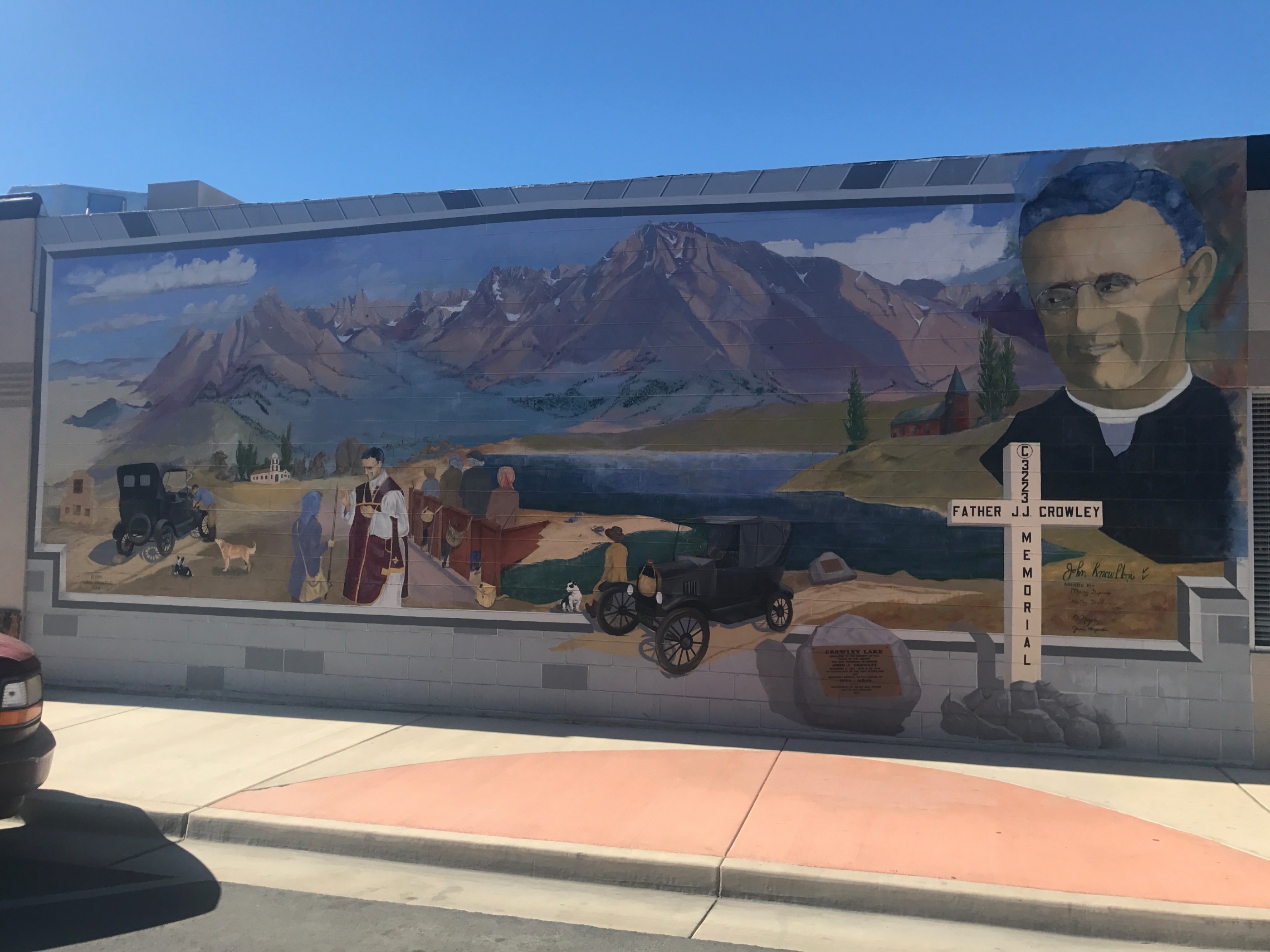
I discovered a fascinating story about Bishop and the Owens valley involving a Father J. J. Crowley, known as the ‘desert padre’. I had spotted a memorial to him up on Towne Pass. During the 1920’s the city of Los Angeles started to buy up all the land round here in order to build an aqueduct to divert the water for the rapidly developing city 250 miles to the south. Essential as that water might have been for LA, it decimated the farming community here. When Crowley arrived in his parish families were despairing and packing up to leave.

He went to work campaigning to raise the profile of the area and the issue, and came upon the strategy of publicising the area as a tourist destination. He was a master of publicity and did things like climb Mount Whitney and celebrate mass on top, and flying water from the highest point of America at Mt Whitney to the lowest point in Death Valley.

He was phenomenally successful, and pursued Hollywood to start to use the area for locations for films like Gunga Din, King of the Kyber Rifles and the Hopalong Cassidy. Crowley became friend to some of the biggest film stars of the area, and was pivotal to the revitalisation of the area and then one night in 1940 driving home late from a fundraiser in his battered old jalopy, he was tragically killed in a road accident.

19-bishop.jpg


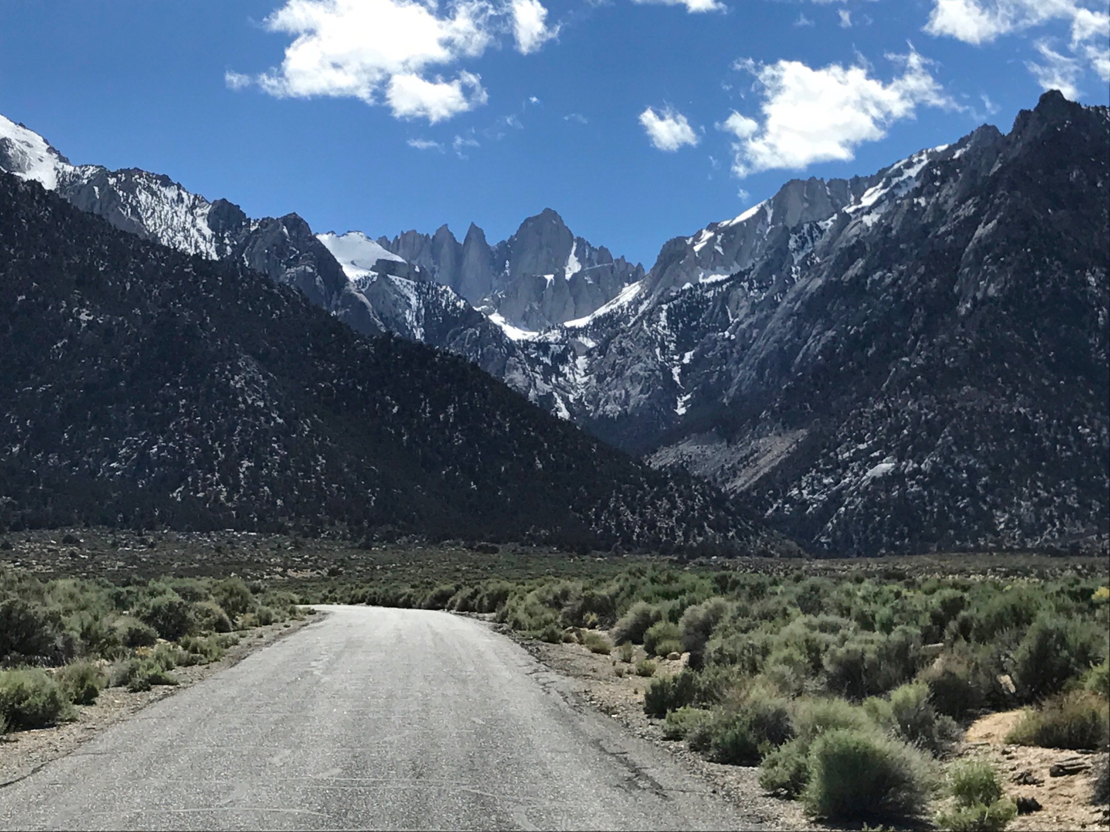
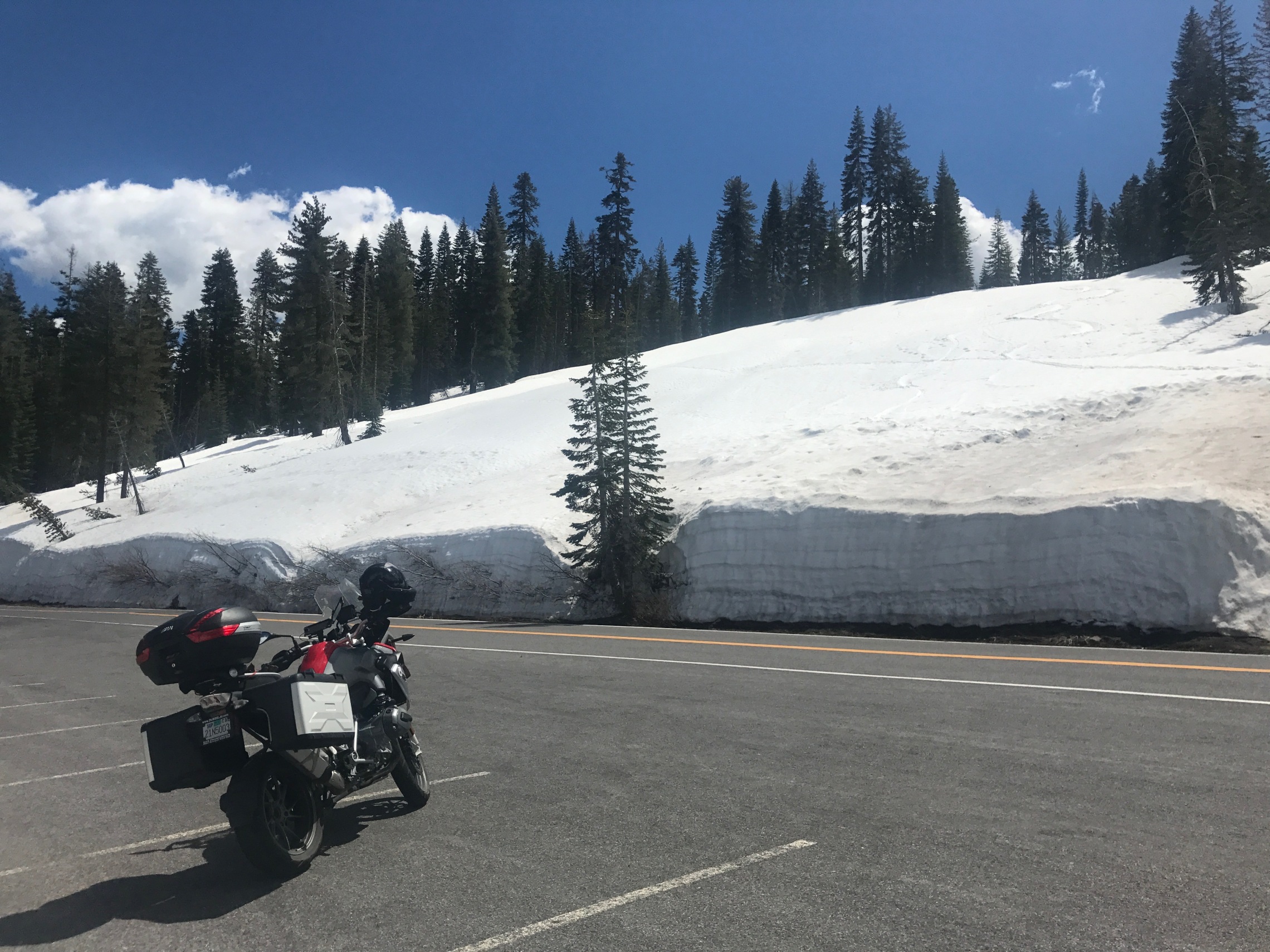
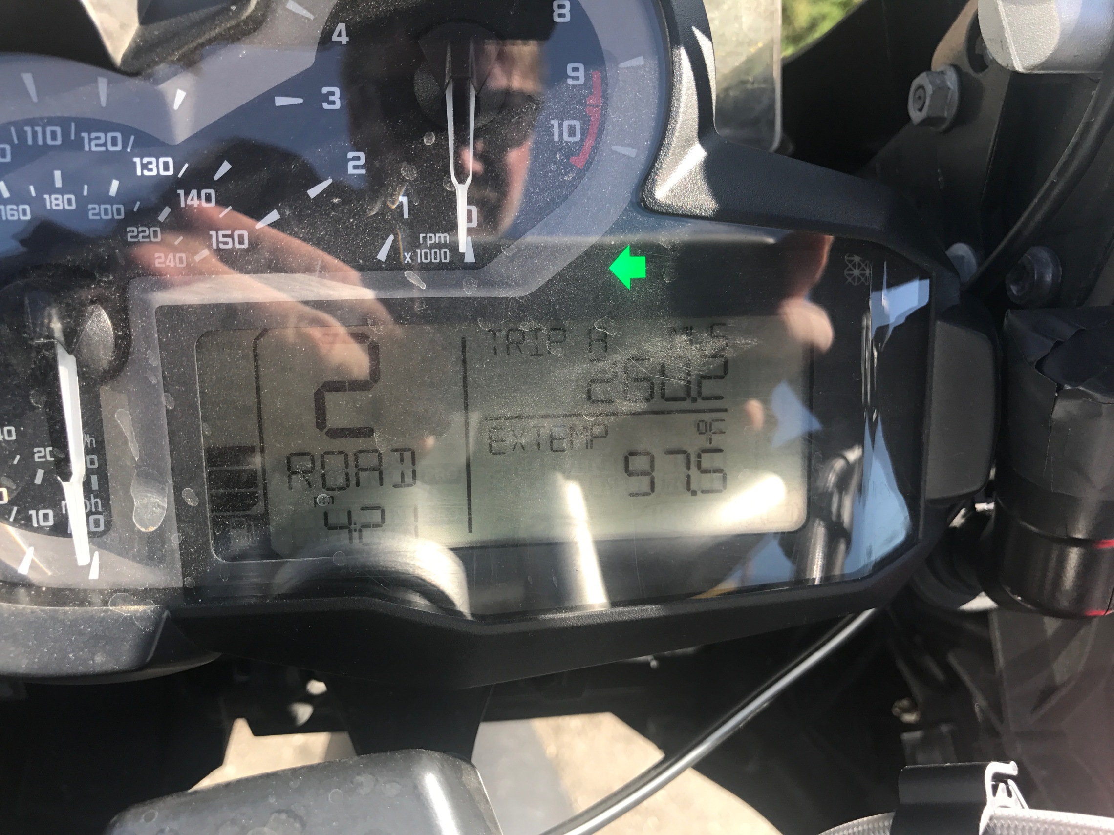
Grateful for the good padre, I had a fine breakfast at Jack’s Restaurant, and then set off north along the most scenic road I know, with the Sierra Nevada to the west and the desert to the east. The road rises quickly to around 7000 feet. The air is crisp and clear. At Lake Mono there is the turning over Tioga pass to Yosemite , which was of course closed by all the snow. I hoped that didn’t mean I wouldn’t get to Yosemite this trip, but I knew that was a possibility.

20-bishop-2.jpg


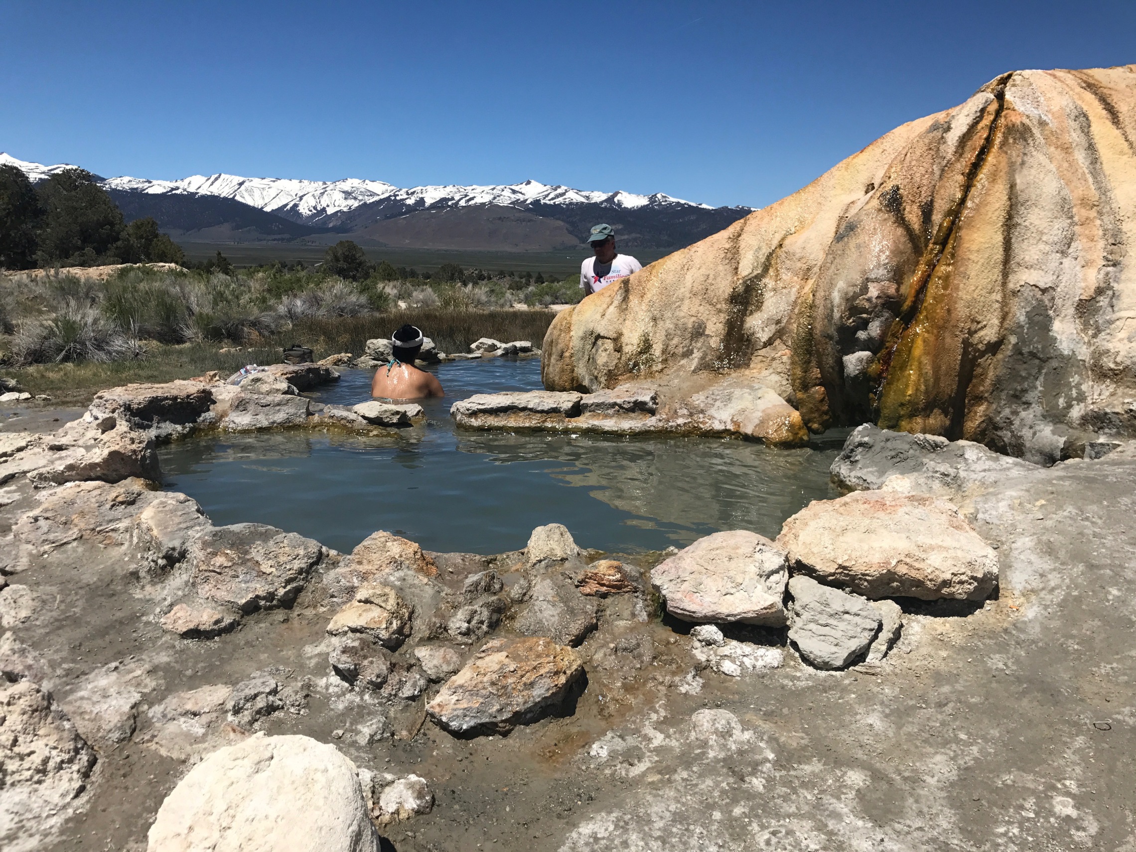
I’m now heading for an amazing natural feature in the middle of the desert called Travertine Hot Spring. There is a dirt road to get there, and it is the most amazing spot. The hot mineral rich water bubbles up and creates that rocky feature – which historically was mined for Travertine, a decorative rock. It builds really quickly and the whole area is covered in those amazing outcrops. But here, the water is dammed to make a pool and you can soak in the very hot water. There were some eccentric old gentlemen who had dug their own pool further up the hill next to the carpark, who tried to persuade me that theirs was much better than this one, but as they were all hanging out naked, I made my excused and wandered down to the natural one. It is glorious, steaming hot and super relaxing. I’m told it gets very busy at weekends, but there were just a few people around, including this nice Italian couple.

19-travertine-hot-spring.jpg


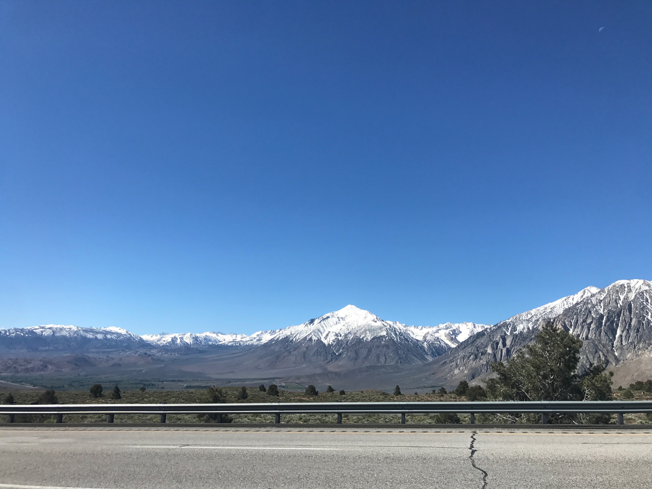
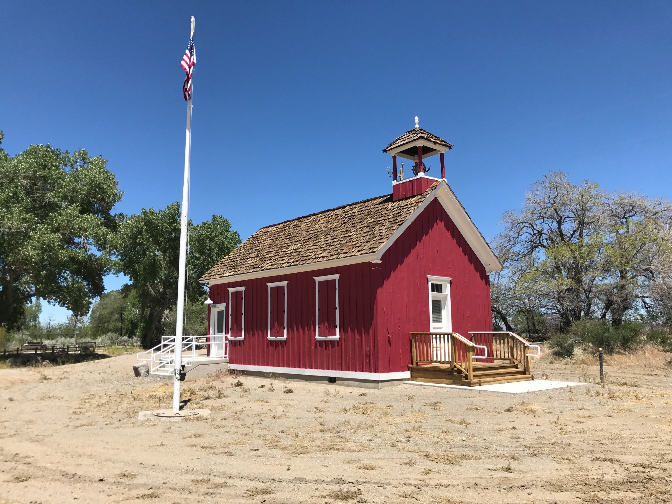
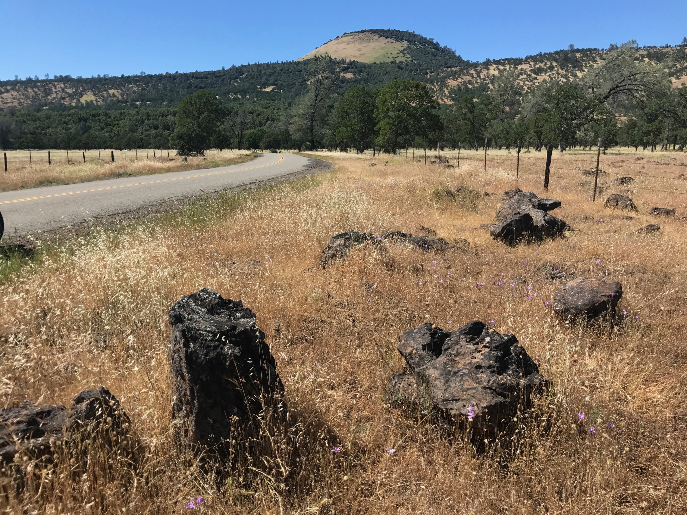
Back on the road, I came off the 395 at Bridgeport, and took the backroad route 182 up into Nevada. Lots of good riding through high pastures and ranches. All very lovely, but after the drama of the Sierra Nevada, less to make you stop and take photos. Amazing to think of people living their whole lives out here though, it feels so remote. This little schoolhouse at Smith, Nevada is a testament to the community that people built. I could imagine generations of kids traipsing off reluctantly here year after year.

19-smith-nevada.jpg


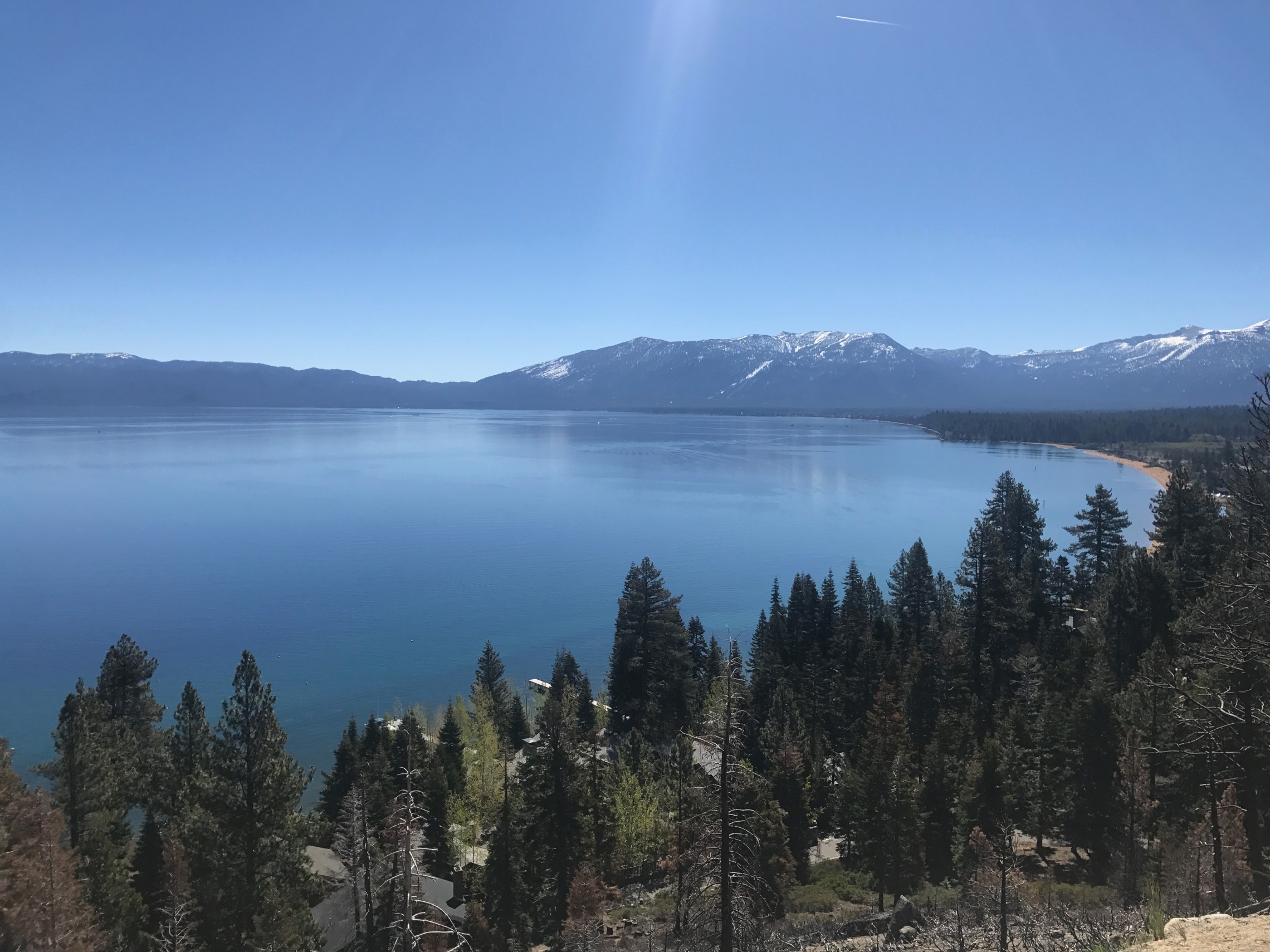
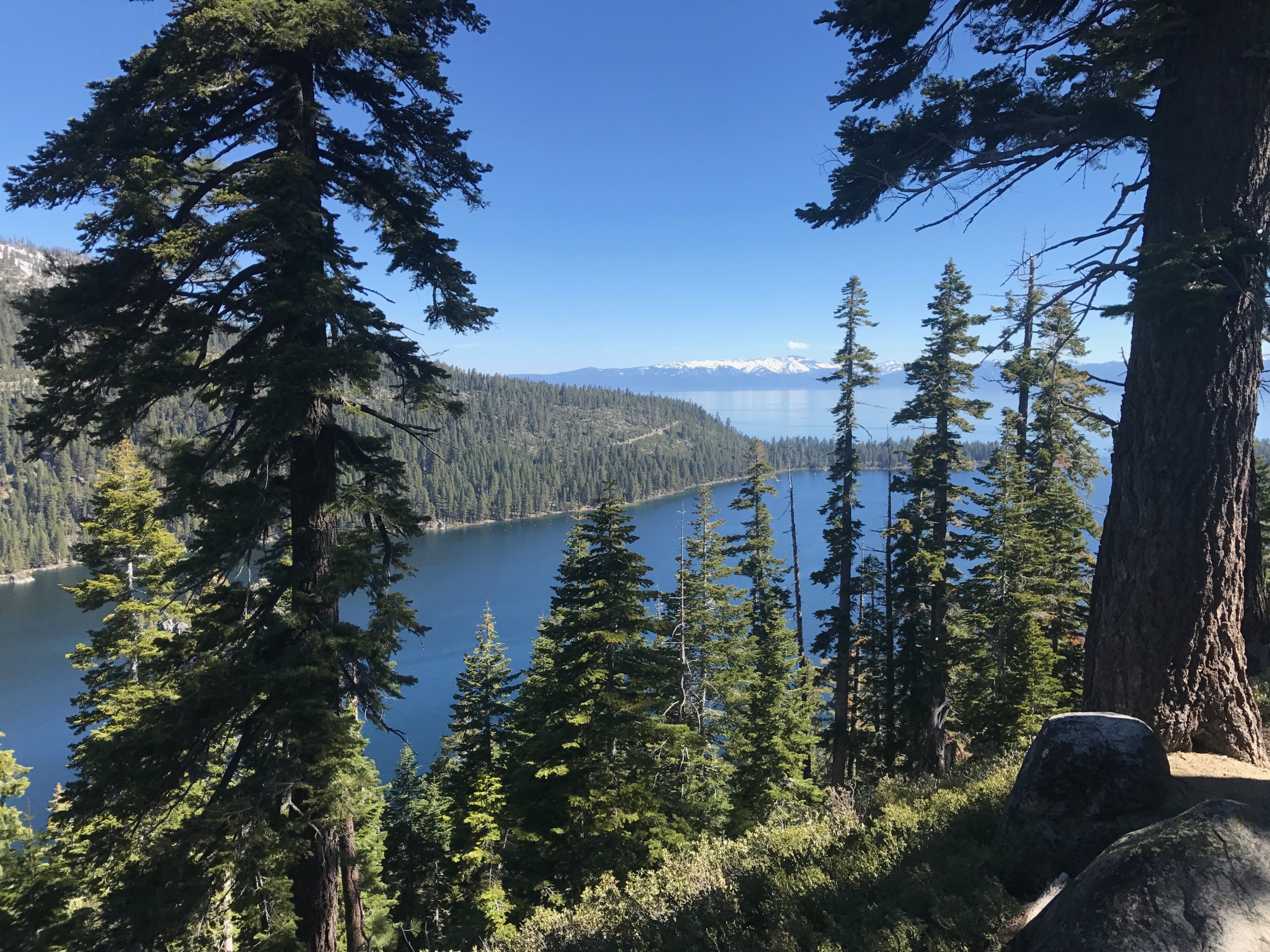
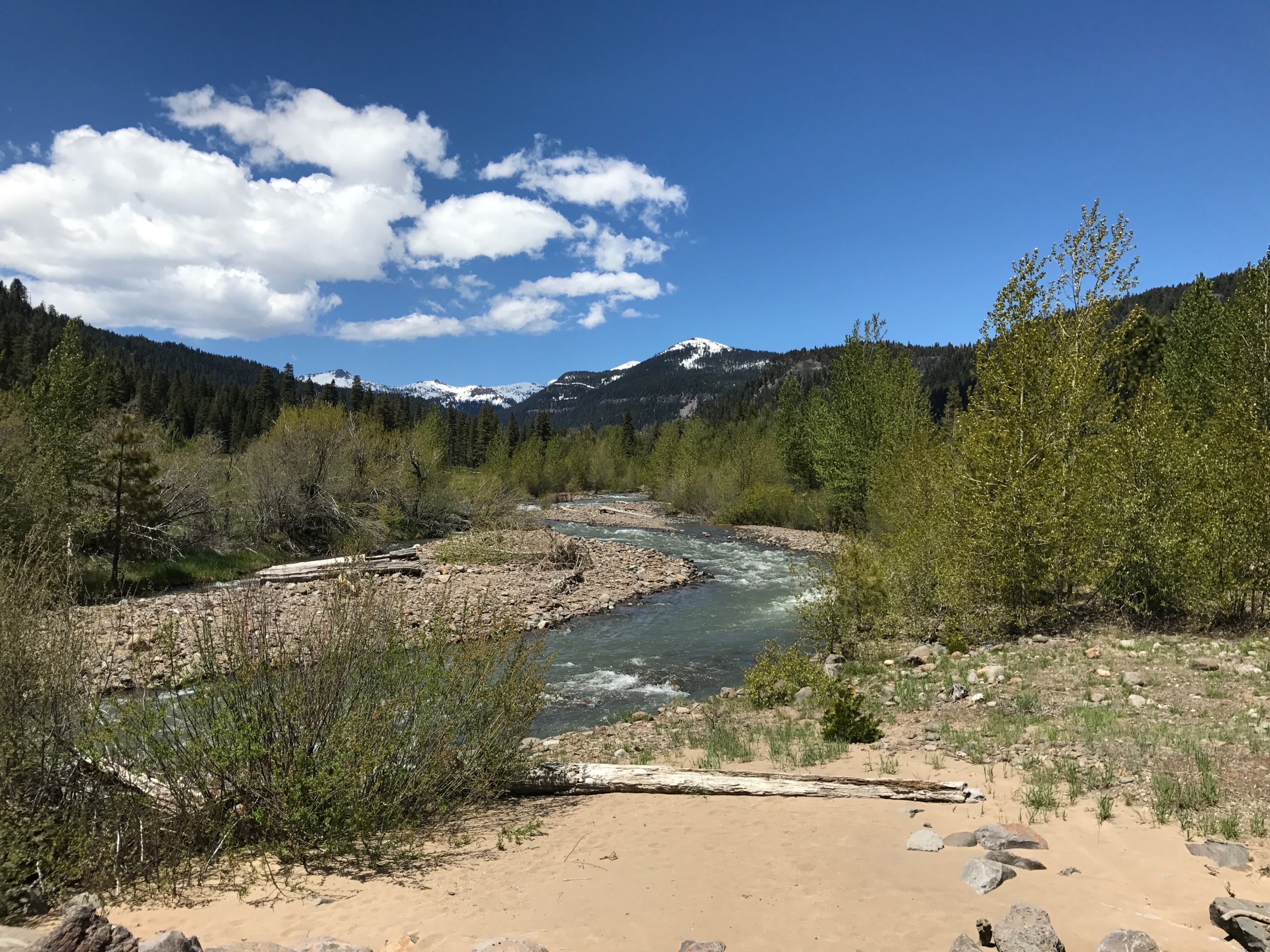
The praries are lovely, but I’m really here for the mountains and the forests. And so my next destination is Lake Tahoe. It is a dramatic ride from the plains up the mountain to Tahoe, which is also on the California/Nevada State line, and there are a series of massive Casinos just on the Nevada side. It has been a resort town for many years – wealthy people from San Fransisco would often have a second home here. And if you have seen the Godfather 2, you will remember the great house by the Lake which is filmed just on the other side of the lake.

7-tahoe.jpg


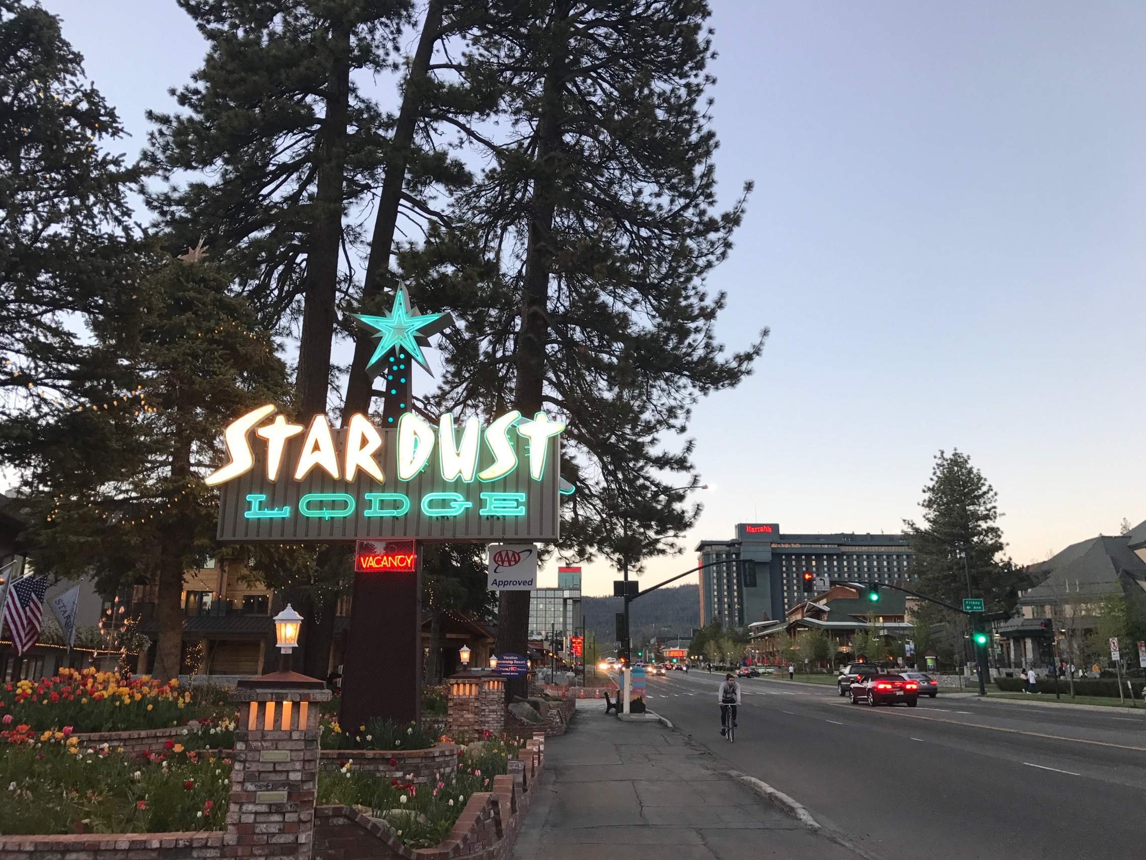
It’s a beautiful place, if clearly very privileged. For the first time I feel a bit out of place in my now fairly grubby riding gear and weather beaten face. But I find a quite reasonable motel, and take a swim in the pool, before going for an evening walk on the beach as the sun sets over the lake. Then into town, and there is a real end of the ski season vibe to it. It is lovely. I get pizza in the main square, listen to the live band playing slightly cliched crowd pleasers, and feel a bit lonely and miss my family.

19-stardust-lodge.jpg
 
Day 9 - Volcano Country

20-tahoe.jpg


I set off around the lake. It is Saturday morning and the road is busy with slow drivers taking in the sight, which are amazing. The west side of the lake has the feel of a Norwegian Fjord, and clearly I'm not the only one who thinks so - there is a 1929 mansion here built called Vikingsholm. Nice.

Route 89 north leaves the lakeside at the north , and I'm heading for Lassen Peak, an active volcano with some seriously good roads around it. It is about 200 miles through rural Northern California, wild and beautiful, very much less populated than further south.

20-lassen-forest.jpg


After a stop for petrol at Chester on Lake Almanor the 89 starts to ascend. But at the junction with the 36 there are 'road ahead closed' signs, which is disconcerting but I obviously ignore them. There is a toll booth which marks the entrance to the Park but they tell me you can only go a short way up as the road is under a tonne of snow. It looks like a beautiful place, perhaps even more so in the snow, but I'm not going to pay the entrance charge just to ride up and down again. So I stop and take pictures, and chat to a guy wearing T Shirt with a John Muir quote on it. "Of all the paths you take in life, make sure a few of them are dirt". A good motto for life

20-lassen-peak.jpg


So I head back down the road and turn onto the 36 heading into the valley. As I descend towards the Sacramento river, for the first time this trip the temperature starts to soar. I'd come prepared with summer trousers and and mesh jacket, which obviously hadn't been much use up till now, but soon even they were too hot. I was riding in just a T'shirt, and it was gloriously hot. The landscape reflected the temperatures, and instead of the lush springlike conditions in the mountains, the place already had a sunburned and parched feel. The temperature rose and rose, eventually hitting to 97.5°f

20-temperature.jpg


I was intrigued by this odd shape hill and went to investigate. It turned out to be a cinder cone - a volcanic vent made up of loose pyroclastic fragments. And in the fields all around it were there basalt boulders which must have been pyroclastic bombs fired out from it. It would have been fun to be around when this was going off.

20-cinder-cone.jpg


Next to catch my attention was a dramatic white peak of Mount Shasta which dominates the landscape of the central valley visible from 140 miles away. I check and there is a good campsite there, next to the railway tracks, and so I ride up highway 5, past the dammed Shasta Lake and pull into the Mount Shasta City KOA.

20-mount-shasta.jpg


Amazing location, with fabulous views of the peak. On the reviews there were a few complaints about noise from the railroad, but the proprietor reassures me it is fine. I put up up tent in between the trees, and then a train rolls past. It is ridiculously loud, and for the full effect it blows its horn. There is no chance of sleeping here, even with earplugs. I pack up and storm back to the office for a refund. The owner hands it over without complaint.

But now I have to find somewhere to stay on a saturday night, and there are not many options. I end up at the A-1 Choice motel. I should have walked away when I met the unshaven owner with stains on his shirt.

The A-1 choice it most certainly was not. The room was grim, ill smelling, broken TV, thin scratchy sheets with serious doubts about their cleanliness. At least the shower worked, but I didn't trust the towels. I changed, and went out for dinner at the Black Bear Diner, which was great. And the beer was carefully labeled in case you forgot where you were.

20-bud-america.jpg


Then back to the crappy motel and ended up sleeping in my sleeping bag because the bed made my skin crawl.
 
Day 10 – Riding with Giants

7-chevvy-truck.jpg


It was my last full day on the bike, and I had a lot I still wanted to do, and I was a long way from San Fransisco. So I obviously headed further north into the wilds. After over a week of deserts and mountains I was hungry to see the ocean again, and I really wanted to get to Redwood National Park.

It is so beautiful up here, with a real sense of the untouched wilderness that the pioneers discovered. It isn't virgin forest at all actually, this whole was logged, and this is second growth. It couldn't be more different from southern California and feels more like Montana - real 'a river runs through it' country.

10-a-river-runs-through-it.jpg


It is vast and wild, and the forests seem to go on for ever. Also there aren't many options in terms of roads. At the brilliantly named 'Happy Camp' I tried to head north into Oregon on the Greyback road, only to be flagged down by a motorcyclist heading in the opposite way who said the road was under snow ahead, and impassable. Then I had a brilliant moment when after about 160 miles down route 96, at a tiny town called Weitchpec, at the junction of the Trinity and Klamath rivers I'm stopped by a roadblock, and told that the road was closed for repairs after another landslide, and would be only open for half an hour later that afternoon. The expectation seemed to be that we would hang around and wait. So didn't have time for that so had to take a very sketchy looking Bald Hill Road which started out paved, and eventually turned into a dirt track, over the mountains and took me through the most fabulous country over the crest of the coastal range, until ahead of me was Redwood National Park and in the distance, the Pacific ocean.

10-redwood-national-park.jpg


Standing up on my pegs riding on the dirt is an absolute joy. And as the road starts to descend around you rise up some of the most dramatic forests on Earth. In these steep ravines logging was too difficult, and so these are the survivors of the vast ancient redwood forest which once cloaked the whole coastline. This is where they filmed the Endor scenes in Return of the Jedi, and it feels so familiar you can dream you are riding on a speeder bike chasing stormtroopers.

There is no way to convey the scale of these trees. I Stopped at Lady Bird Johnson Grove and took tonnes of picture trying to capture their grandeur. But nothing gets close.

10-lady-bird-grove.jpg


Riding down the mountainside, through dense forest as the dappled sunlight illuminates the road is magical. But as I get near sea level, all of a sudden everything is swathed in mist, there is one of the famous northern Californian sea fogs has rolled in and the mood becomes quite dark and quite mysterious. The trees loom out of the mist and disappear into the clouds. But then I can hear the sound of the waves again, and I'm back on the 101 at a tiny town called Orick. I pull over and wander down to the beach. The sand is warm under the sea fog which must be a sign of how quickly the mist rolls in. I take of my helmet lie down and have a nap. Lovely.

10-beach.jpg


South from here is another of the greatest sections of road in California, if not the world. Weaving in and out from the coast, up over the headlands and down along the beaches, and in and out of the sea fog I travel south, loving being back at the ocean. They call this the Redwood Highway, for good reason. Often these giants are right next to the road. I can imagine generations of families in station wagons travelling up this road for their holidays, stopping to drive through the hole carved in the Chandelier tree and looking out for Yogi Bear and Boo-boo.

10-giants.jpg


The road goes on and on, and never gets any less wonderful. You see signposts to the Avenue of the Giants, which is a scenic drive through the Redwoods, next to the highway. It is warm now, and I slow down to try and take it all in, knowing it will end soon.

10-chandler-tree.jpg


I have another petrol drama at the next stop. My fuel light came on a few miles back and so pull into a little gas station. But I'd forgotten it was a Sunday and this one was closed. There were two cars there in a similar predicament, wondering which way to the closest gas station. We were just at the junction where between the 101 which becomes a freeway here, and route 1, which sticks closer to the coast, which I was meaning to take, but it was getting late and I'm still a long way north. According to the Satnav there was a Chevron 22 miles down the 101. We set off that direction in convoy in case anyone didn't make it.

It has now been another massive day, brilliant but tiring, and in my fatigued state I am failing to make decisions about accommodation. I look out for a campsite near the road, but somehow never spot one. Then at Cloverdale, the road descends out of the uplands into the Russian River Valley, and the end of my adventure starts to sink in. It is nice here, vineyard country, but it is familiar, suburban California. And there isn't much road left ahead of me until San Fransisco.

I faff around badly until it gets dark, order Pizza from a road side place at Willits, and sit outside on this warm evening eating some of the finest pizza I have ever tasted. Then I find a slightly odd, but very nice Wild west style motel and crash out on the deepest, softest mattress you can imagine.
 
Day 11 - In conclusion

marin-headland.jpg


I only had a couple of hours before I need to return the bike, so after a spectacular last breakfast at Lumberjacks Restaurant, I cruise down the final stretch of the 101 in the sunshine, until there before me is the Golden Gate bridge, the end of my adventure. Typically the bridge is covered in rolling sea fog, and I have to wait for breaks in the cloud to even get this picture of it.

11-golden-gate.jpg


And then with a heavy heart I set off on my last leg, and just like everyone else taking the obligatory and frankly dangerous selfies while crossing the bridge, I do a final lap round San Fransisco and make my weary return to Dubbelju's.

11-dubbelju.jpg


The owner Wolfgang was there when I arrived, and he checked the bike over threatening to charge me by the kilo for the bugs all over it. He is a good guy who set up Dubbelju in 1991 when he moved here from Germany. He has ridden all over the States, and tells some great stories. We agreed that the US is all about the wilderness. The cities are fine, but nothing like Europe, and the lack of history and culture is really apparent. But what America has to offer that you can't find anywhere else are the vast unspoiled wilderness and the freedom to ride.

11-wolfgang.jpg


It has been a remarkable trip, but after 10 days almost constantly on the bike, I needed time to stop and process it all. Did I enjoy it? Well obviously, but it isn't as simple as that. Just as much of the story is about what went wrong and how you coped with it.

I said at the beginning, I think these trips matter because they make us who we are. For me the wilderness is a place that reduces things to the bare essentials, offers a simplicity that faces me up to the truth about myself, and reveals my character for better or worse. And so while I will go back to may family with great happiness and settle down to try to be a decent husband and dad, I will be planning my next adventure too.
 
Great report and pictures.

Many people get hooked up on riding the PCH or Route 66 when they go Stateside but getting off the beaten track is the way to go. There are some fantastic roads out there and the people are really friendly and accommodating especially up in Northern California.
 
Thanks Mark, great report, pics and writeup, Your last paragraph was a bit blurry:augie, but yes, it does make you think and look at what is valuable, made me go and look at all the pics again from our trip, memories last a lifetime. Cheers,:beerjug: John B
 
Well done, great report & pics :clap
Think you covered more miles in your 10 days than we did in 4 weeks :blush
 
Nice RR !

You’re right about the cities,though I love San Fran but hate LA.
Arizona and Utah are amazing.Having been there on 4 wheels this year to hike the canyons,were definitely going back on 2 wheels asap.
 
Great trip report and pictures, I'd love to go again, maybe one day
 
Superb.. Thanks for taking the time to put that together..

R
 
Day 10 – Riding with Giants

There is no way to convey the scale of these trees. I Stopped at Lady Bird Johnson Grove and took tonnes of picture trying to capture their grandeur. But nothing gets close.

.....generations of families in station wagons travelling up this road for their holidays, stopping to drive through the hole carved in the Chandelier tree and looking out for Yogi Bear and Boo-boo.

I found the PCH north of SF to be overhyped, but my wife wanted to see the Redwoods and they were the highlight of the drive north to Eureka

Here’s a tubby Yorkshire lass to give you some scale of their size :p

a691f097fe35660b87d869e65a559b37.jpg


0a5a94a941b195cf6227da1b30ac907b.jpg


e5ed6933f72c6ed06772a3ba96b20abf.jpg


c413bcc2f58b63763708c16f8e39dcde.jpg
 
I found the PCH north of SF to be overhyped,

You've mentioned that before but I'm not sure why you say it. It's personal opinion of course but I find the PCH north to be a much better biking road because it's much quieter and is more curvy. The last 30 miles or so as it heads inland to teh Chandelier tree are absolutely superb to ride and I always look forward to that section. There aren't many touristy things on the road thats for sure but that suite me. There are also some fantastic roads inland if you know where to look and something like Highway 36 is motorcycle heaven. You also witness how rustic and redneck California is once you get away from SF and LA.

For a lot of people, it doesn't have the appeal of of the southern section as it's not as famous but for my money, they are missing out on some spectacular stuff and some awesome riding.
 
Wonderful words and photographs Mark - thanks for taking the time to put this together.

Only hope I get the chance to do something similar myself.
 
You've mentioned that before but I'm not sure why you say it. It's personal opinion of course but I find the PCH north to be a much better biking road because it's much quieter and is more curvy. The last 30 miles or so as it heads inland to teh Chandelier tree are absolutely superb to ride and I always look forward to that section. There aren't many touristy things on the road thats for sure but that suite me. There are also some fantastic roads inland if you know where to look and something like Highway 36 is motorcycle heaven. You also witness how rustic and redneck California is once you get away from SF and LA.

For a lot of people, it doesn't have the appeal of of the southern section as it's not as famous but for my money, they are missing out on some spectacular stuff and some awesome riding.

To be honest, I’m a county boy brought up in the Pennines and I much prefer hills and mountains to the coast. I did like the Big Sur section of the PCH and also a few short sections north of SF, but was much happier once we left the coast and headed inland to McMinnville to see the Spruce Goose and then into eastern Oregon, before heading back to SF via Crater Lake, Lassen Volcanic Park, Bodie and Yosemite. The old town and railway museum in Sacramento were also a great place to spend a few hours, especially if you like Hell on Wheels :beerjug:
 
superb, thanks for the great pics and story


Back
Top Bottom