<- Coming from Iceland (part I)
On the way to Laki around ten river crossings had to be dealt with, but it was well worth it. Near the track we could see the very nice Fagrifoss (foss standing for falls), no tourists and thus pure unspoiled beauty.

Appear to Dissapear

Fagrifoss
And through the Katla lava field:
To Vík, the southernmost tip of Iceland and its magnificent Three Sisters:
Shades of Time
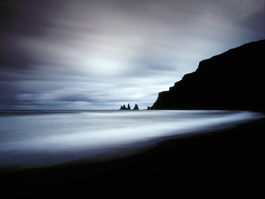
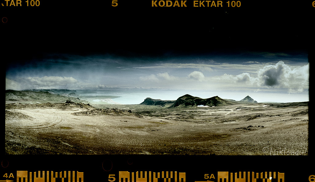
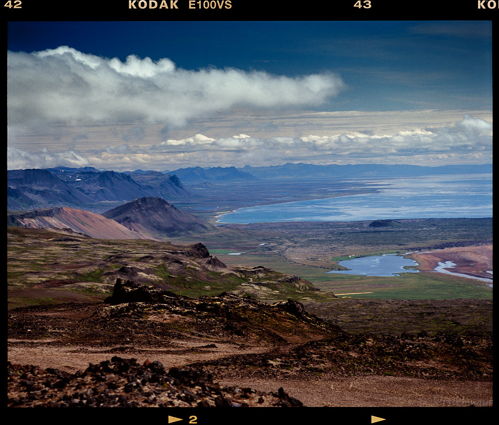
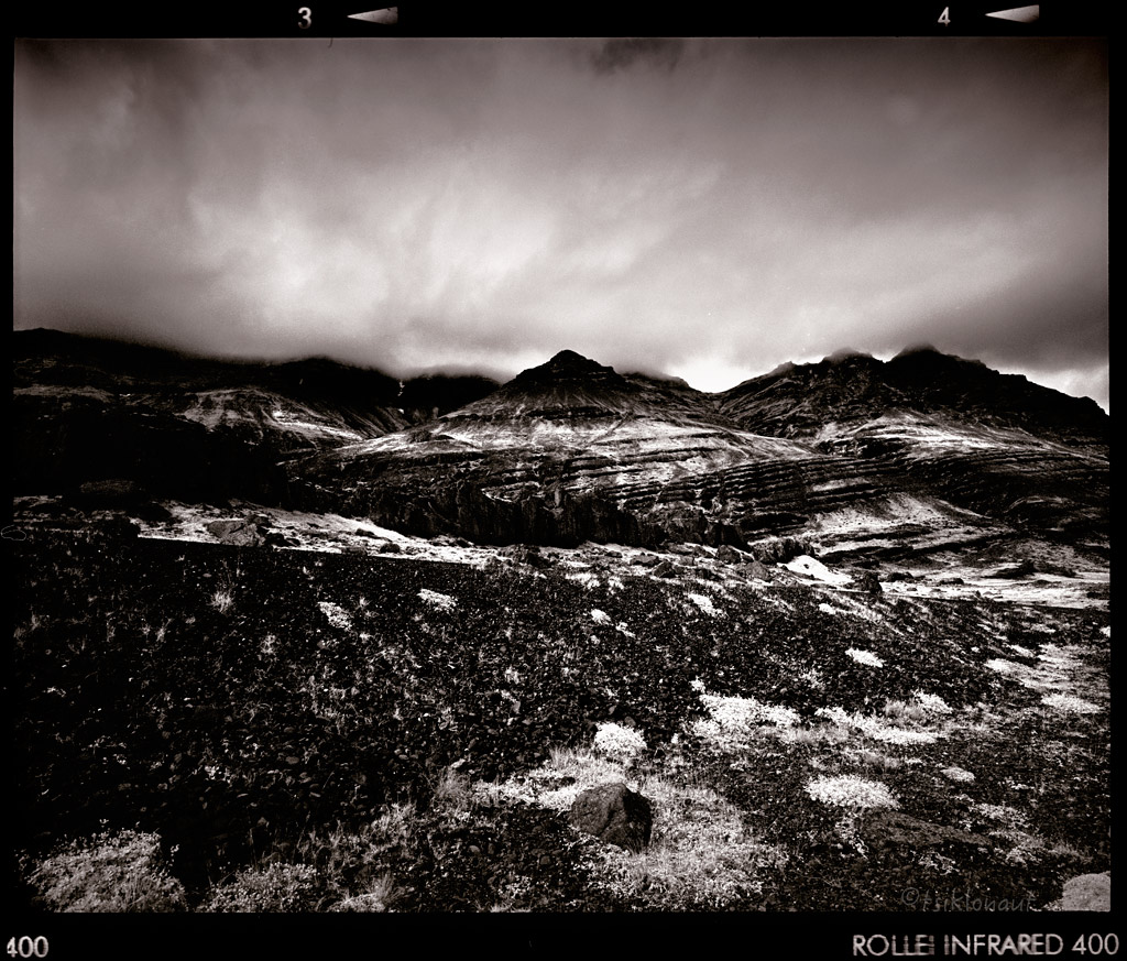
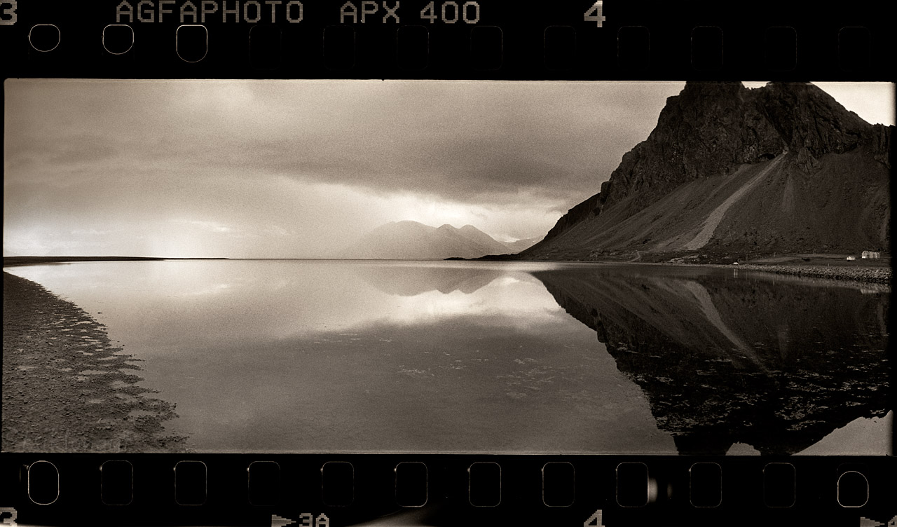
View to the stormy Northern Atlantic ocean:
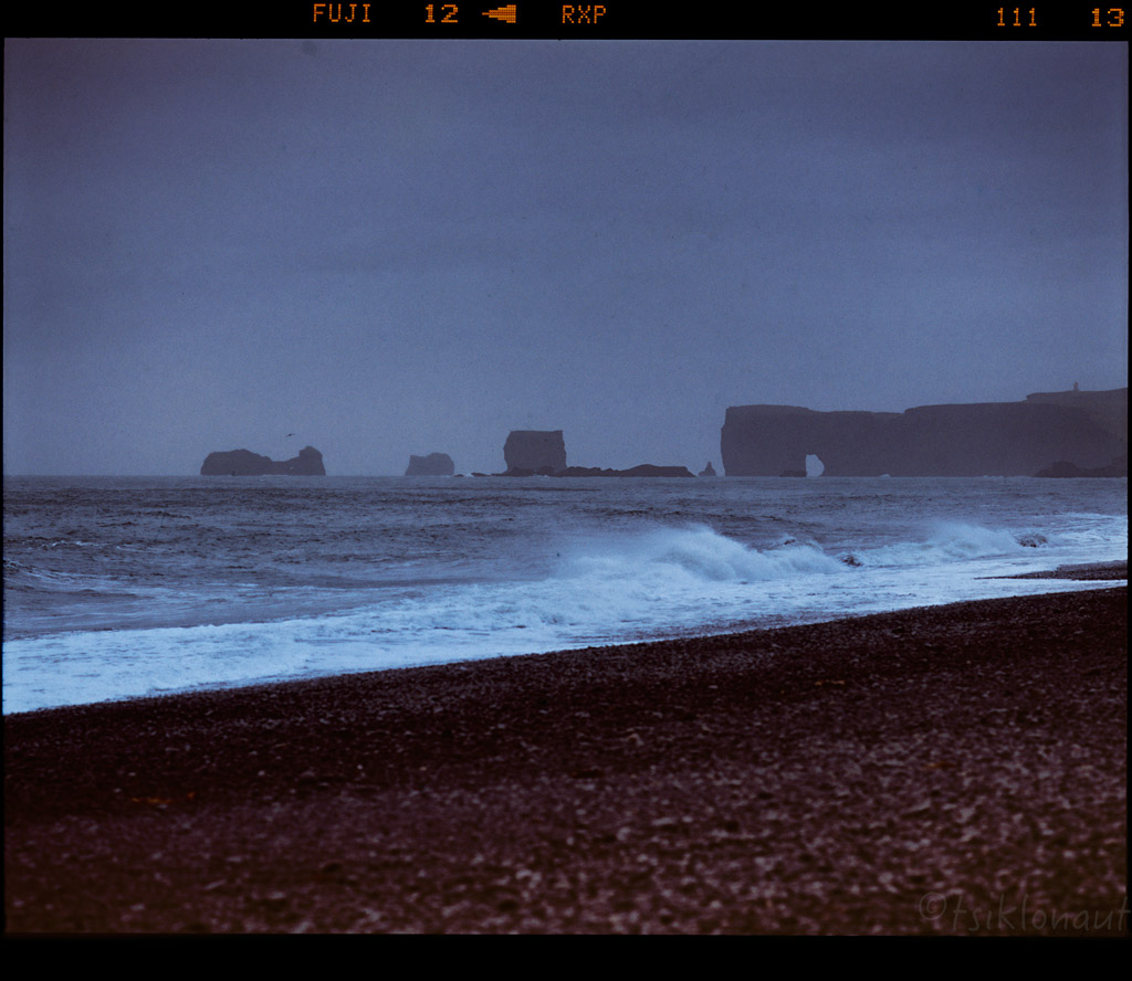

Icelandic southern coast.
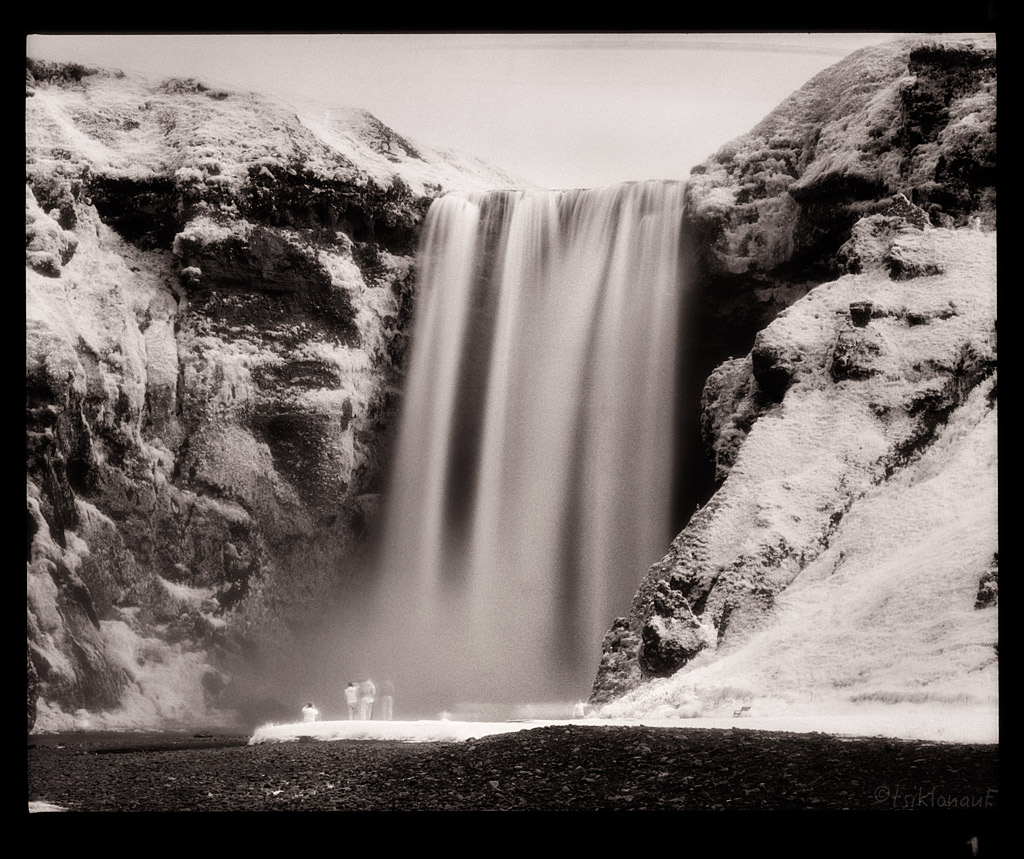
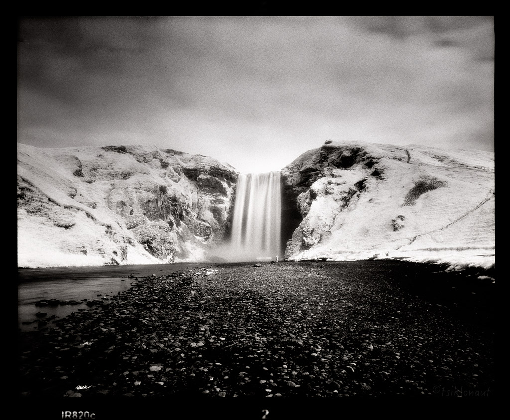
Not far away there was another tourist trap, Skógafoss, but instead I loaded in an infrared film and took a little different picture of the bored-to-death most-photographed waterfall in Iceland. Captured with a different visual perspective in mind, with an Efke "Aura" B&W infrared film (no manipulations - this is how it looks like on film!):
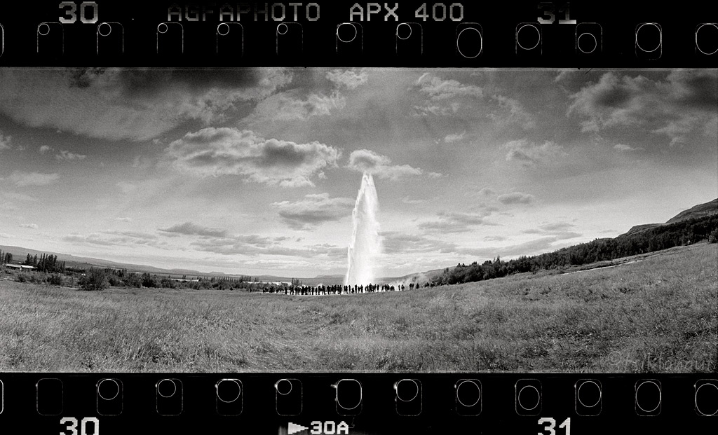
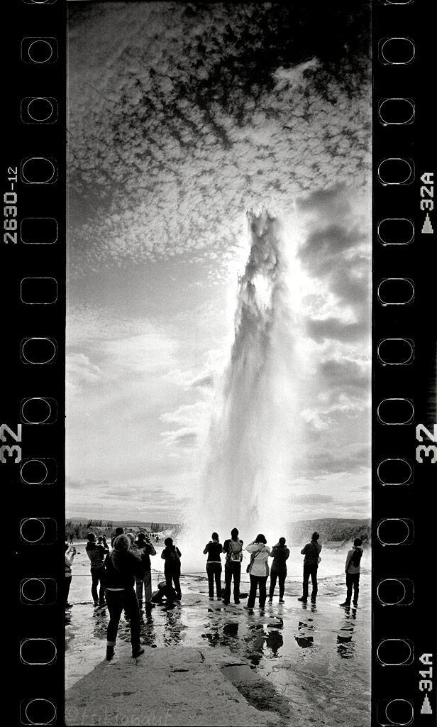
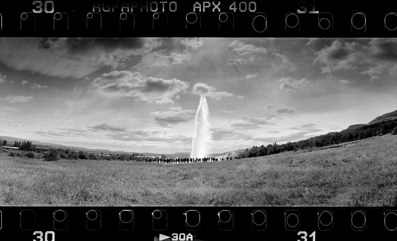
And soon the geysers greeted us. Strokkur (Icelandic for "churn") is a fountain geyser located in a geothermal area beside the Hvítá River in Iceland in the southwest part of the country, east of Reykjavík. It is one of Iceland's most famous geysers, erupting once every 8-10 minutes. Its usual height is 15-20 m, although it can sometimes erupt up to 40 m high.
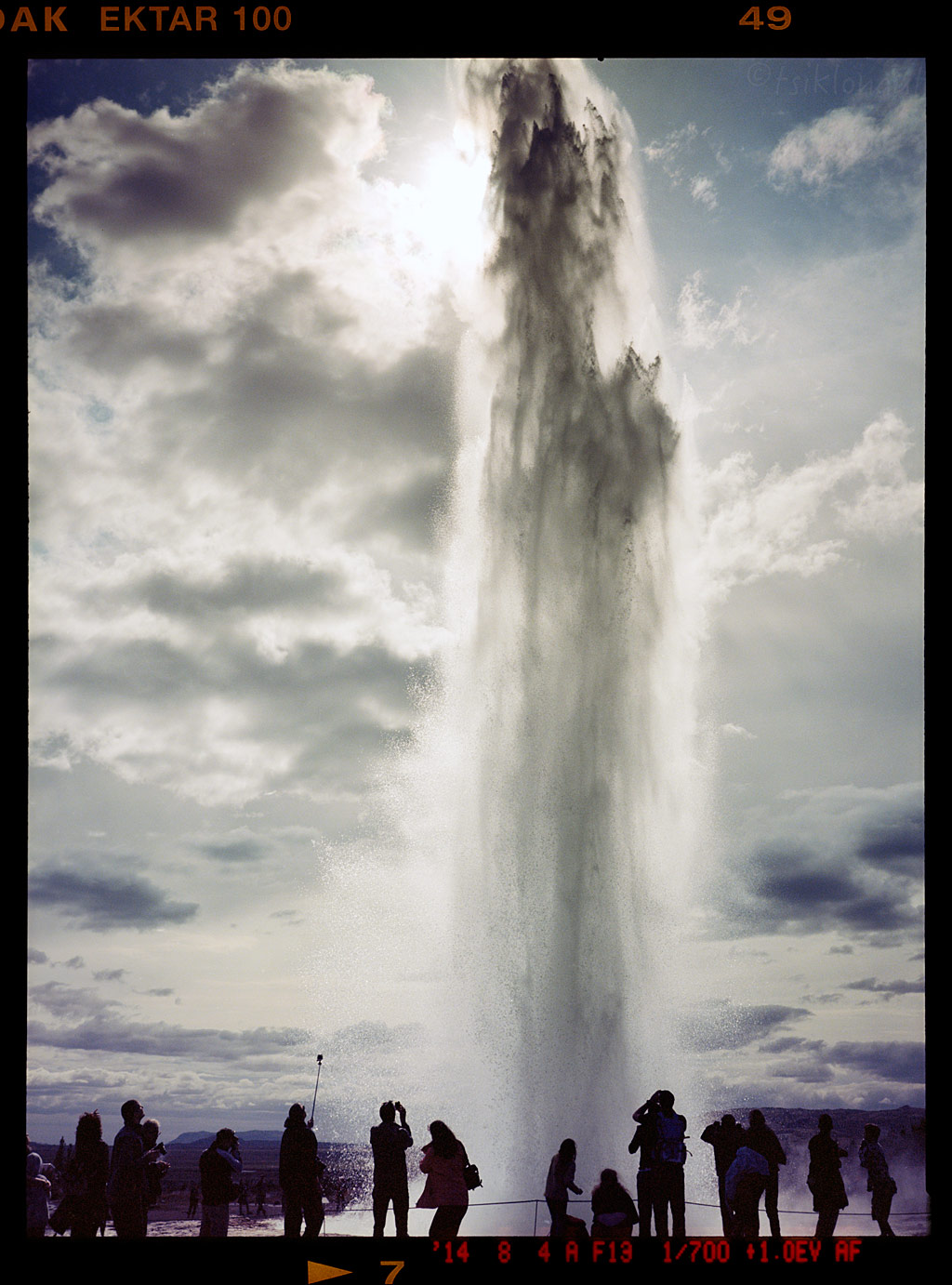
One last big burst in color:
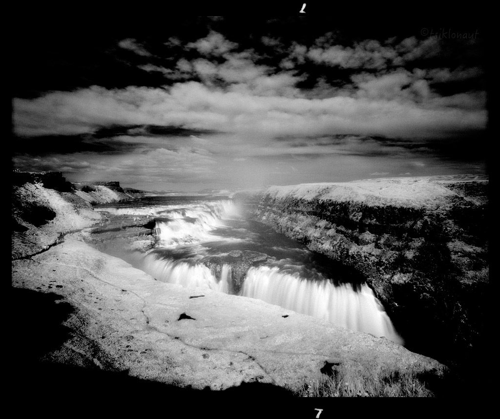
Nearby is the Gullfoss, one of the most popular tourist attractions in Iceland. The wide Hvítá rushes southward, and about a kilometre above the falls it turns sharply to the right and flows down into a wide curved three-step "staircase" and then abruptly plunges in two stages (11 m and 21 m) into a crevice 32 m (105 ft) deep. The crevice, about 20 m (66 ft) wide, and 2.5 km in length, extends perpendicular to the flow of the river. The average amount of water running down the waterfall is 140 m³/s in the summer and 80 m³/s in the winter. The highest flood measured was 2000 m³/s.
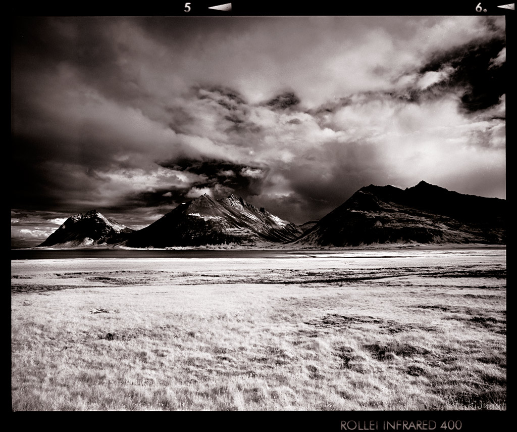
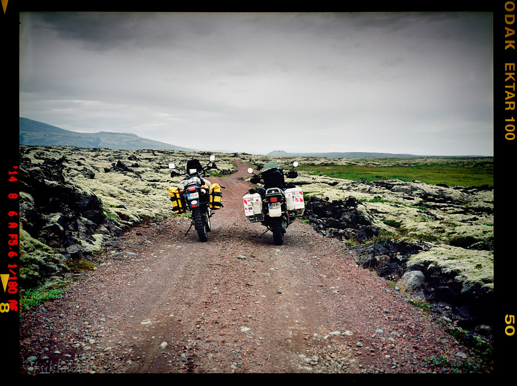
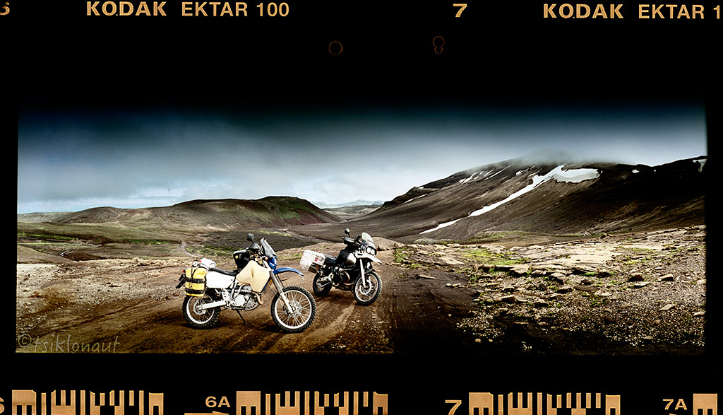
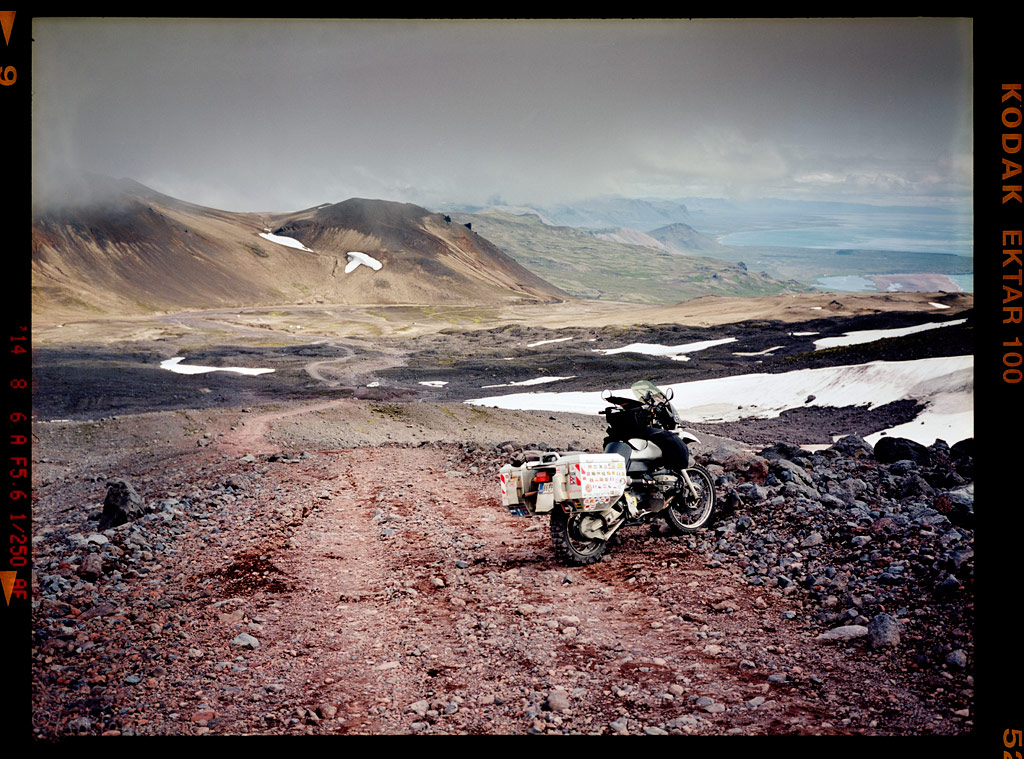
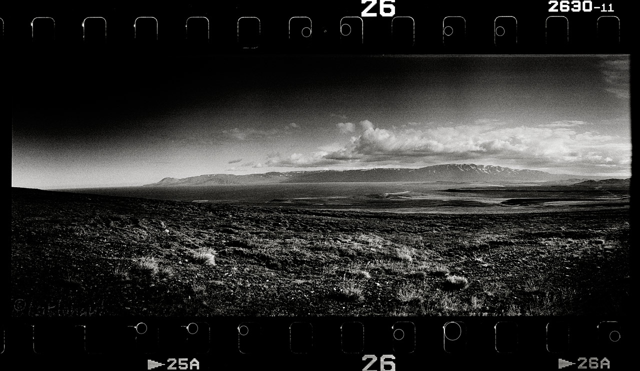
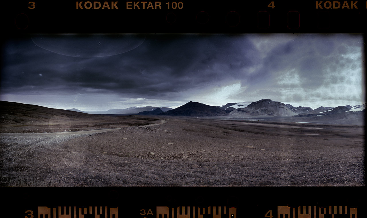
Then we set off to Kaldidalur, F550. The route begins a bit to the north of Þingvellir and to the west of the volcano Skjaldbreiður, which really comes up to its name (meaning broad shield). The track continues between the glaciers of Þórisjökull and Ok and leads up to the north. To the east of Reykholt it comes near the Reykholtsdalur to Húsafell. Then it continues up to Hvammstangi at the Miðfjörður. The place is like a Moonscape.


Kaldidalur.
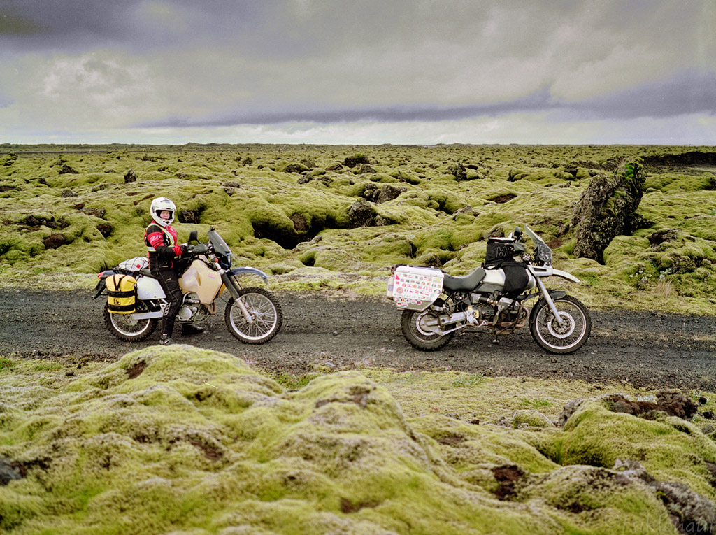
We tried the very little known and very rough F578 piste north, but were miserably stopped by over a waist-deep river halfway to our destination. First I took Kariina’s bike over (judging by the turbulences on the water, there were some large rocks on its bottom, and she probably would not have managed to ride through the river some fifty meters wide), and it was difficult enough. The water level was high enough to reach the air intake of the GS in places, so we had two choices – either to set camp by the river and wait until next morning to try and take the GS across (because there is less melt water in the morning and thus the water levels are much lower) or return the way we had come. Since it was still mid-day, we decided to turn around. So I rode the Suzuki back across, totally soaking my boots in the process. So before we turned our front wheels towards the Snæfellsnes peninsula, I changed the socks and pulled plastic bags over them to keep the water in the boots away from them.

On the way we passed by the unreal hexagonal basalt columns in Gerðuberg, an otherworldly place:
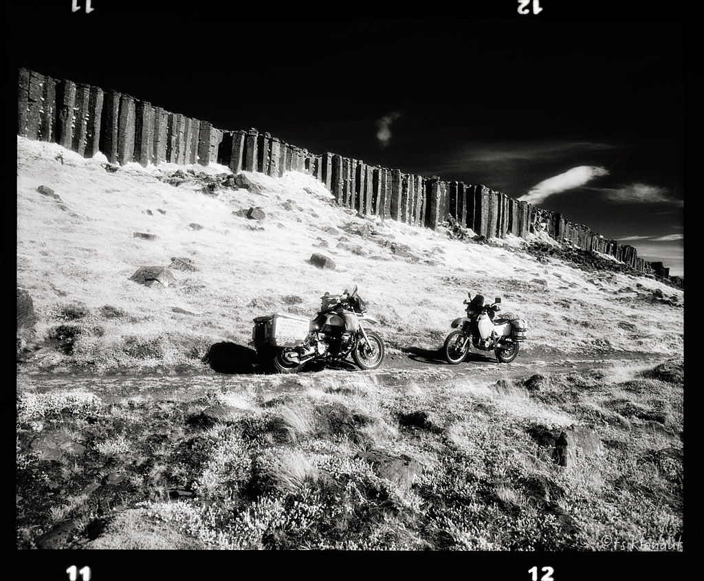
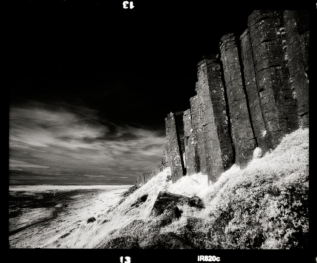
Gerðuberg.
Then we saw the "Most Beautiful Church in Iceland", the Búðakirkja in Buðir:
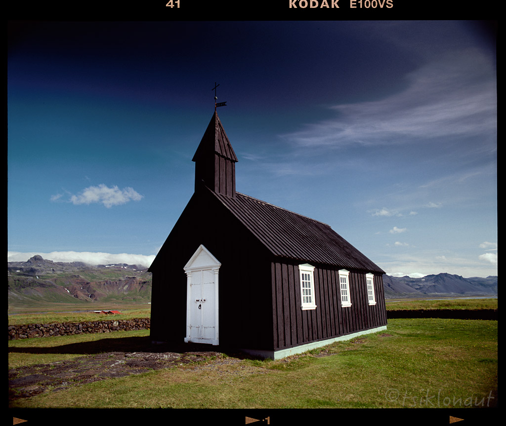
White door by tsiklonaut
Snæfellsnes peninsula has been named "Iceland in Miniature", because many national sights can be found in the area, including the Snæfellsjökull volcano, regarded as one of the symbols of Iceland. With its height of 1446 m, it is the highest mountain on the peninsula and has a glacier at its peak. The volcano can be seen on clear days from Reykjavík, at the distance of about 120 km. The mountain is also known as the setting of the novel Journey to the Center of the Earth by Jules Verne. The area surrounding Snæfellsjökull has been designated one of the four National Parks by the government of Iceland.
I decided to ride all the way up to the glacier, but my attempt wasn’t quite successful as the track was very steep and loose. Got a decent view nevertheless.
Pictures don't do justice how steep it actually was. It was that steep that I had to come up the last steep part literally on a full-on wheelie (front wheel had no traction and I couldn't slow down to lose the vital momentum), but lost control just 10 meters from reaching the top (where I took the pic) and did nearly a sharp 120-degree turn while on a wheelie on losing my final momentum. That was a very awkward maneuver to turn such a pig heavy loaded bike just from the rear wheel, I'm not sure how the hell I managed to stay upright and not crashing. The front wheel landing just between larger rocks had something to do with this I reckon. You can see some of it from the drag track.
The view up on the Snæfell.
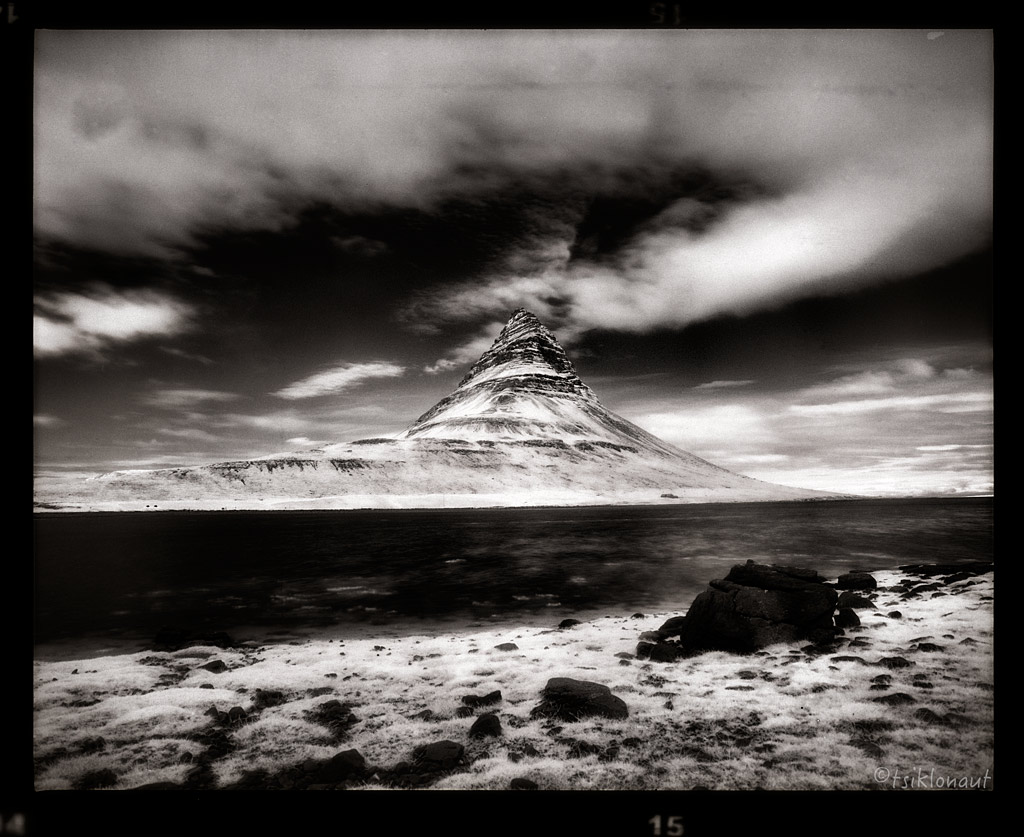
On descent and on the way further north we could see Kirkjufell Hill in Grundarfjörþur:
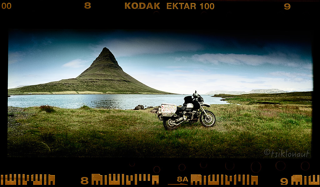
Different angle and different film media take on Kirkjufell:
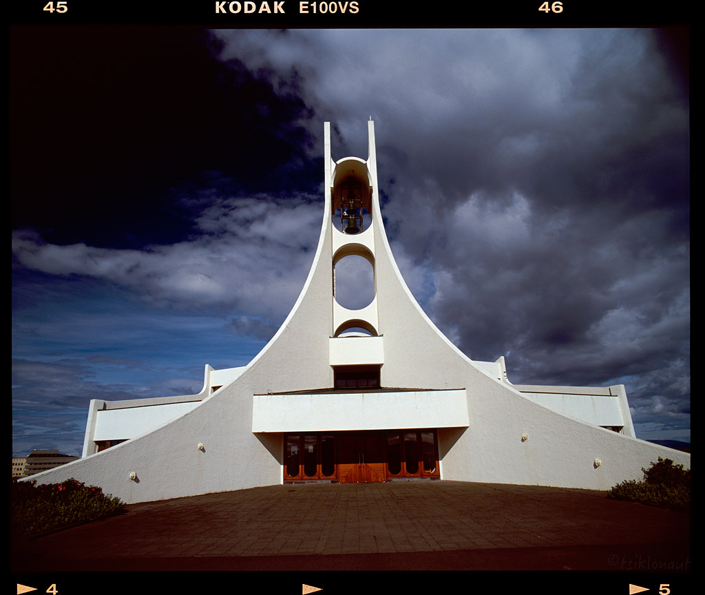
Icelanders have also a very funky understanding of the architecture, a good example is the church in Stykkishólmur:
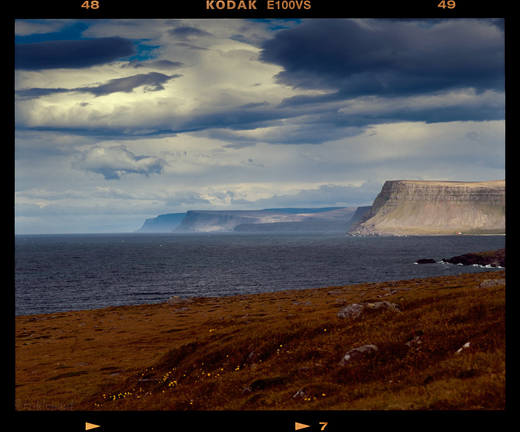
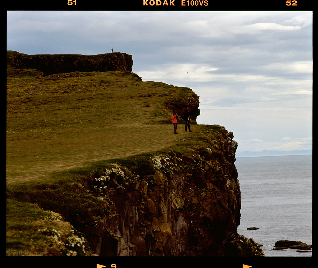
On to the West Fjords. Looking at the map their complex layout alone sparked humbleness in us, but we decided to go ahead and complete the full circle around West Fjords.
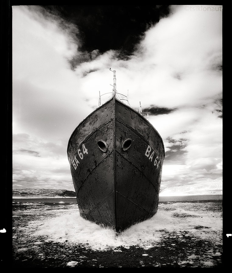
On the way to Látrabjarg, Iceland’s westernmost point one can see the oldest iron hulled ship in Iceland, the Garðar BA 64. It was built in 1912 in Norway and years later in 1981 was beached on the Latrabjarg Peninsula in the West Fjords of Iceland.

Garðar
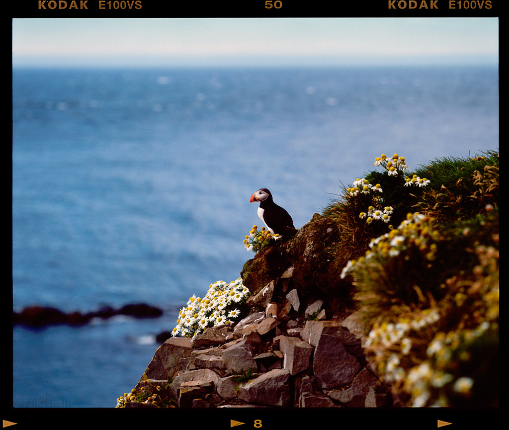
At Látrabjarg, we could see puffins, seals and other species.
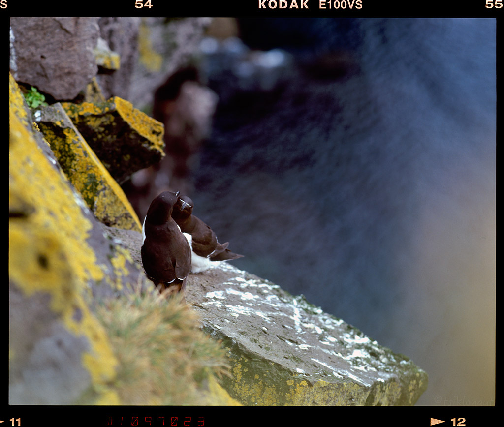
Those two groomed each other like 30 minutes straight, never seen such a passion between the birds.
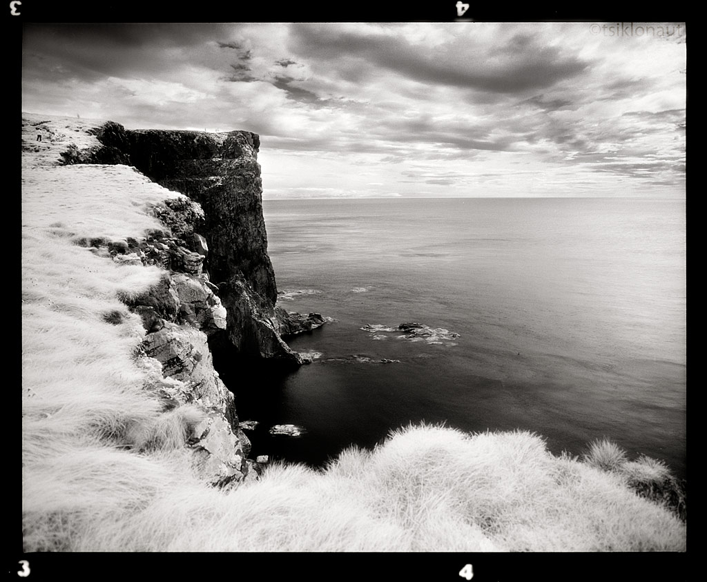
Edge by tsiklonaut
-> Go to Iceland (part III)
Cheers,
Margus
On the way to Laki around ten river crossings had to be dealt with, but it was well worth it. Near the track we could see the very nice Fagrifoss (foss standing for falls), no tourists and thus pure unspoiled beauty.
Appear to Dissapear
Fagrifoss
And through the Katla lava field:
To Vík, the southernmost tip of Iceland and its magnificent Three Sisters:
Shades of Time
View to the stormy Northern Atlantic ocean:
Icelandic southern coast.
Not far away there was another tourist trap, Skógafoss, but instead I loaded in an infrared film and took a little different picture of the bored-to-death most-photographed waterfall in Iceland. Captured with a different visual perspective in mind, with an Efke "Aura" B&W infrared film (no manipulations - this is how it looks like on film!):
And soon the geysers greeted us. Strokkur (Icelandic for "churn") is a fountain geyser located in a geothermal area beside the Hvítá River in Iceland in the southwest part of the country, east of Reykjavík. It is one of Iceland's most famous geysers, erupting once every 8-10 minutes. Its usual height is 15-20 m, although it can sometimes erupt up to 40 m high.
One last big burst in color:
Nearby is the Gullfoss, one of the most popular tourist attractions in Iceland. The wide Hvítá rushes southward, and about a kilometre above the falls it turns sharply to the right and flows down into a wide curved three-step "staircase" and then abruptly plunges in two stages (11 m and 21 m) into a crevice 32 m (105 ft) deep. The crevice, about 20 m (66 ft) wide, and 2.5 km in length, extends perpendicular to the flow of the river. The average amount of water running down the waterfall is 140 m³/s in the summer and 80 m³/s in the winter. The highest flood measured was 2000 m³/s.
Then we set off to Kaldidalur, F550. The route begins a bit to the north of Þingvellir and to the west of the volcano Skjaldbreiður, which really comes up to its name (meaning broad shield). The track continues between the glaciers of Þórisjökull and Ok and leads up to the north. To the east of Reykholt it comes near the Reykholtsdalur to Húsafell. Then it continues up to Hvammstangi at the Miðfjörður. The place is like a Moonscape.
Kaldidalur.
We tried the very little known and very rough F578 piste north, but were miserably stopped by over a waist-deep river halfway to our destination. First I took Kariina’s bike over (judging by the turbulences on the water, there were some large rocks on its bottom, and she probably would not have managed to ride through the river some fifty meters wide), and it was difficult enough. The water level was high enough to reach the air intake of the GS in places, so we had two choices – either to set camp by the river and wait until next morning to try and take the GS across (because there is less melt water in the morning and thus the water levels are much lower) or return the way we had come. Since it was still mid-day, we decided to turn around. So I rode the Suzuki back across, totally soaking my boots in the process. So before we turned our front wheels towards the Snæfellsnes peninsula, I changed the socks and pulled plastic bags over them to keep the water in the boots away from them.

On the way we passed by the unreal hexagonal basalt columns in Gerðuberg, an otherworldly place:
Gerðuberg.
Then we saw the "Most Beautiful Church in Iceland", the Búðakirkja in Buðir:
White door by tsiklonaut
Snæfellsnes peninsula has been named "Iceland in Miniature", because many national sights can be found in the area, including the Snæfellsjökull volcano, regarded as one of the symbols of Iceland. With its height of 1446 m, it is the highest mountain on the peninsula and has a glacier at its peak. The volcano can be seen on clear days from Reykjavík, at the distance of about 120 km. The mountain is also known as the setting of the novel Journey to the Center of the Earth by Jules Verne. The area surrounding Snæfellsjökull has been designated one of the four National Parks by the government of Iceland.
I decided to ride all the way up to the glacier, but my attempt wasn’t quite successful as the track was very steep and loose. Got a decent view nevertheless.
Pictures don't do justice how steep it actually was. It was that steep that I had to come up the last steep part literally on a full-on wheelie (front wheel had no traction and I couldn't slow down to lose the vital momentum), but lost control just 10 meters from reaching the top (where I took the pic) and did nearly a sharp 120-degree turn while on a wheelie on losing my final momentum. That was a very awkward maneuver to turn such a pig heavy loaded bike just from the rear wheel, I'm not sure how the hell I managed to stay upright and not crashing. The front wheel landing just between larger rocks had something to do with this I reckon. You can see some of it from the drag track.
The view up on the Snæfell.
On descent and on the way further north we could see Kirkjufell Hill in Grundarfjörþur:
Different angle and different film media take on Kirkjufell:
Icelanders have also a very funky understanding of the architecture, a good example is the church in Stykkishólmur:
On to the West Fjords. Looking at the map their complex layout alone sparked humbleness in us, but we decided to go ahead and complete the full circle around West Fjords.
On the way to Látrabjarg, Iceland’s westernmost point one can see the oldest iron hulled ship in Iceland, the Garðar BA 64. It was built in 1912 in Norway and years later in 1981 was beached on the Latrabjarg Peninsula in the West Fjords of Iceland.
Garðar
At Látrabjarg, we could see puffins, seals and other species.
Those two groomed each other like 30 minutes straight, never seen such a passion between the birds.
Edge by tsiklonaut
-> Go to Iceland (part III)
Cheers,
Margus

")