OK.....
Here to start with (and by way of fun only) is the official '
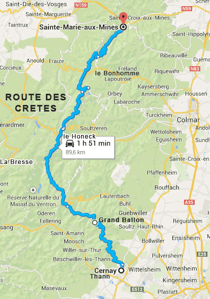
La route des crêtes', running from Sainte-Marie-aux-Mines, southwards to Cernay. Any arguments with this, please take it up with the local tourist board.
Here is that route in a .gpx file:
https://www.dropbox.com/s/agrky2rr4y9omq8/Route des Cretes.GPX?dl=0
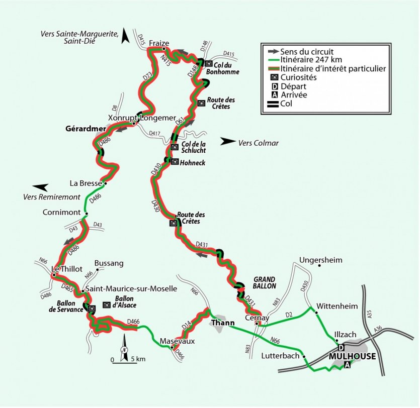
Bolted on around this one road is a whole bunch of alternatives, nice days out, awesome mind blowing hooning, bimbles and things that may (or may not) be the route des crêtes, depending on who you talk to. Here's an example, lifted from a very nice guide of motorcycling routes, created by Petit Fute who produce all sorts of nice touring suggestions:
From this excellent and free website here:
https://www.petitfute.com/guides-thematiques/t3-france-a-moto/n785241-la-route-des-cretes.html
As you can see it goes
up the route des crêtes from Cernay, all the way to the col du Bonhomme (so short of Sainte-Marie-aux-Mines) before bending
down south again - via Gerardmere - to finish at Thann, not far from where it started from. Total distance 250 kms / 150 miles
-----------------------------------------------------------------------------------------------------------------------------------------------------------------------
Now back on track to deal with the pressing matter of Wonkey donkey's holiday:
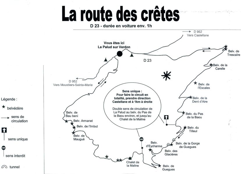
To the official 'route des crêtes' we can then add in something else, which shares the same name but is entirely different, not least as it is a long way away.
Here's that route in a gpx format, carved out in a clockwise direction:
https://www.dropbox.com/s/t9barysrqbr3t1u/The other route des cretes (clockwise).GPX?dl=0
Now that we are cooking with gas, we can extend that quite short but fun clockwise excursion to include the whole of the Gorge of Verdon, the Route des Cretes (local version) and even come back along the Corniche Sublime. Lifted from this local tourist office website:
http://www.marvellous-provence.com/other-places/sights-and-attractions/gorges-du-verdon
To then create them in BaseCamp and even go as far as to near enough colour the routes the same:
https://www.dropbox.com/s/8140hacgc...and the Route de la Corniche Sublime.GPX?dl=0
Which, if nothing else, shows how easy it is to dig around to find routes, ideas and all other sorts of stuff.... and do it yourself


PS As usual, I created the routes on a Mac using BaseCamp. I then hosted the files on Dropbox in a .gpx format. This means that they should open straight up in BaseCamp or Mapsource or in any software that is capable of reading gpx exchange files. That being said, sometimes the movement of the file between a Mac and Dropbox changes the file extension from .gpx to .txt This changes it into a text file, meaning that you get a load of text and no routes. Do not panic. Save the file to your computer and rename it by deleting the .txt extension but leave the .gpx bit. All should then be well.