California 2015

markkfletcher

Active member
UKGSer Subscriber
Joined
Jan 1, 2013
Messages
274
Reaction score
0
Location
Switzerland
tumblr_o1gkx4V9ts1qzj0t3o10_1280.jpg
California. I’ve been meaning to get there for twenty years. Most memorably one summer as a student we drove route 66 in an gold Mazda RX8 (with a wankel rotary engine). We almost made it but in New Mexico I got news from home and had to take the Greyhound back to New York and an early flight home.

So last year when a good friend announced he was getting married in Texas I grabbed the chance to finally make the California road trip happen.

It was a great wedding - Austin, Texas is one of the coolest towns I know. Well cool is one word. 30ºC in April is cool by their standards. And driving around in a great boat of a car with gas prices cheaper than mineral water is fun. But getting on the flight to San Fransisco felt like the adventure starting properly. One of my favourite things to do when visiting a new city is to watch a classic movie set there. You are spoiled for choice with San Fransisco, but I opted for Hitchcock’s Vertigo. Great choice.

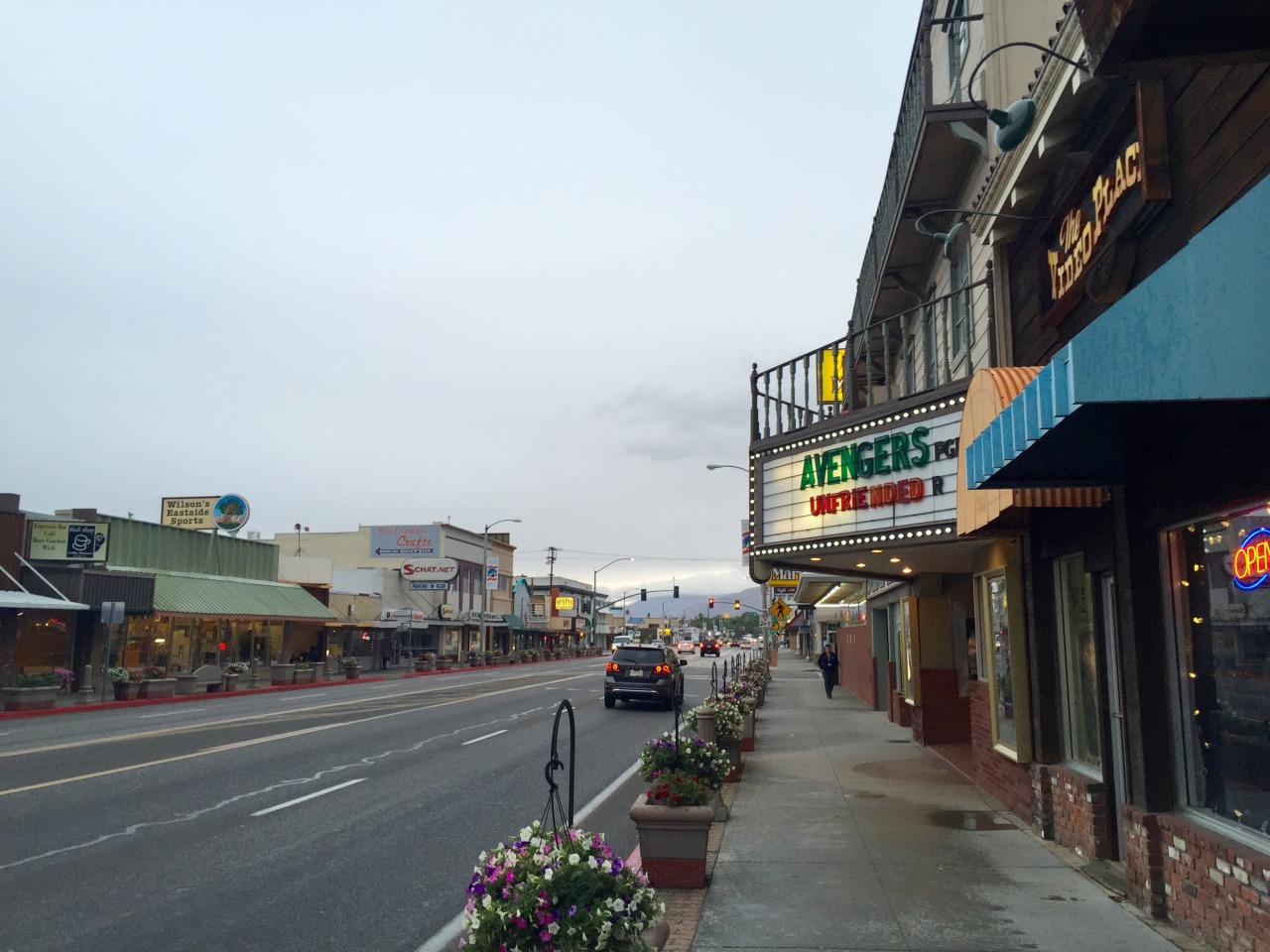
The Airport at SFX is on land reclaimed from the bay - so looking down as you land it is slightly concerning that all you can see is water until the very last minute. You get an easy BART train from the airport to the city centre. (BART=Bay Area Rapid Transport). First impressions were mixed however. I arrived at Powell Street, and lugged bags heavy with riding gear, up the escalator to arrive a dark, frankly slightly squalid street. Market Street is not the most glamorous part of town. Hotels are expensive too. I got a last minute deal at the Best Western Plus Americania on 7th Street which was fun - it is a refurbished Art Deco motel, found a Chipotle to get something to eat and crashed out.

Day 2

tumblr_o1gkx4V9ts1qzj0t3o5_1280.jpg

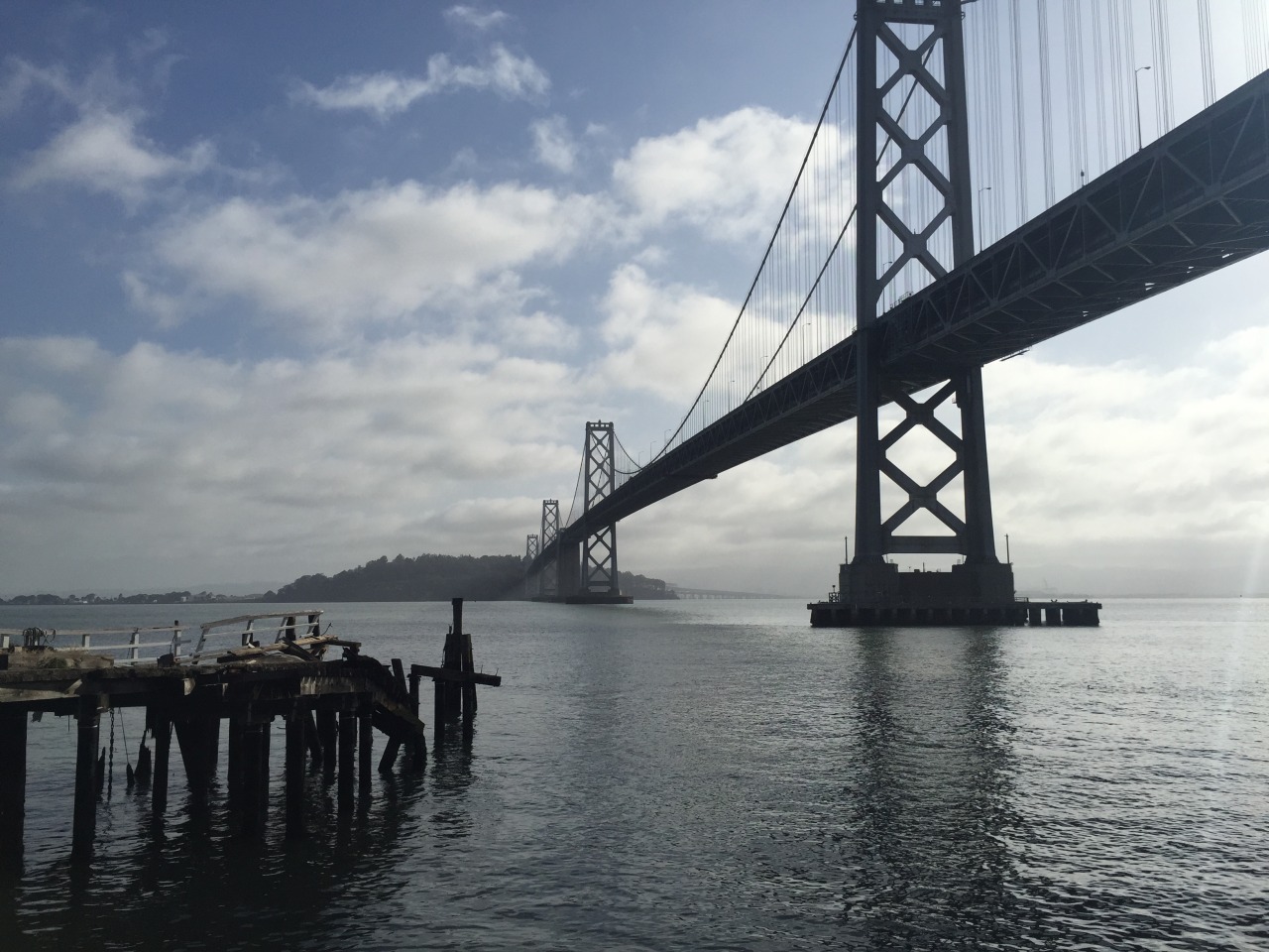
Next morning things looked better. I wake up and have time for a walk before picking up the bike from Dubbelju’s. The Bay Bridge is the first one you see, and it is a cracker. San Fransisco is a dream of a city. Water on three sides, skyscrapers, those crazy steep streets. The only downside is the weather. I was lucky to have blue skies - but it was cold! Mark Twain apparently said ”The coldest winter I ever saw was the summer I spent in San Francisco.” And I wasn’t really kitted out for cold.

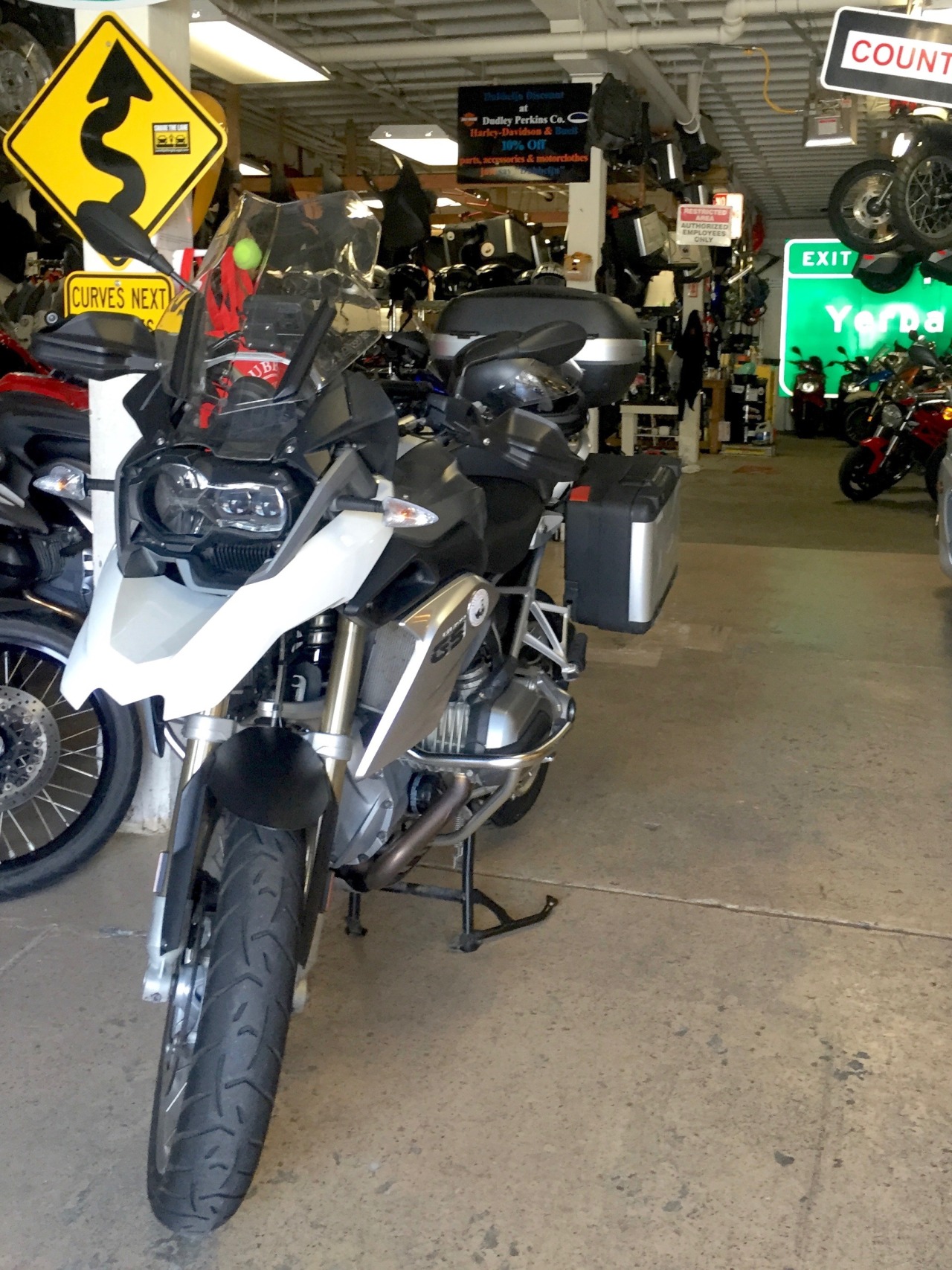
Checked out of the Hotel and wandered over to Dubbelju on Bryant & 5th Street. They were just opening up when I arrived. But they were expecting me, and had my bike waiting. It was a White 2012 GSW. And it was beautiful. (But it really should be for $1200) I spend ages signing forms and then backing the bike in the way I wanted. Dubbelju have storage for your left luggage so I tried to travel light.
tumblr_o1gkx4V9ts1qzj0t3o4_1280.jpg


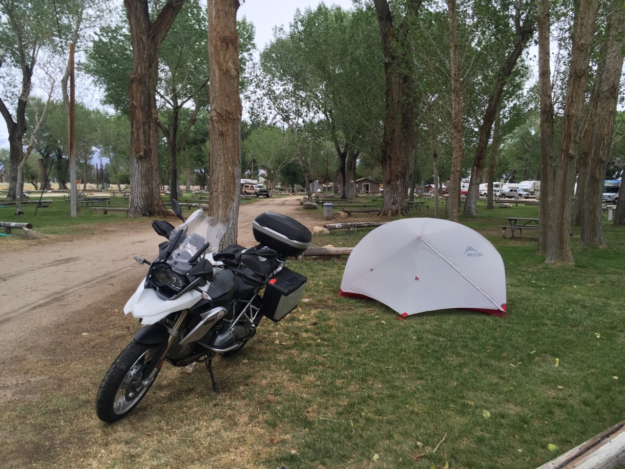
And then it was time to get moving. There is an REI on Bryant & 7th and I rode into the carpark, getting some envious glances at the bike and dropped several hundred dollars on camping gear (MSR Hubba Hubba NX tent, Thermarest Neoair, nice cheap new Leatherman Wave, Headtorch etc.)

I have an r1150gs at home and this was my first time on the water-cooled r1200. It is lighter than the 1150, and easier to handle, but what is going on with that clutch? I found it very jumpy, and the gearing seems odd. I particularly noticed it on the very steep SF streets. Second gear too high, first gear too low. I did have a mild panic thinking I hope I’m not going to hate this. That did not detract from how brilliant San Francisco is by bike. Wide streets, filtering legal (California is the only state in the US where it is) but rarely necessary, and stunning views in every direction.

After an hour of hooning around the city and spotting locations from Vertigo I stopped at the Coit Tower and spotted the Golden Gate Bridge. It’s hard to resist that - so I headed for it. In terms of route planning I had a long list of places I would like to see, but no real plan. Why spoil a good adventure by planning?

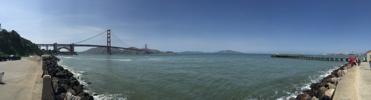
So the Golden Gate Bridge set the direction. It is a breathtaking bit of ironwork. I suppose it is as much about its iconic status, and its location - the Golden Gate is the name of the narrow inlet from the pacific ocean into the San Fransisco Bay - with the city on the south side, and the forested mountains of Marin County on the other. Riding over it, standing up on your pegs you can’t help grinning. And the sun is shining, but the wind is blowing and it is cold!
tumblr_o1gkx4V9ts1qzj0t3o6_1280.jpg

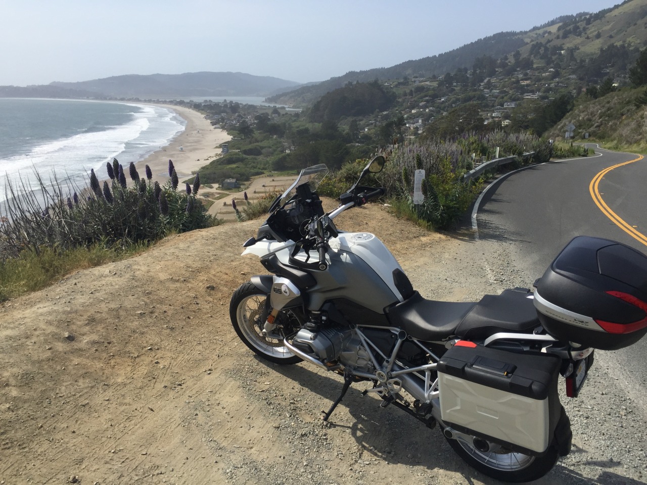
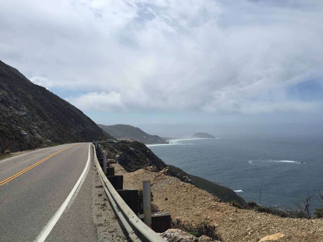
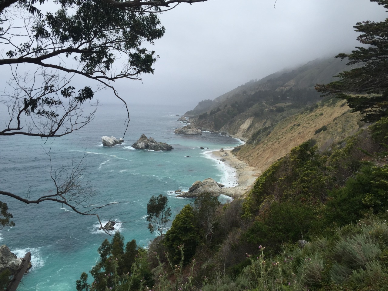
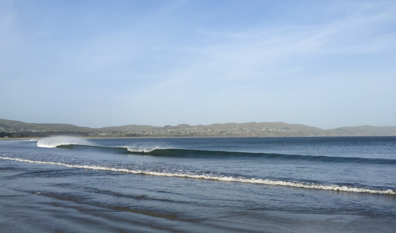
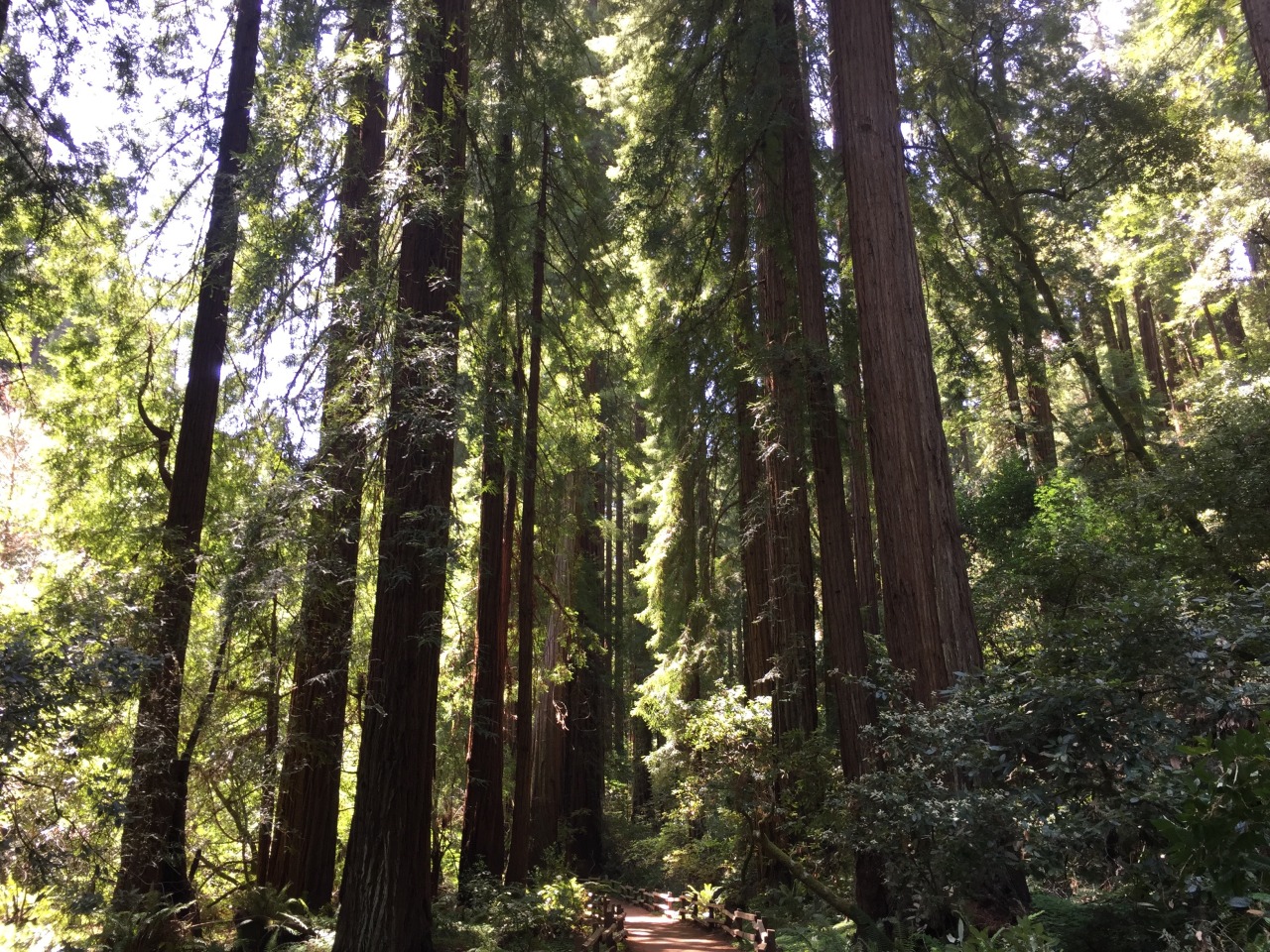
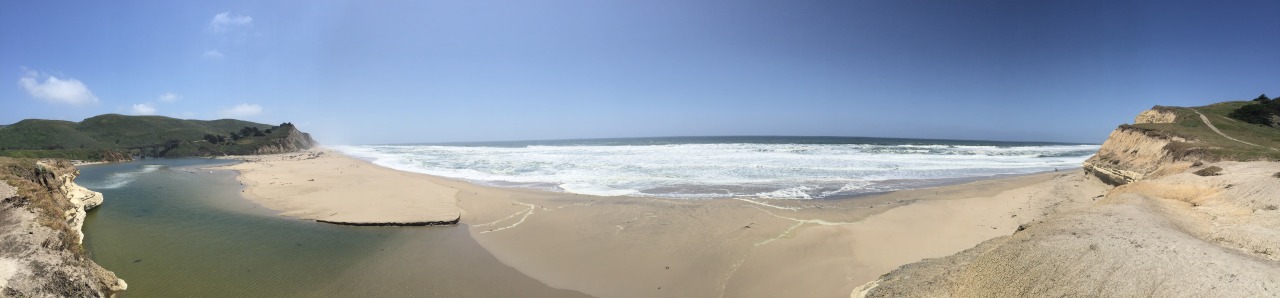
Once over the bridge take a left onto old Route 1. It is a fabulous stretch of twisty tarmac, with the added bonus of cliff top views, vast ocean panoramas, crashing waves on white sandy beaches and giant redwood trees, oh and enormous tectonic fault lines. After a couple of hours of joyful riding I stopped for a look at the San Andreas Fault at Point Reyes. It’s hard to envisage this gentle ruler straight valley, with sheep grazing on pastures in wooded glade being the source of lethal earthquakes. But it is. And when you look you can almost see the two tectonics plate straining against each other, just waiting to jolt. The other reminder of how serious geology can get is the square blue signs with a stick man running away from a wave marking the Tsunami Evacuation route. This way to higher ground. Because you don’t want to run in the wrong direction.

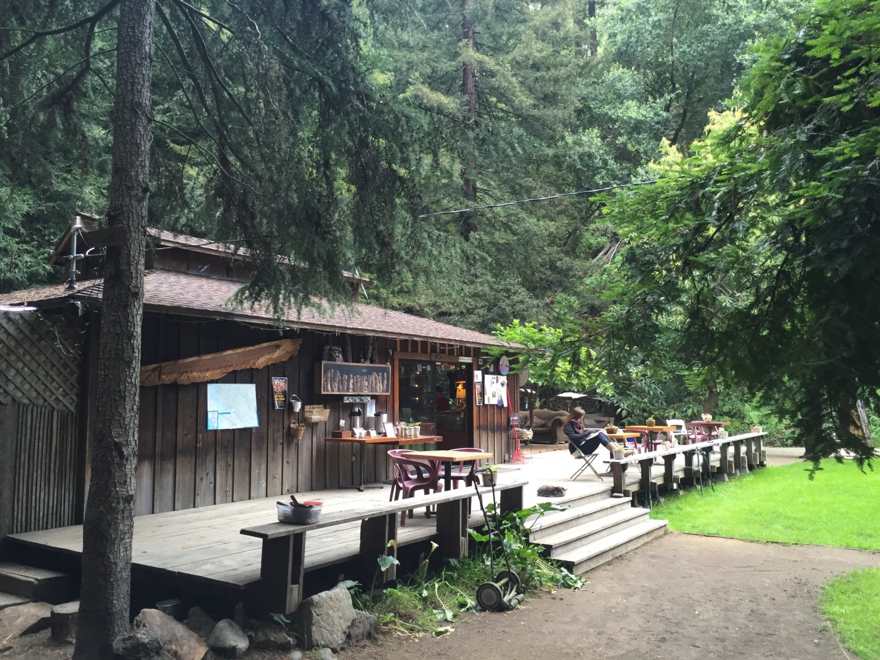
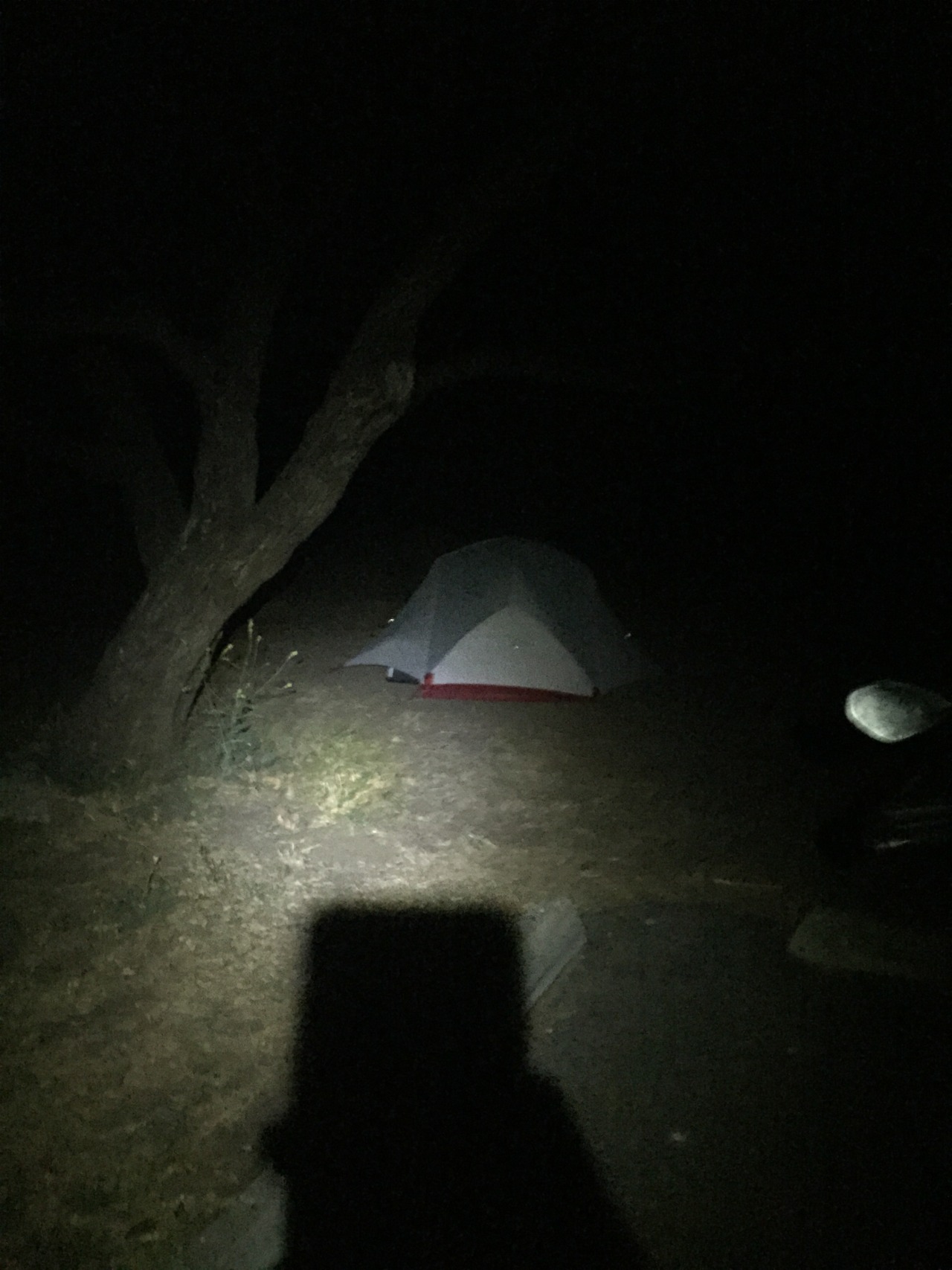
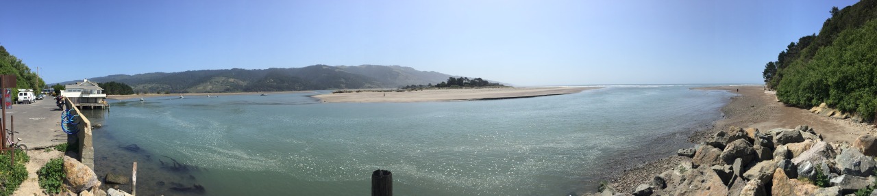
There is a lovely campground here, sheltered and sunny and I thought about stopping, but you know how it is. It was only late afternoon and I’m loving the ride. So back on the bike and head north. It is amazing how sparsely populated California is, even along the coast. Now Route 1 heads inland for a stretch. It is still lovely, but I start to feel the cold a bit. Then back towards the coast and I reach the brilliantly named Bodega Bay. I’m famished, but I want to pitch my tent before it gets dark. A bit of searching on Google Maps and I spot a campground with a stunning location on Doran Spit. My only concern is that it is really blowing a gale and this spot is quite exposed. It is really early season here - and there is hardly anyone at the campground. I find a site behind a tree and pitch up in the sandy ground right near the beach.
tumblr_o1gkx4V9ts1qzj0t3o9_1280.jpg

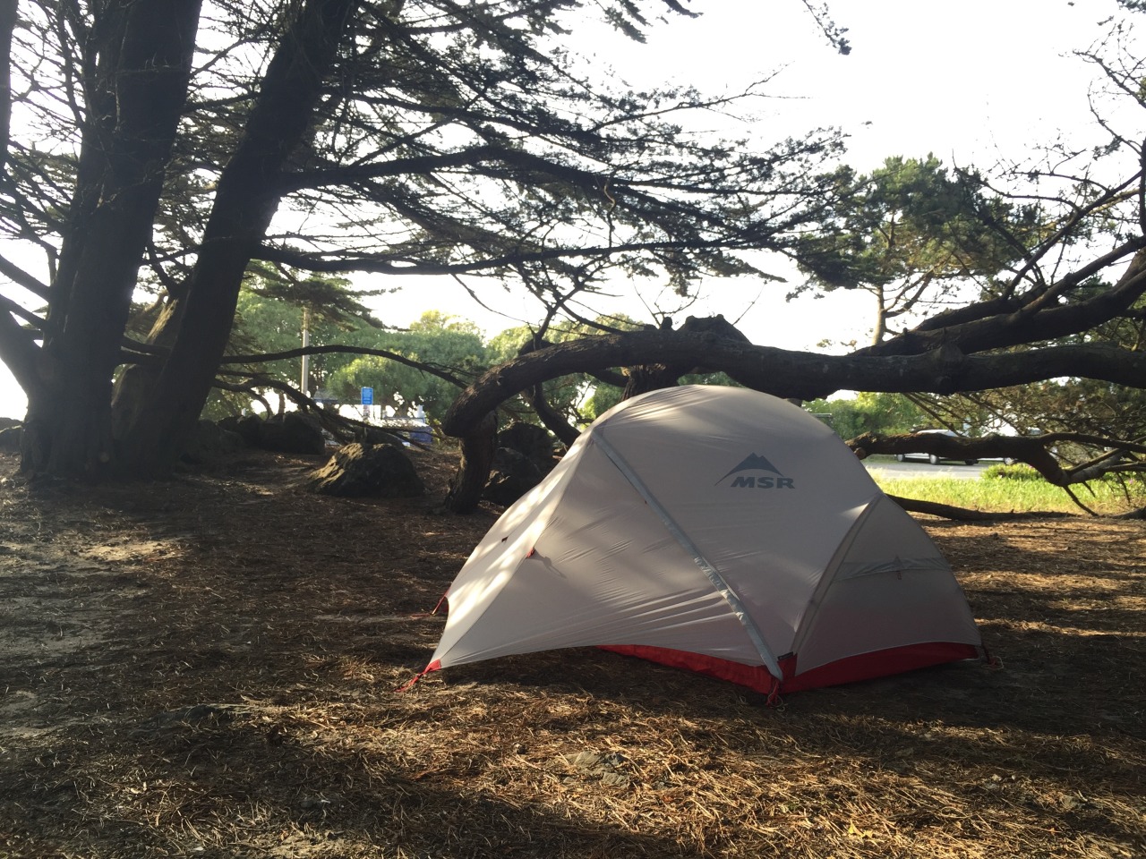
My new tent is very impressive - very small and light, but with an innovative (and slightly complicated) pole design that makes it very spacious for the pack size. Takes me a while to get it right, but once you know what you are doing it is very straightforward. Beautiful. Now for food. I just hope the tent hasn’t blown away by the time I get back.
tumblr_o1gkx4V9ts1qzj0t3o3_1280.jpg

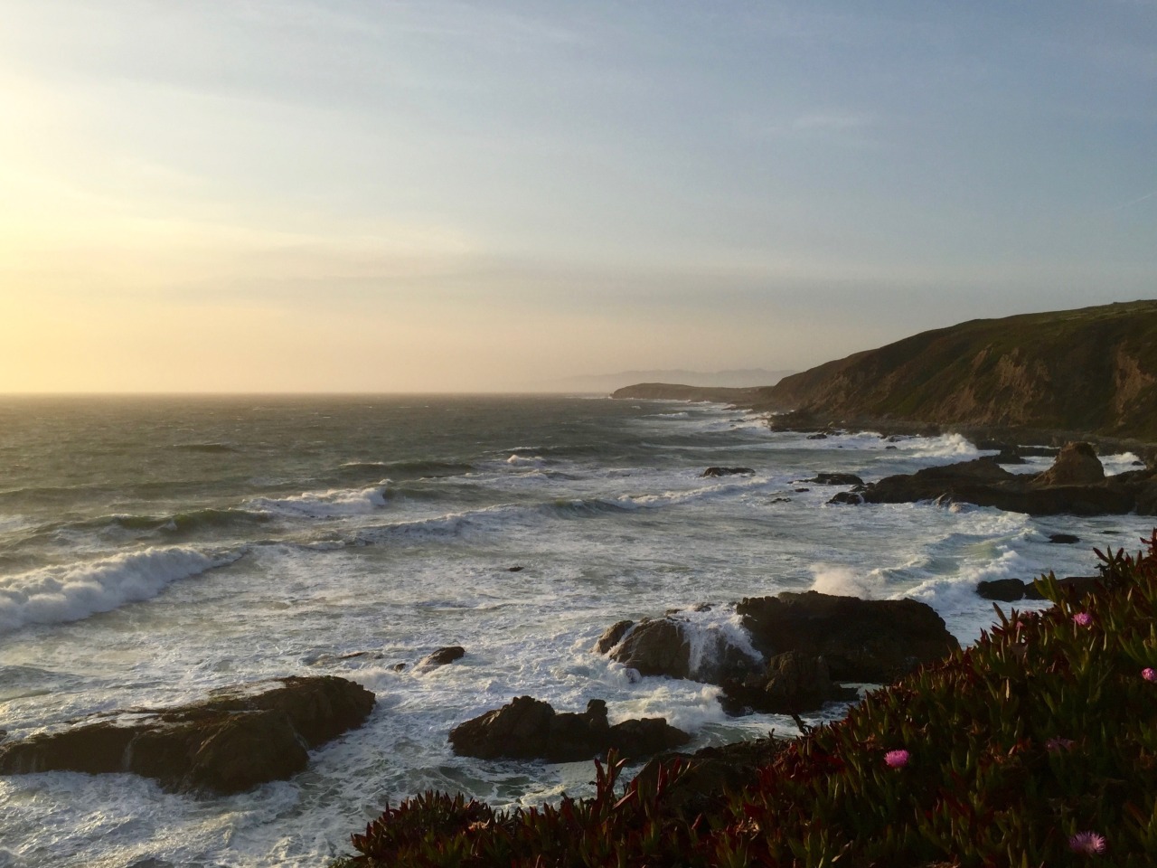
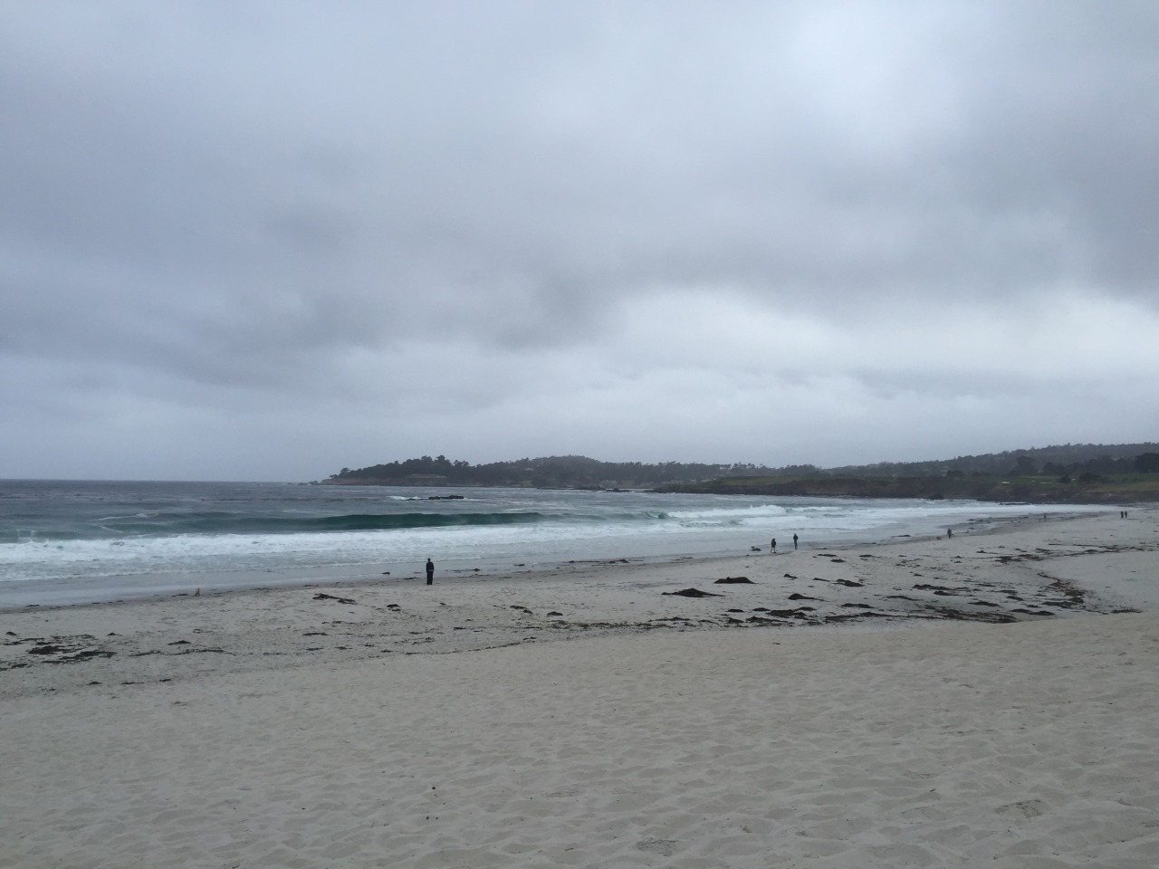
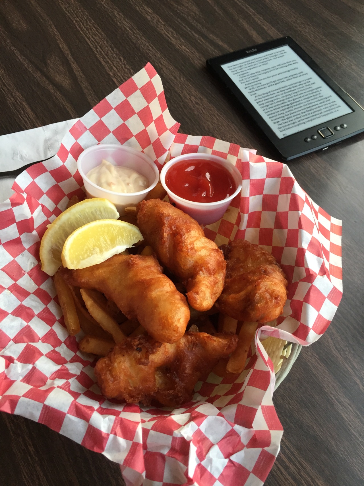
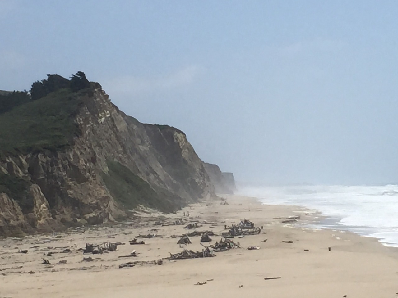
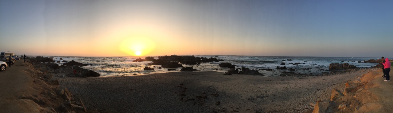
The guy at the campsite kiosk recommended the local fish and chips, which sounded perfect. So after a detour via the headland to watch the sunset, and clambering around on the rocks trying to get a perfect picture while huge waves crashed, I arrived at a very simple fish and chip shop called the Boat House. The food was made fresh but quickly and served with salt and vinegar - what is not to love? The fish was battered in small chunks, and the chips were crisp but greasy. I’m reading California novels on the trip too. And so it is Cannery Row by John Steinbeck with my tea.
tumblr_o1gkx4V9ts1qzj0t3o7_1280.jpg


The tent is still there when I get back but the wind has picked up, and I fear it could be a noisy night. But I am clearly knackered and fall straight to sleep.
 
Looking forward to this too as I'm hiring a Mustang in SF in June and heading up the Pacific Coast Highway to Oregon :beerjug:

I rode the PCH south from SF in 2012
 
Day 3

tumblr_o1ie3gj5811qzj0t3o1_1280.jpg


I woke up early to the sound of waves crashing on the beach. It doesn’t get better than that. But peering out of my tent the weather is chilly and overcast, it is still early May but I thought it would be warmer than this. And I’m staring to have some doubts about my choice to head for Northern California. The general route plan that I developed yesterday was to head all the way up the coast and then back down to Yosemite through the Sierra Nevada mountains. But when I look at the map - Norther California is MASSIVE, and I have only got a fraction of the way. And the temperature is making me think that south might be a better idea, or at very least warmer. And I would quite like to see LA and the desert. It’s a tricky decision, but eventually I decide to head back the way I came. So I set off worrying that I am arseing up the trip of a lifetime already.
tumblr_o1idvhx1Jw1qzj0t3o6_1280.jpg

tumblr_o1idvhx1Jw1qzj0t3o1_1280.jpg


I set off down the road, and the road is epic even second time round. And then praise be, the sun comes out. I arrive in Point Reyes Station, and stop at the Pine Cone Diner on 4th Street for one of those coronary inducing american breakfasts with five kinds of carbohydrates. Two very dignified older ladies stop to talk about the bike, and it turns out they had biker boyfriends in their youth. They tell me stories of riding pillion on gravel trails in Big Sur and I make notes on their tips for places to see.

Back on the bike feeling great. Funny how food does that to you. I take a detour at Bolinas Lagoon to see the ‘loveliest fishing village’ as recommend by the ladies - and as I am signalling to turn I spot a Patrol car in the bushes. I would definitely have been over the speed limit if I hadn’t been turning off. Thank you ladies.

tumblr_o1idvhx1Jw1qzj0t3o7_r1_1280.jpg


Bolinas is delightful. I rode mountain Bikes in the 90’s and back then my bike of choice was Marin (named after Marin County - which was the epicentre of the new sport). All the different bikes were named for places in the County - Bolinas Ridge, Muirwoods, Pine Mountain. I found I was ticking off these obscure cultural references. A will be doing quite a bit more of that as this trip goes on.

tumblr_o1idvhx1Jw1qzj0t3o10_1280.jpg


Next stop Muirwoods - a famous grove of Sequoia (Giant Redwood) trees. Ever since Return of the Jedi in 1983 (filmed in Northern California) I’ve wanted to see one of these beautiful trees. And good Lord - I was not disappointed. Steinbeck said of them “they are not like any trees we know, they are ambassadors from another time.” It feels like waking with Dinosaurs, and one of the most unforgettable parts of my trip. Oh and also there is a creepy scene in Vertigo set there. Bonus points.

It is early afternoon now and I’m almost back at the Golden Gate Bridge. I stop to fuel up for the first time - and have to work out how US petrol stations work. They don’t like UK credit cards, so you have to go into the kiosk - pay up front, fill up and then go back for them to refund what you didn’t use. Pain in the arse. Eventually I started to carry cash - go in hand over $20 (gas is really cheap) and just fill up that much. Much less hassle.

I ride over the Golden Gate Bridge again, and can’t help but whooping. Tourist going nuts too. Hanging out of windows, standing up out of sunroofs. Very entertaining. Oh - you have to pay for there bridge heading in this direction. The opposite of the severn Bridge - it is free heading north and you pay on your way back south. I did it online later - which was a hassle. Probably better to stop at a kiosk in the lay-by on the south side and pay there.

I skirt down the west side of San Fransisco, and jump on Route 101 for a short section, and then spot the turn off for the Pacific coast Highway - US Route 1 South. And all of a sudden the city is behind you and it is perfect twisting tarmac, cliff top views, wild beaches covered in driftwood, huge crashing waves. So much beauty, and yet hard to stop and take pictures, because it keeps getting better round the next corner.

tumblr_o1ie2fGeMZ1qzj0t3o1_1280.jpg


I ride and ride, turn after turn, beach after beach. There is hardly any traffic. Throwing the bike into corners, accelerating hard out of them. The GSWC has this brilliant grunty power, it never lacks oomph. The engine noise is a treat. And I’m just beginning to explore what it can do.

tumblr_o1idvhx1Jw1qzj0t3o3_1280.jpg


Eventually after something like 100 breathless miles I start to descend - it is warmer and I see signs for Santa Cruz. It is supposed to be a great little town, but I am conscious of being nearly 2 days in and having covered hardly any of the ground I want to. So I set the SatNav on my phone and ask it to take me to one of my tick list destinations. Salinas. Home of John Steinbeck.

tumblr_o1ielcNqWL1qzj0t3o2_1280.jpg


If you have read his work, you will have any number of associations with this place - but most famously it is the setting of East of Eden. You can literally follow the high street from location to location in the book. There is a museum, and the house where Steinbeck lived and worked. But you know what - unless you are a big fan - give this a miss. I was underwhelmed. It is a slightly crap town in the middle of endless farmland. It reminded me of Norfolk. Still I did my tour, took my pictures and moved on.

tumblr_o1ielcNqWL1qzj0t3o1_1280.jpg


I needed to find somewhere to stay for the night, and another place made famous by Steinbeck is Monterey. Now this is more like it - Monterey is a bit special, a beautiful bay backed by pine clad hills. I saw Sea otters - a mum teaching a baby otter to swim. Just lovely, and it feels noticeably warmer too. Also I spotted a Campsite on the hill called Veterans Memorial Park. Which turned out to be brilliant. No frills, but reasonably priced, quiet pitches and hot showers and a friendly and helpful park ranger. Can’t ask for more than that.

tumblr_o1ie2fGeMZ1qzj0t3o3_1280.jpg


I start to think about food - but first the sun is setting, and I am almost as far west as I will be all trip. So I head out to Point Pinos Lighthouse in Pacific grove. And there is a huge crowd of people there to watch. It is like the sunset is the greatest show on earth - everybody heads out here to watch it. And we are not disappointed. The sun slowly descends into the Pacific - there is no land was of any size for nearly 10,000 mile. Literally next stop Japan. I take picture after picture. And then eventually the sun is gone, and everyone climbs into their cars and goes home.

tumblr_o1idvhx1Jw1qzj0t3o8_1280.jpg

tumblr_o1idvhx1Jw1qzj0t3o4_1280.jpg


Finally I really need food. I spot signs for Cannery Row (another Steinbeck reference) which is basically a street of fish canning factories turned into a Steinbeck tourist attraction. It is fine — Ed Ricketts actual western Pacific Laboratory is there, and I found a Chowder restaurant I had some crazy fish soup in a bread roll and browsed the internet on their wifi (and payed my Golden Gate Bridge Toll), and started to plan tomorrow. Good day. But I need to cover more miles tomorrow.
 
An excellent read & great photos, thanx for taking the time. Looking forward to the rest of it. :thumb2
 
Great pictures. Marin and Northern California are like my second home so know every mile you've been on.

The coast around Sn Francisco and north can be very very cold at anytime of the year but you only have to go a mile inland and the burners come on. The "gloom" is caused by the very cold sea air meeting the heat.
 
Day 4

tumblr_o1it9yXrh31qzj0t3o5_1280.jpg


Lovely night sleep and I wake up itching to get back on the bike which is a good sign. I pack up the tent, and I’m planning to start by doing another thing off my tick list - the famous 17-Mile Drive to Carmel. However I couldn’t quite believe it - I spotted on some forum that Motorcycles are not allowed. And it turns out that is true. Resident complaining about loud motorbikes (Harleys Davidsons I suspect) and got them banned. Honestly. Land of the free this ain’t. I’m told that some folks just ride slowly through the checkpoint - smile and wave boys, smile and wave - and the private security dude assume that you are a resident. But I couldn’t be bothered with that, and headed on to Carmel on the Interstate. Carmel is truly beautiful. But is should be given how much it costs to live here. White sands, wooden houses scattered among the steep pine clad slopes.

tumblr_o1it9yXrh31qzj0t3o2_1280.jpg


Back at the intersection I stop for breakfast at a Starbucks. I ended up doing quite a lot of Starbucks on this trip. Not particularly authentic or classy, but easy and comfortable and predictable, with wifi and toilets. Which turns out to be the the things you want for a rest break. As I’m searching what is nearby I spot the Carmel Mission. It turns out that the first westerners here in the 18th Century were Spanish Franciscan monks. And back then it was almost literally the end of the world. It is hard to conceive that this place, one of the most opulent and desirable places to live in the world was just over 200 years ago the absolute back of beyond. You were as far from civilisation as you could be.

tumblr_o1it9yXrh31qzj0t3o8_1280.jpg


tumblr_o1it9yXrh31qzj0t3o3_1280.jpg


The Mission is beautiful and I found it very moving, particularly the very simple cell of the founder Saint Junípero Serra who died there in 1784. I bought a Franciscan cross from the gift shop to remind me of the place. I’m still wearing it.

tumblr_o1it9yXrh31qzj0t3o10_1280.jpg


But now for one of the big objectives of my trip. After Carmel comes Big Sur. For the next 100 miles or so where the Santa Lucia Mountains come down to the sea, along the steep heavily forested mountains sides, over ravine after ravine a thin ribbon of tarmac is cut out of the mountain. It is surely one of the great roads in the world.

tumblr_o1iuh5Dn5U1qzj0t3o1_1280.jpg


I had a couple of places on my tick list to stop off at - notable the Henry Millar Memorial Library. In fact I didn’t stop off in enough places - I was having too much fun. I saw McWay falls (utterly beautiful) , but failed to stop to get pictures. In fact my only complaint was despite everything it was over too quickly. And one word of warning there are not an abundance of gas stations - so if you see one, don’t think there will be another around the corner. I failed to eat enough food, and I can feel myself getting properly hungry. I’m not sure I did justice to the place, and felt a bit sad that it was over.

tumblr_o1it9yXrh31qzj0t3o6_1280.jpg


There is a good comedy stop off a little further down the road. The Piedras Blancas Elephant Seal Rookery was recommended to me by the Park ranger back at Monterey, and he was right - its an astonishing sight. Thousands of Elephant seals just hanging out on the beach, throwing sand at each other, making a noise and a stink. I’ll never need to see another elephant seal again, but I’m glad I stopped off. His other tip was Mono bay - where I stop off for a late lunch. Its a good call, there is a huge monolithic piece of rock out to sea, (thus Mono bay) it is very dramatic. I also fell off the bike for the first time (don’t tell Dubbelju) riding slowly through soft sand in the car park, and the front wheel just goes away from me. No harm done. I’m famished by now, and have to make do with Candy Bars and Soda (as they call chocolate and pop over here.) I also have a box of Clif Bars that I got from REI back in San Fransisco, which are good for keeping you going. They don’t fill you up - they just put some energy in your tank.

tumblr_o1it9yXrh31qzj0t3o9_1280.jpg


I sit on the grass next to the harbour munching and planning. Looking at the map, I realise that I need to start heading North soon - I only have a few days left and if I am going to see LA at all it I going to have to do some miles tonight. L.A. is 200 mile south. The coast road doesn’t look quite so good from here, so I decide to head for the freeway - Route 101. There is a local GS rider heading in the same direction, and we pair up for a few miles, grinning and pulling away hard at the lights.

The rest of the day is a bit of a blur. After the joys of Big Sur the freeway is just dull. There is some good scenery through the Gaviota mountains, but I’m just ploughing on. The freeway merges with Route 1 at Santa Barbara, and I stop off there briefly. Lovely place, worth far more time than I could give it. Then on as it got dark, leaving the freeway behind and heading into Malibu. I have very little idea where I am heading or where I am going to camp for the night.

Checking my phone while sitting at intersections I spot that there is a campsite on at Sycamore Canyon on the beach, so I’m back on route 1 and trying to spot the campsite in the dark. Its pitch black when I find it, and the campsite is have hardly anyone there (turns out that might be because it is really expensive!) The only inhabitants are a redneck family having a massive campfire and making a lot of noise. I’m too tired to care. Pitch tent in the dark. Go to sleep.

tumblr_o1it9yXrh31qzj0t3o4_1280.jpg
 
Day 5

tumblr_o1j245MOEE1qzj0t3o2_1280.jpg


Waking up with an unexpected rush of excitement - I’m just outside L.A. I haven’t much time but I feel like a kid in a sweetshop. I should say that before I left I put together a little USA themed soundtrack for the trip. It kicks off with Razorlight’s America which I have been singing all the way down here “all my life watching America, all my life there’s panic in America…” . And now I’m bombarded by these deeply familiar places that I have no idea what they are actually like. And there they all are on the map in front of me. Tom Petty - Free fallin. “All the Vampires… move west down Ventura Boulevard…” Sheryl Crow - “All I want to do is have some fun. Until the sun comes up over Santa Monica Boulevard”. There is Mulholland Drive, there is Hollywood. Too much too much. I jump on the bike and race off with the beach on my left and the Malibu hills on my right. Malibu… the less said about that association the better (but I’ve never liked coconut since).

All of a sudden this vast sprawling megacity is upon me, Route 1 turns right onto Santa Monica Boulevard. I stop to take pictures at Venice Beach with that iconic funfair. Then breakfast at the brilliantly pretentious Deus Ex Machina on Venice Boulevard. (Ticklist ticked)

tumblr_o1j245MOEE1qzj0t3o1_1280.jpg


I head up Santa Monica Boulevard up into west Hollywood, down Sunset Boulevard with all those stars. I take a wrong turn and there are Prada and Gucci shops everywhere - what the heck I’m on Rodeo Drive Baby! And there is the Beverly Wiltshire Hotel. (Those are Pretty Woman references in case you missed them).

tumblr_o1j245MOEE1qzj0t3o3_1280.jpg


I catch a glimpse of the Hollywood sign up on the hills in the distance. So I head for that. It is really hard to get close to, loads of crazy switchback roads that go nowhere. And all these damn tourists trying to get the picture must annoy the hell out of the residents. The roads have no-stopping signs, but that doesn’t really count for bikes. I got my picture at 6255 Mulholland Highway - grinning like a cheshire cat. There is an official lookout spot 1/4 mile down the road - but everyone gets that picture. Then feeling like a total tourist I decide to get out of here and do some real riding.

tumblr_o1j245MOEE1qzj0t3o9_1280.jpg


So that was it for L.A. One crazy morning. I wouldn’t have missed it, and maybe I will go back for a proper visit. But then again maybe that is enough.It is 270 miles to Bishop, California the next thing on my tick list and I intend to be there by nightfall.

I jump onto Highway 5 north and it is pure L.A. nightmare. Carmageddon. Ten lanes of traffic in gridlock. It gives me palpitations just thinking about it. It was like that scene from ‘Everybody Hurts’ video. Except nobody was getting out of their cars. I fight my way through, riding up the sides, dodging oversized 16 wheel trucks. Where are they all going? Clearly nowhere fast. Finally I see the the turn off for route 14 North towards Lancaster.

tumblr_o1j245MOEE1qzj0t3o4_1280.jpg


Now the road is almost empty, no-one is going this way. And the landscape is like nothing I have seen. I am heading for the high desert. it is flat and dry, sand and scrub with occasional rocky outcrops. The Mojave is breathtaking (quite literally - it is high and cold). Over to the east is the Edwards Airports Base on the pan flat dry lakebed of Lake Muroc where the pioneers of of jet flight first broke the sound barrier (and themselves in the process). I read up on this when I got home and I would highly recommend ‘The Last Pilot’ by Benjamin Johncock.

tumblr_o1j245MOEE1qzj0t3o6_1280.jpg


The road goes on, vast stretches of empty tarmac, long, long dead straight sections with nothing to get in the way. I’m wearing all the layers I have with me. The mojave is the place on earth with the greatest range of temperatures - it can hit 49 degrees celsius in the summer and -20C in the winter. I’m going dead straight with no traffic to worry about so I do two things. One is to take selfies. It is the archetypal America road trip picture. Ruler straight road, desert and in the distance the mountains of the Sierra Nevada.

tumblr_o1j245MOEE1qzj0t3o5_1280.jpg


The other thing I get to do is push the limits on the bike. Lets not incriminate ourselves here, but the GSWC is fast. It just keeps on accelerating. I manage to properly scare myself. I went faster than I have ever gone, and I don’t think that the bike had topped out. It is a long drive to Bishop, and I got pretty cold, but it flew by and was frankly unforgettable. Route 14 becomes Route 395, and though the Pacific Coast Highway was amazing, I love route 395 more.

tumblr_o1j245MOEE1qzj0t3o8_1280.jpg


Bishop CA is a proper mountain town and a mecca for climbers. The Sierra Nevada are just beautiful mountains. I’ve spent some time in the Rockies, and they are fine, but lack that brutal cragginess of the Alps. But the Nevada are real mountains. The other two things that Bishop has are these bonkers boulders scattered all over the desert - climbers come from all over the world to climb them. And hot springs. More of that later.

tumblr_o1j245MOEE1qzj0t3o10_1280.jpg


I pulled into Brown's Town Campgrounds on the outskirts of town and put up my tent. And as I did it started to rain. Man, I don’t really need this. I wandered into town not wanting to get too wet, and feeling a bit fragile and hungry. I stumble upon the brilliant Holy Smoke Texas BBQ and I am warmly welcomed and very well fed. If you have’t had Texas BBQ you are in for a treat. It is basically a big plate of meat. But it is good meat, and it comes in lots of different types. Have the brisket. I don’t know what it is but it is good. And I eat salad too - it is too long since I have had vegetables and they feel like health on a plate.

The rain has stopped now, and I should really go for an early night, but even after a 350 mile day I haven’t had enough. I think - I’ll just go for a little explore. Back on the bike I turn west towards the mountains on East Bishop Creek Road, the last flecks of daylight fade behind the Sierra Nevada. So beautiful. I ride on up the mountain and try to spot some of the classic boulders in the dusk. Higher and higher - I see a sign to say I am at 7000 feet, then another for 8000 feet. And then it is snowing. I need to stop now - if I came off the road I don’t think anyone would find me until morning (if I was lucky). Back down the road, back to the campground and I crawl into my sleeping bag wearing all my clothes.
 
Enjoying this, am thinking of something similar, also a great fan of Steinbeck:thumb2 Cheers:beerjug:John B


Back
Top Bottom