Day 6
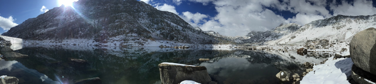
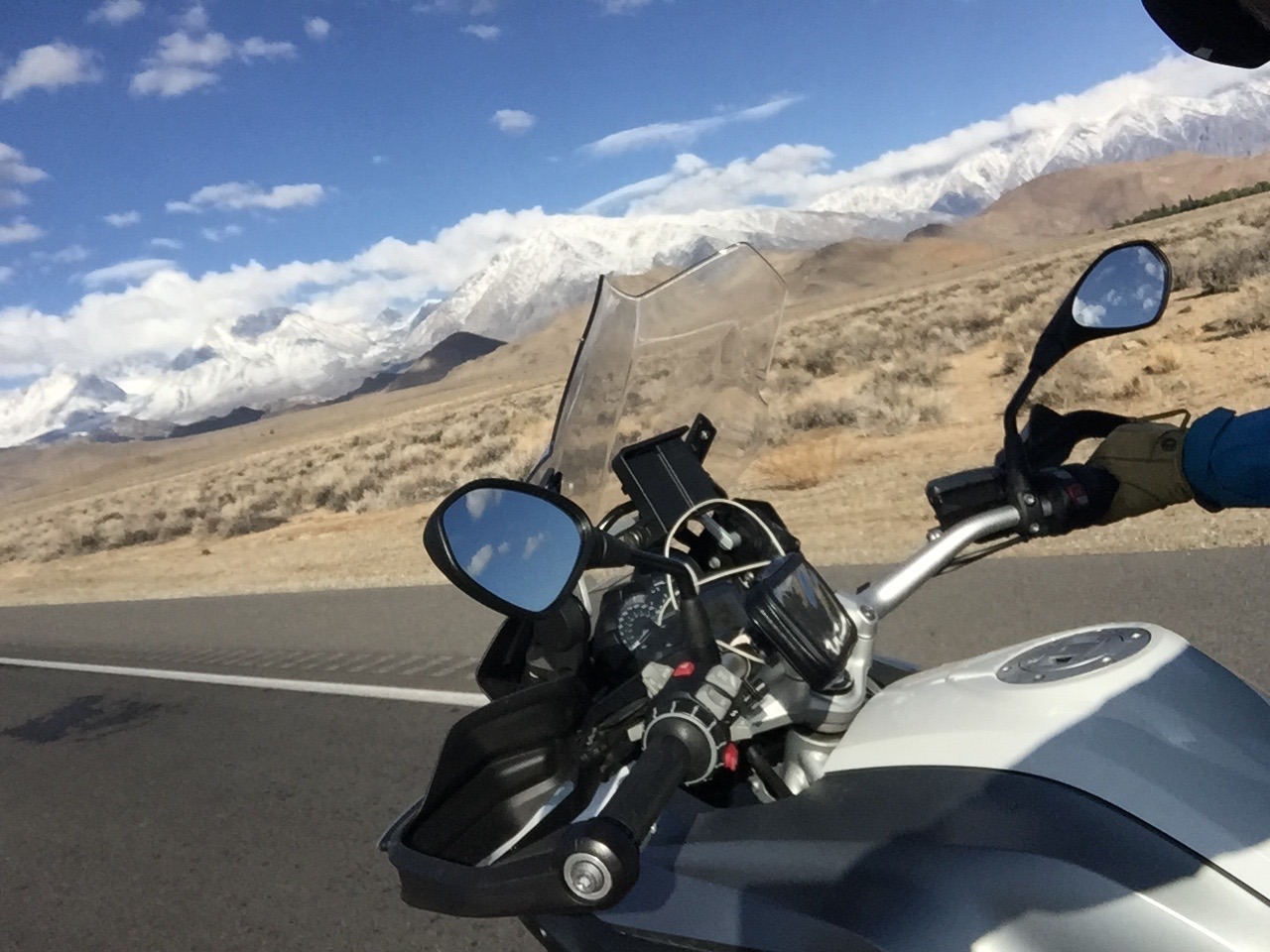 It is a cold night, but the next morning is beautiful. Blue skies, crisp clear air, dry in the valley but the mountains are all frosted with snow. I’m excited to see what I missed last night so I pack up and before breakfast head back up East Bishop Creek Road. It really snowed quite hard overnight and my plan to get to the famous Boulders is cut short. My offload skills are clearly not up to gravel and snow, and I abort before I come a cropper. However the road is clear enough and I see how high I can get. I ride up the mountain, through the lovely little town of Aspendell and reach the trailhead at Lake Sabrina. I am nearly 10,000 feet above sea and the air is thin. I scramble around in the snow on the lakeshore and take pictures and chat the fishermen about my trip.
Tioga Pass is closed they tell me. I’m not quite sure of the significance of that. Tioga Pass is the route over the Mountains to Yosemite. But Yosemite is the one non-negotiable on my ticklist, it is top of the list, the must see for the trip. And the scale of the Sierra Nevada is such that if you can’t go over Tioga pass the alternative route is at least a hundred miles further. That would be Sonora Pass and that is closed too they say.
When will they reopen? The Parks Service will work on clearing them, but not until they are sure this is the last of the snow. The high mountain passes close in late October with the first fall of snow, and then reopen in March or April. They had been open last week but last nights snowfall had caught everyone out. If I can’t get over Tioga or Sonora I have no idea what I will do. I have two full days left. Yosemite is about 40 miles way as the crow flies but it is about 350 miles if I have to go all the way round.
It is one of the things that surprised me about California. I hadn’t counted on the scale of it. And quite how empty it is. It is the most populous state in the US, but so much of it is wild and empty. And the Sierra Nevada are 400 miles long and 65 miles wide and up to 14,505 ft high. They are an epic mountain range.
I headed back to Bishop for a good breakfast at Jacks Diner. And tried to map out the next two days. One of the images that brought me out here was of hot springs in the desert. There was an article in the paper about Travertine Hot Springs, which just looked magical - hot, volcanic water bubbling up in the desert and people had dammed the stream to make a natural Jacuzzi. But that would mean a detour, and I kind of had to choose between Yosemite or the springs so I decided to miss them. I regret that.
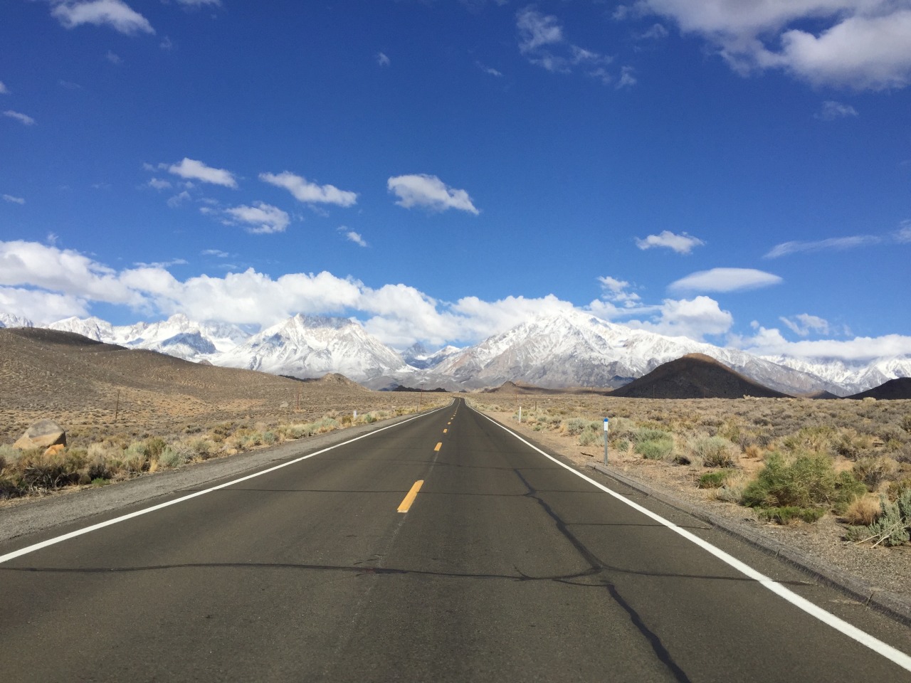
So it is Yosemite or bust. I’m still hoping that maybe the Tioga Pass will be open by the time I get there. Route 395 heads north from Bishop, getting higher as it goes, and there is snow on the ground. It is 70 miles of utterly beautiful scenery to Mono Lake - where the turning for Tioga Pass is. Big illuminated sign. Tioga Pass closed.
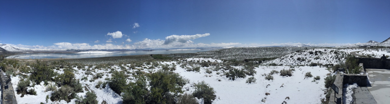
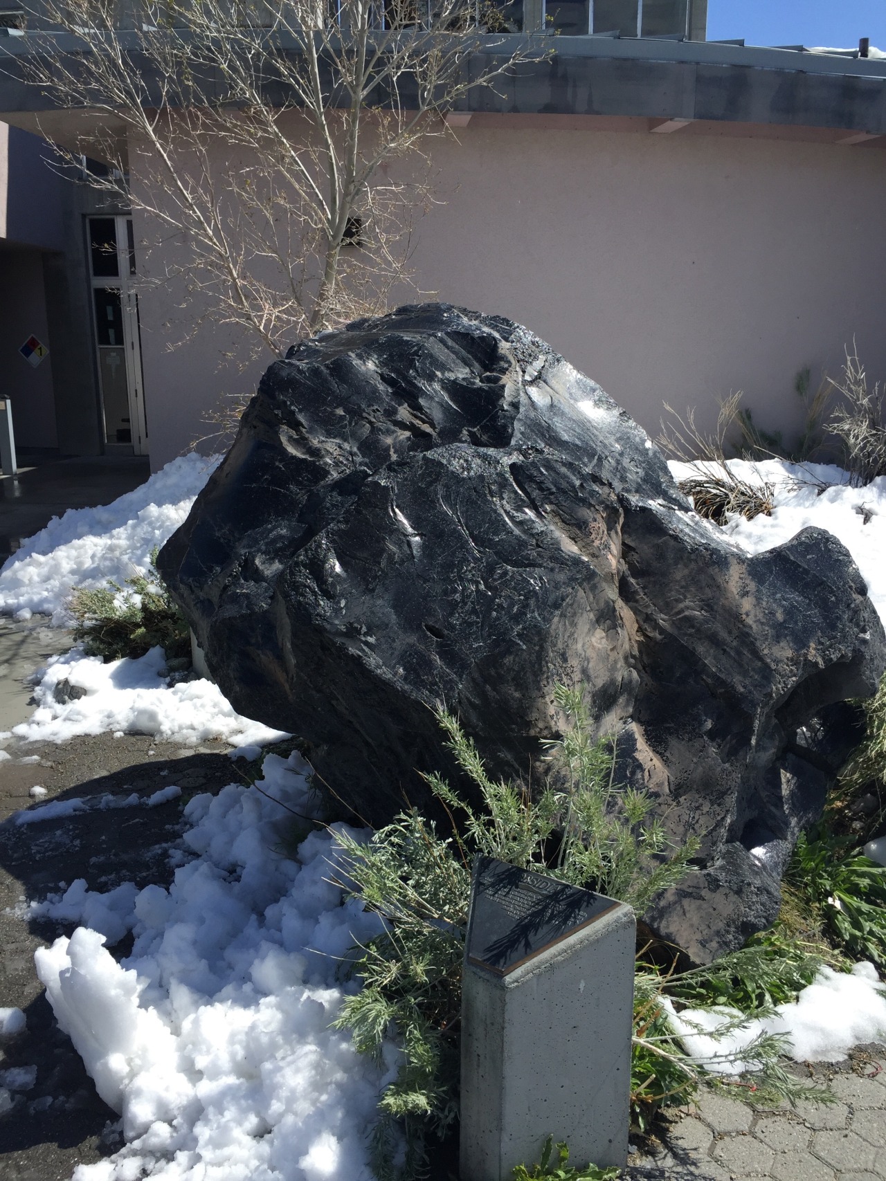
I pull into the Visitors centre at Lake Mono - it is an amazing place - a caldera from an dormant volcano filled with water. The lake has no outlet, and very high evaporation because it is so dry so the lake is saline which makes it a unique ecosystem. Mark Twain visited in the late 19th Century and described it as a ”lifeless, treeless, hideous desert... the loneliest place on earth." I think he must have been having a bad day, because I thought it was beautiful. But he is right - it is a long way from anywhere. In the carpark is a massive piece of obsidian - volcanic glass. I took a picture for my kids who love Minecraft.
From Mono it is 40 miles on to Sonora Junction. Maybe Sonora pass will be open. Nope. Sonora is closed too. I’m right near the Nevada border here, so I race up the road, over the state line and stop for cheap gas and a quick go on the slots. Crazily I come out of the Casino with more money than I went in with.
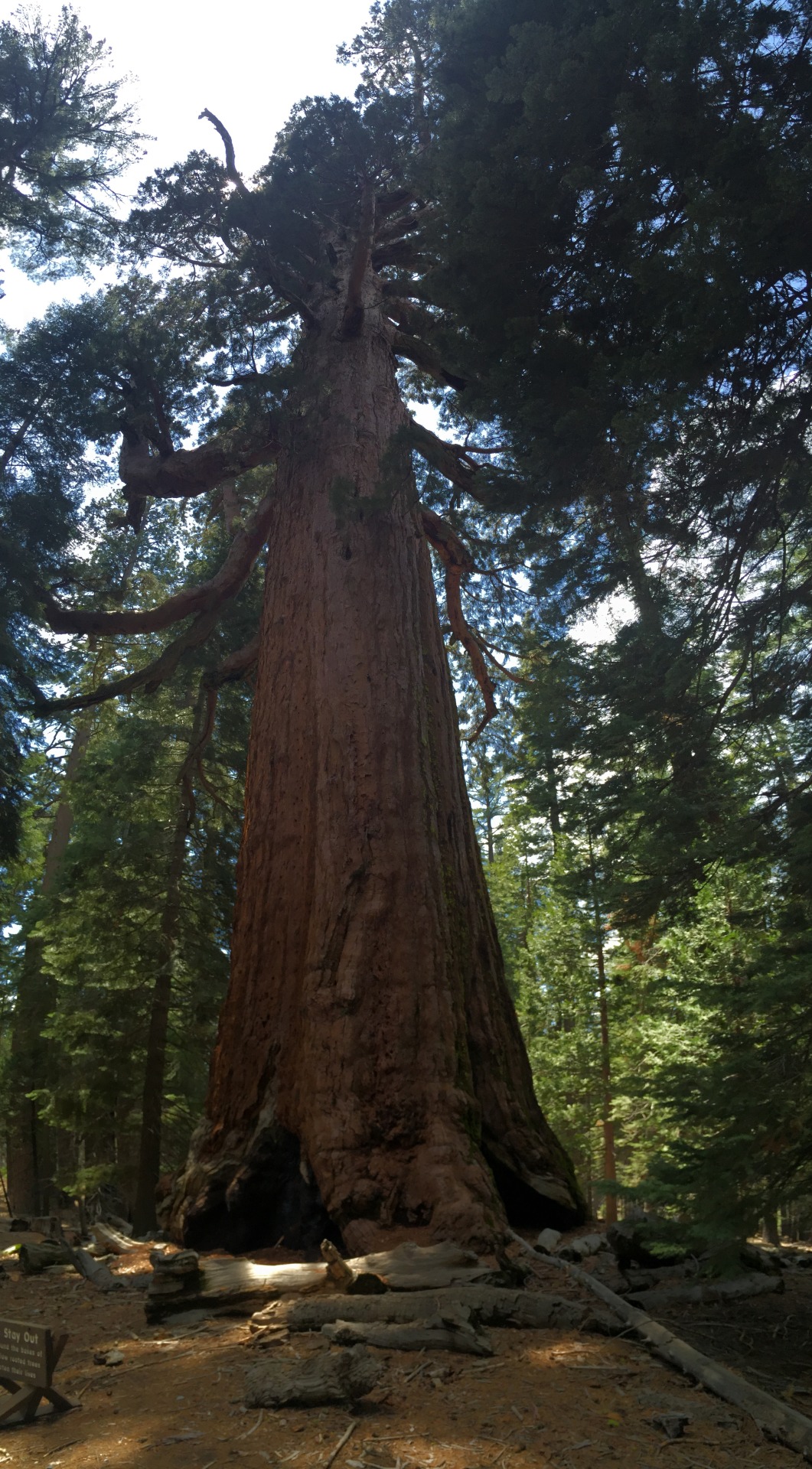
Despite my luck, I’m beginning to think it is not my day to get to Yosemite. Eventually I get to route 89 which is open because it is lower, but I am at least a hundred miles further north than I planned to be. The road winds upwards, and it is fabulous riding. The tarmac is all you could hope for and you throw yourself into the switchbacks. But obviously you are not going very fast. I stop to take pictures of the ancient bristlecone pines - these are some of the oldest living things on earth. What a place this is.
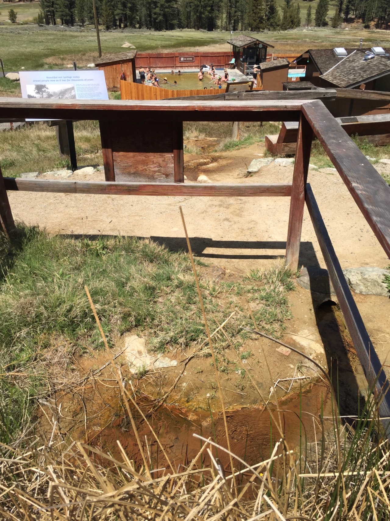
It is mid afternoon by now, and in Markleeville I spot a sigh for Grover hots springs. I think I might as well. I turn off onto his springs road and ride for a few miles through a warm sunny valley. I realise that it is the first time in days that I have been warm. There is the hot springs - slightly disappointingly with a fence around it and a paystation, but I pay my money and climb in. It is like a hot bath, slightly discoloured water, but very welcome. Not as picturesque as the desert hot springs but a treat for aching muscles.
Half an hour later I’m back on the bike, and heading up hill again. Route 89 become route 88 and praise be, Carson Pass is open. Quick picture at the summit and then the long, long road down the other side of the mountains.
We are in gold rush territory, and it looks like it. The rivers that cut into the mountains here carried nuggets of gold, and in 1849 some 300,000 ‘forty-niners’ descended on the place and literally tore it apart. Nature has recovered, but it is very different from the other side of the mountains, and the temperature difference is striking. I’m soon stripping off layers and for the first time in the trip my Airshell Jacket seems like appropriate apparel. Lovely sunny afternoon ride all the way down to Jackson, where the mountains recede into the distance and I’m in the Valley.
Now it is properly hot. I had heard that there is this crazy temperature difference between the central valley of California and the rest, but I had no idea. I stop for some great vat of crushed ice and sugary coffee in our favourite multinational beverage corporation.
But I’m not really happy. I wasn’t done with the mountains. It is a straight run from here back to San Fransisco, but I have more than a day to play with until my rental is up. I could go and visit some of the Bay area - Berkeley, Oakland, see some more San Fransisco, but that all seems tame compared to the wilds of the Eastern Sierra. It is now early evening, but I make up my mind. Yosemite damnit.
Route 49 is the most direct route, is actually a cracker - winding through the foothills of the Sierra, rolling farmland, sun dappled and beautiful wooden farmhouses. I’ve got great memories of this and I am running on adrenaline.
The road starts to ascend again. New Melones Lake is stunning, next the rather surprisingly named ‘Chinese Camp’ which is an old goldrush town - the first chinese gold diggers were hounded out of everywhere else and so settled here. And then I find myself on route 120 - which is the bottom of the other side of Tioga Pass. Amazing. Yosemite must be just round the corner.
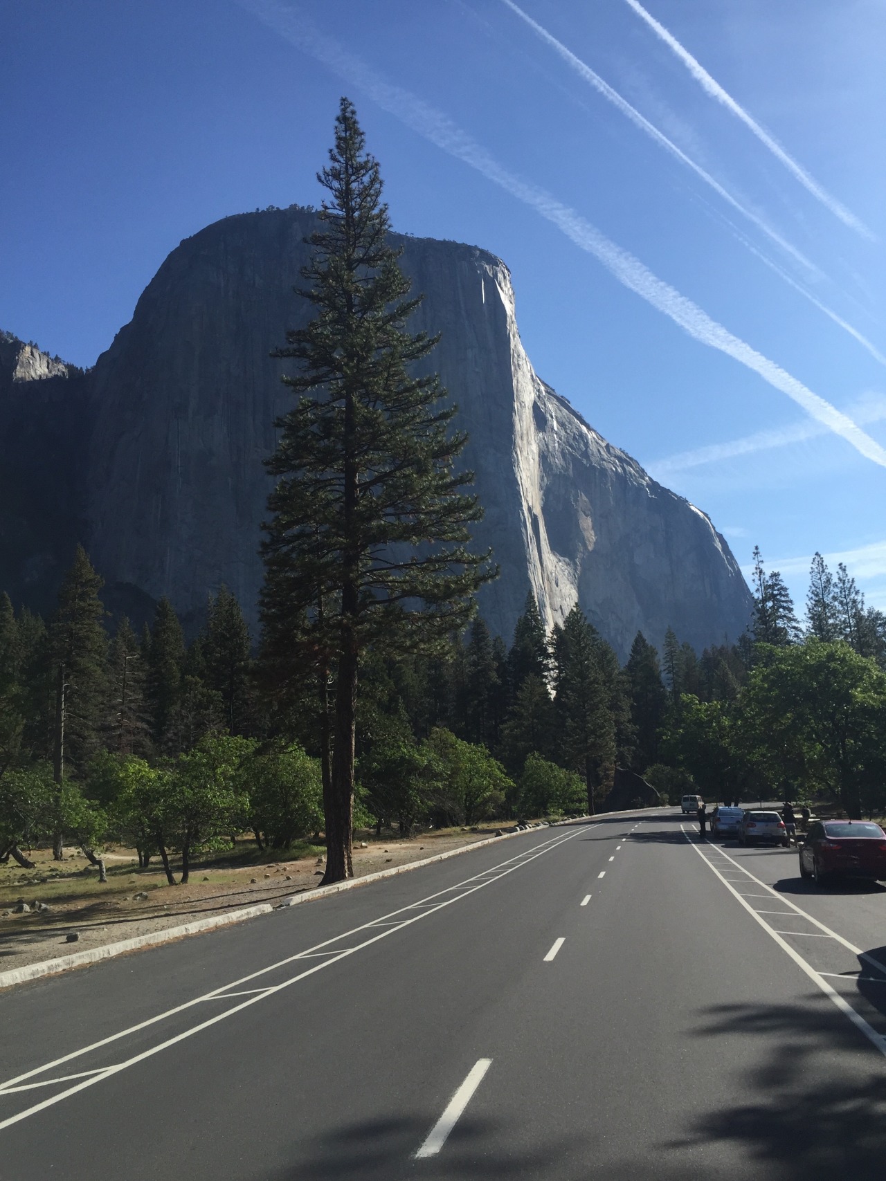
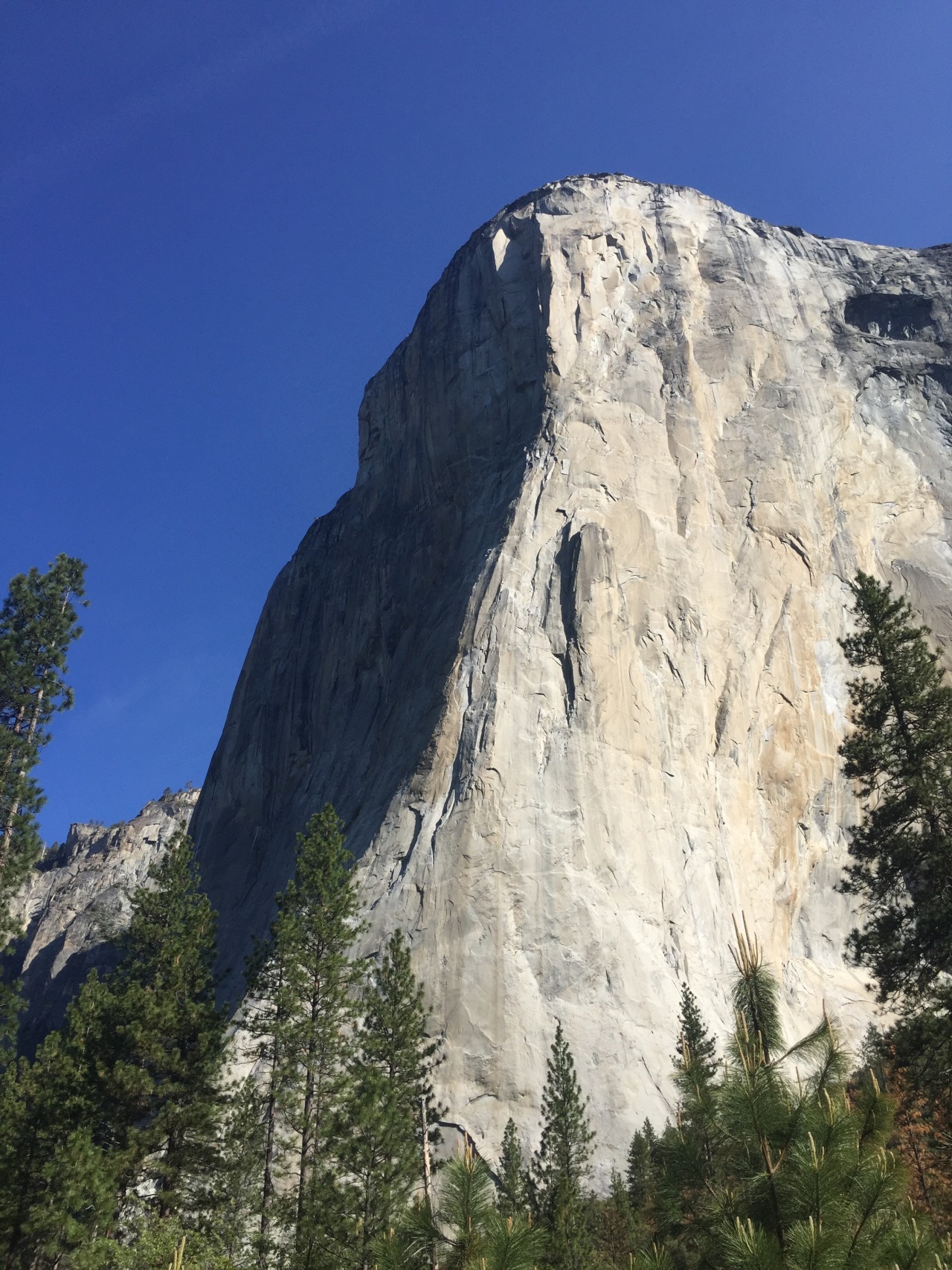
It isn’t, it is considerably further than you think. I’m also famished again from not eating properly, but I just keep going. The sun is going down, and I really want to be there for sunset. And then, all of a sudden, just when I thought I would miss it. Boom.
“The world is big and I want to have a good look at it before it gets dark” - John Muir.
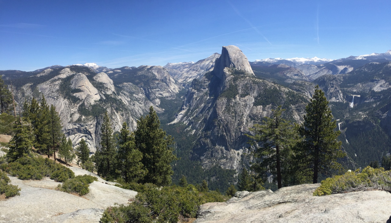
John Muir was a Scottish Engineer and naturalist, and his early journeys in this valley and his writings came to be a driving force for the preservation of these natural wonders. His writing is very special, and his capacity to express the joy and beauty of the natural world is a delight. It is said that when he first saw this valley "He was overwhelmed by the landscape, scrambling down steep cliff faces to get a closer look at the waterfalls, whooping and howling at the vistas". I knew exactly how he felt.
I made it. In the end my odometer tells me is was i did 400 miles - not one of which was a motorway mile, and not including breaks I was on the bike for 12 hours. A quite monster day.
But to more practical matters. You can’t just turn up and camp in Yosemite. You need to book well in advance, and by that I mean weeks or months.
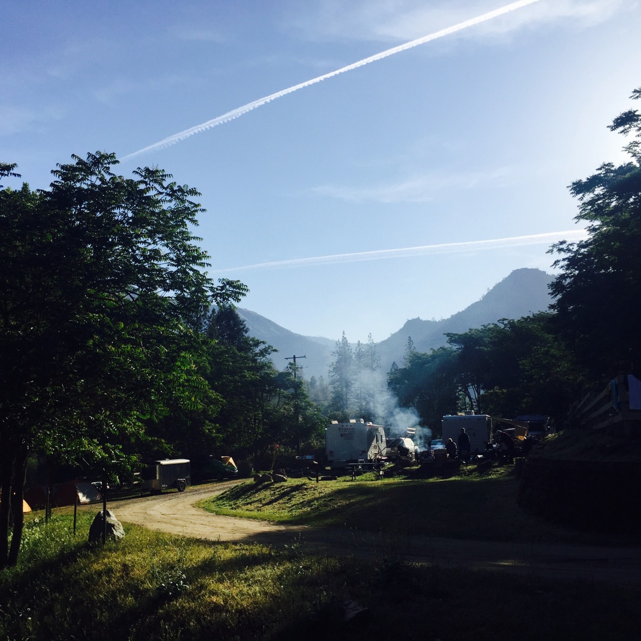
So no campsite for me. I ask around - the information centre is closed, but the lady who is locking up takes pity on me and suggests a campsite outside the park but not too far away.
It is called Indian flat Campgroud, and it is packed. But the owner graciously finds a corner to cram me into. I pitch and then go to the hotel next door to get some food. This is all a bit of a shock to they system, and I clearly have the look of a wild eyed loon. So they seat me upstairs by myself. And then take too long bringing me food which makes me rather tetchy. I’ve surely not been away from civilisation for that long, but I’m feeling very uncivilised.
And now to bed. Tomorrow I will see Yosemite properly.
Tioga Pass is closed they tell me. I’m not quite sure of the significance of that. Tioga Pass is the route over the Mountains to Yosemite. But Yosemite is the one non-negotiable on my ticklist, it is top of the list, the must see for the trip. And the scale of the Sierra Nevada is such that if you can’t go over Tioga pass the alternative route is at least a hundred miles further. That would be Sonora Pass and that is closed too they say.
When will they reopen? The Parks Service will work on clearing them, but not until they are sure this is the last of the snow. The high mountain passes close in late October with the first fall of snow, and then reopen in March or April. They had been open last week but last nights snowfall had caught everyone out. If I can’t get over Tioga or Sonora I have no idea what I will do. I have two full days left. Yosemite is about 40 miles way as the crow flies but it is about 350 miles if I have to go all the way round.
It is one of the things that surprised me about California. I hadn’t counted on the scale of it. And quite how empty it is. It is the most populous state in the US, but so much of it is wild and empty. And the Sierra Nevada are 400 miles long and 65 miles wide and up to 14,505 ft high. They are an epic mountain range.
I headed back to Bishop for a good breakfast at Jacks Diner. And tried to map out the next two days. One of the images that brought me out here was of hot springs in the desert. There was an article in the paper about Travertine Hot Springs, which just looked magical - hot, volcanic water bubbling up in the desert and people had dammed the stream to make a natural Jacuzzi. But that would mean a detour, and I kind of had to choose between Yosemite or the springs so I decided to miss them. I regret that.
So it is Yosemite or bust. I’m still hoping that maybe the Tioga Pass will be open by the time I get there. Route 395 heads north from Bishop, getting higher as it goes, and there is snow on the ground. It is 70 miles of utterly beautiful scenery to Mono Lake - where the turning for Tioga Pass is. Big illuminated sign. Tioga Pass closed.
I pull into the Visitors centre at Lake Mono - it is an amazing place - a caldera from an dormant volcano filled with water. The lake has no outlet, and very high evaporation because it is so dry so the lake is saline which makes it a unique ecosystem. Mark Twain visited in the late 19th Century and described it as a ”lifeless, treeless, hideous desert... the loneliest place on earth." I think he must have been having a bad day, because I thought it was beautiful. But he is right - it is a long way from anywhere. In the carpark is a massive piece of obsidian - volcanic glass. I took a picture for my kids who love Minecraft.
From Mono it is 40 miles on to Sonora Junction. Maybe Sonora pass will be open. Nope. Sonora is closed too. I’m right near the Nevada border here, so I race up the road, over the state line and stop for cheap gas and a quick go on the slots. Crazily I come out of the Casino with more money than I went in with.
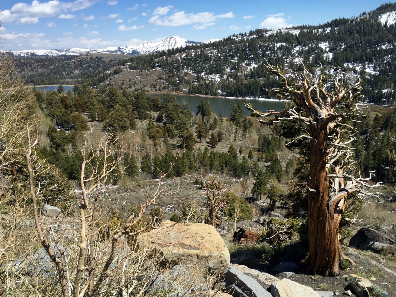
Despite my luck, I’m beginning to think it is not my day to get to Yosemite. Eventually I get to route 89 which is open because it is lower, but I am at least a hundred miles further north than I planned to be. The road winds upwards, and it is fabulous riding. The tarmac is all you could hope for and you throw yourself into the switchbacks. But obviously you are not going very fast. I stop to take pictures of the ancient bristlecone pines - these are some of the oldest living things on earth. What a place this is.
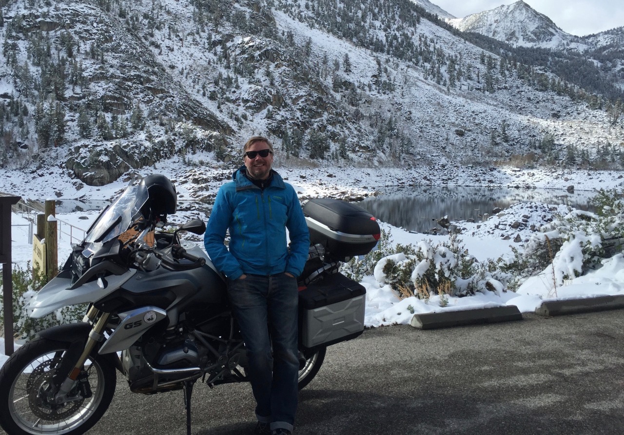
It is mid afternoon by now, and in Markleeville I spot a sigh for Grover hots springs. I think I might as well. I turn off onto his springs road and ride for a few miles through a warm sunny valley. I realise that it is the first time in days that I have been warm. There is the hot springs - slightly disappointingly with a fence around it and a paystation, but I pay my money and climb in. It is like a hot bath, slightly discoloured water, but very welcome. Not as picturesque as the desert hot springs but a treat for aching muscles.
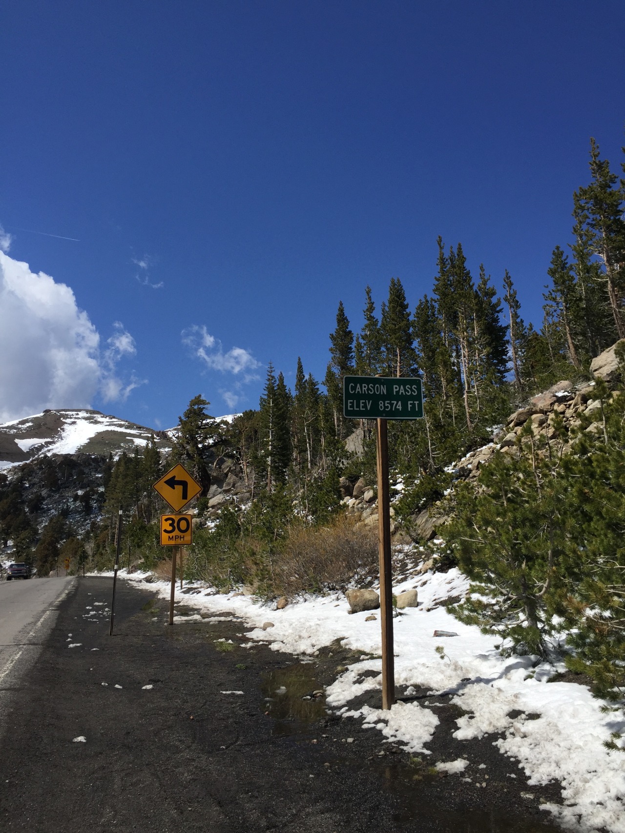
Half an hour later I’m back on the bike, and heading up hill again. Route 89 become route 88 and praise be, Carson Pass is open. Quick picture at the summit and then the long, long road down the other side of the mountains.
We are in gold rush territory, and it looks like it. The rivers that cut into the mountains here carried nuggets of gold, and in 1849 some 300,000 ‘forty-niners’ descended on the place and literally tore it apart. Nature has recovered, but it is very different from the other side of the mountains, and the temperature difference is striking. I’m soon stripping off layers and for the first time in the trip my Airshell Jacket seems like appropriate apparel. Lovely sunny afternoon ride all the way down to Jackson, where the mountains recede into the distance and I’m in the Valley.
Now it is properly hot. I had heard that there is this crazy temperature difference between the central valley of California and the rest, but I had no idea. I stop for some great vat of crushed ice and sugary coffee in our favourite multinational beverage corporation.
But I’m not really happy. I wasn’t done with the mountains. It is a straight run from here back to San Fransisco, but I have more than a day to play with until my rental is up. I could go and visit some of the Bay area - Berkeley, Oakland, see some more San Fransisco, but that all seems tame compared to the wilds of the Eastern Sierra. It is now early evening, but I make up my mind. Yosemite damnit.
Route 49 is the most direct route, is actually a cracker - winding through the foothills of the Sierra, rolling farmland, sun dappled and beautiful wooden farmhouses. I’ve got great memories of this and I am running on adrenaline.
The road starts to ascend again. New Melones Lake is stunning, next the rather surprisingly named ‘Chinese Camp’ which is an old goldrush town - the first chinese gold diggers were hounded out of everywhere else and so settled here. And then I find myself on route 120 - which is the bottom of the other side of Tioga Pass. Amazing. Yosemite must be just round the corner.
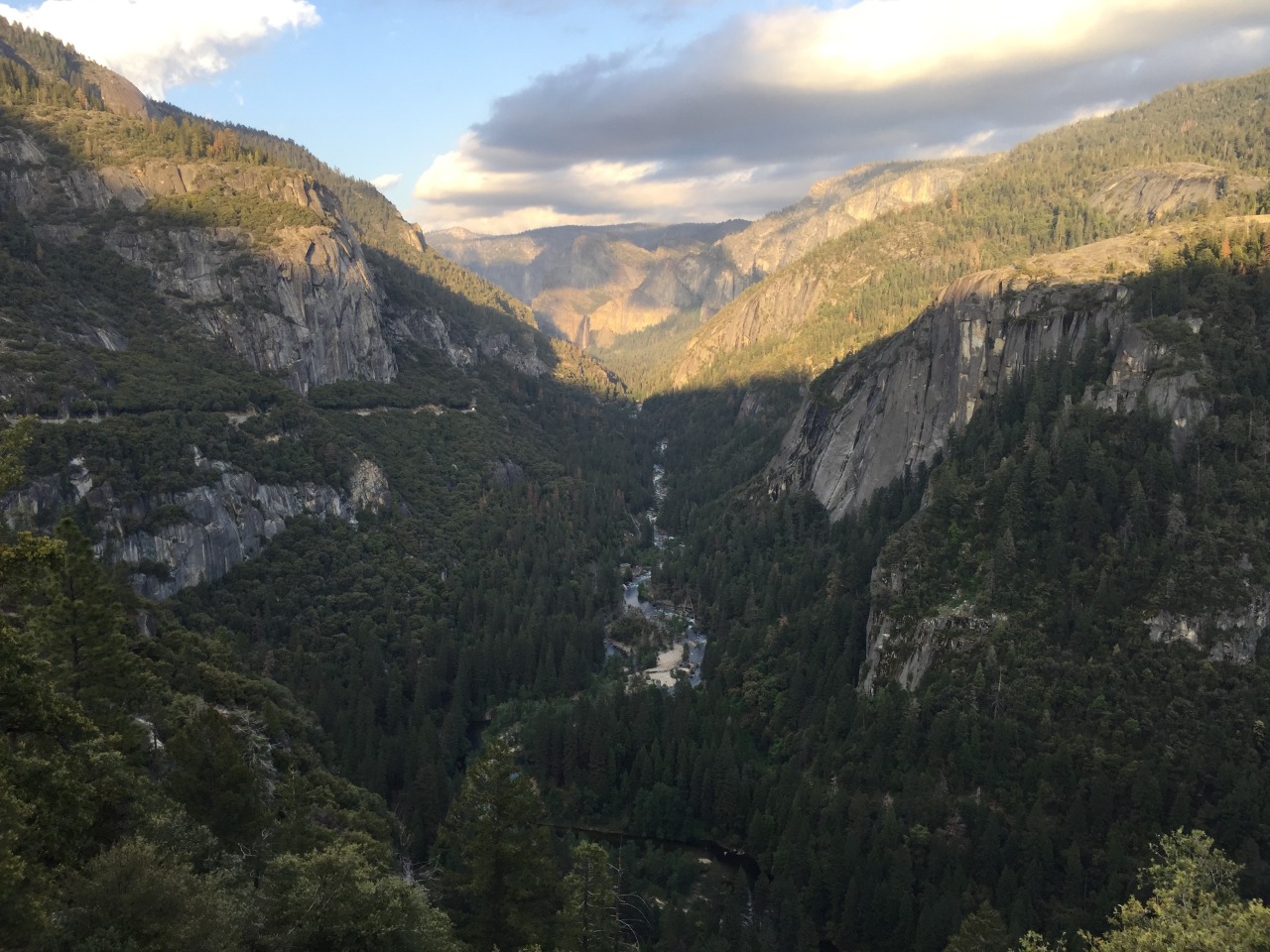
It isn’t, it is considerably further than you think. I’m also famished again from not eating properly, but I just keep going. The sun is going down, and I really want to be there for sunset. And then, all of a sudden, just when I thought I would miss it. Boom.
“The world is big and I want to have a good look at it before it gets dark” - John Muir.
John Muir was a Scottish Engineer and naturalist, and his early journeys in this valley and his writings came to be a driving force for the preservation of these natural wonders. His writing is very special, and his capacity to express the joy and beauty of the natural world is a delight. It is said that when he first saw this valley "He was overwhelmed by the landscape, scrambling down steep cliff faces to get a closer look at the waterfalls, whooping and howling at the vistas". I knew exactly how he felt.
I made it. In the end my odometer tells me is was i did 400 miles - not one of which was a motorway mile, and not including breaks I was on the bike for 12 hours. A quite monster day.
But to more practical matters. You can’t just turn up and camp in Yosemite. You need to book well in advance, and by that I mean weeks or months.
So no campsite for me. I ask around - the information centre is closed, but the lady who is locking up takes pity on me and suggests a campsite outside the park but not too far away.
It is called Indian flat Campgroud, and it is packed. But the owner graciously finds a corner to cram me into. I pitch and then go to the hotel next door to get some food. This is all a bit of a shock to they system, and I clearly have the look of a wild eyed loon. So they seat me upstairs by myself. And then take too long bringing me food which makes me rather tetchy. I’ve surely not been away from civilisation for that long, but I’m feeling very uncivilised.
And now to bed. Tomorrow I will see Yosemite properly.